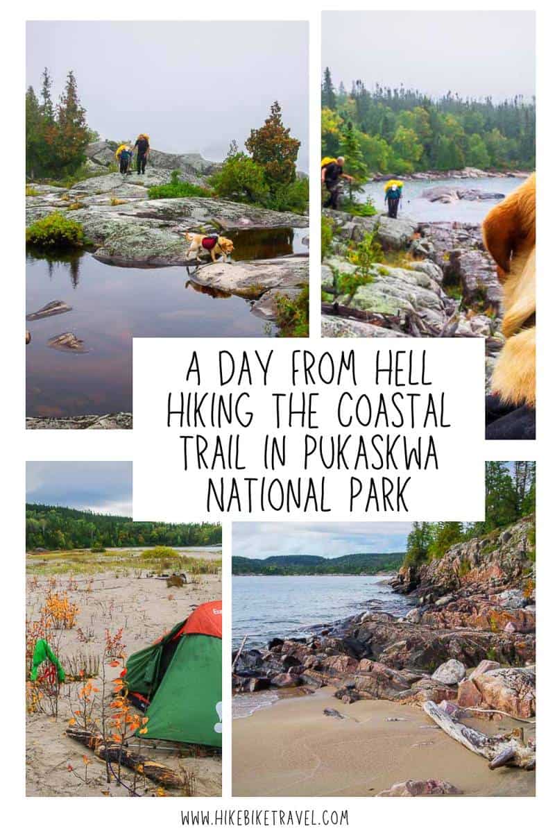
A Day From Hell on the Coastal Trail in Pukaskwa
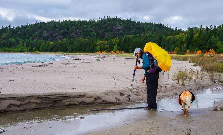
I thought after guerrilla camping on the Coastal trail and backpacking in the dark that the worst would be behind us. But that wasn’t to be the case. Our group of three and a dog were on day three of a five day backpacking trip in Pukaskwa National Park in northwestern Ontario. It turned out to be our day from hell.
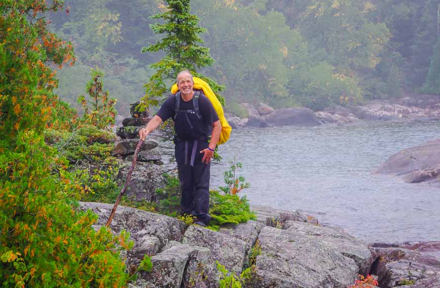
The plan for the day was to backpack from Fisherman’s Cove to Morrison Harbour – a distance of 15.7 km. According to the downloadable information off the Pukaskwa National Park website, it should take us approximately six hours.
Backcountry campsite reservations open for the Coastal Trail in Pukaskwa National Park on Monday, February 3, 2025 at 8 AM ET. You can reserve online or by calling 1-877-737-3783 from North America and 1-519-826-5391 outside North America.
Would you like to save this?
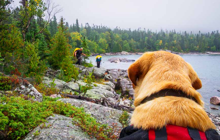
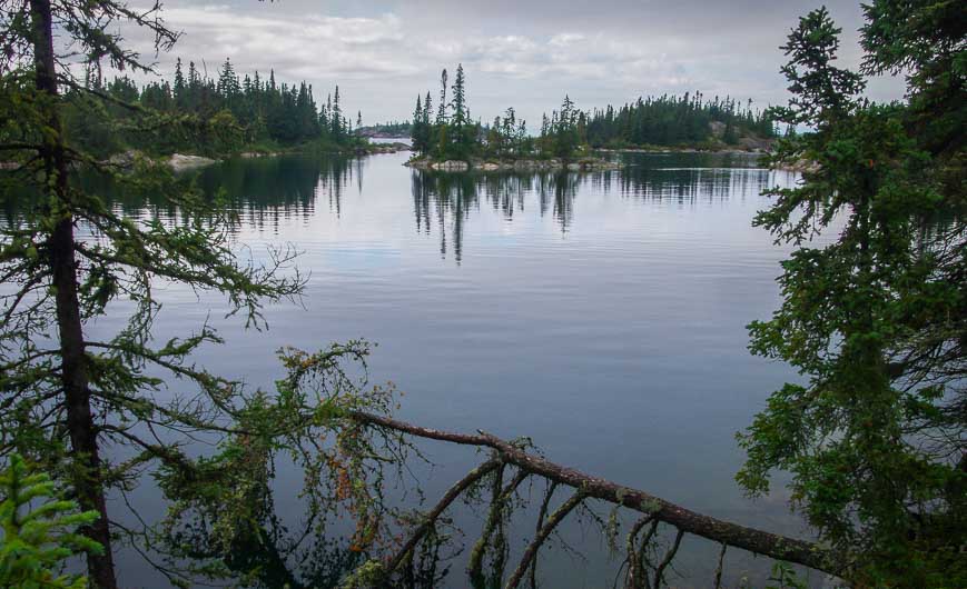
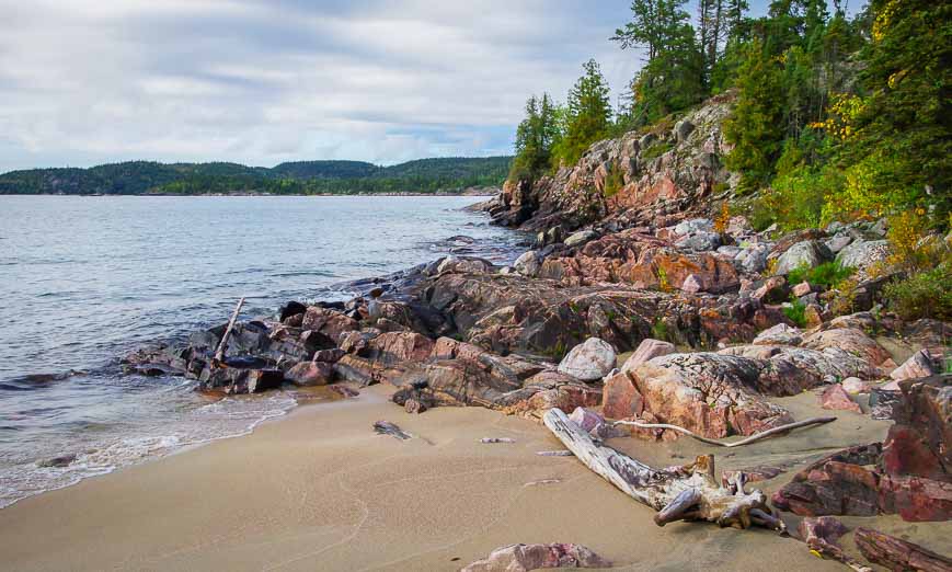
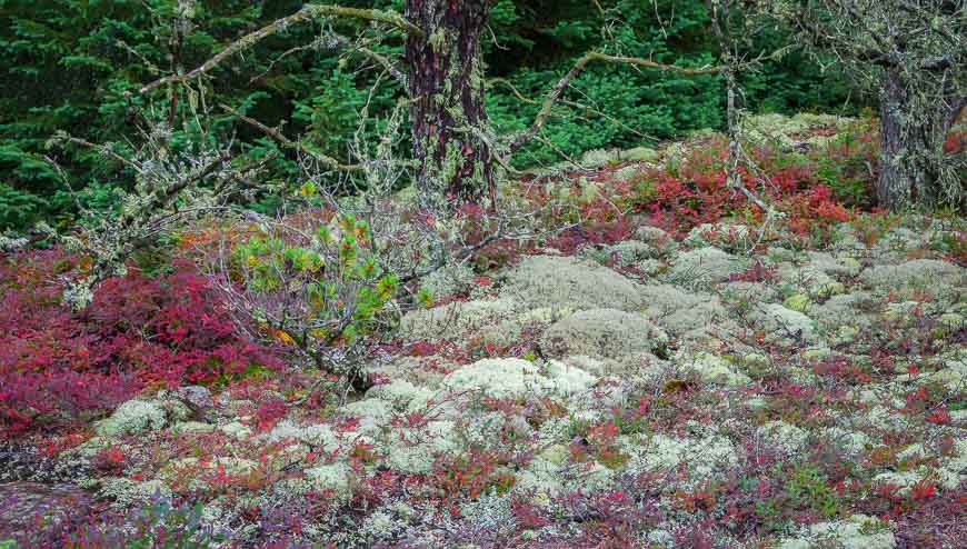
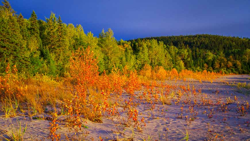
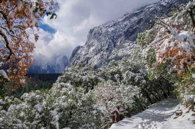
Superlative scenery on day 3 on the Coastal Trail in Pukaskwa
Don’t get me wrong about the day from hell. The scenery for most of the day is superlative – a 9/10 in my books. It’s the trail that is the problem and it’s a twofold one.
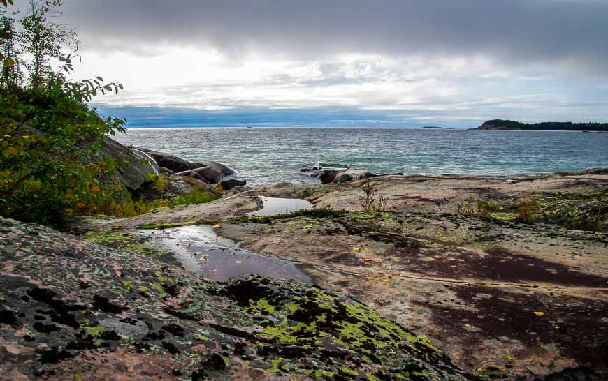
Finding the trail on occasion takes some time. And it’s particularly treacherous along the coast. Wet, slippery rocks lie in wait to derail the unsuspecting hiker. Take your eyes off your footing for a second at your peril. I have the bruises to prove it.
Finding the real trail is time-consuming
We start the day by going down a beach looking for a trail and taking tracks through the woods in error. By the time we’ve finally located the real trail – and waded a pond we’re already thirty minutes into the day and we’ve gone all of about 200 m.
Next is a stiff climb up a stream bed laced with large, mossy boulders. I’m already feeling anxious about our pace by the time we get to the top of the hill but it still takes us another hour of walking through the woods before we reach the lake again. We haven’t even gone a kilometre.
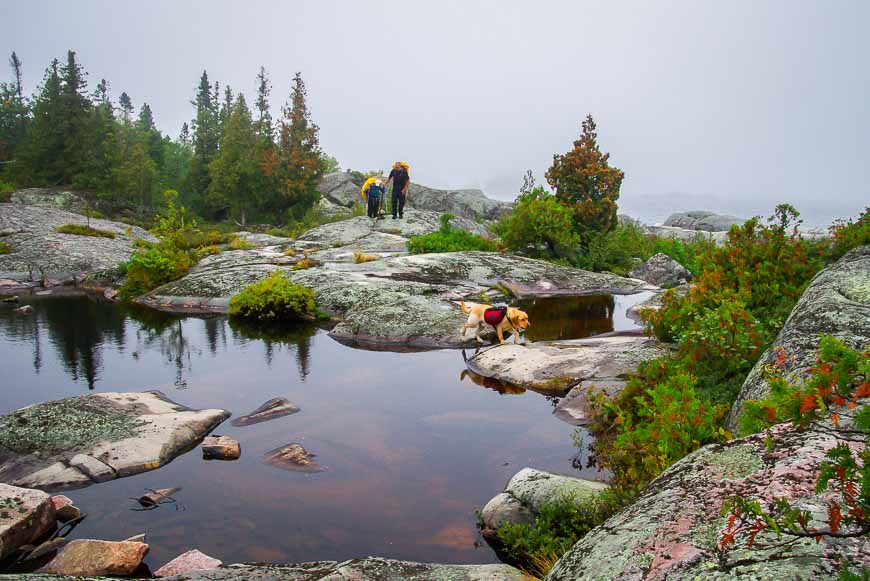
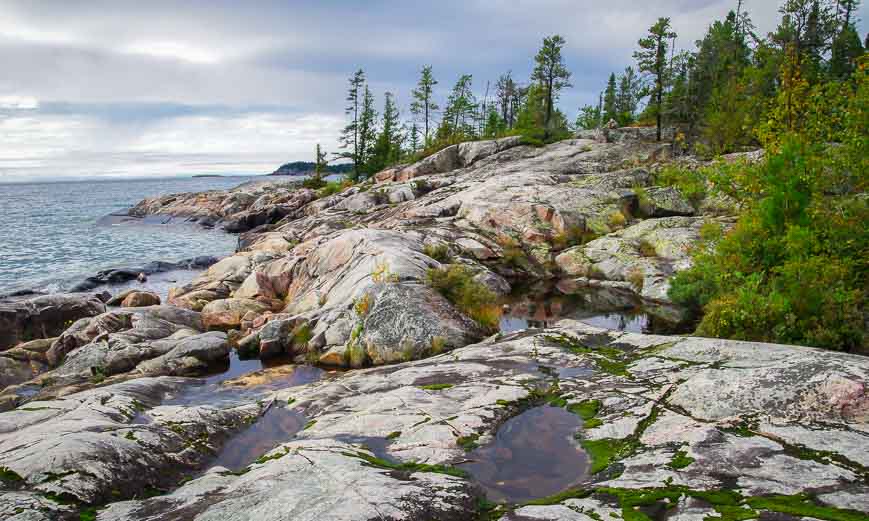
When we arrive at Lake Superior again we look in dismay at the rocks. They’re full of fractures – and easily capable of causing a leg break or sprain. It’s excruciatingly slow going to get through the rocks and another hour slips by.
I look repeatedly at the map figuring the map must be wrong. (You do need map reading skills out here!) But that’s just wishful thinking on my part.
A disheartening lunch stop on the Coastal Trail
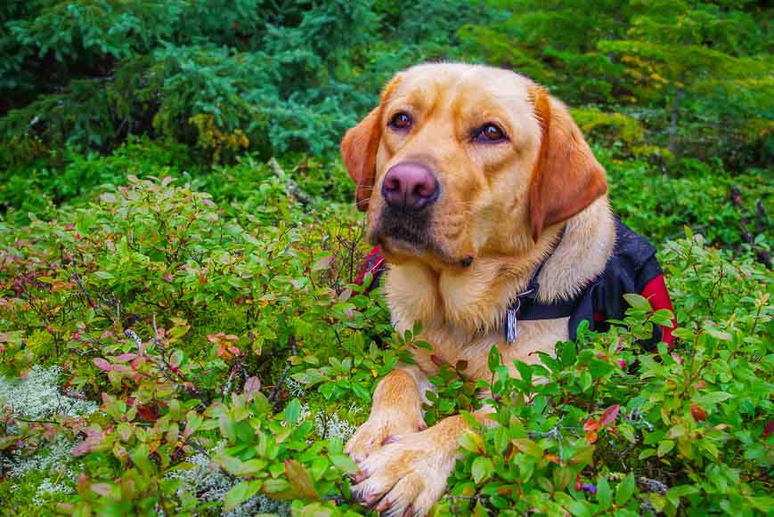
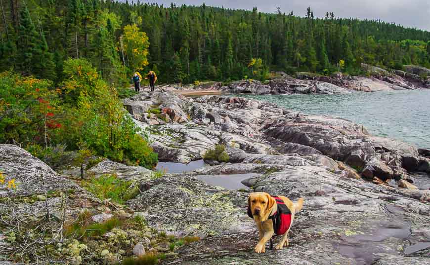
By the time we stop for lunch we’d hiked for 3.5 hours and covered all of about two kilometres. Even the dog seemed disheartened.
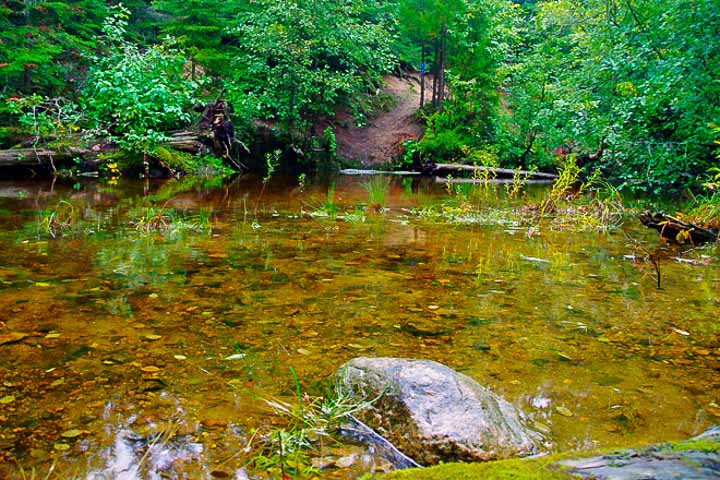
After lunch we enter the woods so for a while we make up some lost time. It seems we have an ongoing love/hate affair with the woods when it came to hiking the Coastal Trail. Today with the coast so rugged we were happy to be in the woods – and other times we’re begging for a beach.
These woods are lusher and greener than I ever would have expected.
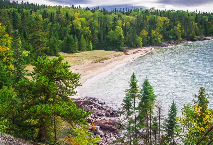
Oiseau Bay – here we come
The afternoon wears on and we decide by 3 PM that there is no way we can make Morrison Harbour. Even Fish Harbour – 3.4 km closer – doesn’t seem possible. We set our sights instead on making it to Oiseau Bay.
We struggle on in the afternoon – alternating between hiking across slippery rocks, getting down on our rear ends with a heavy pack and sliding down rocks and enjoying the odd easy stretch in the woods.
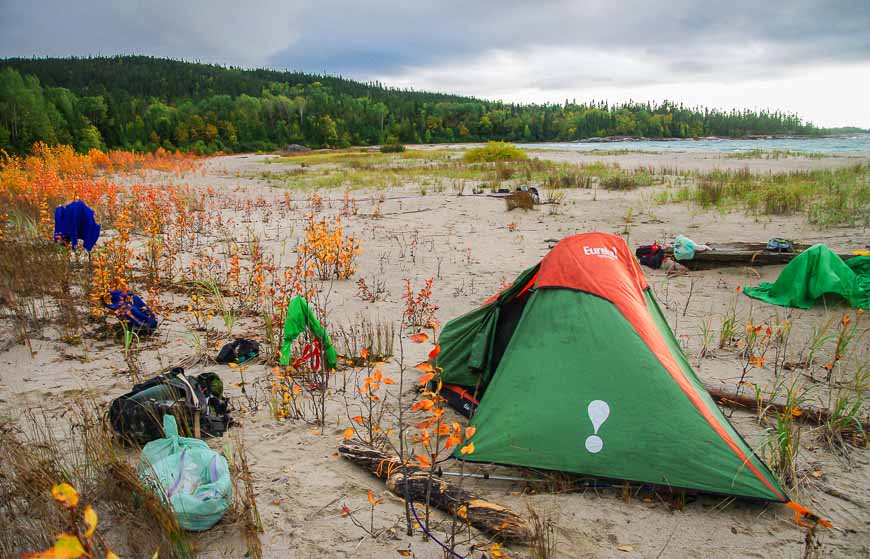
Oiseau Bay finally!
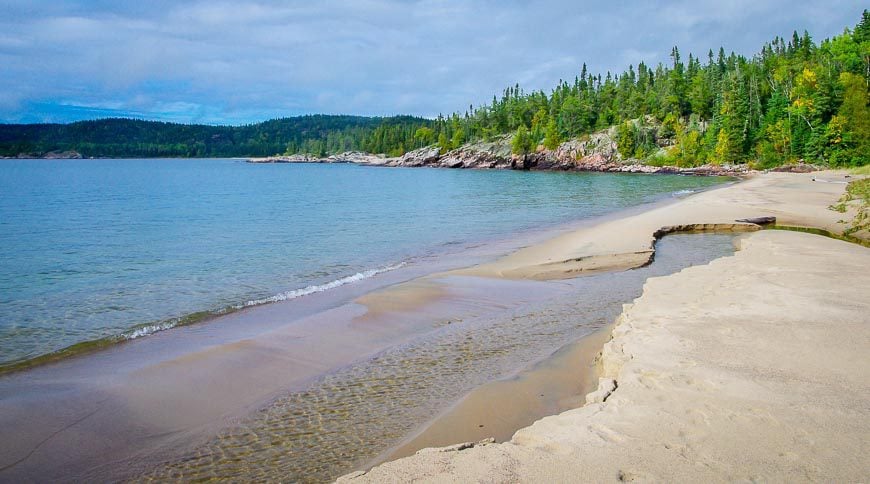
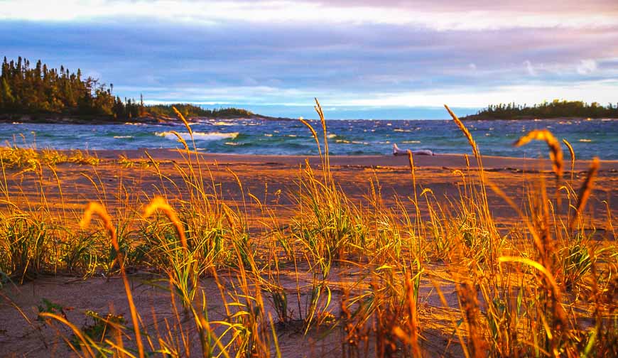
It’s 5:15 PM when we reach Oiseau Bay – and what a wonderful sight it is. It boasts a huge, deserted beach – suitable in places for camping – though the official campsites are in the woods and closer to outhouses and bear lockers.
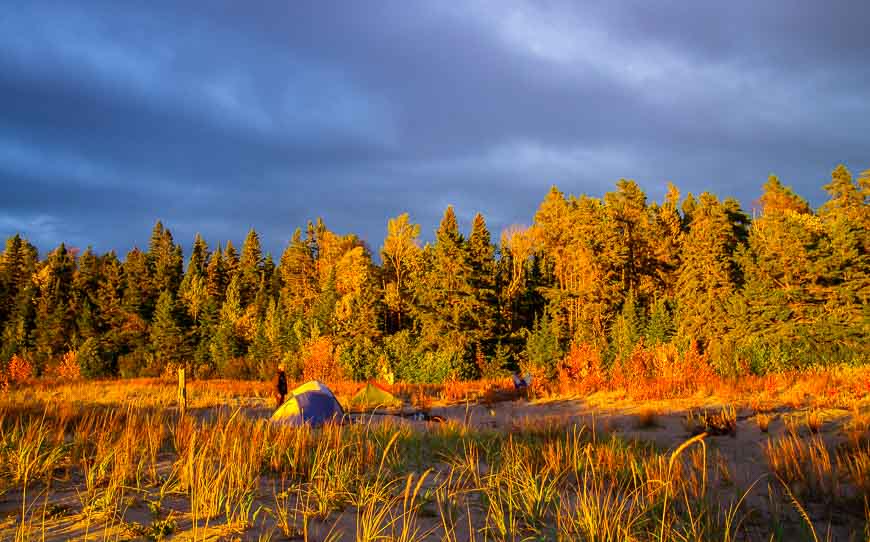
We decide to camp on the beach figuring we could dry out our clothes in the wind and enjoy the scenery from our tents. It’s definitely more of a hike to the bear lockers but I’d always take a beach over the woods for camping.
A paltry 7.2 km is all we did on our day from hell on the Coastal Trail
In the end we hiked all of 7.2 km, averaging about a kilometre an hour – totally disheartening numbers. However, the beauty of the camp site, a hot meal of spaghetti with a glass of wine, and a superlative sunset provided a welcome boost to our spirits.
So the day from hell ended on a good note but as the map reader I couldn’t help but wonder if we’d ever get off this trail.
For more information on Pukaskwa National Park visit the park website.
Further reading on hiking in Pukaskwa National Park
- Hiking the Coastal Trail in Pukaskwa National Park – Part I
- Day 2 on the Coastal Trail in Pukaskwa National Park
- Hiking the Coastal Trail in Pukaskwa – Day 4
- Day 5 on the Coastal Trail in Pukaskwa National Park, Ontario
- A Hike on the Southern Headland Trail in Pukaskwa National Park
Click on the photo to bookmark to your Pinterest boards.


I did this trail in 2012. I agree, by far the hardest stretch was from Fisherman’s Cove to Oiseau Bay. I’ve read other people’s blogs and they say the same too. Great photos though brought back a lot of good memories. Thanks
@Steve Glad you enjoyed. Sometimes the mileage doesn’t begin to tell the story!
I’m considering doing this next summer. Are the rocks normally wet (wind/mist/fog off the lake), or is that due to specific rain/weather conditions? Vibram soles and wet rock/wood are not a good combination–BTDT!
@LKL The minute it starts raining it gets “slicker than snot.”
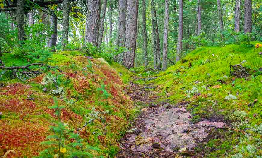
Yikes, that did sound like a hike with some peril indeed. That tree stump picture is AMAZING!!! I liked all the photos as usual, Leigh, and I’m glad the day turned out ok all told. But one question, what is your dog’s name?? He’s adorable!
@Mike At a few points in the day I certainly wondered how it would end. Fortunately the worst days always make the best stories. And that wonderful dog isn’t mine but my friends and goes by the name of Keeper. Mine was home in Calgary and I’m not sure she could have made it.
Glad you stuck with it so that we could enjoy these fabulous photos. That red moss is very cool — I saw something like it at Point Lobos near Carmel, CA but not sure if it was the same. The dog really does look disheartened. What an adventure, Leigh!
@Cathy You should have seen the dog by the 5th day. But after Keeper had a day of recovery he seemed raring to go again. In fact I think we got him into too good shape. And the whole trip really was an adventure – especially backpacking in the dark.
You’re a real trooper, Leigh. I probably would have turned back. Glad you had such scenic views or that day would have been much worse.
@Marcia We didn’t have the option of turning back. Once the boat drops you off you are committed unless you have a serious injury. We knew that going in.
At least the temperatures look nice. After hiking hot and humid Isle Royale,temperature is everything to me, but I can understand how difficult this trip was. It is written all over the dog’s face. Beautiful colors though and you cannot beat a beach on Lake Superior for a campsite.
@Ted The days were very pleasant – even a tad warm and humid on the first two. The last two nights were cold but fortunately we could have a fire – which is a nice way to start the day.
Sorry to hear this part of your trip didn’t go well. But, what gorgeous scenery to have a bad day in. Love all the unique aspects of this hike. I also love that you manage to take all these beautiful photos despite the bad day.
@Mary Every day on the hike was hard but everyday was so different. I’m looking back at the photos and even though there were some tough moments I would definitely do it again.
I love both the photos and the narrative. So interesting. But you ended the post too early. How did you find getting out/moving on the next day or days? Did you still find the rocks really slick?
@Cathie On Day 4 we made some headway – and the rocks were much better.
That is the most colorful moss I have ever seen! The beach looks beautiful, though the day sounds like a completely frustrating one.
@Jennifer It’s the first time I’ve seen red moss and it created quite an impression. The whole day was beautiful but it was painstakingly slow. I’ve never been on rocks so slick – without any rain.
Doesn’t sound too fun but at least the nature was beautiful to make up for it. Those colors and the plants! Wow.
@Jenna You appreciate the other days after you’ve had a day from hell. And every day was so different. Fortunately a good night’s sleep cures most everything.
That beach really does look beautiful. . . but I would not want to hike over those rocks. Give me the woods any day.
I had a survey in the Yukon that turned into a long-distance hike when we got lost in some muskeg. It was slow, and wet, and smelly. And not even that scenic.
@Jess Getting lost in muskeg would be truly miserable. Fortunately by the fourth day the rocks weren’t so slippery and in fact you could walk straight down them with the friction of your boots making it possible.
I’ve never seen red moss either – that’s amazing. Sorry it was miserable to get to it though 🙁
@Cindy We saw the moss on a few more occasions plus some interesting red berries – actually lots of great stuff and despite the hardship it’s a trip I’m glad I did.