The Prairie Mountain hike, accessed near Bragg Creek in Kananaskis Country, Alberta, is one of the top year-round hikes to do if you live in the Calgary area. Nothing beats it for the workout and the views, especially during the winter months. And you don’t have to worry about avalanche danger if you stick to the main trail.
Even though the Prairie Mountain hike is similar to Vancouver’s Grouse Grind, there is no sky tram at the top to whisk you down to a Starbucks at the bottom.
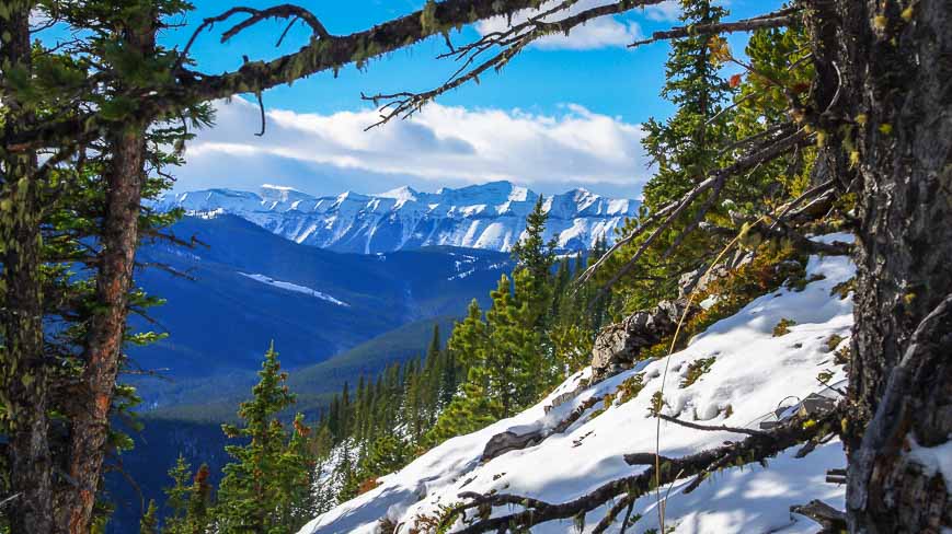
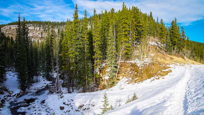
You have to hike down – but you can get a coffee 12-minutes later at a locally owned café in Bragg Creek. The views are great – both early on because of tree removal related to the trail upgrades and again once you emerge from the trees.
Note: Prairie Mountain is closed until May 1, 2024 because of the mud!!
Changes to the Prairie Mountain trail
October 2023 update: The Prairie Mountain trail has been completely refurbished to the tune of $820,000 (not a typo) with parts of the trail moved – as evidenced by all the pick-up-sticks (trees that were cut down) covering the old trail. The following are the biggest changes I noticed.
- The start of the Prairie Mountain trail is more gradual, so you won’t be huffing and puffing as much. Follow the new trail signs if you start across from at the trailhead across from the entrance to the Elbow Falls parking lot. The trail has been moved to accommodate the more moderate grade.
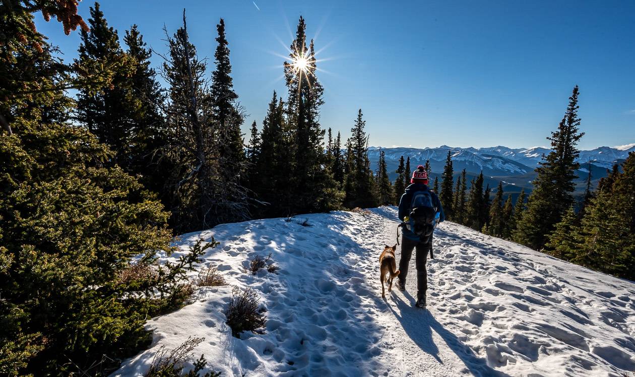
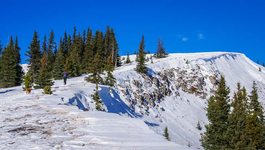
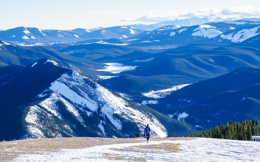
- The Prairie Mountain trails – from the two different trailheads – still meet up at the same place – which is now a viewpoint. (See photo below.)
- The trail is much wider and tree branches have been removed to head height.
- The lower half of the trail has had all steep steps and a lot of rocks removed. What is left is a trail with a lot of clay. It’s a tad slippery coming down when it’s wet, so I would recommend hiking poles.
- There are short sections with stone steps as a shortcutting option.
- Along the trail there are large boulders that now double as stone benches.
- The upper half of the trail is much easier than it was – both going up and coming down. You won’t look up and wonder how you’re going to do the steep part anymore – as it’s gone. There is still the same amount of vertical, so you’ll get a workout. Emerge at treeline a little lower than you did before.
This post includes some affiliate links. If you make a qualifying purchase through one of these links, I will receive a small percentage of the sale at no extra cost to you. Thank you very much for your support.

Prairie Mountain hike summary
Distance: 6.6 km (4.1 miles) return according to Alberta Parks
Elevation: 726 m or 2,382 feet
Difficulty: Hard because it’s steep – though the new trail is much less steep. Regular hikers or the super-fit would label it as moderate. There is nothing technical about the hike.
Time needed: 2.5 – 4 hours return. I usually take 2 hours & 20 minutes return but I’m passed by the super fast. There will be some that might take five hours, especially with a lunch stop thrown in there.
Elevation on the Prairie Mountain summit: 2,210 metres
Best time to hike: A great year round hike, even in the dead of winter!!
Permit: You do need a Kananaskis Conservation Pass.
Map: Gem Trek Bragg Creek & Sheep Valley
Dogs: Allowed on a leash.
Hiking season: The Prairie Mountain hike is popular year-round for people wanting a workout. There is no avalanche danger on the main trail.
Weather: Count on strong winds when you reach treeline, so dress accordingly.
Signage: As of summer 2023, the Prairie Mountain trail is signed.
Facilities: There are toilets and a garbage bin at the Elbow Falls parking lot.
Trail conditions: Check trail reports in Kananaskis before you go.
Options: For another cool hike close by, check out the Canyon Creek Ice Cave.
Don’t forget: Always pack the 10 hiking essentials – even or such a busy hike. I’d also recommend a second set of car keys as I have met many people who have lost theirs over the years.
Prairie Mountain hike description
From the parking lot, the Prairie Mountain hike starts up on the north side of Highway 66. People start by the winter gate and across from the entrance to the Elbow Falls parking lot. There is signage now – and both trails meet up in short order.
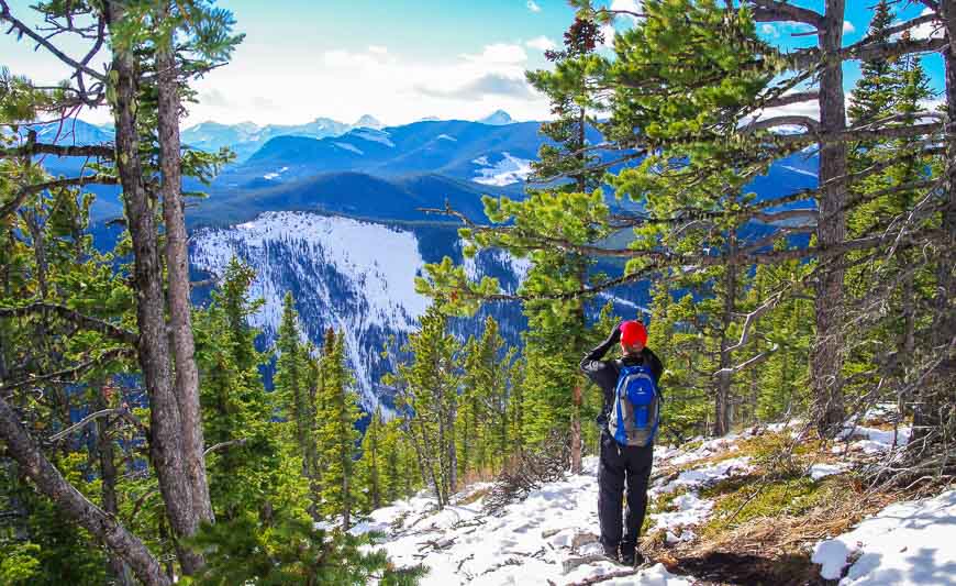
I used to break the Prairie Mountain hike into three three parts. The first got me up the initial steep bit (not so steep now) and through some pretty open forest to the first good viewpoint – about 40 minutes into the hike.
The second half of the hike used to be very steep but it has been graded to such a degree that all the steep bits are gone – so it is way easier both going up and coming down. When you emerge from the trees, it’s still a quick walk to the summit.

Prairie Mountain route description
The Prairie Mountain hike starts off gradually now, though it’s a bit steeper if you start up from the trailhead near the winter gate.
Both routes intersect, about 10 – 15 minutes into the hike, and from there you can catch your breath on an easier, somewhat level section. The take your breath away steep sections have been replaced by new graded trails. There are still steep bits, but they’re short.
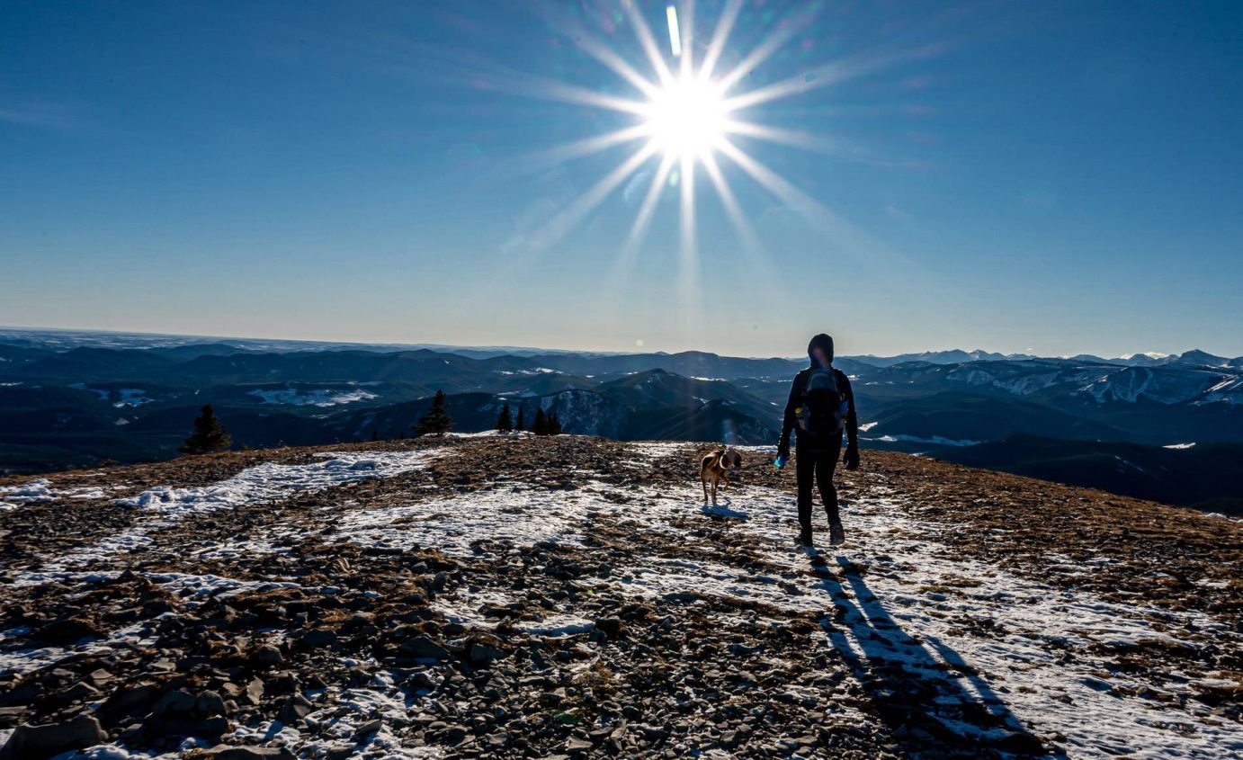
Turn right once you pop out of the trees and and follow the ridge, past snow cornices in winter, all the way to the summit. It will take you between 10 – 20 minutes once you leave the trees. This is my favourite section of the Prairie Mountain hike as you are rewarded with expansive mountain views, all the way to the top but at a grade that doesn’t take your breath away!
However, this part of the hike up Prairie Mountain is usually very windy to the point that if you have any loose cords on your jacket, you will get painfully slapped on the face.
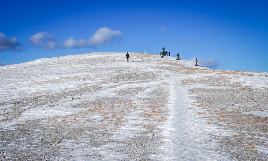
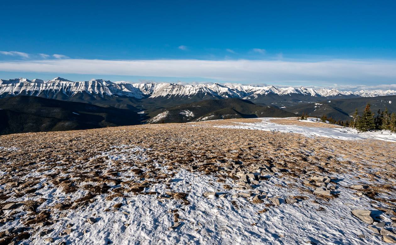
At the top of Prairie Mountain, you are treated to views of the prairies, the city of Calgary – including downtown Calgary to the east, and Moose Mountain, Banded Peak, and Powderface Ridge if you look west. There is a smaller summit cairn than there used to be and a very small Canadian flag now.
It’s a quick descent in the winter (usually about 75 minutes) as the snow is easier to descend then the rocks and scree you find the rest of the year. Even the dogs seem to breathe a sigh of relief when we’re on the descent. I have never done this hike in summer – and prefer it as my shoulder season and winter workout.
The hike is a popular one and in all likelihood you’ll meet many people going up and coming down. Don’t be surprised if you see some people doing the hike multiple times – something I marvel at! This is one of those hikes where I know my legs will be hurting for days afterwards if I haven’t regularly been doing hikes with big vertical.


What to take on the hike
The Prairie Mountain hike is one of the few near Calgary that you can literally hike 365 days of the year.
Obviously you have to use some common sense on your choice of days in the winter months, but if you’re properly attired and prepared then it should be quite doable. If there’s a major winter storm with awful visibility, give it a pass.
I’d HIGHLY recommend carrying icers or microspikes once the snow starts to fly because you can’t always tell at the bottom of the hike, how slippery it will be up high.
I like the Canadian-made Hillsound and Kahtoola especially for the descent along with a pair of hiking poles. Take a thermos of something hot to warm you up along with a few energy bars.
Take a windproof jacket for the upper part of the mountain. I would also suggest a warm hat in winter and a lightweight down coat.
I’ve never seen so much as bear scat but bears can be around. I’ve seen deer and I’ve heard of people seeing cougars so it would be prudent to carry bear spray.


Prairie Mountain hike trailhead location
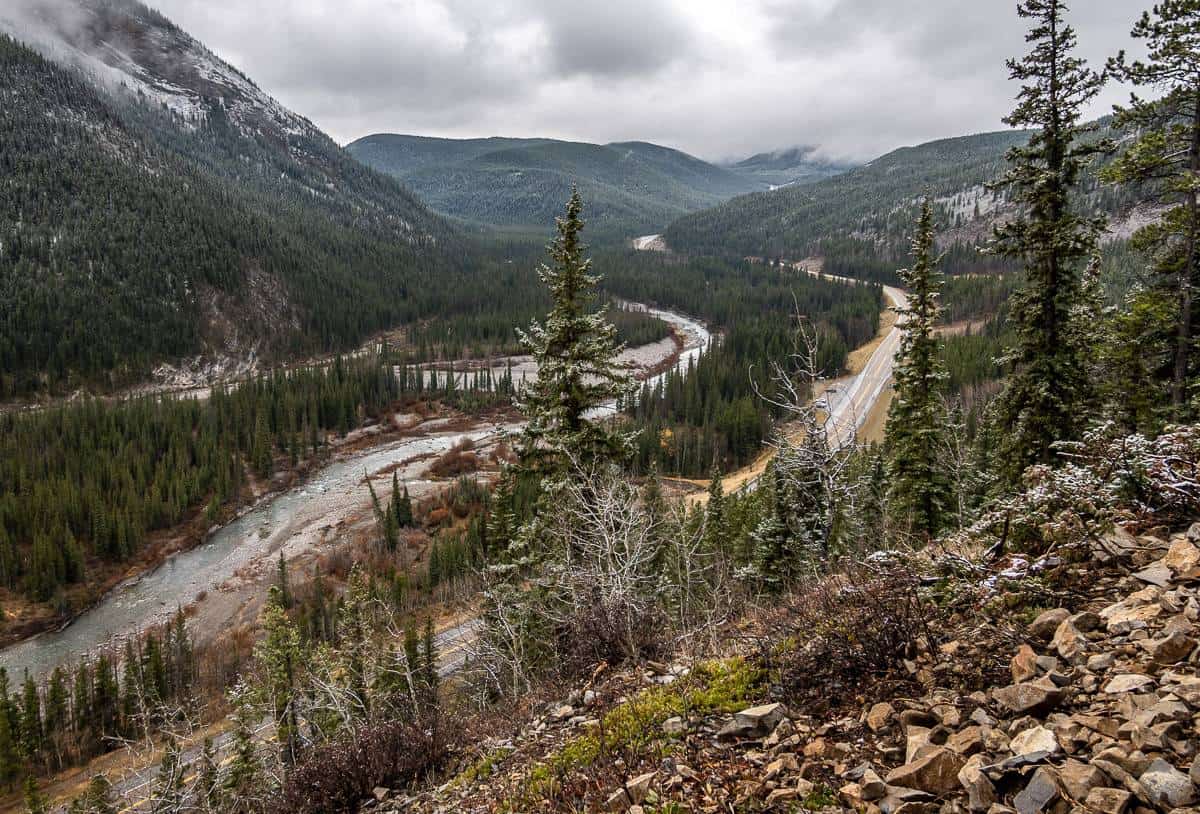
The trailhead is just 45-minutes from downtown Calgary via Highway 66 near Bragg Creek. It’s roughly 22 km from Bragg Creek to reach the Elbow Falls parking area.
There is another parking lot that holds about 15 cars on the south side of the highway, just past the entrance to the Elbow Falls parking lot. It’s free. If it’s full, park along the shoulder of the highway.
Two ways to access the Prairie Mountain trail
- One trailhead is near the winter gate, with the start just after the sign that says Beaver Lodge. This section of trail has been improved with three sets of stairs. Meet the main trail up Prairie Mountain after about 10 minutes of climbing.
- People that park on the shoulder across from the Elbow Falls parking lot often start up right from the highway across from the entrance to the Elbow Falls parking lot. This trail was vastly improved in summer 2023 and isn’t nearly so steep. Be sure to follow the Prairie Mountain trail signs (these are new) as the routing has changed significantly near the beginning. It is much more mellow.
There is another trail that follows the Elbow River Valley, paralleling Highway 66. You do not want that one.

Location map of the Prairie Mountain hike
Further reading about hikes near Bragg Creek
- The Fullerton Loop Hike in Kananaskis Country
- The Moose Mountain Hike in Kananaskis Country, AB
- The Fabulous Forget-Me-Not Ridge Hike
- The Nihahi Ridge Hike in Kananaskis Country
- The Cox Hill Hike in Kananaskis Country
Click on the photo to bookmark to your Pinterest boards.
