Fullerton Loop Trail Hike near Bragg Creek
The Fullerton Loop trail hike is a great year-round choice, with a trailhead that is only 10 minutes from Bragg Creek. On the first time we did it, we were actually trying to do the Sugar Mama hike but missed that turnoff by 100 metres. Fortunately, the Fullerton Loop hike is an excellent alternative as you only need a half day to knock off the Fullerton Loop.
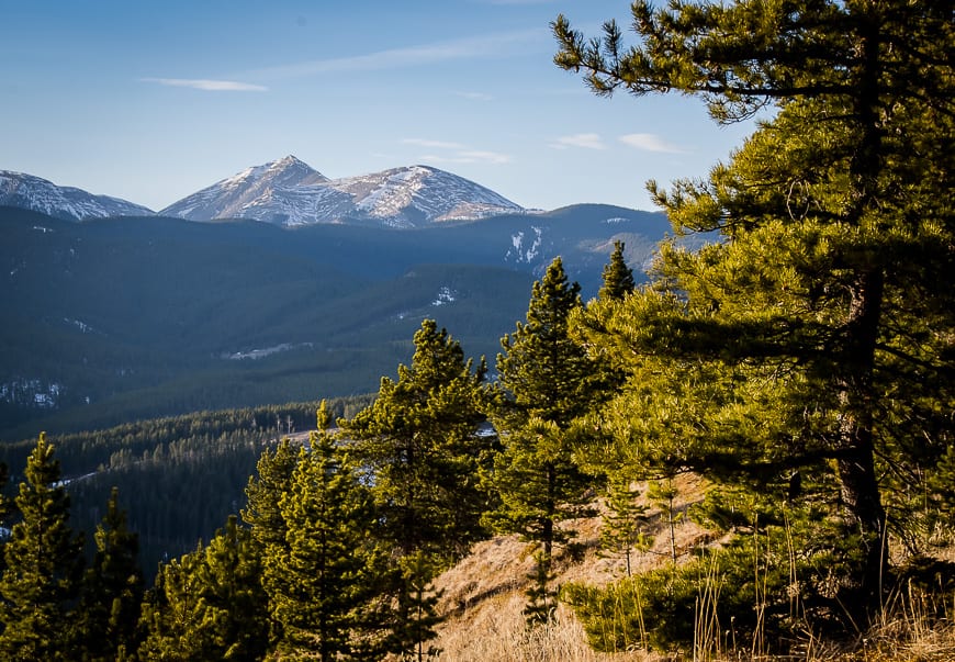
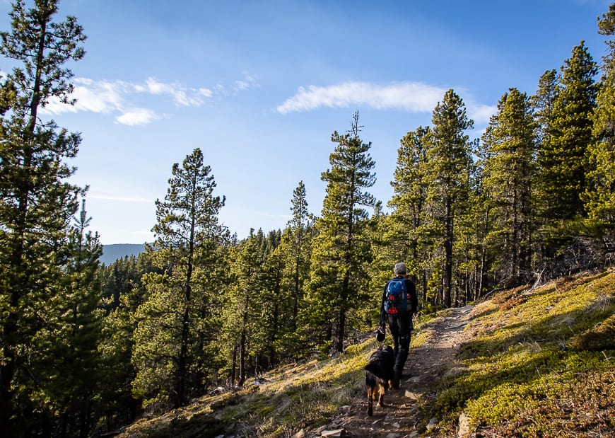
Do the Fullerton Trail on snowshoes or with microspikes once the snow flies. Expect a combination of a beautiful ridge walk and hilly valley trails with multiple options to extend the hike.
This post includes some affiliate links. If you make a qualifying purchase through one of these links, I will receive a small percentage of the sale at no extra cost to you. Thank you very much for your support.
Would you like to save this?
Fullerton Loop trail hike summary
Distance: 6.8 km (4.2 miles) minimum. It is possible to add on loops including one to the Ranger Summit that will put in the range of a 12 km hike.
Elevation: 213 m or 692 feet, but considerably more if you add in Ranger Summit.
Level of difficulty: Easy but moderate for young families.
Time needed: 3 hours
Dogs: Allowed on a leash. The rangers are very strict in Kananaskis and the fines for off-leash dogs are well over $100.
Permits: You will need a Kananaskis Conservation Pass to do any of the hikes off of Highway 66 near Bragg Creek. It’s $15 for one vehicle per day or $90 for a year covering two cars at the same address.
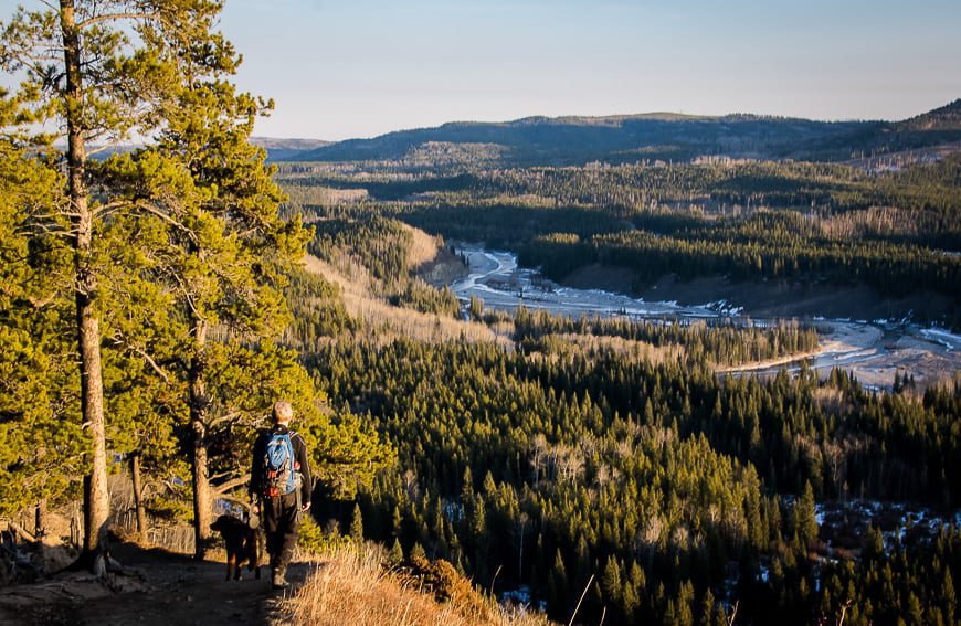
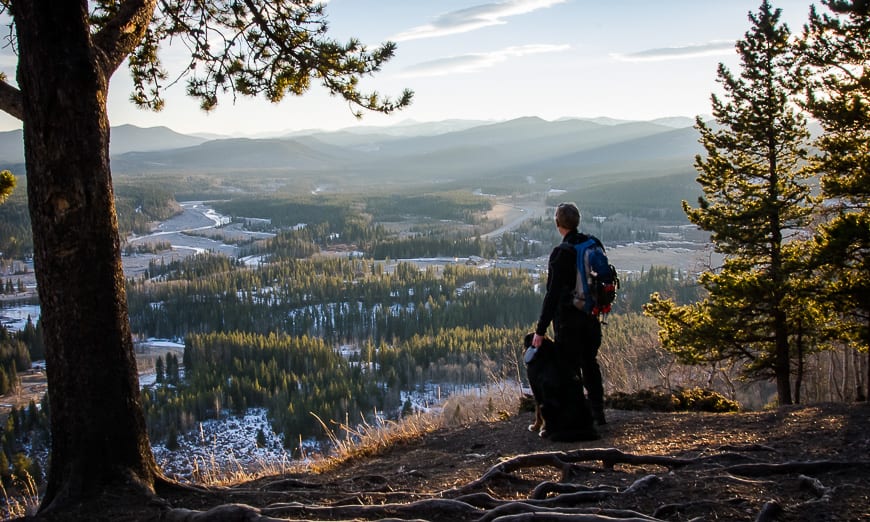
Hot tip: Hike counter-clockwise for the best views. The ridge is an incredible place to catch a sunset – and makes a good destination for a picnic.
Map: The map for this hike is Gem Trek Bragg Creek & Sheep Valley. I also recommend the Organic Maps hiking app.
Trail conditions: Check trail reports in Elbow Valley before you go. There are lots of Bragg Creek area hikes, should this one be too busy or unavailable.
Fullerton Loop hike location
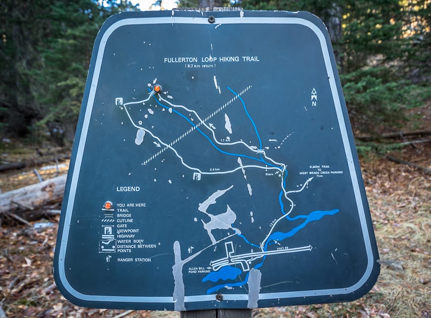
Look for the Allen Bill trailhead on Highway 66, 13.4 km past the four way intersection in Bragg Creek. The trailhead is at most an hour’s drive away from Calgary. Parking is free. There is parking on both sides of the highway.
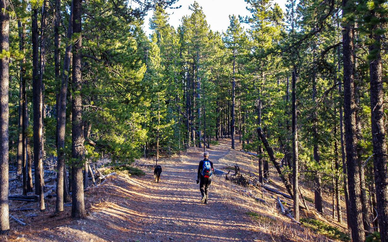
The Elbow Trail takes off from the Allen Bill parking lot just before a couple of buildings. It will take you to the intersection with the Fullerton Loop. This part of the hike is all pretty darned obvious and there is good signage.
Best time to hike the Fullerton Loop trail
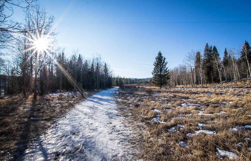
You can do the Fullerton Loop hike year-round, but in winter, depending on conditions, you will likely need either microspikes or snowshoes and perhaps hiking poles. Still I prefer it in winter, when the options for higher peaks aren’t as readily available.
In late November and December, this is a fantastic hike to do combined with cutting down a Christmas tree – something you’re allowed to do in the area with an online permit. (You can cut three Charlie Brown Christmas trees no more than 7 feet tall with an inexpensive permit.) For years we have done the hike around noon, and cut a Christmas tree – just as the light is fading.
Fullerton Loop trail hike description
John and I have passed the turnoff to the parking lot at the Allen Bill Day Use Area (where the trailhead is located) at least 20 times and had never given it more than a quick glance.
The first time we did the Fullerton Loop hike, we were looking for Sugar Mama – as it was supposedly a mellow hike that wasn’t going to take the whole day. I had never heard of the Fullerton Loop, so that was serendipity at work.
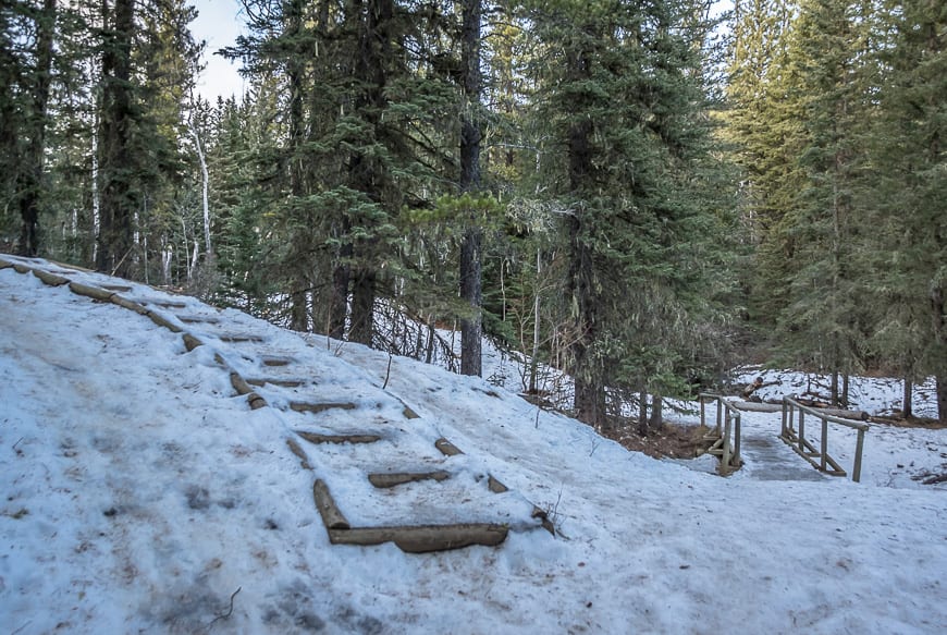
The initial hiking is on an easy grade, but it’s icy or snowy in December, mostly because it’s in a shaded valley. You can get by without icers but I found myself taking them off and putting them back on again numerous times.
After about a kilometre you cross a bridge and continue to the intersection pictured below. Don’t head towards any trails signed for Snagmore if you’re committed to the full loop. You can obviously hike the loop in either direction. We went right because we thought we were on Sugar Mama or Momma.
It turned out to be a good decision as we caught wonderful light coming down the ridge at the end of the hike. (To reach Sugar Mama continue 100 metres towards Snagmore and then turn left. Now we know.)

A side hike to Ranger Summit
We got to a signed intersection about 3 km into the hike. It wasn’t until then we realized we weren’t on the Sugar Mama trail. I was looking for more than a 6.7 km return hike so we opted to add an out and back hike to Ranger Summit via the Bobcat Trail. That increased our mileage for the day by 4.2 km.
A year ago almost to the weekend we had snowshoed a loop coming in from the West Bragg Creek side that took us to the same trail intersection. Conditions couldn’t be more different from one year to the next – snowy trails versus dry, dusty trails.
We gained a significant amount of elevation but because it was gradual I never felt myself breathing hard. The descent turned out to be quick and easy, except along the ridge. What slowed us down was the beauty of the setting sun – and the only thing that kept us moving was the thought of cutting a Christmas tree down in the dark.
Recommended reading: Snowshoeing the West Bragg Creek Trails in Alberta


How long will the Fullerton Loop hike take?
You can knock off the 6.8 km Fullerton Loop hike in a couple of hours. In total we ended up doing closer to 12 km with add-ons – so we took about 3.5 hours. There are lots of permutations to the loop if you want a longer day. I’d also recommend going up Sugar Daddy and down the ridge on the Fullerton Loop for about a four hour hike.
In a normal winter, this would be an awesome trail to snowshoe. This hike is a family-friendly outing and would be a perfect activity over the holidays.
Refreshments in Bragg Creek post hike
There are several places to stop post hike in Bragg Creek. One of the easiest ones to get to is Cinnamon Spoon as its at the four way intersection in Bragg Creek.
Where to stay nearby
There are several campsites that aren’t far away if you’re doing the hike from spring to fall. Check out the McLean Creek Campsite, Gooseberry Campsite, or Little Elbow Campground – a great choice in summer.
For a getaway, you might want to check out the Riverside Chateau in Bragg Creek.
Further reading on Bragg Creek area hikes
- Canyon Creek Ice Cave Hike Near Bragg Creek
- The Moose Mountain Hike in Kananaskis Country, AB
- The Fabulous Forget-Me-Not Ridge Hike
- Prairie Mountain – A Year Round Day Hike from Calgary
- The Powderface Ridge Hike near Bragg Creek
Click on the photo to bookmark to your Pinterest boards.


Hey Leigh,
There’s so much to do in Kananaskis Country. Do you have the same problem as me? Do your list of trails to complete only keep getting longer and longer? For every hike I do, it seems that two more are added!!!