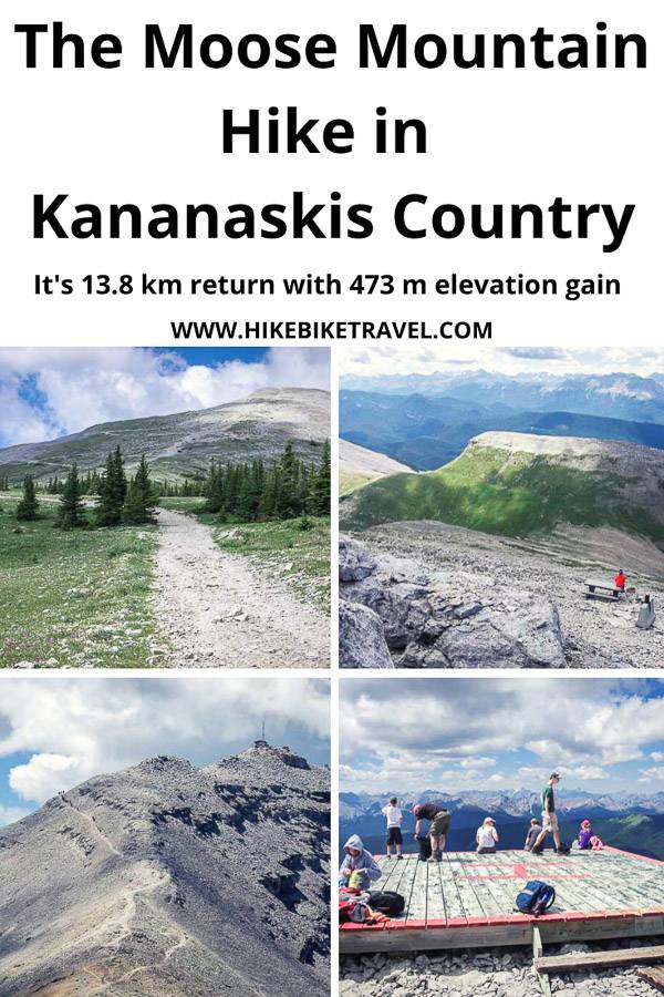
The Moose Mountain hike in Kananaskis Country, Alberta – which tops 2,437 metres (7,995 feet), offers some of the premier vistas in the area. It’s a popular day hike – and mountain bike ride for those living in the Bragg Creek and Calgary area.
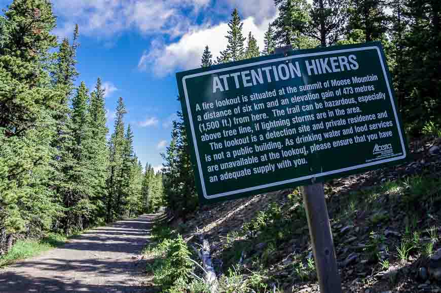
The hike takes you from the trees to a working fire tower. The Moose Mountain hike can be approached by a number of routes. Most people do it via the trail that is accessed from a 7 km dirt road that takes off from Highway 66 just after the Paddy’s Flat Campground. The road is passable for two wheel drive vehicles from May 15 to November 30th every year.
This post includes some affiliate links. If you make a qualifying purchase through one of these links, I will receive a small percentage of the sale at no extra cost to you. Thank you very much for your support.
Moose Mountain hike summary
Distance: 14.6 km (9.1 miles) return
Elevation: 470 m or 1,540 feet
Difficulty: Moderate
Time needed: 3.5 – 5 hours depending on your speed and conditioning.
Best time to hike: Spring, summer, and fall because of winter road closures.
Dogs: Leashed dogs are permitted on the trail. Rangers are happy to ticket in this area and fees run upwards of $150.
Permits: Purchase a Kananaskis Conservation Pass before beginning your hike or risk a ticket.
Don’t forget: Always pack the 10 hiking essentials and let someone know where you’re going.
Trailhead location: The end of Moose Mountain Road off of Highway 66 near Bragg Creek.
Map:Gem Trek Bragg Creek and Sheep Valley or use an offline hiking app likeOrganic Maps.
Moose Mountain hike description
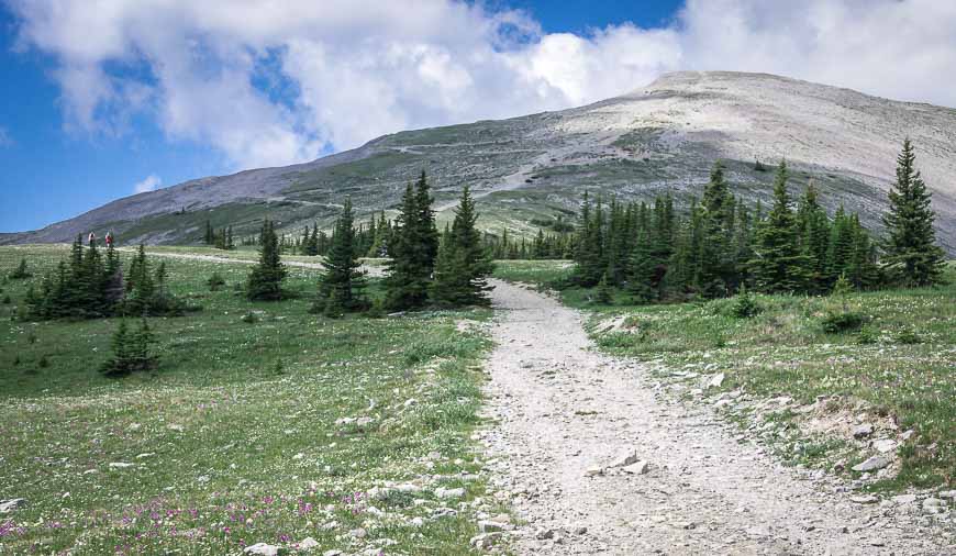
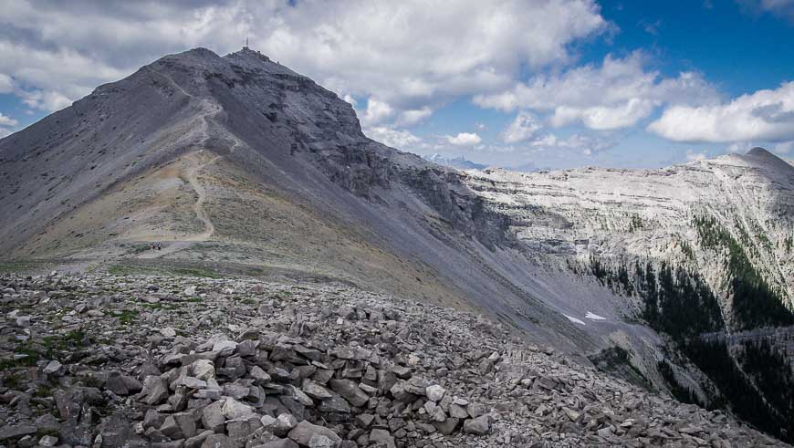
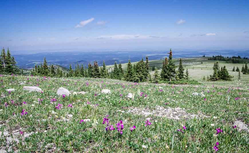
The Moose Mountain hike starts off at the end of Moose Mountain Road on a fire road. The first few kilometres are in the trees and only offer the odd peek-a-boo view. But in roughly three kilometres the landscape opens up and the destination becomes obvious.
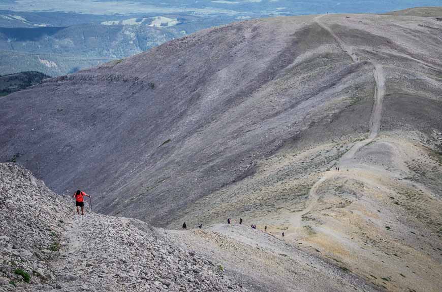
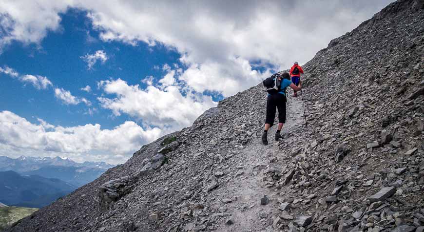
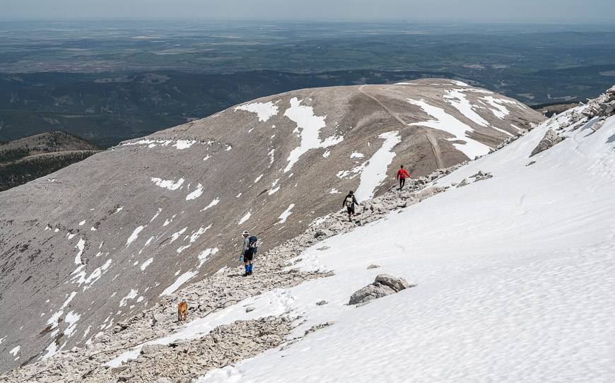
It’s a bit of a slog to the top as you switchback 470 m (1,540 feet) up the mountain in fairly short order. Be prepared to share the trail with mountain bikers.
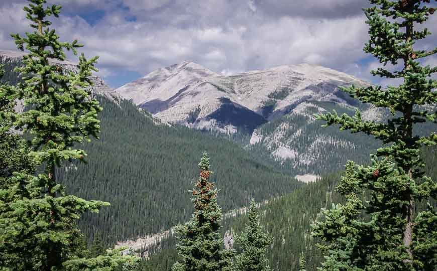
Fortunately the views just get better and better the higher you go. The landscape also changes, becoming rockier and more desolate the higher you climb. Don’t forget to include warm, wind-proof clothes as you may need everything you’ve got near the summit.
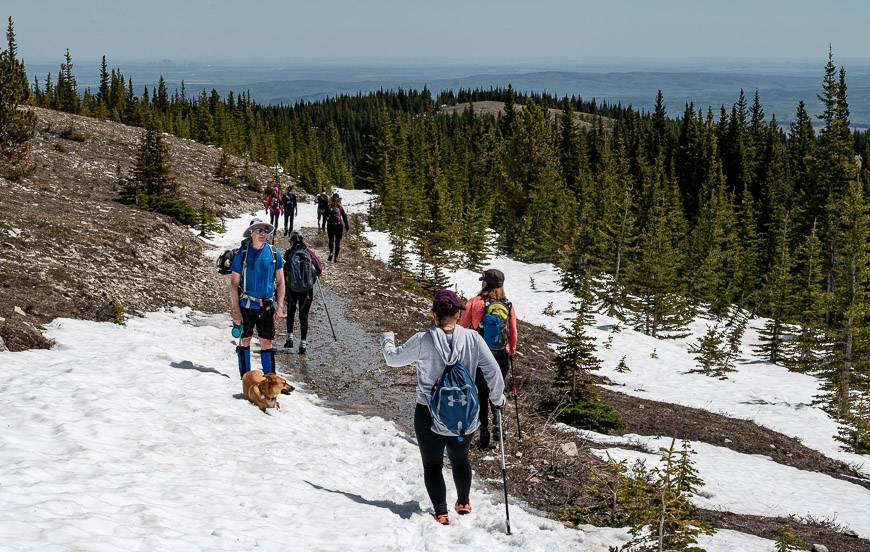
The trail up Moose Mountain is well-trodden and easy to follow. It’s a popular one, even with spring snow, so you can expect company.
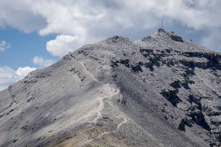
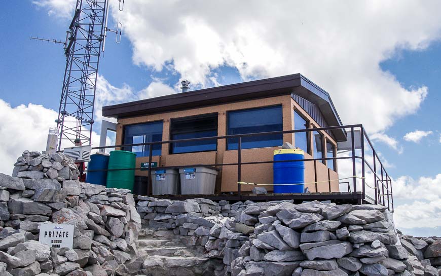
A working fire lookout on the summit of Moose Mountain
At the top of Moose Mountain there is a new working Fire Lookout – that is also the home of the fire lookout ranger.
He or she is tasked with looking after 5,000 square km of forest. You can’t actually go the the very summit of Moose Mountain now, but you can still admire the new fire lookout.
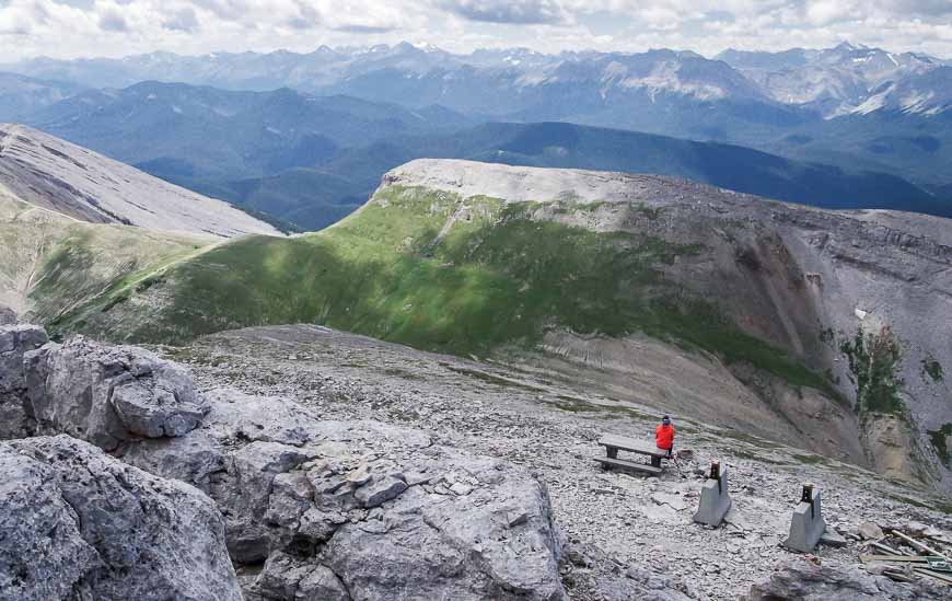
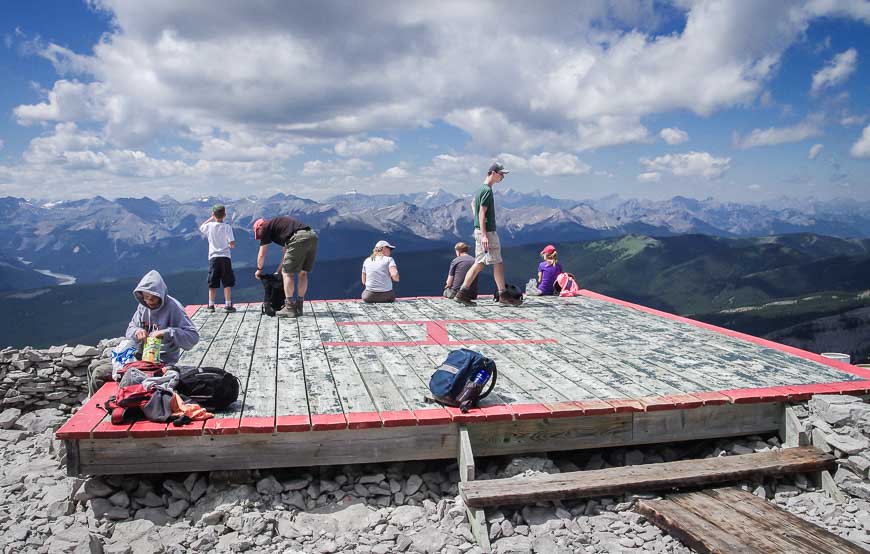
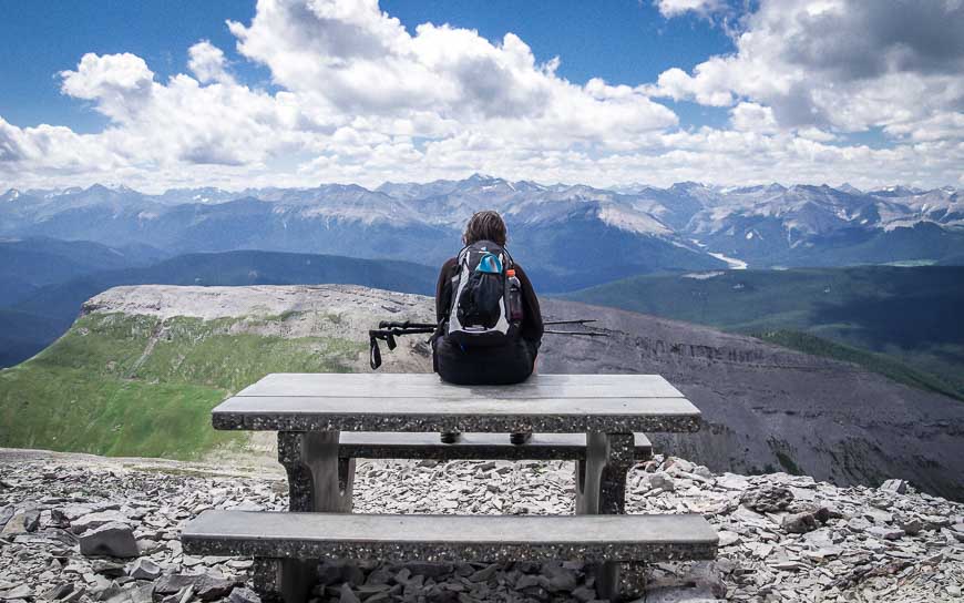
Lunch with a view on Moose Mountain
Sitting and eating lunch on the helicopter landing pad or at one of the picnic tables with a 360 degree view is the reward for the two to three hour hike to the top of Moose Mountain.
Be sure to bring lots of water as there is nowhere to top up a water bottle along the way. Some people might like hiking poles on the steep sections as well.
Th summit area is no place to be caught in an electrical storm, with so much exposure and nowhere to hide. If a storm is threatening, either turn back if you’re on your way up, or beat a hasty retreat. I have been caught in one too many lightning storms and know it’s not worth taking a chance.
For the crazies who like trail runs
For the lover of tough adventure runs, Moose Mountain plays host to an annual Moose Mountain Trail run and the Iron Legs 50 Miler. I think I’ll stick with the hiking!
The best time to do the Moose Mountain hike
The best time to hike the trail is from May 15th until the snow flies in October. The hike is often done as a snowshoe in the spring. You may be able to get by in hiking boots and gaiters but I’d recommend takingsnowshoesas the snow depth can be quite deep until sometime into June.
Hard core hikers can start at the bottom of the Moose Mountain fire road before May 15th but appreciate you’ll have to add the time to hike up the access road – which is approximately 7 km one way. It could turn into an epic day in short order but at least the days are long.
What should you take on the hike
Takegaitersfor sure if you hike early in the season and an extra pair of dryhiking socks.
I thinkhiking poleshelp on the descent and for balance in the deep snow.
Moose Mountain in Alberta trailhead location
Take Highway 66 from Bragg Creek and follow it just west of the Paddy’s Flats Campground. Turn north (right if coming from Bragg Creek) just past Paddy’s Flat onto the Moose Mountain Fire Road. Follow it for 7 km to the parking lot. The access road to the trailhead is closed from December 1 – May 15th every year.
Map showing the Moose Mountain hike
Where to get a snack or meal post Moose Mountain hike
Head to Bragg Creek and support one of the local businesses by ordering cold drinks, coffees, pastries or even a full meal after your hike.
Top picks include the Italian Farmhouse Restaurant & Bar for a delicious Italian meal, The Heart of Bragg Creek for great coffee and wholesome food, and the Bragg Creek Bakery & Cafe on Balsam Avenue.
Further reading on hikes in Kananaskis Country
- 7 Bragg Creek Hikes along Highway 66 in Alberta
- The Fantastic Hike to the Summit of Ha Ling Peak
- BEST Kananaskis Hikes for Mountain Lovers
- The Cox Hill Hike in Kananaskis Country
- Easy Kananaskis Hikes Everyone Will Love
Click on the photo to bookmark to your Pinterest boards.