Buy Now! "200 Nature Hot Spots in Alberta" - Published June 2022

I am ready here for the hiking day to be over

Rockwall Trail – A Standout Multi-Day Hike

Last updated:

The Rockwall Trail is located in Kootenay National Park, one part of the Canadian Rockies UNESCO World Heritage Site. It’s a 3 – 5 day tough backpacking/hiking trip covering 55 km (34 miles) one way. All told there is an elevation gain of 2,260 m (7,415 feet) and a knee-pounding loss of 2225 m (7,300 feet).

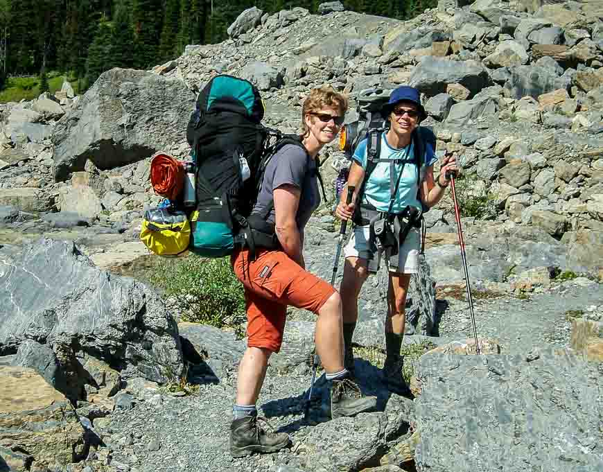
The Rockwall Trail is truly one of the outstanding multi-day hiking trips in the Rockies. It’s a challenging hike with so much daily elevation gain and loss – but the scenic rewards, especially of the big hunk of rock – the Rockwall itself, along with pretty meadows, lakes and waterfalls puts it way up there on the must-do list. Much of the hike is above treeline.

This post includes some affiliate links. If you make a purchase via one of these links, I may receive a small commission at no extra cost to you. Thank you very much for your support.

Access points to the Rockwall Trail

There are four access points to the Rockwall Trail along Highway 93 South. The most popular staring point for those wanting to do the full Rockwall Trail is the Floe Lake trail and the Helmet Creek Trail.

  • Floe Lake Trail, access via Floe Lake trailhead
  • Numa Creek Trail, access via Numa Falls trailhead (it can be damaged by avalanche debris in winter so check trail reports.)
  • Tumbling Creek Trail, access via Paint Pots trailhead 
  • Helmet Creek Trail, access via Paint Pots trailhead 

Floe Lake or Helmet Creek to start the Rockwall Trail?

You can start the Rockwall Trail at either end. It’s partially going to be a function of what campsites are available when you go to book. Most people I believe start at the Floe Lake Trailhead and finish at the Paint Pots Trailhead. The Floe Lake Trailhead is on the west side of Highway 94, 22.5 km south of the boundary of Banff and Kootenay National Parks. (There’s a big park sign announcing your entrance to each park.)

The Paint Pots Trailhead is 13 km northwest of the Floe Lake Trailhead. If you’re coming from the Trans-Canada Highway you’ll pass it first.

The trailheads are about a 2.5 hour drive from Calgary. The trailheads are only 13 km (8 miles) apart by car. Hitchhike back to your car at the end of the trip or arrange a car shuttle before you begin.

The harder hiking days are the first two if you start from Floe Lake. You do need to reserve the day backcountry campsite reservations open – or try and score a cancellation later on in the summer.

 Beautiful Floe Lake is the first stop if you're heading towards the Paint Pots
Beautiful Floe Lake is the first stop if you’re heading towards the Paint Pots

The best time to hike the Rockwall Trail

The best time to hike the Rockwall Trail is from mid-July to early October. If you try and book earlier, you’ll likely run into snow on the higher sections of trail. In fact, you can’t book the Floe Lake Campground until July 10th at the earliest. Some falls are fantastic for hiking while others are snowy early on – so fall is riskier to book.

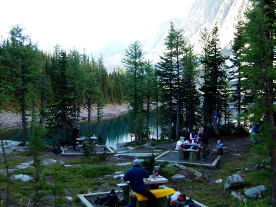
Campgrounds on the Rockwall Trail

In total there are five campgrounds on the Rockwall Trail. Distances are from the Rockwall trailhead. They include Floe Lake (10.7 km), Numa Creek (20.9 km), Tumbling Creek (28 km), Helmet Falls (40.4 km) and Helmet Ochre Junction (48.8 km). Floe Lake is gorgeous and the Helmet Ochre Junction is quite lovely too.

All campgrounds come with tent pads, food storage lockers OR cables, communal picnic tables and toilets.

Note: Reservations for summer 2023 open at 8 AM MST on March 22, 2023. Book on the Parks Canada website or by calling 1-877-737-3783 or 1 – 519-826-5291 if you’re from outside of North America.

Didn’t get the campsite reservation you were looking for? Don’t give up. Be the first to know when there is a campsite cancellation for your desired trip dates by visiting Schnerp

Day One on the Rockwall Trail: The hike to the Floe Lake Campground 

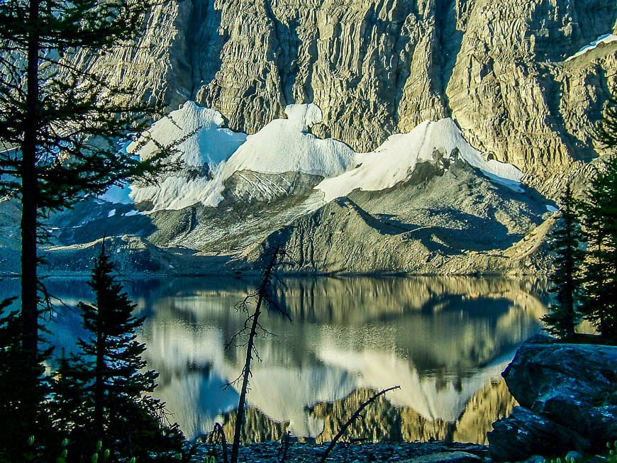
Floe Lake campground is the first destination. Hike 10.7 km up a steep and unrelenting trail from the parking lot through burned forest. Floe Lake is in a lovely setting at the base of the Rockwall.

"Cooking area at Floe Lake - separate from where you pitch tents"
Cooking area at Floe Lake – separate from where you pitch tents
Me with the Rockwall in the background on Day 2

Day 2 on the Rockwall Trail: Floe Lake Campground to Numa Creek Campground

On the second day out continue on the Numa Pass Trail to the Numa Creek campground via Numa Pass, the highest point on the Rockwall Trail. It’s 10.2 km between campsites.

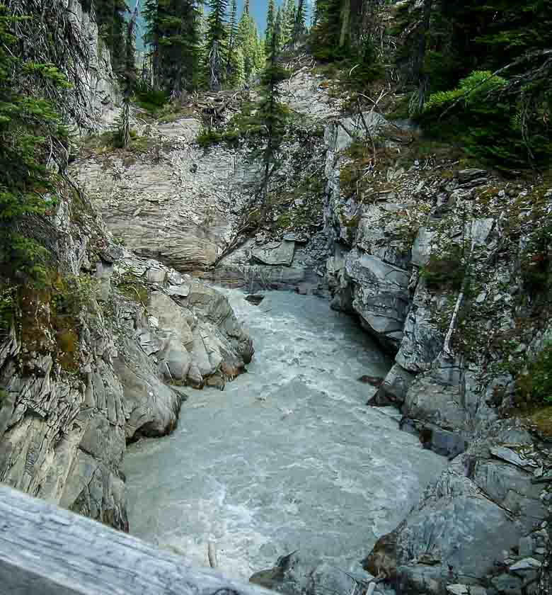
The distances sound manageable but there is constant elevation gain and loss over the length of the Rockwall Trail. You can get back to the highway via the Numa Creek Trail. In 2020 Parks Canada replaced the Numa Falls bridge and the rest of the restoration work was completed on the Numa Creek trail beyond the falls in July 2021. The trail is finally fully open again.

Resting
Resting our weary bones
Some easy lovely meadow walking on the hike

Day 3: Numa Creek Campground to Tumbling Creek Campground

It’s only 7.1 km from Numa Creek campground to the Tumbling Creek campground. Cross gorgeous Tumbling Pass – 4.8 km into the day’s hike to get there. But pay attention through here as this has been termed by writer Graeme Pole as the grizzly grocery store with its abundance of berries.

From there head through a boulder meadow and climb up a scree shoulder east of Tumbling Pass. Enjoy the views of Tumbling Glacier. Continue on through a lateral moraine and then steeply descend  to Tumbling Creek. The Tumbling Creek campground is 300 m west of the bridge.

Surveying the route on the Rockwall trail
Surveying the route
Getting refueled before the long descent
One of the silt-laden streams we crossed
I am ready here for the hiking day to be over

Day 4: Tumbling Creek Campground to Helmet Falls Campground

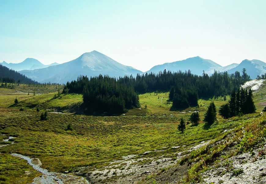
From the Tumbling Creek Campground, it’s 12.7 km to get to Helmet Falls Campground. There’s some steep climbing initially – a rude start to the day but nothing new – and then you enter the beautiful sub-alpine meadows that make up the Wolverine Plateau.

Wolverine Pass is 3.1 km up from the Tumbling Creek campground. Rockwall Pass is next – just 400 m away.

Easier hiking follows, then a climb to Limestone Summit and from there it’s a steady descent to the Helmet Falls Campground.

We elected to continue another 8.4 km – on a mostly gentle grade to the Helmet/Ochre Junction Campground. It’s a beautiful spot and if there’s some juice left in your legs at the Helmet Falls Campground give some consideration to continuing. It also wasn’t crowded.

Then it’s a relatively short and easy 5.2 km (3.1 miles) out past the Paint Pots to the trailhead by Marble Creek Campground.

My friend Sarah and I checking our location

Be bear aware

Do make lots of noise on this trail. The rangers monitor the area closely for bears and shut down sections of trail if they deem it to be unsafe because of too much bear activity. Use lots of common sense and keep your tent free of food and fragrances. Keep easy to access bear spray with you at all times. I like mine in a bear spray holster so I don’t set it off accidentally.

Read: Bear Safety Tips – What You Need to Know

In the parking lot at the northern end of the trail
In the parking lot at the northern end of the trail with a Dutch woman who joined us for the hike

More options for hiking the Rockwall Trail

Not everyone has the desire to hike the whole of the Rockwall Trail. If that’s the case consider one of these options. There really are a lot of permutations of the trail though given my druthers I would really want to include Floe Lake!

  • Do an out and back hike to Floe Lake with one night at the campground.
  • Spend two nights at Floe Lake Campground but on the second day hike do and out and back hike on the Numa Pass Trail.
  • Hike to Floe Lake and camp. Hike to Numa Creek Campground and camp or hike back to the highway on the Numa Creek Trail. You’ll need a car shuttle. 
  • Hike in from the Paint Pots to Tumbling Creek and then continue onto Numa Creek, Floe Lake and out to the Floe Lake Campground. 
  • Do a small loop hike starting at the Paint Pots trailhead or Tumbling Creek trailhead. Spend a night at Helmet Creek. From Helmet Creek you can also hike 4.0 km one way to Goodsir Pass and then out.  

A few things I’d recommend for the Rockwall Trail hike

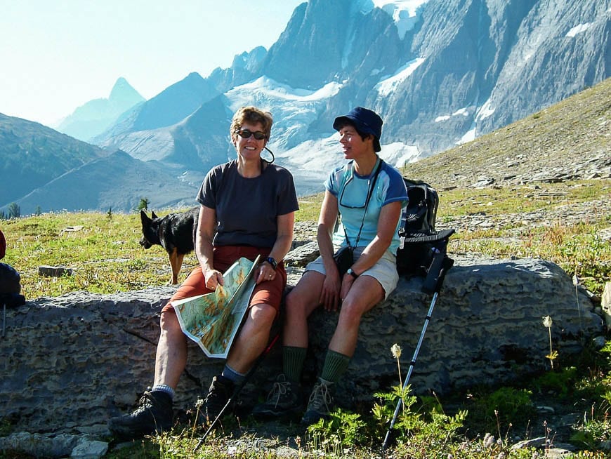
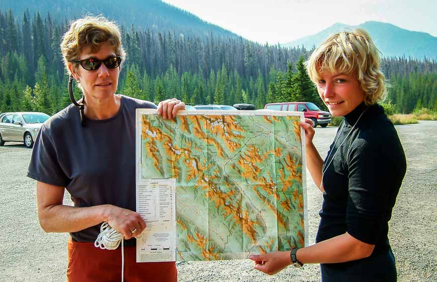
Before you go I highly recommend purchasing a copy of the Gem Trek Kootenay National Park map.

Don’t forget a headlamp, a water filter or water purification tablets, bear spray (you must buy in person), and a first aid kit. I highly recommend Compeed as a blister treatment, the best I’ve found on the market. I find it works way better than moleskin.

Location map of the Rockwall Trail (to give you a rough idea of start and end points)


Further reading on backpacking trips in the Rockies

Click on the photo to bookmark to your Pinterest boards.

Backpacking The Rockwall Trail - Kootenay National Park, BC


  1. Stunning photos! What a great way to spend the summer. Especially at such a scenically beautiful place like Kootenay National Park.

  2. Stellar photos (especially the reflection in the first photo) and fine description of this great national park. I have only driven through it missing such beautiful country as you describe but it is a quieter escape from Banff National Park and still very beautiful.

  3. We had a plan to hike the Rockwall Sept 8-12/10 but rain/snow and cold temps unfortunately changed our destination. This is definitely on my hiking ‘bucket list’ and hope I can do it with weather like you had – spectacular photos!

    1. What a shame the weather didn’t cooperate. The Rockwall Trail is a hike that is best done under sunny conditions. This year I have heard that the weather has been terrible in Calgary through to the Rockies all summer and I suspect there have been many disappointed hikers.

  4. Incredible! I think i might just have to check this hike out this summer. Look at that scenery… we are lucky people! 😉

    1. We were so lucky to have great weather the week we hiked it. We also never saw a bear or even any bear scat and I know my friend who had been stressing out about that was very happy about the hike. Gorgeous country on the entire hike & so worth doing.

  5. What beautiful hiking country! What would you recommend for a day hiker on the Rockwall Trail? That’s more my speed.

    1. I haven’t forgotten about you Donna – but my detailed map in in Vancouver – 500 miles away. There are four routes up so will check the map out when I gethome so I can recommend the best route for a day hike. Please allow another few weeks.

  6. Oh gawd!! So beautiful! It definitely makes me itching to go outside with my pack on, like, right now. Thx for sharing!

  7. I hiked the trail to Floe Lake when I was 21 in 1978 and I found it a great hike but somewhat demanding. In 2010 I went back with my 22 year old son to hike the Floe Lake trail. It was a wonderful hike but a little more demanding on me. With the view unobstruted by the forest fires several years back you could see for miles. Definitely one of my favourites.

  8. My word, Floe Lake is stunning! Certainly a rewarding hike. Although the “grizzly bear grocery store” is a bit scary!

    1. @Christina We entered the grocery store (packed with 4 types of different berries) with some trepidation and made lots of noise. Saw a deer but nothing else. And the Rockwall Trail, around Floe Lake is a fabulous hike.

  9. Looking at the picture and reading i recall moments that i spend alone trekking across Himalaya of Nepal (2000km) for 128 days.
    Nice article.Hope in future ,I be able to witness and experience what you have expressed above.

  10. Hi there,
    My husband and I are planning to do the Rockwall this August for our 1st Anniversary celebration! Super excited but curious how long you would say the full trail would take (reaching the peak and returning )? 110 km I believe….
    Love the pictures,
    Thx 🙂
    Rena

    1. @Rena I’d recommend a one way trip only and that would probably take you four nights and five nights. A back and forth would be tough and it’s easy enough to hitchhike back to your car – only about a 20 minute drive away down the highway.

  11. I grew up in the Kootenai National Forest and loved to backpack in the Cabinet Mountains Wilderness Area. It looks like Kootenay National Park is even more spectacular. I’ll have to get up there sometime. Your photographs are beautiful!!

  12. Thank you so much for the Rockwall Trail review. I will be doing this trail starting Aug 30th to Sep 3rd, 2012. I will start from Floe lake trail head, however not sure how to get shuttled from Marble Canyon (Paint Pots is supposedly closed) to Floe lake trail head.

    Anybody eles doing this hike during those days?

    1. Hi Aruna,

      We hitchhiked at the end – and a park ranger was kind enough to pick us up. I personally would try that BUT make a sign beforehand so people know you only want to go 5 or 6 miles or whatever it is.

  13. I have hiked portions of the Rockwall on four occasions, and the grizzly activity was pretty heavy on the trail to Floe Lake prior to the fire. After the fire, no grizzly signs on the trail. There were some bear signs coming down from Numa Pass on both occasions. But never actually saw a bear on only of the trips.

    I will say this, be in good shape and have knee supports in your pack and trecking poles if your knees have the mileage that mine do. Summer time is spectacular for flowers and fall for larch turning. I do wish there was a hiker’s shuttle along the highway twice a week to do the whole loop trip.

    1. @Bruce We never even say bear scat on the trail when we did it. I consider that to be a lucky thing, The section through the “grizzly bear grocery store” made me nervous but felt OK everywhere else on the trail with regards to wildlife. I think the rangers monitor the trails through here pretty closely.

  14. Hi all,
    After 2 years of drooling over this trail I have chose to hike the Rockwall this summer (July/August 2013).
    Consider myself to be in quite good physical shape, and have a great deal of hiking experience, is there anyone else planning to hike this trail looking for a trail mate?

    Cheers,
    Rena 🙂

    1. Good luck with that Rena. WE ended up picking having a lone female Dutch girl join us for the hike. We met her in the parking lot and she ended up being great company. Plus she had a dog and we liked the heads up for wildlife.

  15. I never really see myself backpacking to the mountains but if the destination is as beautiful as this place, I bet I’ll be willing to try!

  16. Looking forward to hiking this trail in mid August. Just made our reservations! I’m sure we wont be disappointed. Looks beautiful 🙂

  17. Does anyone have access to a good topographic map of the Rockwall Trail, in Kootenay National Park?

    1. Hey! I did some mapping in this area for my Geology undergrad and used Geological Survey of Canada for Topo maps. Geological Survey of BC/Alberta might have them too. Not sure if they will cost you anything. Best of luck.

  18. great photos! what a beautiful place to go. Is this hike possible during the last week of april / first week of May? I am not familiar with the conditions and climate of the rockies during April and May. Thanks!

  19. Hi, do you recall what the tree-cover was like at the camping sites? Could you hang a hammock or would you have to be on the ground? thanks!

    1. @Daniel I think I’d be pushing it if I said only take a hammock. I think in places it would work but I’d only want it for back-up. It’s been a few years so who know what the parks people have done with the campsite too.

  20. Do you know if this hike is dog friendly? (On leash of course) also if not would you happen to know any multi-day hikes that are dog friendly?

    1. @Samantha We hiked this trail with a woman who had a dog and no problem. The trails that are a problem with dogs are ones where there might be caribou like the Skyline Trail and the Brazeau Loop.

  21. Thanks for the trip report, the scenery looks amazing! I am doing this hike in 2 weeks, do you have more information on the car shuttle?

    1. @Laura There is no formal car shuttle. You have to arrange your own or hope for the kindness of strangers to get you back to your starting point. Smile alot – someone is bound to help you out. And the driving time between trailheads is very short.

  22. Great post, when I was in my early 20’s I ran from the Floe lake parking lot to the Ink Pots parking lot in one day, about 55Km, took about 10-12 hours as I remember, although at the time I wasn’t sure what I was doing, eating peanut butter and jam sandwiches! Would Love to do that again, with better running shoes! Thanks for sharing, I’m inspired!

  23. Hi Leigh!!
    We are traveling thru Canada this summer and we are excited to do the Rockwall Trail!
    What is your thought on water…shall we bring a filtering kit?!
    ( newbies we are…although we have put many miles on day hikes!!)
    Thanks,
    Chris and Sarah

    1. @Chris and Sarah, I definitely would despite trying to reduce weight. There’s no way you want Giardia. Don’t forget the bear spray either.

  24. Hi Leigh!
    Is The Rockwall Trail dangerous in terms of Cliff, or Cliff slippery area? I am afraid of heights.

    Thanks, Grace.

    BTW, the previous email was mistakenly sent. Please ignore. Thanks a lot!

  25. I have a question about booking campsites. Are there more than one tent pad per site? My friends and I are going to do this in Aug and need to know if we book a site for each of us or can we share. Thank you.

    1. @Brenda There are multiple tent pads at each campsite but I think the most you can have is 2 tents on each campsite. Ask when you book.

  26. Lovely photos! Thanks for sharing. I’m booked in for late June (super early season/Spring). Because of how early I’m booked unfortunately Floe Lake isn’t offered thus I’m doing Helmet Falls 1st night, Tumbling Creek 2nd, Numa Creek 3rd, and then hiking out to my car at Floe Lake Trailhead. Clearly that’ll be a long day but predominantly a descent. Just curious about how hard it was to get a hitchhike? I’m a 31 year old male and am hoping it’s heavily trafficked at that time and that me being a single male traveler won’t discourage someone from transporting me to Paint Pots. Thanks!

    1. Hi Nick,
      I was with my girlfriend and we didn’t have to wait long as a park ranger picked us up saying it might take a while to get a ride.
      I’d say look smiley, perhaps have a sign made up ahead of time and don’t be afraid to approach someone and ask in a friendly manner if you’re in the parking lot. It’s the luck of the draw.

Your email address will not be published. Required fields are marked *

This site uses Akismet to reduce spam. Learn how your comment data is processed.

My Cart Close (×)

Your cart is empty
Browse Shop