If you want a moderate hike that gets your heart rate up, delivers Rocky Mountain views and wildflower filled meadows, do the Powderface Ridge hike near Bragg Creek.
The trailhead for Powderface Ridge is about an hour’s scenic drive from Calgary – about 10 minutes past Elbow Falls and the trailhead to the popular Prairie Mountain hike. While there are several variations of this hike, we did the straightforward up and back hike from the trailhead to a cairn with a flag – which is definitely not the full ridge hike. It is hike #31 in Gillean Daffern’s Kananaskis Country Trail Guide.
Note that the road to access this hike is closed from December 1 – May 15 every year.
Before you go
Current conditions: Check the Alberta Parks website for current trail reports.
Permits: Purchase a Kananaskis Conservation Pass before you leave for the hike.
Don’t forget: The 10 hiking essentials.
Always practice: The 7 Leave No Trace principles. That includes plan ahead and prepare, travel on durable surfaces, dispose of waste properly, leave what you find, respect wildlife, minimize campfire impacts (not relevant on this hike), and be considerate of others.
Powderface Ridge hike details
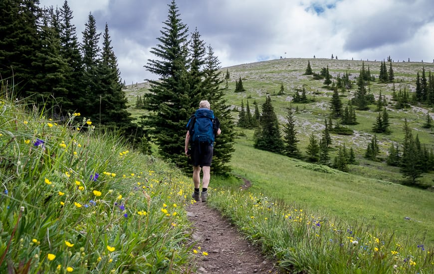
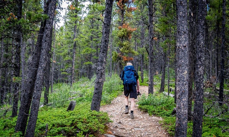
The main Powderface Ridge hike starts off strenuously – in the same vein as Prairie Mountain but with none of the early views. Reportedly it’s a climb of 400 m over 2 km, enough to get the attention of your heart.
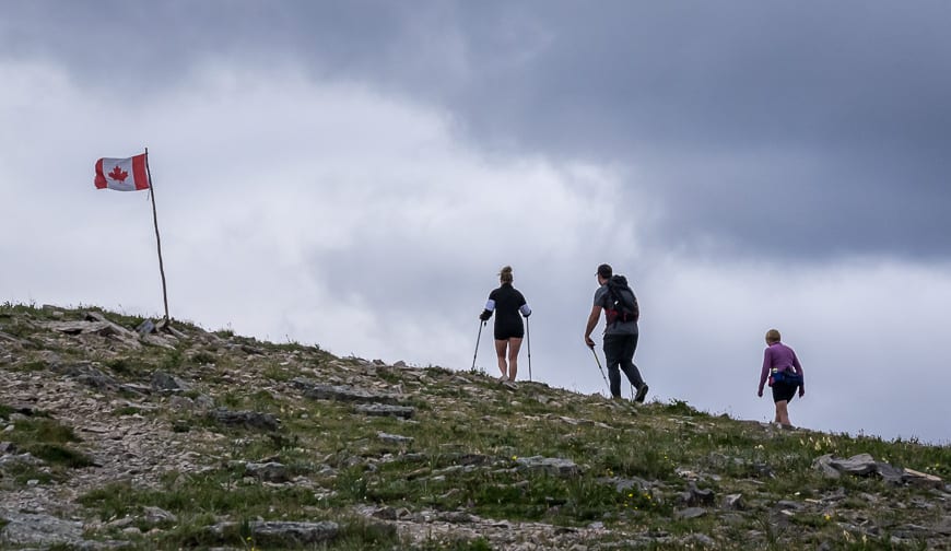
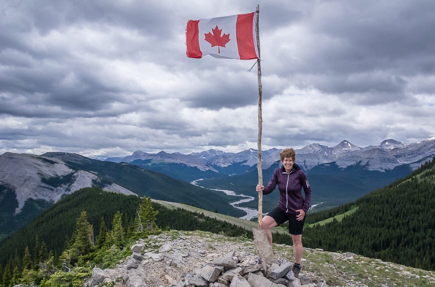
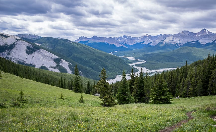
Fortunately once you reach the meadows the closed in feeling goes away and the trail moderates in grade. In about 700 metres reach a col. Head right to reach the flag and cairn and what is actually the Rainy Summit Ridge – along with great views of Mount Glasgow, Cornwall, Outlaw and Banded Peaks.
This seems to be a popular turnaround point judging from what we saw. It took us just two hours to get up and down from the flag.
But to actually hike Powderface Ridge requires more effort – and it wasn’t until I got home and started reading more descriptions that I realized we hadn’t done the whole thing – by a long shot. From the col head left into the trees following a trail for 2.3 km to reach the northern end of the ridge and the summit.
Options to do the whole Powderface Ridge
There are options to do the Powderface Ridge but a map is recommended along with some prior planning.
- From the intersection of three trails (Three Pass Trail) on Powderface Ridge you could do an out and back on gentle slopes at the north end of the ridge and then descend on one of the routes described below or simply retrace your steps.
- Another option is to descend west for 1.3 km on Three Pass Trail to reach the dirt Powderface Trail Road – where you will have either left a car, are prepared to walk 6 km on a dusty road or you find someone on the road willing to drive you back to your starting point.
- Or head east down Powderface Creek towards Highway 66, about 8 km away to come out near the Prairie Mountain Trailhead. Again you would need a car shuttle or the kindness of strangers to return to your vehicle.
Here’s a look at the Powderface Ridge hike to the flag and back (called the normal route)

The Powderface Ridge Trail starting at Sacramento Pass
One July weekend John and I decided to try another version of the Powderface Trail.
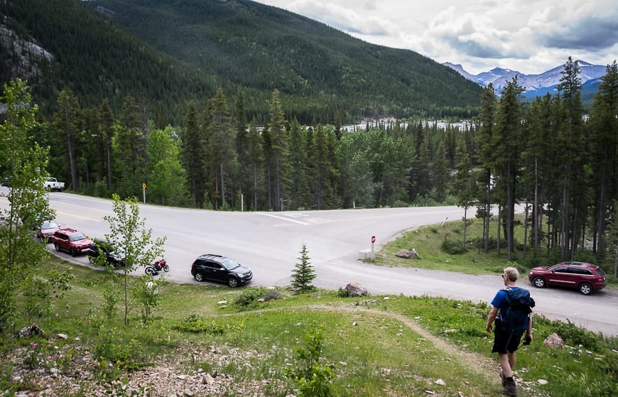
We drove 6 km north of Highway 66 on Powderface Trail (a dirt road) to park at Sacramento Pass where there is room for about six cars.
This version of the Powderface Ridge hike is far easier than the normal route up Powderface Ridge.
Start gently climbing through open woods to reach a T-intersection. There is a trail sign at the intersection. Go right to head for Powderface Ridge. If you go left you end up on North Powderface Ridge.
Continue hiking up through trees to reach a meadow. There are some lovely views – and from the meadow you can see Powderface Ridge above. Continue climbing, never steeply to reach the ridge. Turn right and start walking along the ridge. Part way along you’ll see a trail coming up on your left. That takes you down to Highway 66 near the Prairie Mountain trailhead.
If you’ve left a car at the main trailhead follow the ridge for its full length before the steep descent.
On this hike we simply did an out and back hike along Powderface Ridge and turned back when the storm looked more threatening. It’s lovely easy walking along the ridge. I highly recommend this version of the Powderface Ridge hike to families.


Location map of the Powderface Ridge hike
Other hikes close to Bragg Creek to consider
- The Nihahi Ridge Hike in Kananaskis Country
- The Sugar Mama – Sugar Daddy Hike
- The Moose Mountain Hike in Kananaskis Country
- The Fullerton Loop Hike in Kananaskis
- Canyon Creek Ice Cave Hike Near Bragg Creek
Click on the photo below to bookmark to your Pinterest board.
