Kananaskis Country was a shock. In my mind Kananaskis Country was the poor cousin to Banff National Park, so I was very surprised on my first visit to the area. Our plan over a weekend stay at Mount Engadine Lodge was to go snowshoeing to mountain lakes – specifically nearby Rummel and Chester Lakes. I didn’t know what a treat I was in for.
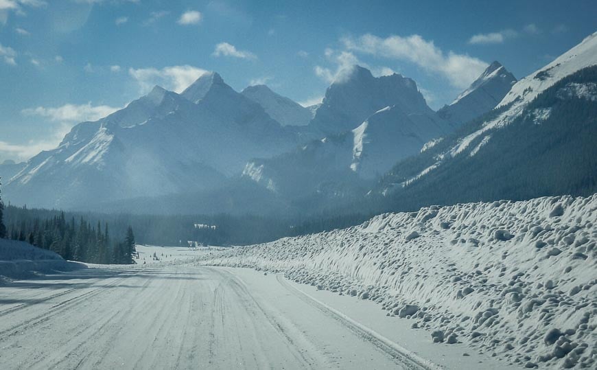
To back up, Kananaskis Country is only 90 kilometres southwest of Calgary and less than 40 kilometres south of Banff as the crow flies. It turns out you get the same great mountain scenery that Banff offers – though you do need a Kananaskis Conservation Pass. And there are loads of choices when it comes to adventures outside – whether it be cross-country skiing or snowshoeing to mountain lakes.
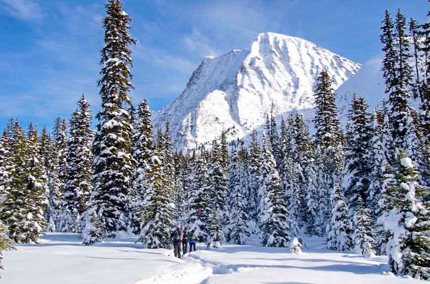
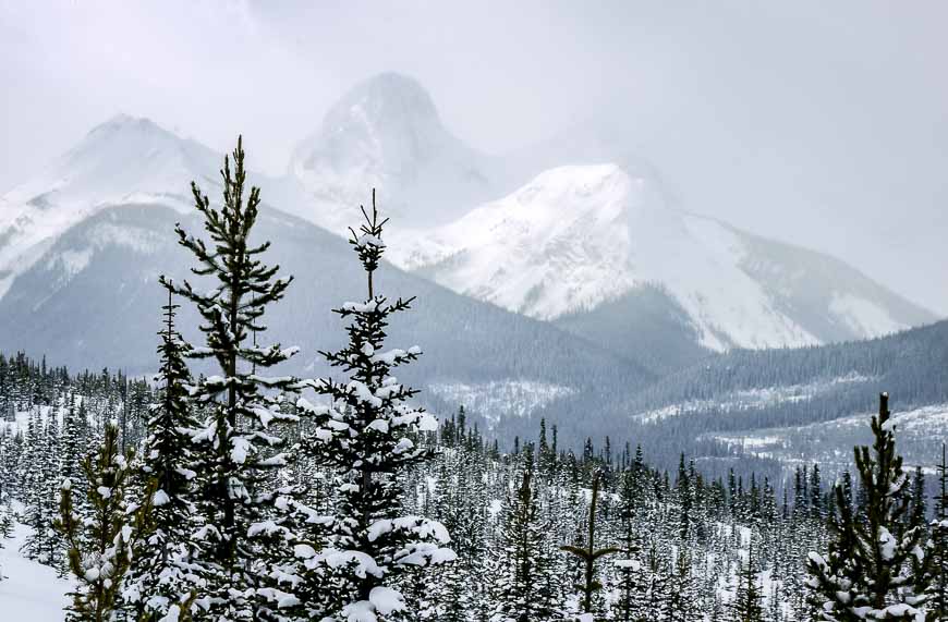
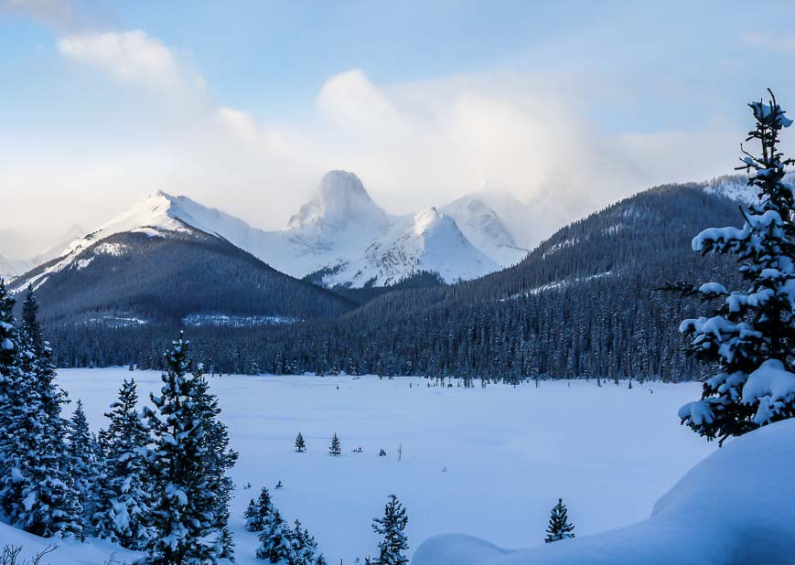
I’d expected lower level mountains with pleasant but not stunning scenery. As you can see in the photo above that’s not the case. There are over 4000 square kilometres of country to explore, including five provincial parks, the Nakiska Ski Resort and the world class Canmore Nordic Center Facility built for the 1988 Winter Olympics.

This post includes some affiliate links. If you make a qualifying purchase through one of these links, I will receive a small percentage of the sale at no extra cost to you. Thank you very much for your support.
World-class snowshoeing practically to Chester Lake and Rummel Lake
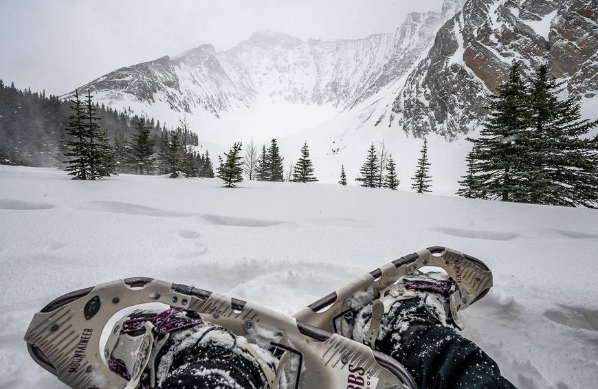
Over our Mt Engadine getaway weekend we explored two superb snowshoe trails to mountain lakes – Chester Lake and Rummel Lake. These outings are the perfect antidote to the winter blues. The trailheads to the lakes are 6 km apart on the Smith-Dorrien/Spray Lakes Road.
You can’t help but feel happy to be alive. Even better for us was the fact that the temperatures cooperated. It was a balmy -6°C versus -15°C in Calgary.
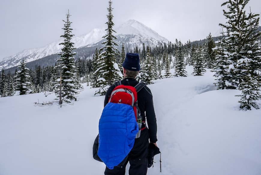
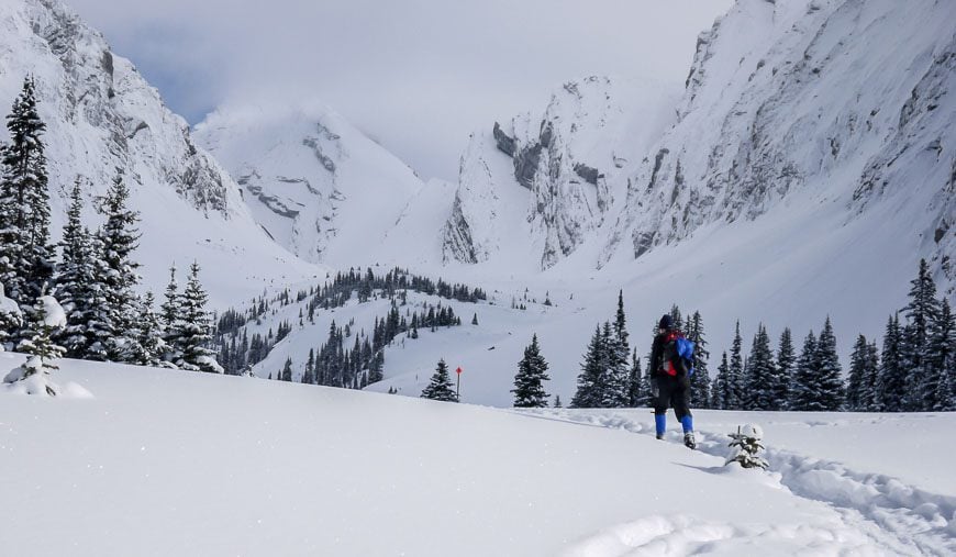
Rummel Lake snowshoeing
The trail to Rummel Lake begins right at the intersection of Mount Shark Road with Spray Lakes Road. This is also the turnoff to Mt Engadine Lodge so it’s well marked. Snow banks are so high that if there are signs pointing to Rummel Lake, they’re buried right now.
Parking is along Spray Lakes Road – so don’t go looking for a formal parking lot.
The trail starts on a logging road. There is a marker and a trail map at the start of the trail. I recommend taking a photo of it to refer to. There were trail signs once you reach the High Rockies Trail and markers once you cross Rummel Creek, on the last third of the trail.
The best map isGemTrek Kananaskis Lakesthough the route to Rummel Lake is right on the edge of it – though still visible.
The bottom line is if there haven’t been recent snowshoers or skiers then the trail may be difficult to follow, especially after the first few kilometres.

After gentle switchbacking on logging roads the trail heads east once you hit the clearing on what is now the High Rockies Trail with the view of the Spray Lakes Reservoir.
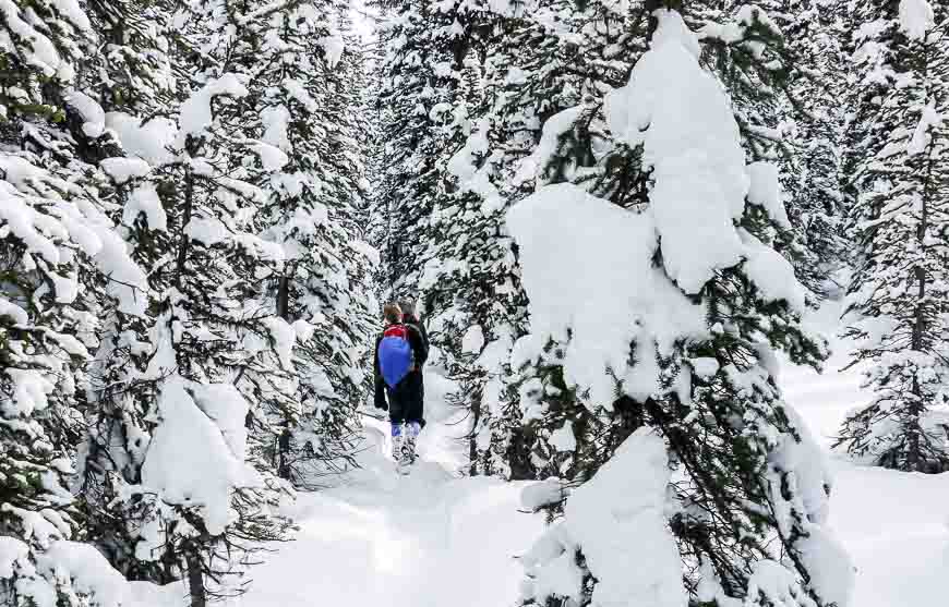
The climbing is mostly undulating from here on in – and almost entirely through the trees until you reach Rummel Lake. The trail disappeared when we were less than half way up. Previous snowshoers had turned back but with some map checking we were able to plow on.
And plow is a good verb to describe the hard work breaking trail all the way up to the lake.
Once in the neighbourhood of Rummel Creek, yellow diamonds marking the trail to the lake come into view. Unfortunately on Saturday when we were there the sun wasn’t shining. It would be a stunning finish in the sunshine.
It took us two hours to get to Rummel Lake and just under 1.5 hours to get down. It’s 10.0 kilometres round trip and the total elevation gain is approximately 310 metres (1,000 feet).

I’d call this an easy to moderate snowshoe hike – definitely moderate if you have to break trail. On the way down we ran into at least a dozen other snowshoers and a few skiers so it seems to be a popular weekend spot.
In a snowstorm or if you’re the first one out after a big snowfall bring a good map because there could be some route finding challenges. I would have to say it’s improved to a certain degree since I first did it. Once on the High Rockies Trail there is signage pointing to the Rummel Lake Trail. The biggest issue still in 2022 is if you are the first one out after a giant snowstorm.
Chester Lake snowshoeing
The Chester Lake trailhead is far more obvious than Rummel Lake. Look for a giant parking lot on the east side of the Smith – Dorrien/Spray Lakes Road, six kilometres south of Mt. Shark Road and the Rummel Lake trailhead, and about 20 kilometres north of Highway 40.
Chester Lake is a very popular cross country skiing and snowshoeing destination. The trails are well signed all the way to the lake.
Skiers and snowshoers follow separate trails after about the first 200 metres and the intersection will be obvious.

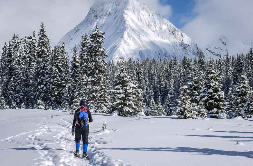
The trail to Chester Lake climbs more steeply and for longer than Rummel Lake so you can expect quite an aerobic workout. But once through the steep climb you enter a huge meadow with superb views in all directions.
Then it’s an easy snowshoe across the meadow, a gentle climb through the trees to another open area and in less than 500 metres you arrive at the lake.
If you’re feeling very ambitious you can continue northwest in to the Three Lakes Valley. At most you can continue 2.7 kilometres before hitting avalanche prone country.
The snowshoe up to Chester Lake took us only about 90 minutes – and that’s to cover 4.4 kilometres one way. It also gains about 300 metres.
The return is quick – just over an hour. But if it’s a nice sunny day find a place out of the wind and enjoy the spectacular beauty.

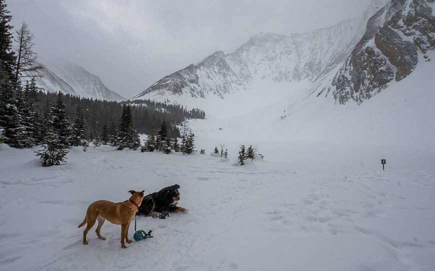
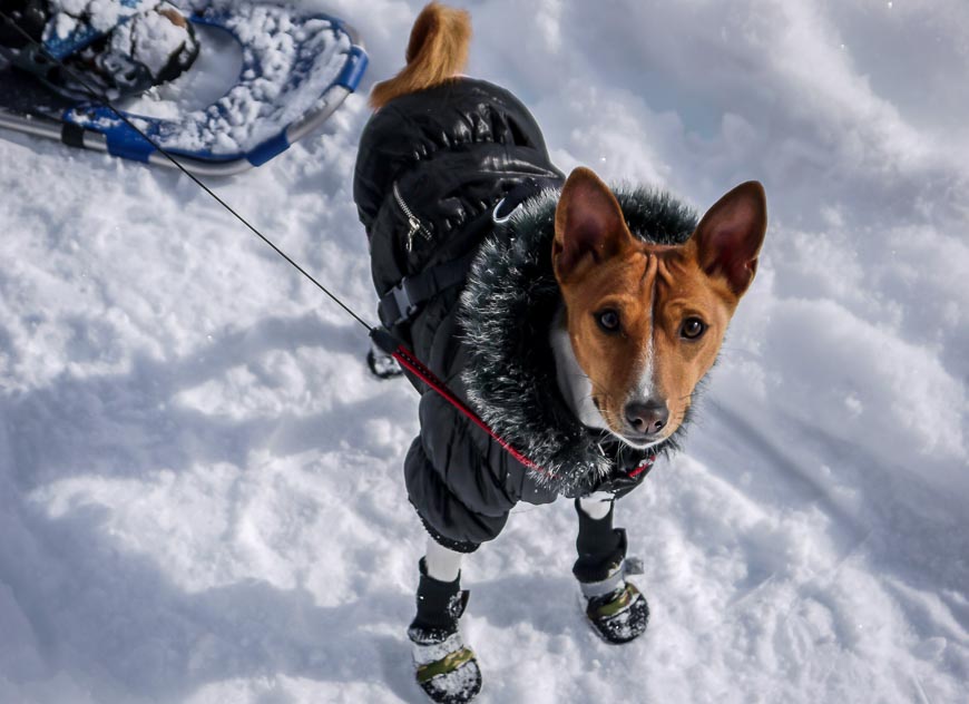
We saw many more people on the Chester Lake trail than Rummel Lake – but that’s probably because it was such a glorious day. We also met many dogs, allowed on a leash which I think is great. This Bezengi sports the latest in dog finery – down booties, pink drawers and a down coat.
Tea at Mt Engadine Lodge after snowshoeing to Chester and Rummel Lakes
You can end a fantastic day of snowshoeing or skiing in this area with a tea put on by Mt. Engadine Lodge – from 2 – 5 PM. I highly recommend this especially if you’re the least bit hungry. Even better I suggest an overnight stay and you can book here.
An incredible charcuterie plate along with hot drinks is available for $35.00 per person. Everything is made on the premises. If there are more than 6 of you, make reservations. The lodge is a five-minute walk from the Rummel Lake trailhead.
Superb snowshoeing, stunning scenery and great food if you stop for tea should put a smile on your face.
Location map of the snowshoe trails in Kananaskis
Further reading on winter activities in Alberta
- 25 Magical Things to Do in Winter in Lake Louise
- Snowshoeing the West Bragg Creek Trails, Alberta
- 8 of the Best Places to Snowshoe in Alberta
- A Snowshoeing Adventure at Fortress Mountain
- Where to Go Snowshoeing in Banff National Park
Click on the photo to bookmark to your Pinterest boards.
