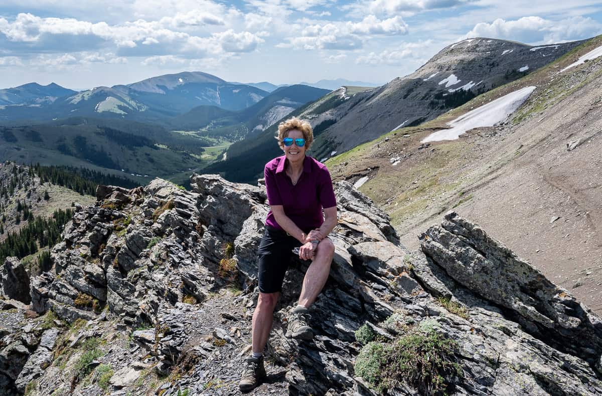
The Hailstone Butte hike in southern Kananaskis Country exceeded all expectations, especially as an early season destination.
The hike is short – as in just 2 km one way, so fit people good at scrambling could be on top of Hailstone Butte 30 – 40 minutes after leaving the parking lot. Many of you might wonder, why bother with such a short hike when it’s a bit of a haul to get here from the Calgary area?
For starters, it’s a pretty drive through the rolling foothills to get to the trailhead. This is an area that isn’t very busy, so you may only see a few other hikers.
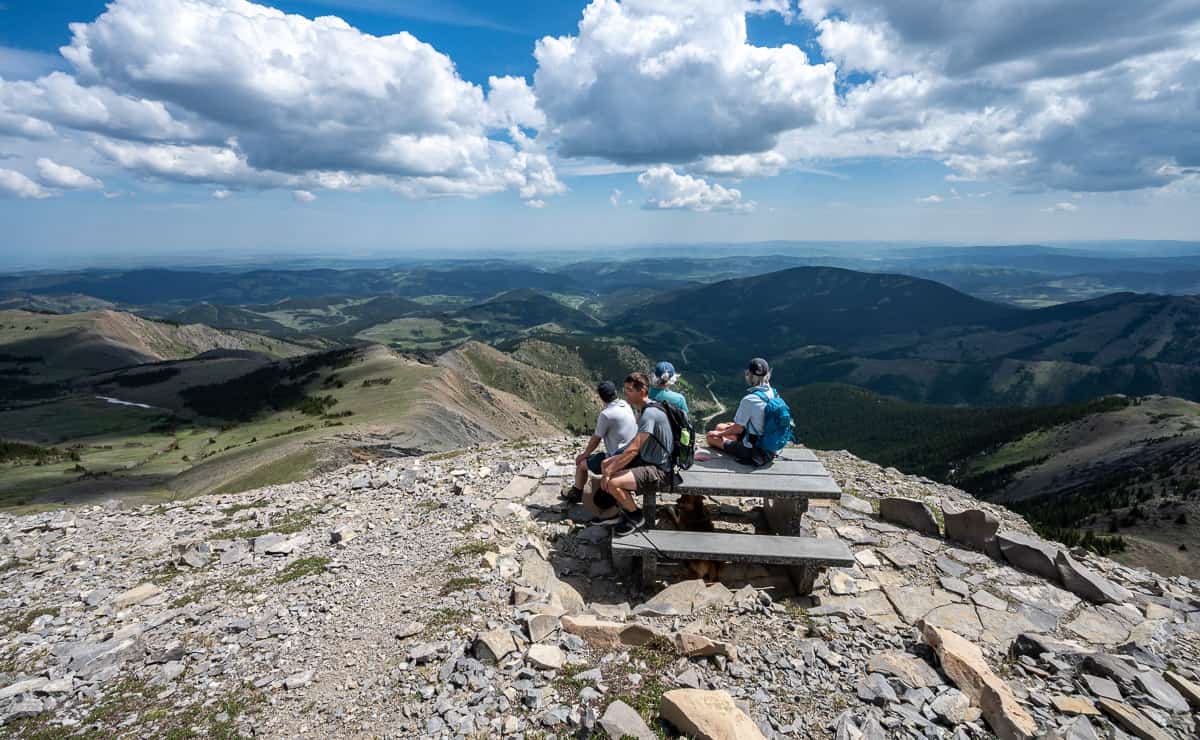
Once on top of Hailstone Butte, you can add mileage – about 3 km return – by continuing to the south summit, reportedly a few feet higher than where the Hailstone Fire Lookout is located. I think that’s a worthy goal to appreciate the panoramic mountain views.
The other option is to hike down the fire road (and back across the gully) to return to your car. That will likely add another few kilometres as well.
In my mind, what’s wrong with simply lazing at the top, enjoying a long lunch, after doing the Hailstone Butte hike? The views behind the Hailstone Lookout of Plateau Mountain, Mt. Burke, Windy Peak and Mt. Livingstone are exceptional, so it’s a lovely place to linger.
One thing I should mention, is that the Hailstone Butte hike is notoriously windy – though it was calm the day we did it.
This post includes some affiliate links. If you make a qualifying purchase through one of these links, I will receive a small percentage of the sale at no extra cost to you. Thank you very much for your support.

Hailstone Butte hike summary
Distance: 4.0 km (2.5 miles) return with the option of adding about 3.0 km (1.9 miles) by hiking to the building off to the south.
Elevation gain: 327 m or 1,073 feet
Level of difficulty: Moderate a you need to cross a steep scree slope and climb some grass and stone benches.
Time needed: 2 – 4 hours depending if you want a fast up and down on the Hailstone Butte hike or want to add kilometres at the top – and linger over lunch with a view.
Best time to hike: Late May to October – but it’s going to depend on the year and how much snow there is, as there can be cornices and wet snow avalanches coming off the top.
Backcountry camping: Yes – reasonably close to Indian Graves Campground and the Cataract Creek Campground.
Dogs: Permitted on a leash. There are cooling streams and a pond at the start of the hike. Carry extra water for them and don’t forget acollapsible dog bowl.
Permit: Be sure to purchase a Kananaskis Conservation Pass before you start the Hailstone Butte hike.
Don’t forget: Always take the hiking essentials. Let someone know where you’re going and when you’re due back. Packa toque, a warm coat like thePatagonia down sweater with a hood– andlightweight gloves.
Bears: We didn’t see any sign of bears but it’s always prudent to pack bear spray that’s easy to access. I like to keep mine in abear spray holster.
Safety: Winds have been clocked at 150 kph (93 mph) on Hailstone Butte, so take a wind breaker and something warm. Beware of electrical storms as it’s very exposed on top of Hailstone Butte.
Book: With lots of wildflowers about, you might enjoyPopular Wildflowers of Alberta and the Canadian Rockies.

Hailstone Butte trailhead location
The Hailstone Butte trailhead can only be accessed by car as of May 1st each year – but you’re better off waiting until early June to hike up Hailstone Butte because of the snow. The dirt roads would likely be muddy mess early in May as well. I was surprised at how scenic the drive is in from Highway 22 – and how reminiscent it is of the dusty Smith Dorrien trail drive.
If you zero your odometers at the Highway 22/Highway 532 intersection or at Highwood Junction, you should have no trouble finding the trailhead.
From Calgary
Take the Cowboy Highway – also called Highway 22 to Longview. Continue for 28.5 km to Highway 532, a dirt road. Turn right or west and drive 21.5 km – past the turnoff to Indian Graves Campground at 13.4 km. You’ll find a large pullout on the east side of the road, just after a large pond and a Texas gate. Parts of the road can be rough, especially the last 8 km.
Note that Highway 532 is closed until April 30th starting from the turnoff to the Indian Graves Campground.
From Highwood Junction (where Highways 40, 541 and 940 intersect)
Drive 31.8 km on Highway 940 (closed December 1 – April 30th). At Highway 532 turn left or northeast and follow the road for another 4 km to a roadside pullout called the Hump, just before a large pond and a Texas gate.


Location map of Hailstone Butte
Hailstone Butte hike description
There is no signage on the Hailstone Butte hike but if you have eagle eyes, you can see your destination high on the ridge to the northwest above you from the parking lot.
To start the Hailstone Butte hike, cross the road from the parking lot and walk about 25 m or so down the road (southerly) to your left. Towards the end of the bank on your right, you will see a small white sign. From here, head up the bank bearing right (avoid stepping on the pretty wildflowers) until you see the emergence of a distinct dirt path.
A short distance ahead (~ 25 m) the path will fork. Make sure you select the left fork which heads down the hill. The right fork path apparently just peters out.
As you head down the left fork you approach a tiny stream. Find a spot to water your dog and keep it in mind for the return. You will be following this stream for a while but don’t count on there being water in it higher up – depending on the season. As you move along you will encounter more leg scratching shrubby areas, sometimes overgrowing the path.
Carry on up the drainage following the path until you are below the cliff bands and looking at the airy point a 100 metres ahead of you. Call this the pre-scree viewpoint and it could be one of the access points for the Roper route described below.
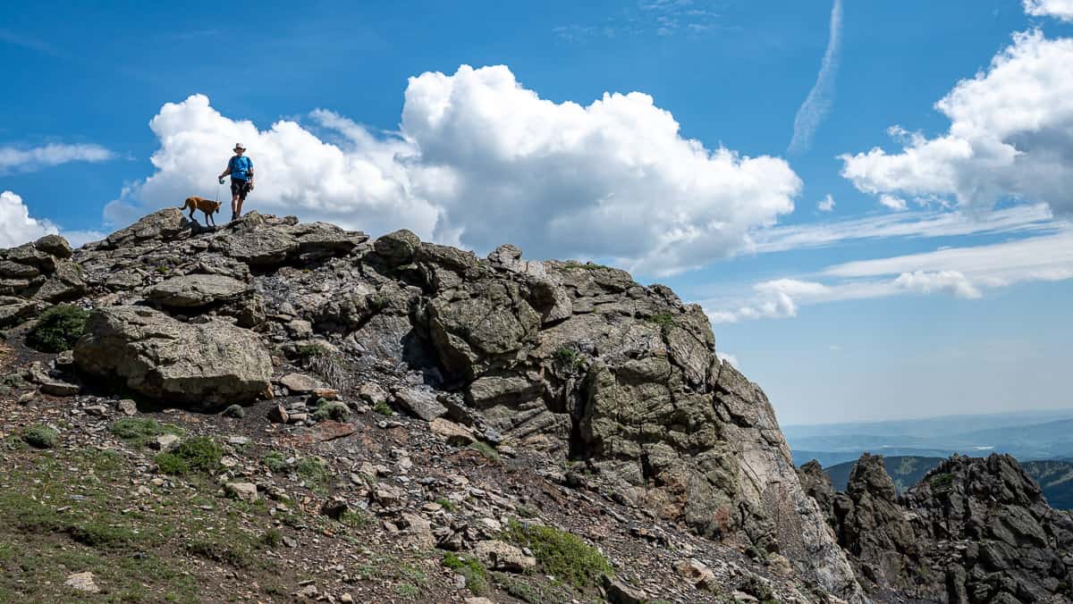
To access the other two summit routes, carefully cross the steep scree slope until you arrive at the airy point as shown with John and our dog Mila. It’s worth a peek over the edge as there are great views and interesting folding in the rocks below.


Once you’re below the Hailstone Butte cliffs there are three ways to hike up Hailstone Butte, one that’s easy but longer, one that’s in between easy and moderate and the most popular, and a harder route that requires more scrambling.
The first and harder way – which we didn’t do is called the Roper Route. From below where the fire lookout sits (if you could see it) the route involves heading south across the sometimes-steep grassy slope, only about 50 metres left of where the fire lookout sits.
To get to the top you must scramble up a rock band and there is some exposure. It shouldn’t take you more than a few minutes and there are some grassy sections to make it easier – but it sure looks imposing. Do not attempt this route in spring if there are large cornices.

The second option – which is what we did – is to cross the steep scree slope pictured below, and then take a hard left and hike up a series of grassy ledges leading to rocky ledges that came out in front of the picnic table. It looks harder from afar than it really is. We knocked it off in about 10 minutes.
The third option is to hike cross-country after crossing the steep scree slope to a fire road you can see off in the distance to the north. It curves around and heads up at a modest incline to reach the Hailstone Lookout. If you’re hiking with young children, it would be your best option but probably adds about 2 km each way.


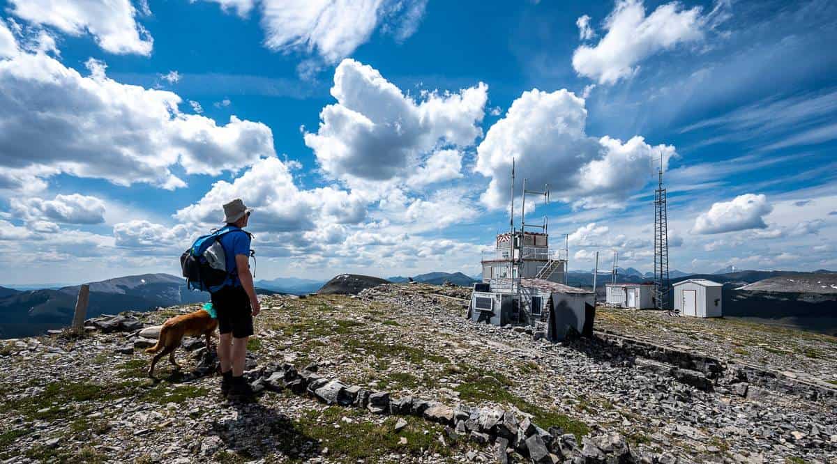
Hailstone Lookout
Hailstone Lookout was not manned when we did this hike in early June. Because of that, we went up the lookout stairs (recommended by one of the hikers at the picnic table) to admire the incredible stonework done by Tom Johnson, one of the former lookouts, from above. It is a thing of beauty and worth the Hailstone Butte hike just to see it.


Extending the Hailstone Butte hike
Notice the small building at the top of the cliff band in the distance. It’s about a 1.5 km hike to get there and well worth doing. The views are very good, and you get a different perspective from hiking to the end of the butte.


Final thoughts
I loved the Hailstone Butte hike for the wildflowers and the mountain views on top. And what what a treat it was to see another fire lookout along with the fabulous stonework. If you’re looking for a longer hike from the same trailhead – providing it’s not crazy windy, try the 9 km Windy Peak Hills hike.
Interested in exploring more of the area and hiking in Southern Alberta?
South Kananaskis hikes
- Mount Burke Hike in Kananaskis
- Raspberry Ridge Hike, Kananaskis Country
- Grass Pass Hike in Kananaskis Country
- Mount Lipsett Hike in Kananaskis
- Hiking the Whaleback Ridge near the Cowboy Trail
Southern Alberta
- Alberta’s Fabulous Table Mountain Hike
- 10+ Fabulous Hikes in Waterton Lakes National Park
- 5 of the Best Crowsnest Pass Hikes
Click on the photo to bookmark to your Pinterest boards.
