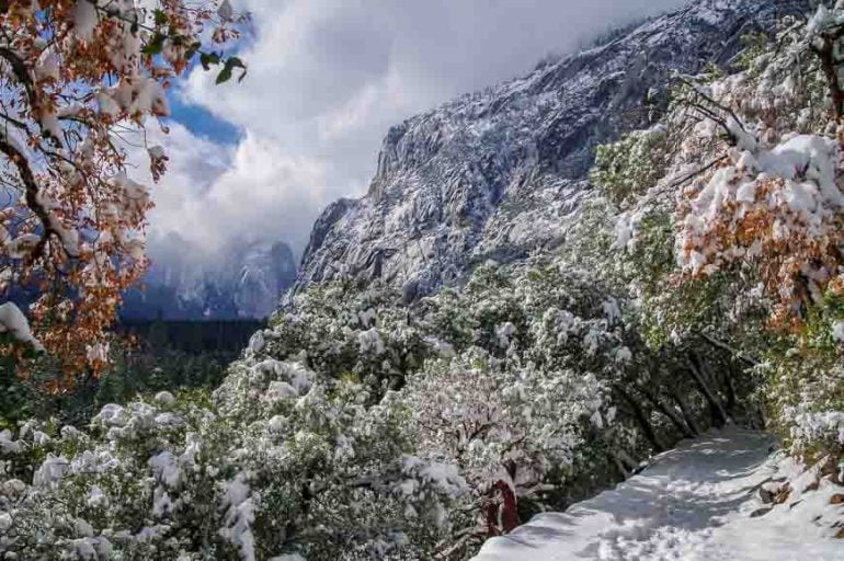
Best Hikes in Jasper National Park
Jasper National Park is a fantastic destination for hikers and backpackers. On the 15 plus best hikes in Jasper described – and personally tested – enjoy everything from a scenic 30-minute hike to Pyramid Island to world-class multi-day hikes in the Rockies showcasing some of the finest mountain scenery on the planet.
Marvel at meadows of wildflowers, stunning waterfalls and rushing water through eroded canyons. There are family-friendly lake hikes, mountain peaks to climb and some easy strolls.
What are the very best day hikes in Jasper? That’s a tough question but if I had to pick only one, I’d go with the Wilcox Pass hike. And for a multi-day hike I’m partial to the Skyline Trail.
What hike you choose is going to be a function of how much time you have, who you’re hiking with, and how fit you are. I’d say the boulder section on the Geraldine Lakes hike is the toughest, especially when wet, of any of the hikes in Jasper I’ve described.
Go prepared. Mountain weather is fickle and can change in a heartbeat. Be bear aware and always carry bear spray. Don’t become a statistic on the hikes near canyons and waterfalls for fleeting Instagram fame.
Note: There are a few hikes that are still closed because of the 2024 Jasper fire.
This post includes some affiliate links. If you make a purchase via one of these links, I will receive a small commission at no extra cost to you. Thank you very much for your support.
Location map of the best hikes in Jasper National Park
- Click on the three dots near the top right-hand corner to email a copy of the map.
Before you go on any of the best hikes in Jasper National Park
Trail reports: Check Jasper National Park trail reports before you go. Trails get closed on short notice for many reasons.
Dogs: Before you head to any Jasper trail, check to see if the dog is allowed. Many of the best hikes in Jasper don’t allow dogs because of caribou.
Map: The Gem Trek Jasper and Maligne Lake is a useful resource. For an offline hiking app I like Organic Maps.
Weather: Check the weather forecast in Jasper (and for specific hikes when possible) before you head out. You don’t want to be on an exposed peak in a thunderstorm.
Bears: If you’re hiking in bear country – and most of the time you are, I always carry a can of bear spray that’s easy to access. I recommend keeping it in a bear spray holster.
Common sense: Always let someone know where you’re going and when you’re due back.
Don’t forget: No matter what the difficulty of the hike, take the 10 hiking essentials. As Parks Canada says – “you are responsible for your own safety.”
Please: Practice Leave No Trace principles.
Hiking tours in Jasper
If you’re traveling alone or would prefer to hike with a licensed professional guide, then sign up for one of the following hiking tours.
The guided Ice Walk on the Athabasca Glacier is offered by Viator. It’s one of the top hikes in Jasper National Park you won’t want to miss.
Companies that offer day hikes in Jasper include Canadian Skyline Adventures and Jasper Hikes & Tours.
High Sights Travel offers the Tonquin Valley and Skyline Trail every summer as well as day hikes.
Starry Summit Mountain Adventures offers backpacking trips most people haven’t done like the North and South Boundary Trails.
Best short and easy hikes in Jasper National Park
Just because a hike is short and easy doesn’t mean its boring. Quite the opposite in fact with the selection of easy Jasper hikes described below. Some of these are perfect for young families like the stroll around Lake Annette Lake, but most families will love the loop hike in Maligne Canyon.
If you haven’t done a lot of hiking start with some of the easy hikes and build up. Hike in different terrain and see how it feels. And then move into longer and harder hikes.
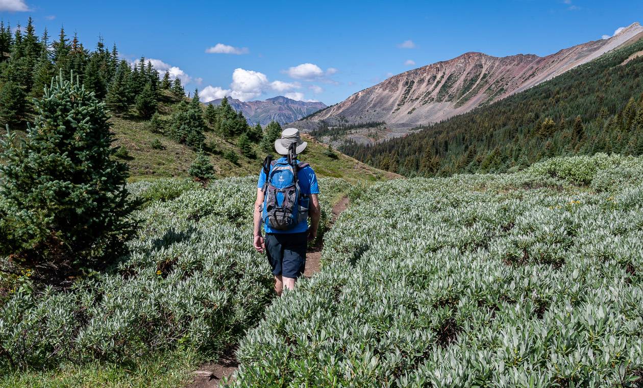
1. Edith Cavell Meadows hike
***Closed still because of the 2024 Jasper fire.***
Distance: 6.0 km or 3.7 miles round trip
Elevation: 400 m or 1,312 feet
Difficulty: Easy
Time needed: 2 – 3 hours.
Best time to hike: June to October
Trailhead location: At the end of the 15 km long narrow Edith Cavell Road.
Type of hike: Out and back
If you want quick access to an alpine meadow, choose the easy Edith Cavell Meadows hike. This is one of the top Jasper hikes for wildflowers and the views of Angel Glacier plunging down the north face of Mt. Edith Cavell. The iceberg laden Cavell Pond below Angel Glacier is also a highlight.
The Cavell Meadows shares its start with the Path of the Glacier trail. After 500 m turn left off the paved trail to climb a lateral moraine. Even though the Edith Cavell Meadows trail is steep in places, switchbacks make it manageable.
Hike a loop enjoying meadows filling with glacier lilies and globeflowers come July. Take a picnic, sit back and feed fill your soul with the landscape from one of the viewpoints.
Would you like to save this?
2. Lake Annette Trail in Jasper National Park
Distance: 2.4 km or 1.5-mile loop
Elevation: Negligible
Difficulty: Easy
Time needed: 1 hour.
Best time to hike: May to September
Trailhead location: From Jasper drive east on the Yellowhead Highway to reach the Maligne Lake Road. Cross the Athabasca River and turn right on Old Lodge Road. Turn left in about a kilometre onto Lake Annette Road and park in a pullout or at the formal parking lot near the beach at the far end of the lake.
The Lake Annette trail is a pretty lakeshore loop hike (more stroll than hike) with a beach that local and visitors alike enjoy. The hike around Lake Annette is picturesque no matter what direction you take.
Dogs are welcome on a leash – and they might enjoy a swim in the cold lake a lot more than you will. It’s a great hike to pair with a walk through Maligne Canyon as they’re close together.

3. Maligne Canyon in Jasper National Park
***Closed still because of the 2024 Jasper fire.***
Distance: 3.7 km loop with the option to add 3.2 km by hiking out and back to the sixth bridge.
Elevation: 100 m or 328 feet
Difficulty: Very easy
Time needed: 1 – 1.5 hours.
Best time to go: Year-round, but do it as an ice walk in winter.
Trailhead: From Jasper head east on the Yellowhead Highway and turn right on Maligne Canyon Road. After crossing the Athabasca River turn left and continue for another 6.2 km to reach the main parking lot. There is also a restaurant at the trailhead.
One of the best hikes in Jasper is also the most popular. The Maligne Canyon hike is a winner on any day of the year though in winter you’ll need ice cleats to explore the canyon bottom.
It’s a fun, family-friendly hike along both sides of a 55 m deep limestone gorge. Watching the water rush through the canyon is a thrilling experience.
The main Maligne Canyon loop walk is just 3.7 km and while it can be comfortably hiked in just over an hour, I think you’ll find yourself stopping repeatedly to take photos. There is great signage along the trail, so you can figure out where you are very quickly. If you’re short on time, just go to the fourth bridge and back.

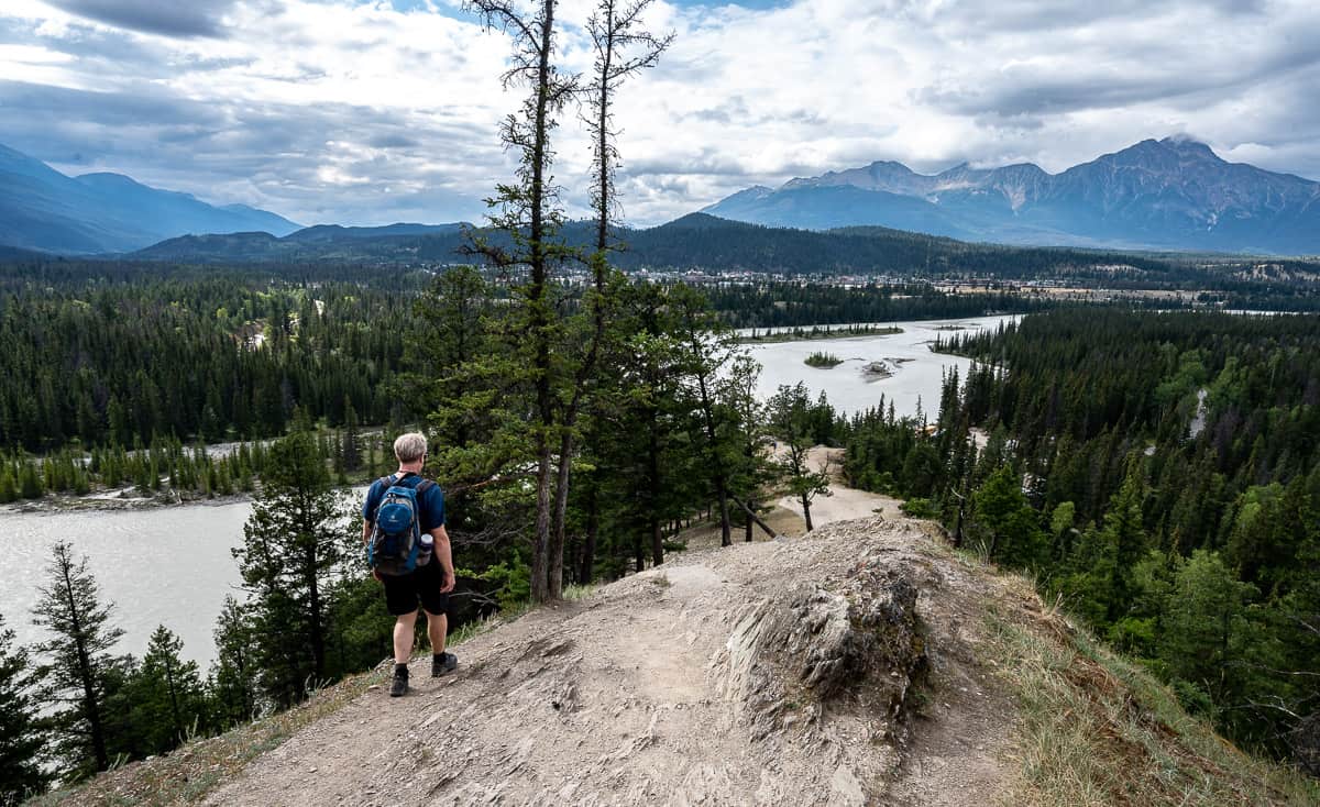
4. Old Fort Point Hike
Distance: 3.8 km return
Elevation: 130 m
Difficulty: Easy
Time needed: 1.5 – 2 hours.
Best time to hike: April until September
Type of hike: Loop or out and back.
Trailhead location: The easiest way is to drive southeast on Hazel Avenue and turn left onto Old Fort Point Road in about a kilometre. Cross the Athabasca River and look for signs pointing to a parking lot.
Old Fort is a prominent hill of bedrock standing 130 m above the Athabasca River. The trail provides a fantastic view of the Athabasca River and the Jasper townsite.
You can do the Old Fort Point hike as a loop or an out and back hike – climbing to the high point and retracing your steps. The trail does hook up with the Valley of the Five Lakes trail. It’s a perfect early morning or after dinner hike.
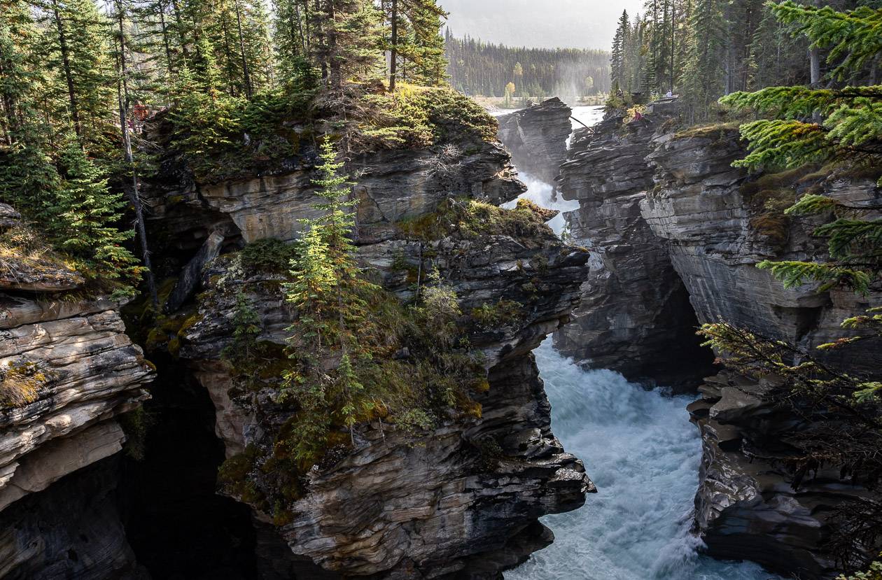
5. Athabasca Falls – one of the stunning Jasper National Park hikes
Distance: 1 km return
Elevation: 25 m or 82 feet
Difficulty: Easy
Time needed: 1-hour tops
Trailhead location: From Jasper, pick up Highway 93S (the Icefields Parkway) and follow it for 30 km. Get off on Highway 93A and continue for 450 m to a well-marked parking lot.
Best time to go: Year-round.
The Athabasca Falls are a sight to behold no matter what the season. Winter is very pretty when the falls are cloaked with ice. There is a network of trails to viewpoints of Athabasca Falls. This is one of the easiest Jasper hikes, but it never fails to impress no matter how many times you wander the trails around it. I love the section that leads you down to the Athabasca River. Watch the spray doesn’t ruin your camera.
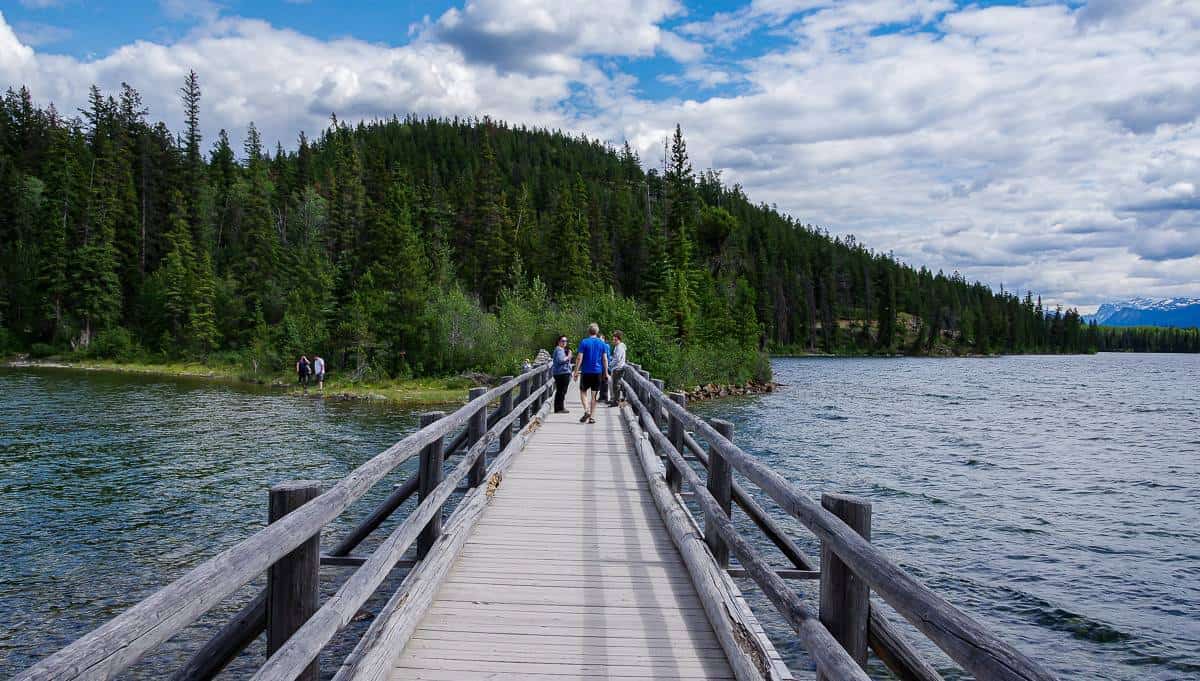
6. Pyramid Island hike
Distance: 0.8 km return
Elevation: Negligible
Difficulty: Very easy.
Time needed: A half hour but Pyramid Island is a lovely place for a picnic.
Best time to hike: April to October
Trailhead location: Take Pyramid Road out of Jasper for 5.4 km. Make a left onto Pyramid Bench Road to reach a parking lot in 700 m.
The out and back hike across the bridge and around Pyramid Island is a scenic one and perfect for the whole family. Pyramid Island is criss-crossed with trails, so there’s no best way to explore the island. There are benches at picturesque locations offering views of Pyramid Mountain. Listen for birds as we found it to be a very birdy area.
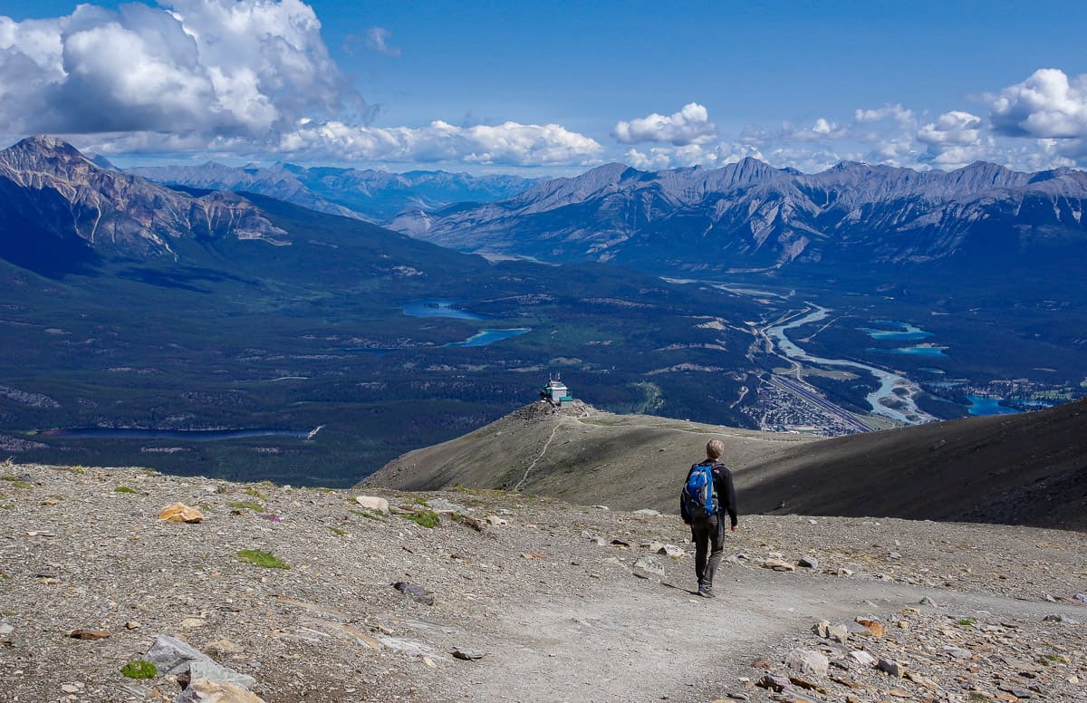
7. Jasper Skytram hike
Distance: Variable – up to a couple of kilometres
Elevation: Variable depending on how much exploring you do.
Difficulty: Easy
Time needed: 1 – 2 hours.
Best time to hike: Mid to late March (on snowshoes) until late October.
Trailhead location: The top of the Jasper SkyTram.
Instead of hiking 9.5 km one way up Whistler’s Mountain with a 1,216 m (3,990 feet) elevation gain, take the Jasper SkyTram so you can explore the good stuff above treeline with the views. There is a network of hiking trails from the SkyTram that take you to scenic viewpoints. Hike as far or as little as you want – but enjoy grand views of Jasper and the Athabasca River.
Best hikes in Jasper National Park that are moderate to difficult
For those of you looking for a full day hike that delivers outstanding scenery and a workout to go with it, try one of the following Jasper hikes. The Bald Hills hike is a real standout and combines well with a boat ride on Maligne Lake at the end of the hike – or a cold drink on the patio.
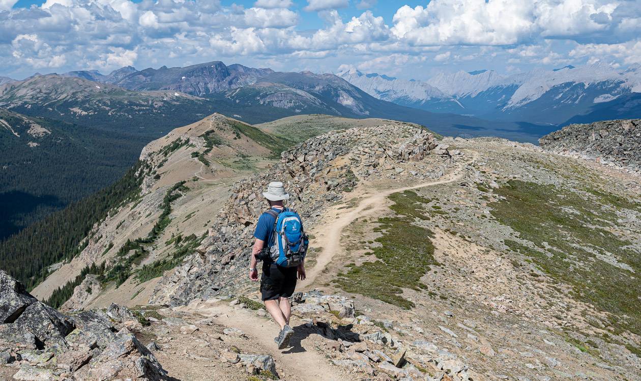
1. Bald Hills hike – one of the top hikes for views in Jasper National Park
Distance: 14.0 km round trip that includes the short cut and the loop; add 2.8 km if you stick with the fire road both going up and coming down
Elevation: Approximately 610 metres or 2,001 feet
Difficulty: Moderate
Time needed: 4 – 6 hours.
Best time to hike: Late May until October
Trailhead location: North end of Maligne Lake
Type of hike: Out and back or lollipop
Dogs allowed: No – because of caribou
Map needed: Gem Trek – Jasper and Maligne Lake
The Bald Hills hike is one of the top hikes in Jasper National Park. It offers incredible views of Maligne Lake and the Queen Elizabeth Mountain Range – though you do have to slog up a fire road to get to the good views. Don’t miss this one.
I loved the up and down on the smaller summits and the 360-degree panoramic views. Take lots of water on this hike in the summer.
2. Sulphur Skyline Trail – one of the best Jasper hikes for peak baggers
Distance: 8.0 km or 5.0 miles return
Elevation gain: 700 m or 2,297 feet
Time needed: 3 – 4 hours.
Difficulty: Moderate but if you’re not a regular hiker or you’re not in great shape you might find it difficult. There are no technical sections on the hike.
Best time to go: Mid-May – October. The road to Miette Hot Springs closes from mid-October until mid-May every year.
Trailhead location: Look for signage behind the Miette Hot Springs building.
The Sulphur Skyline trail is a magnet for people, even though it’s take-your-breath-away steep for a good part of it. This is one of the popular Jasper hikes as it rewards with 360 degree views from the summit.
It’s one of the few hikes in the Canadian Rockies where you can combine a strenuous hike with a soak in a hot spring.

3. Opal Hills Hike
Distance: 8.2 km (5.1 miles) loop
Elevation gain: 460 m or 1,509 feet
Difficulty: Moderate
Time needed: 3 – 4 hours return.
Location: Jasper National Park at the parking lot near Maligne Lake
Map needed: Gem Trek – Jasper and Maligne Lake
The steep Opal Hills hike in Jasper National Park is perfect when you only want a half-day hike. It rewards with lush meadows, mountain views, and even the chance to see Maligne Lake if you do a side hike. It is one of the best Jasper hikes to tie in a visit to Maligne Lake – be it on a boat tour, renting a canoe or enjoying lunch or a drink beside Maligne Lake.
Best Jasper hikes along the Icefields Parkway
Not only is the Icefields Parkway one of the most scenic drives in Canada, but it’s a segway to some of the top Jasper hikes. Access is easy, with trailheads usually very close to the parkway itself. The hikes are generally easy and a great way to break up the drive and see the mountains from a different vantage point.
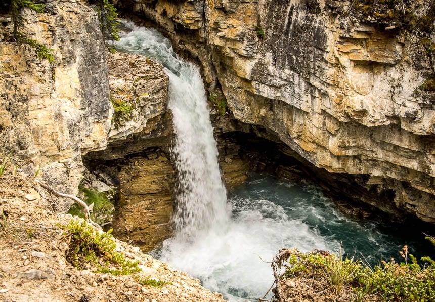
1. Beauty Creek hike to Stanley Falls – one of the little known Jasper hikes
Distance: 3.6 km (2.2 miles) round trip
Elevation gain: 40 m or 131 feet
Difficulty: Easy
Time needed: 60 – 90 minutes.
Trailhead location: The trailhead is on the east side of Highway 93, 15.5 km north of the Columbia Icefield Discovery Centre. It’s a great short hike if you need a break from driving the Icefields Parkway.
The Beauty Creek hike isn’t well-known, so it’s one where you might not see another soul. The Beauty Creek hike takes you up to scenic Stanley Falls located in a canyon. It’s a pretty place to stop for lunch and be surrounded by nature.
2. Valley of the Five Lakes Hike
***Closed still because of the 2024 Jasper fire.***
Distance: 4.3 km for the shortest circuit but there are options to walk around the first lake (7.3 km return). Another option is to start by Old Fort Point and make it into an 18 km return hike.
Elevation: 80 metres for the Valley of the Five Lakes circuit.
Difficulty: Easy and family friendly.
Time needed: 1.5 – 2 hours unless you do more that the Valley of the Five Lakes loop hike. Allow 2-3 hours for the First Lake loop.
Best time to hike: Year round – though the lakes are especially beautiful in summer and early fall.
Trailhead location: The trailhead is 9 km south of the Jasper townsite, just north of a winter gate. It’s well- marked.
The popular Valley of the Five Lakes hike is a great one for families, because it’s scenic, easy, and close to the Jasper Townsite. It’s perfect for an after-dinner or stretch-your-legs kind of hike from late spring to fall, especially if you’re camping in Jasper as the trailhead is nearby.
You can lengthen the Valley of the Five Lakes hike by adding a loop around the first lake or doing an out and back hike from Old Fort Point, though you’ll be in the trees a lot.
3. Lower Sunwapta Falls – one of the easy Jasper hikes
Distance: 3.2 km or 2.0 miles round trip
Elevation gain: 72 m or 236 feet
Difficulty: Easy
Time needed: 1 – 1.5 hours.
Best time to go: May – October
Trailhead location: Look for Sunwapta Falls on the west side of the Icefields Parkway. It’s 55 km south of Jasper and very well signed.
The short hike to Sunwapta Falls is very popular, easy, and highly worthwhile. But if you’ve got an extra hour, why not follow the trail to Lower Sunwapta Falls and enjoy more waterfalls and canyons with the mountains as a backdrop and hardly a soul around. It’s very beautiful and the elevation gain back to the parking lot is minimal – so it’s a good family-friendly hike.
Keep a close eye on your kids in the absence of railings.
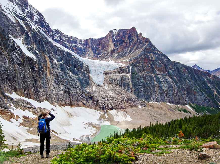
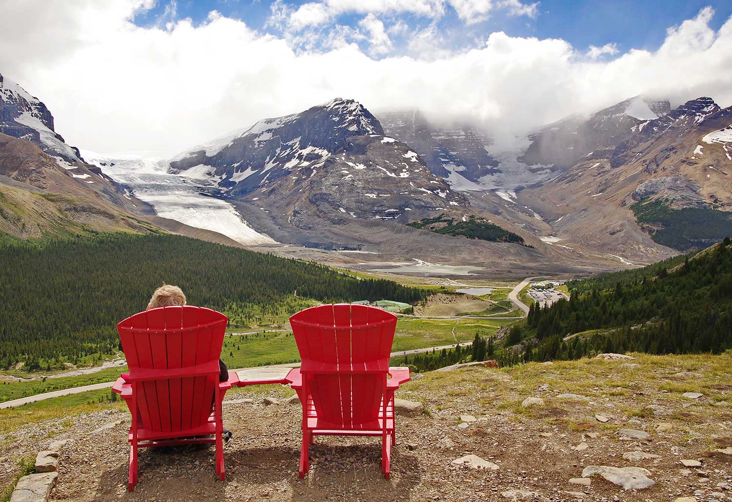
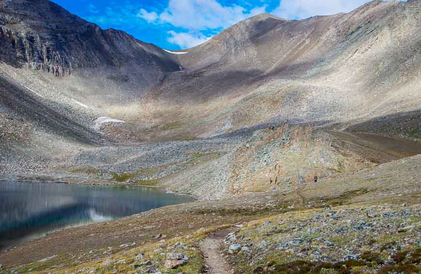
4. Wilcox Pass hike – one of the premier Jasper hikes
Distance: 6.8 km (4.2 miles) return to Wilcox Pass, 9.4 km (5.8 miles) return to Wilcox Ridge. There is an option to continue for 7 km beyond the Wilcox Pass summit to descend Tangle Creek and end up back on the Icefields Parkway at Tangle Falls.
Elevation: 335 m or 1,099 feet
Difficulty: Easy
Time needed: 2 – 3 hours return to Wilcox Pass
Best time to go: May to October
Trailhead location: The trailhead is on the north side of the Icefields Parkway, 2.8 km south of the Columbia Icefields Discovery Centre.
The Wilcox Pass hike, one of the best Jasper hikes, starts off steeply but once you pop out of the trees after just 15 minutes, the Athabasca Glacier stares you in the face. That view is worth the hike.
Shortly after you’ll reach the Parks Canada red chairs. Have a seat and enjoy looking out at the Columbia Icefield before continuing through meadows where you’re likely to see bighorn sheep. Head for Wilcox Pass and then retrace your steps or continue on a trail up to the ridgeline directly above the Icefield Centre for even more magnificent views.
Another option is to continue to the Tangle Creek drainage and take a trail that comes out by the Glacier Skywalk on the Icefields Parkway. You’ll either need to retrace your steps (about a 22 km hike) or hitchhike back to your vehicle.
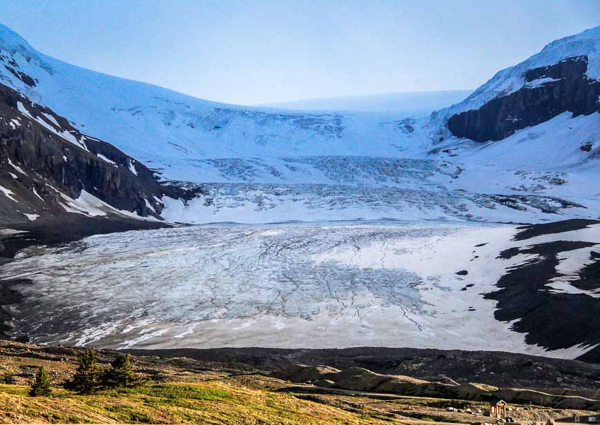
5. Toe of the Athabasca Glacier hike – one of the best Jasper National Park hikes
Distance: 2.0 km or 1.2 miles return
Elevation gain: 60 m or 197 feet
Difficulty: Easy
Time needed: 45 – 60 minutes.
Dogs: Yes – but they’re not allowed on the ice.
Best time to do the hike: May – September
Finding the trailhead: Take the Road to the Glacier across from the Icefield Centre. Drive 1.0 km to the parking lot.
From the kiosk at the corner of the parking lot, cross a footbridge and follow a trail as it winds uphill. The trail steepens as you climb a bench with a view of the glacier. From the highpoint on the trail, loop back across a rock slab overlooking Sunwapta Lake to the parking lot. Try to go early or late in the day to avoid the crowds.
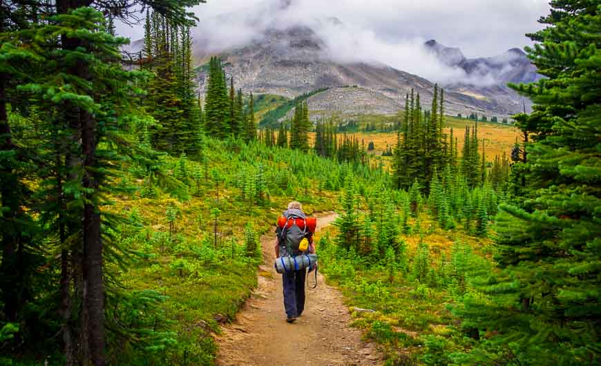
Best multi-day hikes in Jasper
I haven’t done all the multi-day hikes in Jasper, but I have done the best ones. I didn’t include the famous Berg Lake hike as it’s actually in British Columbia (but close to Jasper). It reopened for summer 2025.
The biggest problem with the multi-day hikes in Jasper is getting backcountry reservations. Check out Schnerp for campsite cancellations.
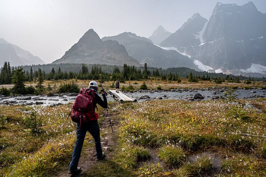
1. Tonquin Valley
***Note: Open via Portal Creek but the Astoria River access is closed.***
Distance: 43 km (26.7 miles) one way
Elevation gain: 905 m or 2,969 feet
Level of difficulty: Easy as far as backpacking trips go as there isn’t a lot of elevation gain.
Best time to go: Late August into September when the bugs have died down.
Number of days needed: 3 – 5 days depending on how many side trips you want to do.
Trailheads: There are two trailheads – Astoria and Portal. Ideally arrange a shuttle or get dropped off at one trailhead and park at the other.
Booking campsites: The dates for reservations vary from year to year. In 2025, backcountry reservations open on January 29 at 8 AM MST.
For a take-your-breath-away beautiful multi-day hiking trip in the Canadian Rockies, you must put the Tonquin Valley hike in Jasper National Park on your hiking wish list.
You’ve probably seen postcards with the famous Ramparts in touristy shops in Banff or Jasper. They’re a mountain range with 10 named summits like Drawbridge, Bastion, Dungeon and Turret Peak – towering over beautiful Amethyst Lakes and the main reason you want to do this hike.
For a backpacking hike, it’s an easy one unless you try and knock the full loop off in a couple of days. Take your time. The scenery on the hike – filled with meadows and mountains is world-class, and if you’re lucky you’ll see caribou.
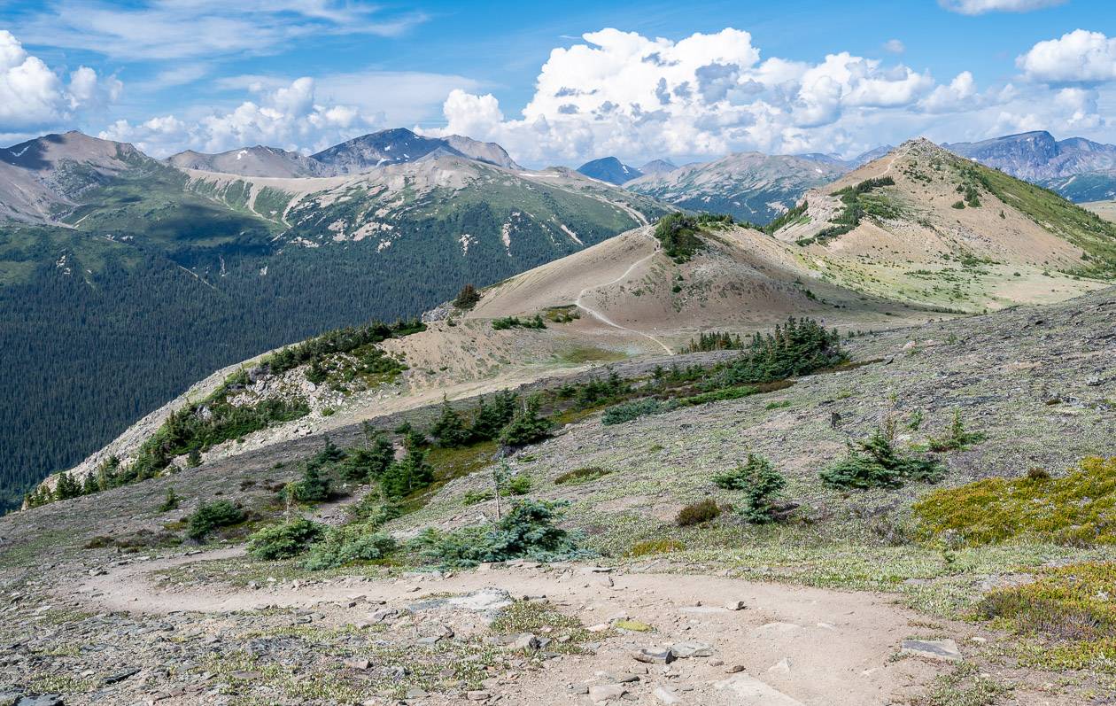
2. Skyline Trail – one of the premiere hikes in Jasper National Park
Distance: 44.5 km (27.7 miles) one way
Elevation gain/loss: 1,205 metre gain and a 1,735-metre loss
Difficulty: Moderate
Time needed: 2 – 3 days for most people.
Total distance: 44.5 km one way
Days needed: One – if you’re a crazy runner, to four days. Most people hike it in three days.
Best time to hike: Mid to late July until mid-late September depending on the year.
Dogs allowed: No, because of caribou.
Trailhead: Park on the Maligne Lake Road at the trailhead where most people finish – and take the Maligne Lake hiker shuttle to the start of the trail.
The Skyline Trail hike is one of the premiere Jasper hikes – and one of the top 10 backpacking trips in Canada. It rewards with incomparable mountain views for 25 km of its 44.5 km length. It rewards with fantastic mountain panoramas, beautiful valleys, and a few lakes.
The season for hiking the Skyline Trail is unfortunately short and one of the reasons it’s so hard to get a backcountry reservation. Don’t even think of reserving campsites until late July after the snow has disappeared from The Notch. By the end of September – in a good year – the season is over.
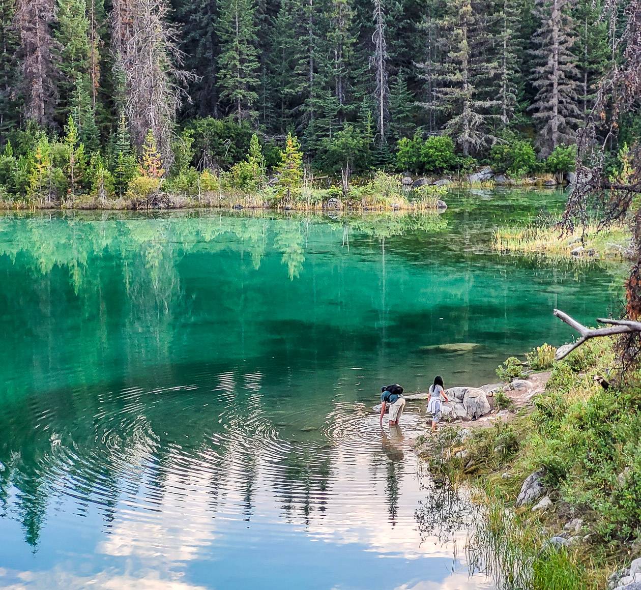
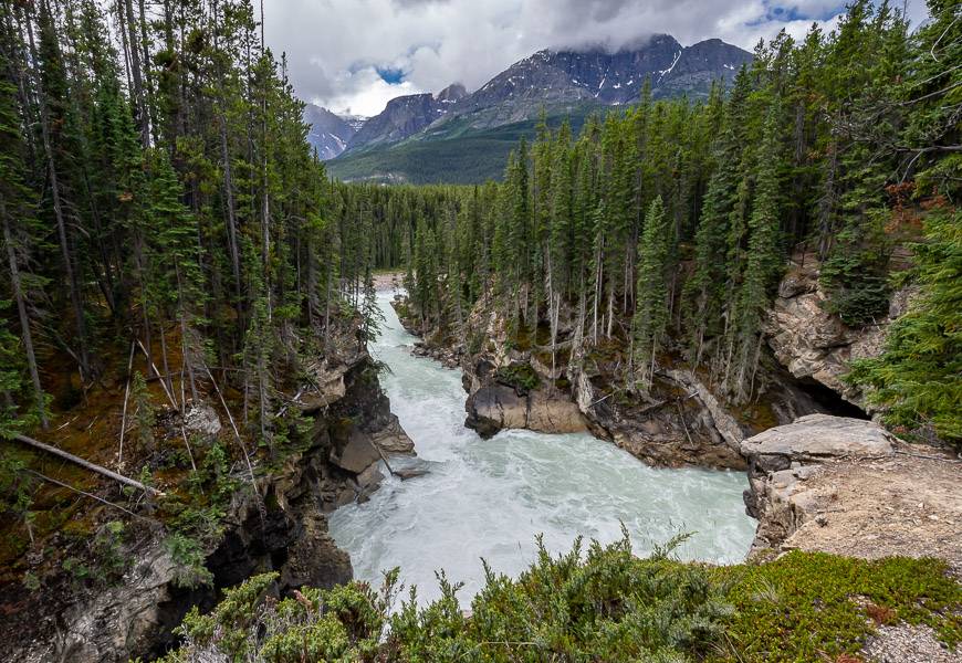
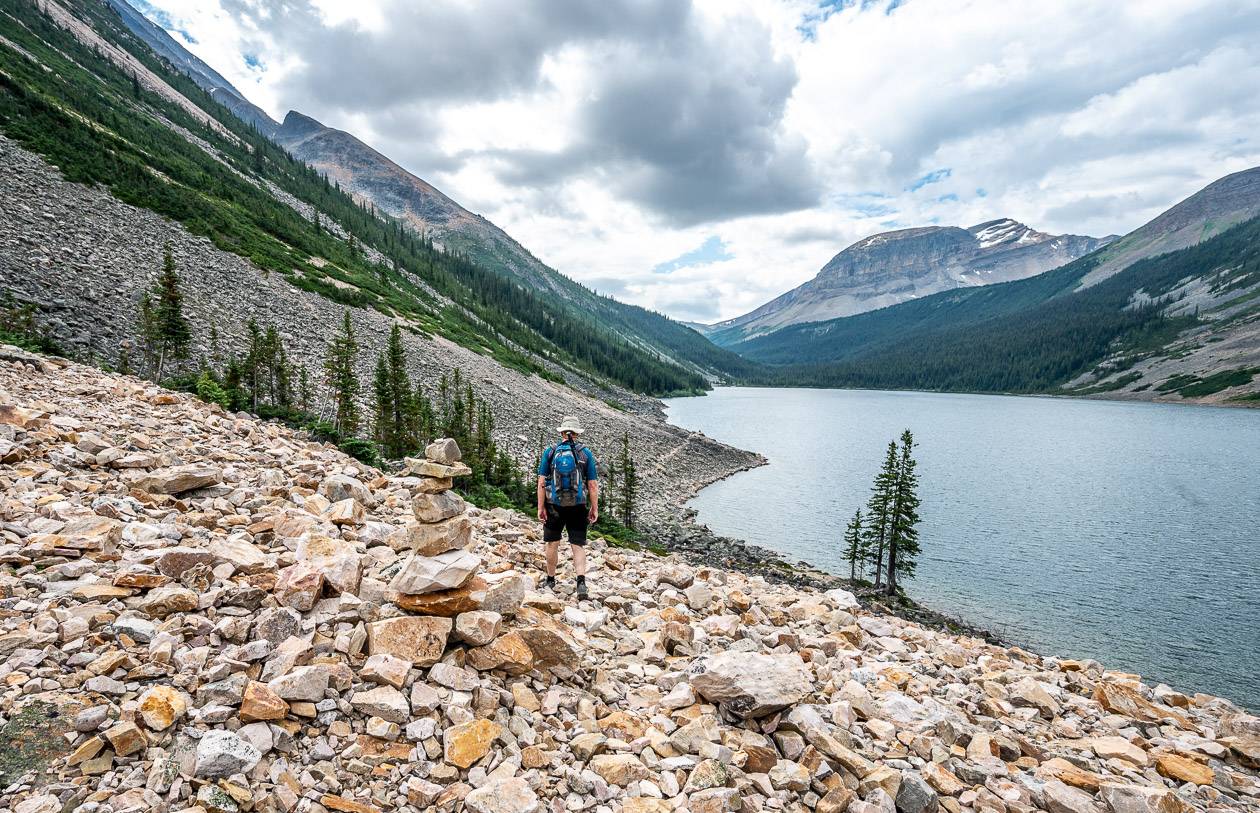
3. Geraldine Lakes – one of the off-the-beaten-path but beautiful Jasper hikes
Distance round trip: 4.0 km to the first Geraldine Lake and 10.5 km to the second lake. It’s 13.0 km to the fourth Geraldine Lake and not doable as a day hike.
Elevation gain: 127 m (417 feet) to the first lake, 407 m (1,335 feet) to the second lake; 497 m (1,631 feet) to the fourth lake
Difficulty: Difficult to the second lake and challenging to the third and fourth lakes
Time needed: 4 – 6 hours return to the second of the Geraldine Lakes – with the higher figure related to going as far as the campground. Do the Geraldine Lakes hike as an overnight backpacking trip if you want to hike to the third and fourth lakes.
Best time to hike: June once the snow has gone until September.
Location: The trailhead is at the end of the Geraldine Fire Road which is 1.1 km from Athabasca Falls via Highway 93A.
Dogs allowed: Yes, on a leash but it would be challenging for some to get through the boulder field on route to the campground.
The Geraldine Lakes hike seems to be a bit of an unknown. Perhaps its because people worry about their cars getting up the fire road, but I can tell you we had no problem in our Subaru Outback. For a day hike, you’re not going to want to go past the second of the four Geraldine Lakes as that in itself is up to a six-hour return hike.
You can book a backcountry campsite located at the end of the second Geraldine Lake – and that’s a great idea if you’re planning to explore the upper lakes.
If not, I’d recommend the scenic but sometimes very tough day hike to the second lake. There’s some steep climbing and downclimbing, and a boulder field that would be very gnarly if it rained. The reward is great scenery and hardly a soul around.
What to pack on the best Jasper National Park hikes
Don’t forget water purification tablets or a water bottle with a built-in filter. There are some summer days where you need to drink an incredible amount of water.
I like something comfortable to sit on at lunch time. While it can be as something as simple as your coat, I swear by my inflatable seat cushion.
I like using hiking poles – especially when a stream crossing or a steep descent is involved. Invest in a collapsible pair, preferably made of carbon because of their weightless quality.
I always pack a buff as it’s got so many purposes – neck warmer, keeps hair off your face, good in dust or smoke, dip it in water to cool your neck, and a 100 other things.
Another nice addition for those of you who love wildflowers is the book Popular Wildflowers of Alberta and the Canadian Rockies.
Compeed – I discovered this Band Aid-like product when I was hiking the Cumbria Way in England and ended up with massive blisters after getting wet feet. I always pack it on hikes.
Where to stay in Jasper National Park
Jasper
The Fairmont Jasper Park Lodge is in a beautiful location but it comes at a price. However, you can count on loads of amenities and lots of activities either on their grounds or close by. Rooms are fine but not as luxurious as you might expect for the price-point.
Another excellent choice is Bear Hill Lodge. And for easy access to a beautiful lake and all the activities around Pyramid Lake, head for Pyramid Lake Resort.
On the strip in Jasper, check out The Crimson Jasper – adjacent to Terra, a restaurant offering delicious food.
Sunwapta Falls
If you would like to stay at a lodge within walking distance of Sunwapta Falls, then check out Sunwapta Falls Rocky Mountain Lodge. It’s not a fancy place but it is comfortable and there is a dining room and an interesting gift store – they carried my 200 Nature Hot Spots in Alberta book, so I’m a fan.
Columbia Icefield
If you fancy a stay in a lovely hotel overlooking the Columbia Icefield, then check rates and availability at the Glacier View Lodge. Just remember it’s always much cooler up here with the wind bringing cold air from the glacier. But the views!!
Interested in more great hikes?
- 10 of the Best Yoho National Park Hikes
- 18 of the Best Banff Hikes You Can Do in a Day
- 10 Best Lake Louise Hikes
- Coast to Coast: Canada’s Long Distance Hiking Trails
- Best Kananaskis Hikes for Mountain Lovers
Click on the photo to bookmark to your Pinterest boards.