Milk River Canoe Trip Over 3 Days
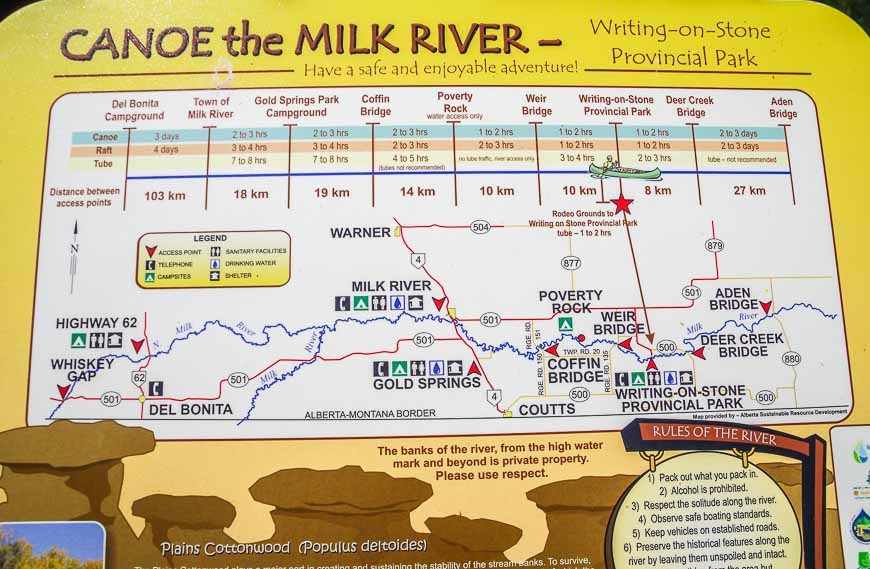
The Milk River, named for its milky colour by Lewis and Clark back in 1805, flows north out of Montana into southern Alberta and then back into Montana again. Over its 1,173 kilometre length, there is a fantastic section that can easily be done as a 3-day Milk River canoe trip beginning in the town of Milk River, Alberta and finishing in Writing-on-Stone Provincial Park.
Would you like to save this?
Milk River canoe trip logistics and summary
Rental canoes: If you don’t have your own canoe, you can rent one from High Level Canoes and Kayaks in Lethbridge.
Starting point: Most people start in the town of Milk River but there is an option to start in Gold Springs. A few people put in at the Coffin Bridge for a shorter canoe trip.
Distance: From the town of Milk River to Writing-on-Stone Provincial Park it’s 73 km.
Milk River Raft Tours: Owners Wendy and Ken Brown no longer rent canoes but they do rent large inner tubes with handles. They will also shuttle your vehicle from Milk River to the parking lot by the pullout in Writing-on-Stone Provincial Park for $75. Call 403-647-3586 to book.
Vehicle shuttle: You can also call Karen for a parking and vehicle shuttle service at 403-758-6683. She operates out of Del Bonita.
Best time to go: The Milk River Canoe trip is best done from the May long weekend until late July. By the time July rolls around, the river level starts to drop and there are more rocks to dodge. If you go to early in May, you’ll find the water to be VERY cold.
Time needed: Allow three days to do the Milk River canoe trip. Plan to camp at Gold Springs and Poverty Rock.
Reservations: I would recommend making a reservation for the Gold Springs Campground, especially if you’re doing the Milk River canoe trip over a weekend.
Important and new for 2023: You can still random camp at Poverty Rock but what you now need is a free permit. You can get that by calling someone at Writing-on-Stone at 403-647-2364 ext 301. While that in itself isn’t a hardship, you now also need a free parking permit if you want to leave your vehicle in Writing-on-Stone Provincial Park while you’re paddling. What that means is that you need to pick up the permit in the park beforehand and then drive to Milk River so you can hand it to whoever is doing the shuttle for you. This is obviously a cumbersome detail that hasn’t been totally thought out in my opinion. They are working on an online solution which would make way more sense.
Cell service: Note that there is poor or bad cell service when you’re on the Milk River canoe trip.
Please: Don’t trespass onto private property and be sure to practice Leave No Trace principles.
Water: This part of the world can get very hot, so be sure you’ve got lots of water, sunscreen and a sun hat.

This post includes some affiliate links. If you make a qualifying purchase through one of these links, I will receive a small percentage of the sale at no extra cost to you. Thank you very much for your support.
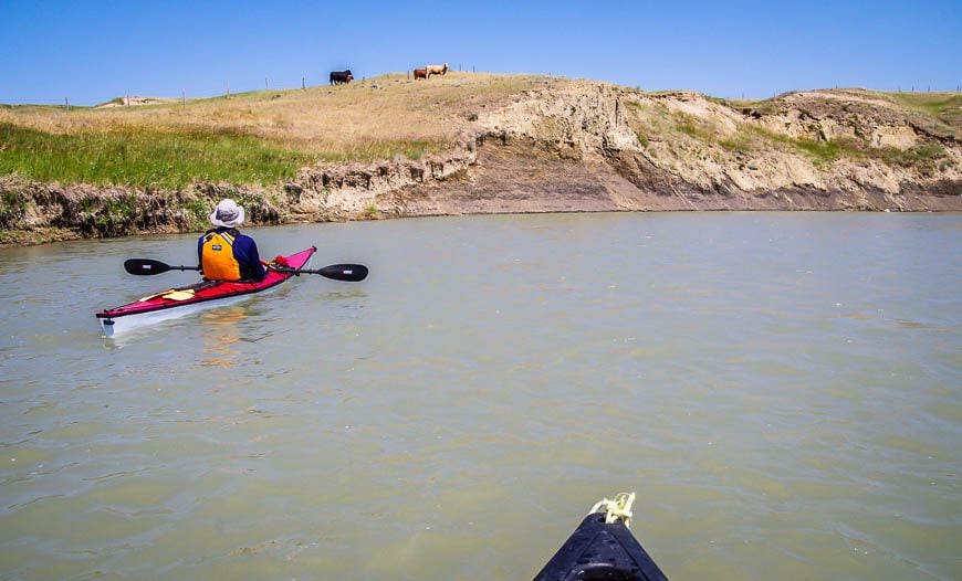
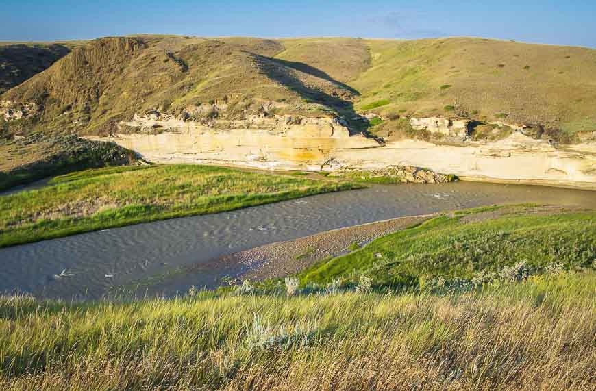
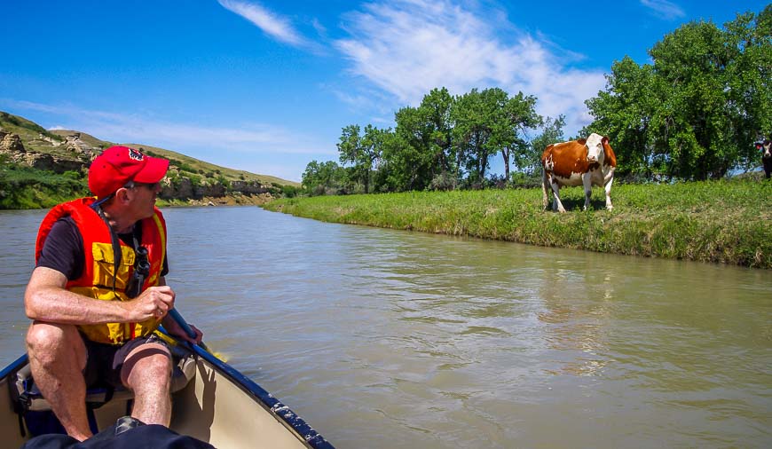
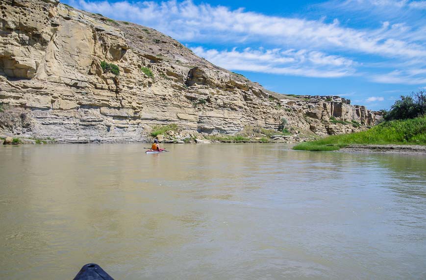
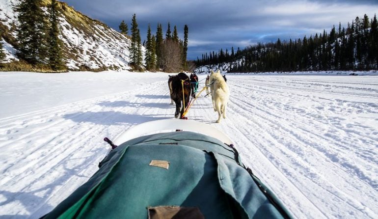
Day one: Launch from the town of Milk River, Alberta
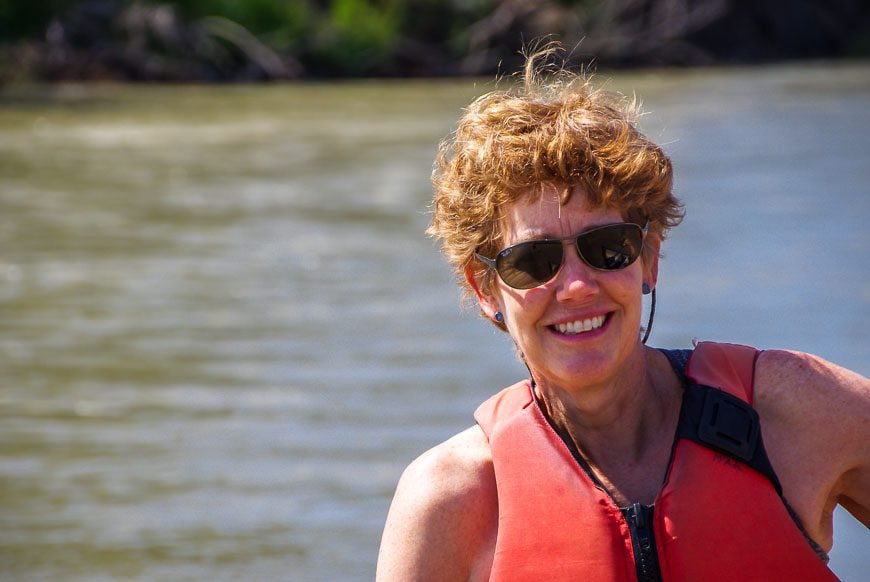
It was a sunny, hot day as we launched from the local campground in Milk River. Our plan was to canoe 20 kilometres to Gold Springs – a private campground that is popular with the RV crowd.
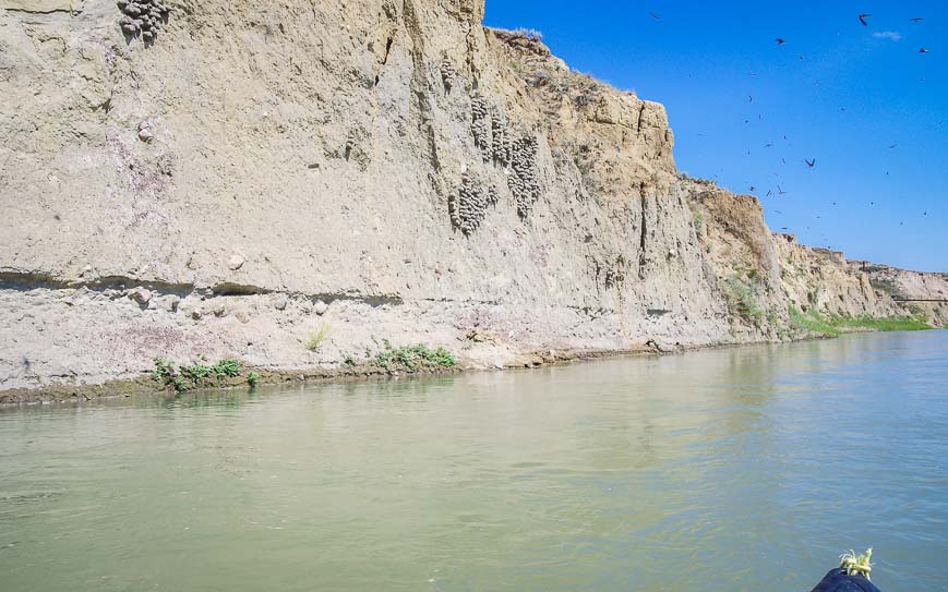
Most of the first day’s paddle was spent admiring the birds – including a great-horned owl and five ospreys within 10 minutes of launching. Swallows were everywhere too – and were our constant companions along the length of the river.
We also had to get in the groove of reacting quickly to the water. There are plenty of rapids – mostly Class I and easy enough to paddle – except that the river is shallow and there are a lot of rocks to avoid.
I went to bed that night thinking – paddle left HARD, go straight, rock on right. We certainly bumped into a few of them and ran aground a couple of times – but nothing more serious than that over the entire 73 km we paddled.
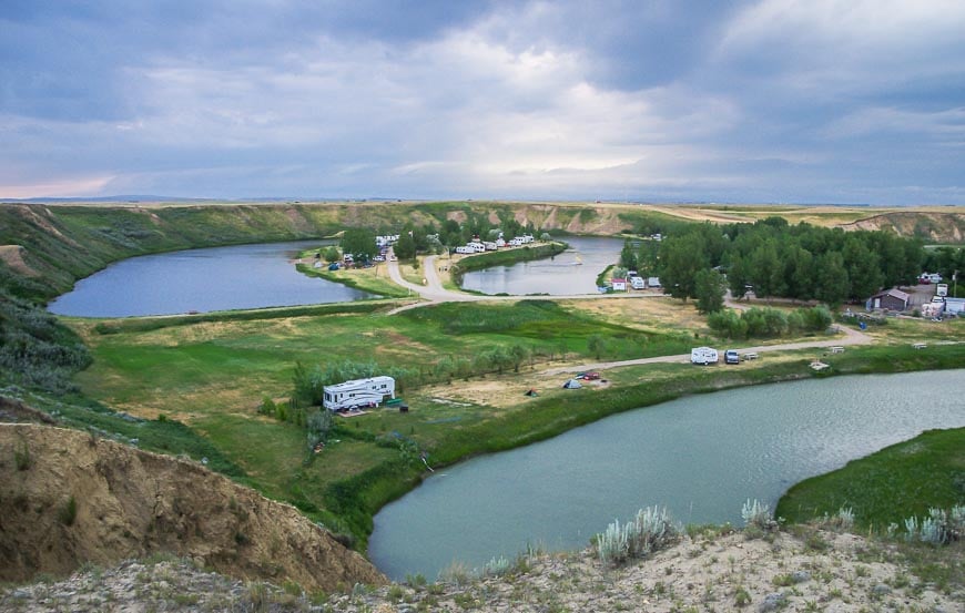
The campground at Gold Springs
When we pulled out at Gold Springs, we felt like we’d gone from relative desolation to full on civilization again. But we were lucky enough to snag a campsite right by the river, between two RV’s.
One was empty and the other stayed that way until the storm hit, so we did feel like we had some personal space – something we all like on a wilderness trip.

Day two: Canoeing 33 km on the Milk River from Gold Springs to Poverty Rock
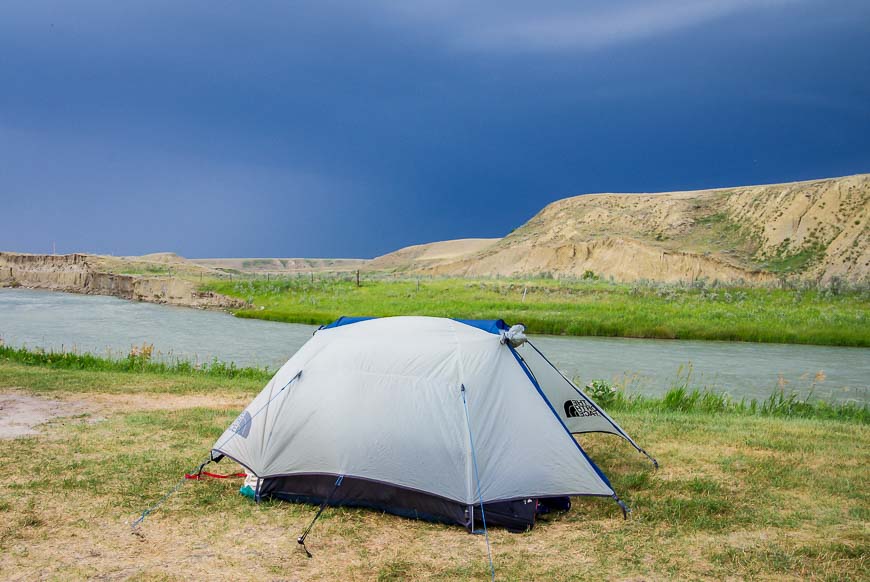
We woke on the second day to chilly temperatures and spitting rain. I was happy it wasn’t pouring and windy considering our tent had been rattled and shaken for hours during the night. Thank heavens we didn’t get the hail that Calgary had that day! Our tent would have been toast.
At Gold Creek there is a picnic shelter so we could eat breakfast without getting wet – an advantage to semi-civilization.
Once on the water we knew it was going to be nothing but rapids for the entire day. In fact the area between Gold Springs and Poverty Rock is known as the Rock Garden and more than a few canoes have met their demise here. The average gradient according to the map is 2.4 m/km.
We wore rain gear all day long though it actually stopped spitting the minute we got in the boat. Still, it was hypothermia-type weather and we wanted to stay warm.
It’s 20 km from Gold Springs to the turquoise-green coloured Coffin Bridge – named for Frank Coffin who came to the area with 200 head of cattle in 1902.
On this section there are only a handful of places to pull out; around the bridge itself, it’s quite steep. Some people drive to Coffin Bridge to put in – as we discovered on arrival at Poverty Rock.
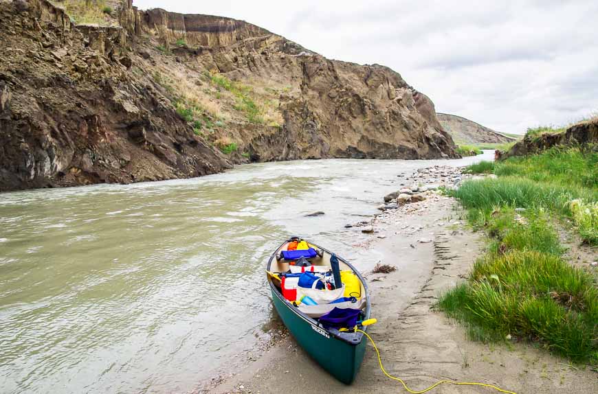
The Milk River canoe trip from Coffin Bridge to Poverty Rock – 13 km
A couple of the rapids in this section of the Milk River are Class II or Class III if the conditions are right (or wrong depending on how you like your rapids.) It took us about 90 minutes to get to Poverty Rock from Coffin Bridge.
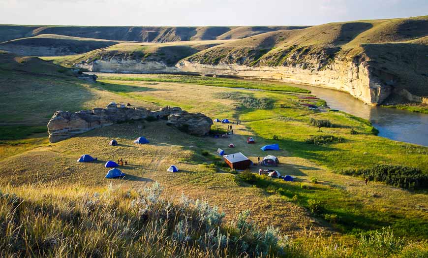
Once there we were met with the sight of about a dozen canoes. As we hadn’t seen a soul on the river we figured we’d have Poverty Rock to ourselves. No such luck – so we just humped our stuff away from the main group – and once again felt a sense of privacy.
The large group at Poverty Rock had put in at Coffin Bridge. They had lots of young kids with them so I can understand their reticence to do a full day of rapids.
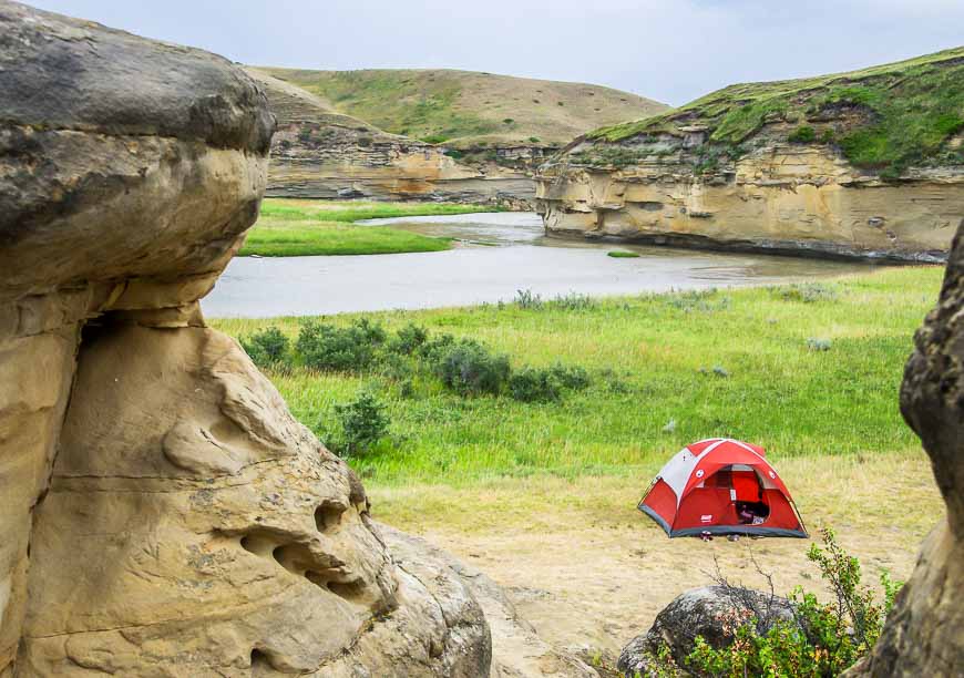
At Poverty Rock there is a cooking shelter, an outhouse and several garbage cans. It’s managed by Alberta Parks but there are no fees to camp here. However, you do need a permit so don’t forget to book it well in advance by calling 403-647-2364 ext 301.
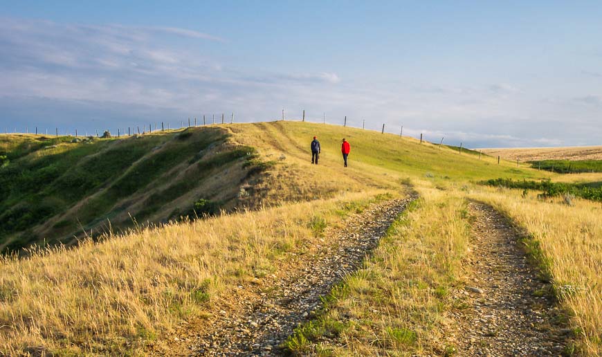
Poverty Rock itself begs to be climbed. But the whole area around it is also fantastic for hiking. We walked for well over an hour, climbing high above the area to enjoy the views.
Do watch out for rattlesnakes around the rocks. Ken, the fellow that shuttles vehicles informed us that “the rattlesnakes are blind right now as they shed their skin so they sense you by vibration only.” Don’t put your hands in any holes and watch out for sunning snakes on rocks. (We saw none.)
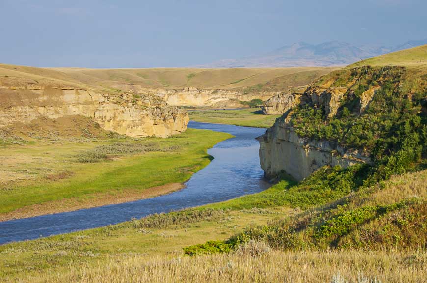
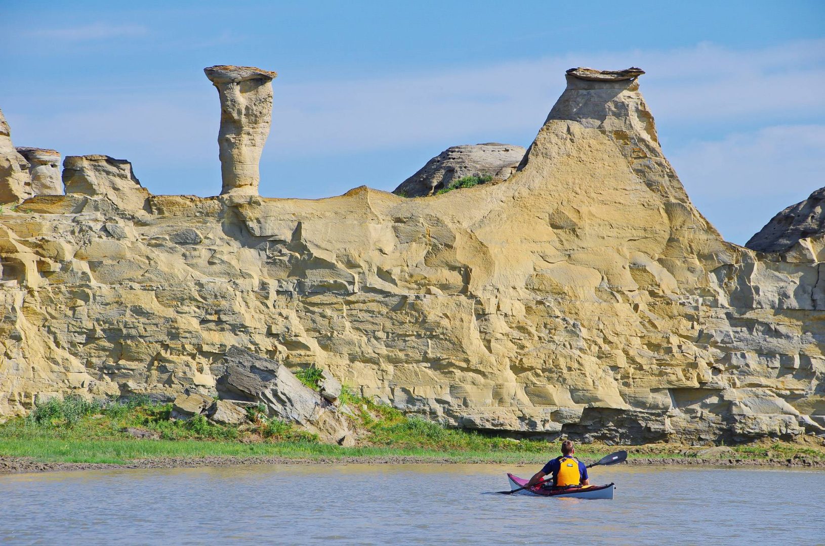
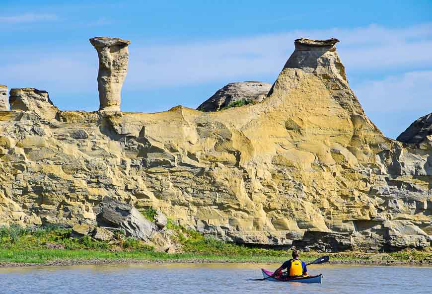
Day 3 on the Milk River canoe trip: Paddle 20 km from Poverty Rock to Writing-on-Stone Provincial Park
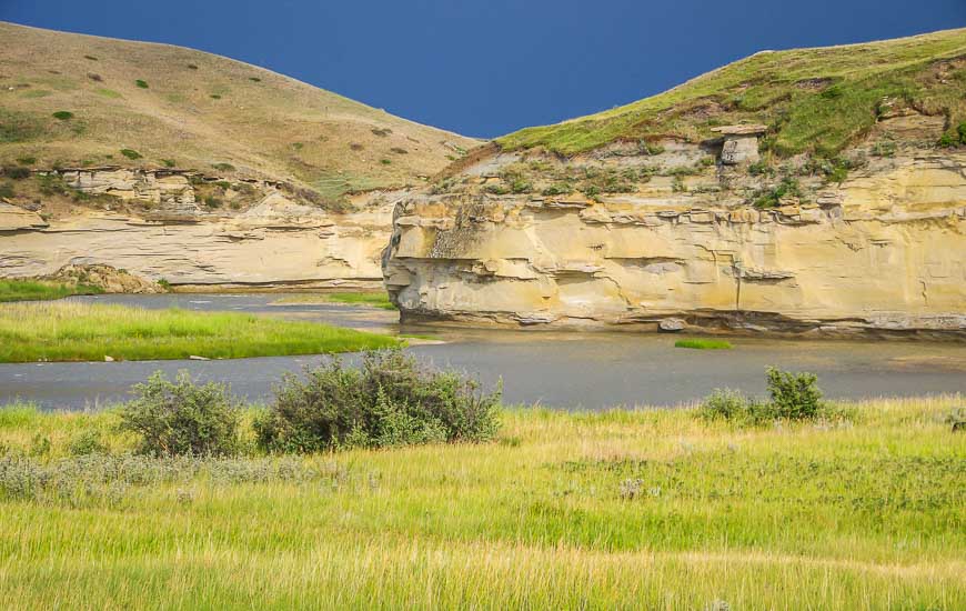
The section from Poverty Rock to Writing-on-Stone Provincial Park is the easiest and I think the most scenic section on account of the huge number of hoodoos.
We did it in 3.5 hours including breaks. One of our stops was across from the nest of a big horned owl. With binoculars you could see inside the nest from across the river – and in it were three owlets.
You can also pull out (and arrange the shuttle) at Weir Bridge, 10 kilometres into the paddle. I’d recommend continuing to Writing-on-Stone for the scenery, though there’s a good place for a break just after the bridge.
A few things I’d recommend for the Milk River canoe trip
From my experience over decades of paddling the following would be useful.
- a waterproof map case
- a PFD like the one by Kokatat with several pockets
- Lightweight Neoprene gloves for those cold, windy days
- a boating sponge
- a paddle-float especially if you’re kayaking
- a paddling knife that can be mounted on your PFD
From the camping perspective I recommend the following for your canoe trip on the Milk River:
I like the MSR Elixir 3-person tent but there are lots of good one, two and four-person Elixir tents too.
On the Milk River canoe trip you could easily pack a camp chair and make the evening that much more comfortable. I have a lightweight one I even take on backpacking trips.
To make your night more comfortable, consider taking a lightweight camp pillow.
Should any of your gear break, you’ll be happy to have some gear-aid patches with you.
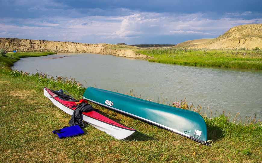
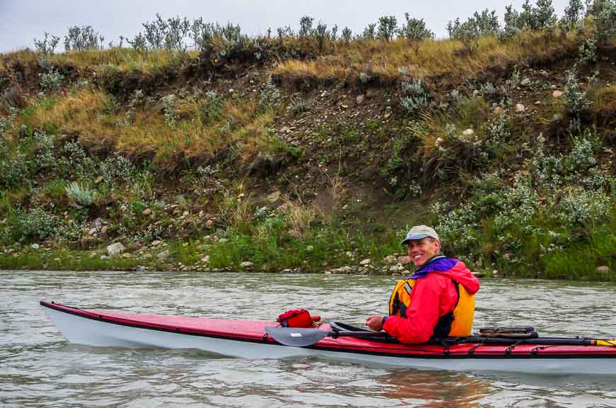
My brother tested out a TRAK kayak on our Milk River canoe trip. You can read about how his TRAK kayak experience stacked up.
When is the best time to do the Milk River canoe trip?
The Milk River flow is constantly shifting. Water levels tend to be highest in June and early July. The flow drops off considerably over the summer so the paddling can be very difficult with the large number of rocks. It’s best that you have some experience before attempting it.
Also, beware of rock fall from the cliffs and slumping on your Milk River canoe trip. That is especially important after a heavy rainfall.
Consider picking up the map – A Paddler’s Guide to the Milk River.
Further reading on paddling trips in Alberta
- Done in a Day: Kayaking the Beautiful Bow River in Banff
- Canoeing the Peace River in Northern Alberta
- The 3 Day Lac la Biche Canoe Circuit in Alberta
- A Weekend Canoe Trip on the Red Deer River
- Kayaking Maligne Lake in Jasper National Park
Click on the photo to bookmark to your Pinterest boards.

Thank you to Travel Alberta for making the trip possible. If you’re an intermediate paddler or better you’ll love the experience.
Love this river. Have traveled it many times into Writing on Stone. Two summers ago, we decided to go all the way. Starting at Coffin Bridge and continuing into the US. If you love to get away from it all……this is the way to do it. Some of the most remote, and beautiful country I have ever experienced. In the 5 days it took to get to the end, we saw a total of….1 person and only at the end of our first day. The river slows significantly and becomes very shallow towards the end. Be sure to get your ducks in a row before you cross the border.
@Evan Thanks for that recommendation. Is there actually a post on the US side of the river that you have to check into? Sounds likes something I’d like to do.
Is it possible to do this trip in late April? Around the 28th-30th?
@H Christie It depends on your experience and water levels. I’d recommend contacting the fellow who does the shuttle and canoe rental as he would know better.
Sounds like a great trip! We camped at Writing On Stone a few years ago, but for only one night – no paddling, unfortunately. We enjoyed hiking among the hoodoos – fantastic formations. We’re going back this year on our cross-Canada trip and will visit there again for a little paddling. Thanks for the article!
@Dave and Robin This is a superlative trip and although only a short section is in Writing-on-Stone you get a lot of hoodoo country. I personally think its an amazing part of Alberta to discover.
I lived on the bank of Milk River for 13 years. We went down the river on inner tubes, kayak and Canoe. It was great fun. That was the days when we didn’t pay anyone to drive our car to the end destination. We were locals. The river is great fun in the summer time. Great pictures.
@Birgit Thank you for your comment. It’s a great place to explore and the scenery is truly magnificent.
I would love to paddle the whole milk river. I would not want to skim over any section. I love it that camping is free at Poverty Rock. Anyone who camps there is rich. I love the scenery in the last section. Looks like a beautiful river.
@Ted It would be an amazing river to paddle down all the way to Montana as that’s the biggest canyon country in North American plains. Maybe one day. It’s scenic, fabulous and I highly recommend going – by mid-July before water levels drop.
Thanks for bringing some beautiful memories back to me. I grew up in Coutts and have been “Tubing and rafting to from Milk River and Gold Springs to Writing-On Stone since I was knee high to the grass. I think a couple of pictures pulled at my heartstrings. Beautiful photos. I know you enjoyed that trip.
Thanks again for shaking up my memories.
@Laurie I truly loved the trip. I saw plenty of families with young kids so imagine many will feel exactly as you do in a couple of decades. Thanks so much for stopping by.
My dad’s farm was about 10 miles from Writing-On-Stone so I grew up climbing the rocks and swimming in the Milk River.Though I grew up in Milk River, I spent many a summer’s day at Writing – On-Stone and it is great to see the area. It brings back so many memories.
@Jean I can sure understand the happy memories. It;s a part of the world so few people see but would they ever be surprised in a good way if they made the visit. If Writing-on-Stone gets UNESCO status one day I suspect the area will see more traffic.
What a great kayaking trip! And at least you had lovely sunny weather the first day :-). We lived for many years in Calgary before moving to Vancouver, and now, looking at your photos, we’re sorry we didn’t explore this part of Alberta while there. Cool-looking hoodoos!
What an intriguing landscape! I love how your photographs show how beautiful it is, as well as the stillness of the river. Lovely.
I often think of the Prairies as being flat and brown, but you’ve really shown me that’s not the case. I can’t believe how incredibly pretty the Milk River region is. I’ve lived in Alberta most of my life, but have never explored the southern bit very much. I’m keen to replicate your experience.
@Jody This area is a treat to see – and the Milk River keeps you on your toes if you paddle it. I highly recommend the experience.
Thanks so much. Very informative. I really want to do this river but am scared of the “rock garden” part. I’ve done Weir Bridge to Writing on Stone already and have done WOS to the next bridge as well, both as day trips. I use a stand up paddleboard so have to be especially careful with rocks. Hit some big ones last weekend on a different river and cracked my poor board.
@Tanya You get very adept very quickly at reading the river. There were definitely some big waves at times but it was the big rocks that had me on high alert. Day two was beautiful but it’s definitely not for everybody. I don’t know how a paddleboard would do in the rapids but you must have good balance if you use it all the time.
Looks beautiful – and the possibility of paddling across borders… love it. Also like the descriptive names: Poverty Point, Writing on Walls…
@Sophie One day I would love to paddle through what had been called the biggest canyon on the North American plains – if you continue down the Milk River. You do have to get permission from landowners to camp – and that’s the problem.
Alberta is a such a beautiful province. Between the Rockies and hidden secrets like this one, I can’t imagine living anywhere else (except B.C. maybe!)
@James It’s fun to discover some beautiful parts of the province few people ever explore.