Fisherman’s Trail, Portugal – A 2025 Hiking Guide
One of the premier multi-day hikes in Europe travels along the southern coast of Portugal on what is called the Rota Vicentina Fisherman’s Trail. Created in 2013 to promote sustainable tourism in the region, it was expanded in 2020 from a four-day route to the current one, which takes an average of 11 to 13 days to hike and spans 226 kilometres between Sines and Lagos.
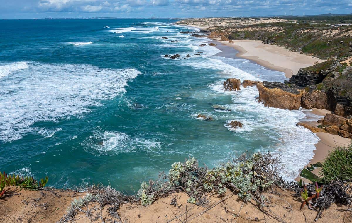
The route follows ancient fisherman’s paths, primarily along the coast and through a host of beautiful Portuguese fishing villages. What is particularly appealing is the lack of development along the coast until you reach the Lagos area. Much of the hike is atop cliffside trails, so anyone with a severe fear of heights, might want to stick to the inland route called the Historical Trail.
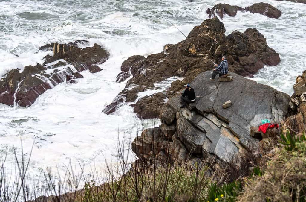
The coastal scenes, pristine white sand beaches, the fisherman sitting atop the edge of precarious cliffs with waves smashing close into the rocks, the storks, wildflowers, small villages, and interesting geology all added to what is now one of my all-time favourite hikes – the Fisherman’s Trail in Portugal.
You might also enjoy this multi-day backpacking trip above the Arctic Circle – Kungsleden Trail Guide: Abisko to Nikkaluokta.
This post includes some affiliate links. If you make a qualifying purchase through one of these links, I will receive a small percentage of the sale at no extra cost to you. Thank you very much for your support.
Would you like to save this?
What is the Rota Vicentina?
The Rota Vicentina is a network of long-distance trails that runs through two of Portugal’s most beautiful regions – the Alentejo and Algarve in the southwest part of the country,
The Rota Vicentina can be confusing as it is really three hiking routes that sometimes overlap for short distances. The most popular and most difficult route is the Fisherman’s Trail in Portugal that primarily follows the coast from Sines to Lagos. Most people start or finish in Porto Covo, especially as it’s very industrial at the northern end.
The second one is the Historical Way which starts in Santiago Do Cacém and finishes at Cabo St. Vincent. It’s an inland route that travels through small villages. In summer it is very hot!
The third are circular routes that permit you to do day hikes while staying in one location. A car would be useful to travel between the circular routes.
To put it all in perspective you might want to get the Costa Vicentina hiking map – though we didn’t find we needed them.
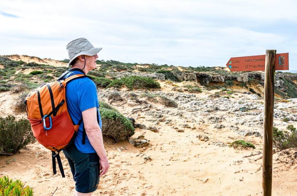
Signage and guides on the Fisherman’s Trail hike in Portugal
If you want a guidebook, pick up a copy of Cicerone’s Rota Vicentina Hiking Guide. I also use Organic Maps – a hiking app that works offline. Just remember to download the region’s maps while you have Wi-Fi.
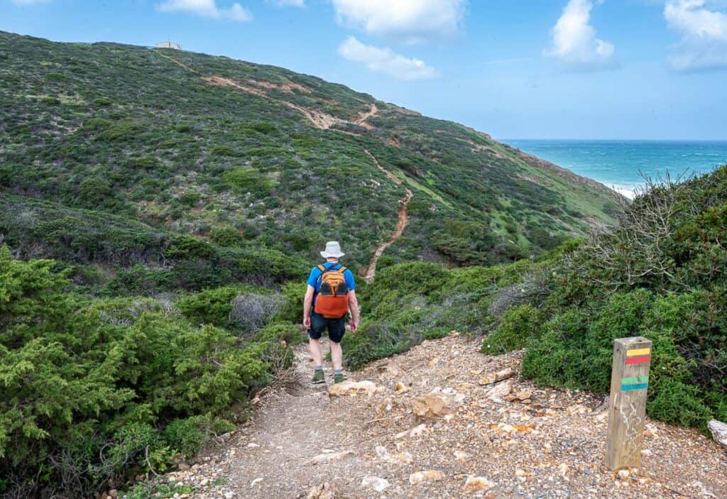
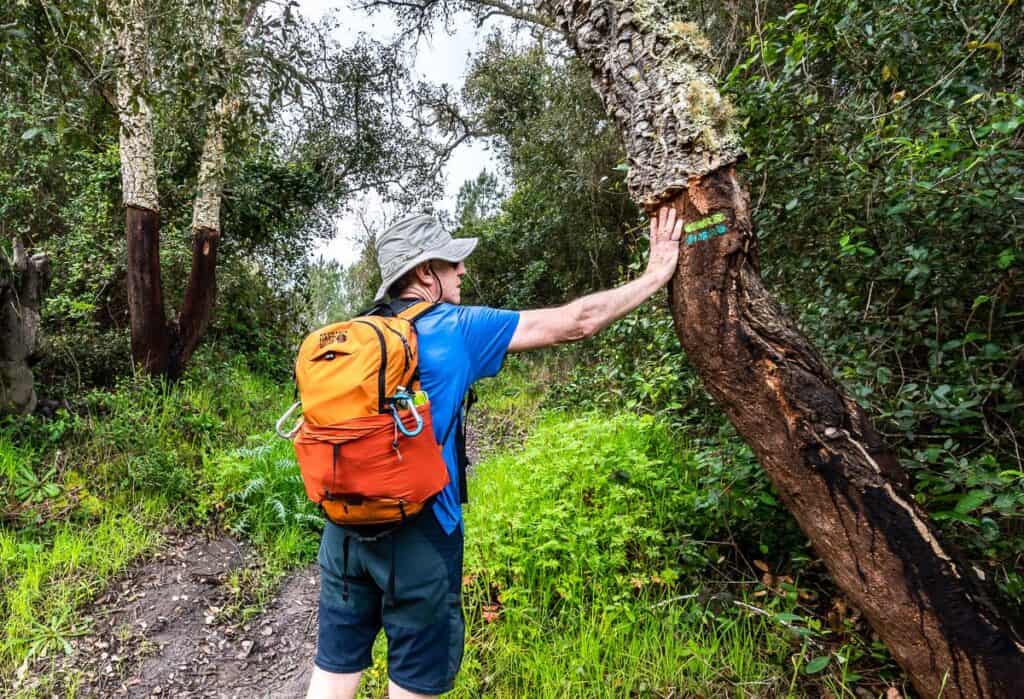
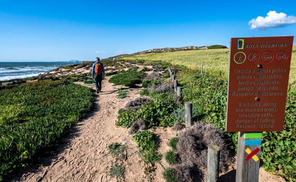
The Fisherman’s Trail is marked with teal and green blazes. Signage is generally excellent. Look for the markings on rocks, signposts, fenceposts, gates, basically anything that is permanent and solid.
Occasionally, the signs are replaced with red and yellow blazes. That’s a sign that you’re on the Historical Trail. The red and white blazes are found on the inland sections of trail. Sometimes the trails overlap so you’ll see multiple blazes.
What to pack for the Fisherman’s Trail
We had one small bag of luggage each that got moved every day to our accommodation. If we didn’t have our computers, it would have been easy to get by with a pack of about 45L because we certainly didn’t wear all the clothes we took.
Every day we wore a pair of quick dry shorts and a Merino wool t-shirt – as they don’t stink even after days of hiking. A fleece, a down vest and a raincoat in our 30 L backpacks ensured we were warm when the weather got rainy and windy.
Several pairs of comfortable socks, a pair of hiking boots (you don’t need heavy-duty, just a hiking shoe with a good tread), and a pair of sandals are also necessities. Throw in a bathing suit and a quick dry towel if you’re hiking the Fisherman’s Trail in warm weather. Include toiletries (don’t forget hair conditioner as it’s almost never provided), a cutlery set for picnic lunches, sunscreen, a sunhat, an e-reader, and you should be good to go.
I would also add, take a long sleeve shirt, an extra t-shirt and a pair of long pants.
Pack a lunch as chances are slim most days that you’ll find much in the way of lunch options once on the trail. Also, pack two litres of water per person per day.
Looking after your feet on the trail
Take care of your feet on the Fisherman’s Trail in Portugal. As I sit here typing my feet are throbbing, perhaps from all the walking on sand. I’d suggest a pair of half gaiters, so you don’t get sand in your hiking shoes. If you do, empty the sand so it doesn’t rub into a blister.
If you do get a blister, try one of these three fixes.
Leukotape – This came highly recommended to me by a fellow who was hiking the whole of the Great Divide Trail in Alberta and BC. I met him near the end of the trail, and he still swore by the stuff.
KT Blister Tape – Several hikers I have chatted with recently have come to love this tape for blisters. I also recommend KT Tape – an athletic tape that I’ve used for foot support on long hikes.
Compeed – I discovered this Band Aid-like product when I was hiking the Cumbria Way in England and ended up with massive blisters after getting wet feet. I always pack it on multi-day hikes.
Booking accommodation on the Fisherman’s Trail in Portugal
I booked all accommodation online months before we showed up. Don’t try to be spontaneous in high season, or you may find yourself walking all over town, trying to find a bed that fits your budget.
I’ve listed everywhere I stayed below each section of the Fisherman’s Trail we hiked along with some other options. The one thing to keep in mind if you’re hiring a baggage moving service, is that they don’t service every hotel and hostel. If you have to pre-pay, then it’s best to know if the baggage service will deliver.
A luggage moving service
We used Vicentina Transfers on the Fisherman’s Trail hike in Portugal and never had any issues. They offer daily service from February to November between Santiago do Cacém and Lagos, in both directions.
Leave your bag out by 9 AM at your first accommodation with your name on a piece of paper identifying it. They’ll label the luggage and have it at the next place by 4:30 PM at the latest. That will be the routine every day. There was only one day that are bags arrived later than 3 PM.
If you’re staying at Airbnb’s or “Alojamento Local” that do not have staff or a reception you can still use their service by providing a contact phone number.
A few rules
The luggage can’t weigh more than 18 kg. You can’t pack any food (dry or fresh) or beverages in the luggage. And the luggage must be stand alone without other bags attached to it.
Costs
One transfer is equal to one route section. If you book four or more luggage transfers, it’s 15 Euros per transfer – and that includes two bags. If it’s less than four transfers, it’s 20 Euros per two bags.
It cost us 165 Euros for two pieces of luggage to be delivered daily for 12 days. I think that was a good deal.
What way should you hike the Fisherman’s Trail?
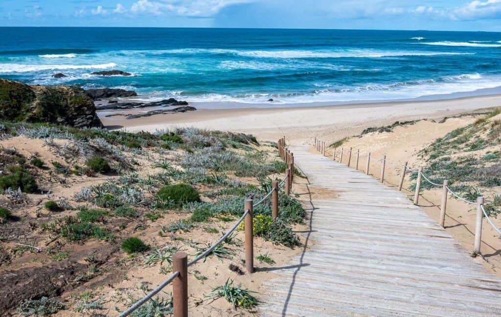
You can hike the Fisherman’s Trail in either direction. Most people hike from north to south but it’s entirely up to you.
When should you hike the Fisherman’s Trail??
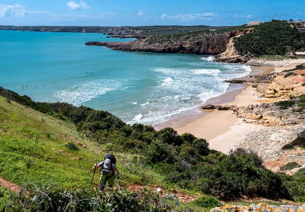
In theory the best time to hike the Fisherman’s Trail is between mid-September and June as July, August and early September can be blazing hot – though the winds tame the heat to a certain degree. In the winter, you can still hike the Fisherman’s Trail, but not all restaurants and hotels are open.
We went in mid-March which seemed about perfect to me. Temperatures were mild, so shorts and t-shirts were the norm during the day. There were occasional rain showers but nothing as nasty as you can get in winter. Accommodation was open and easy to book. Most, but not all restaurants were also open.
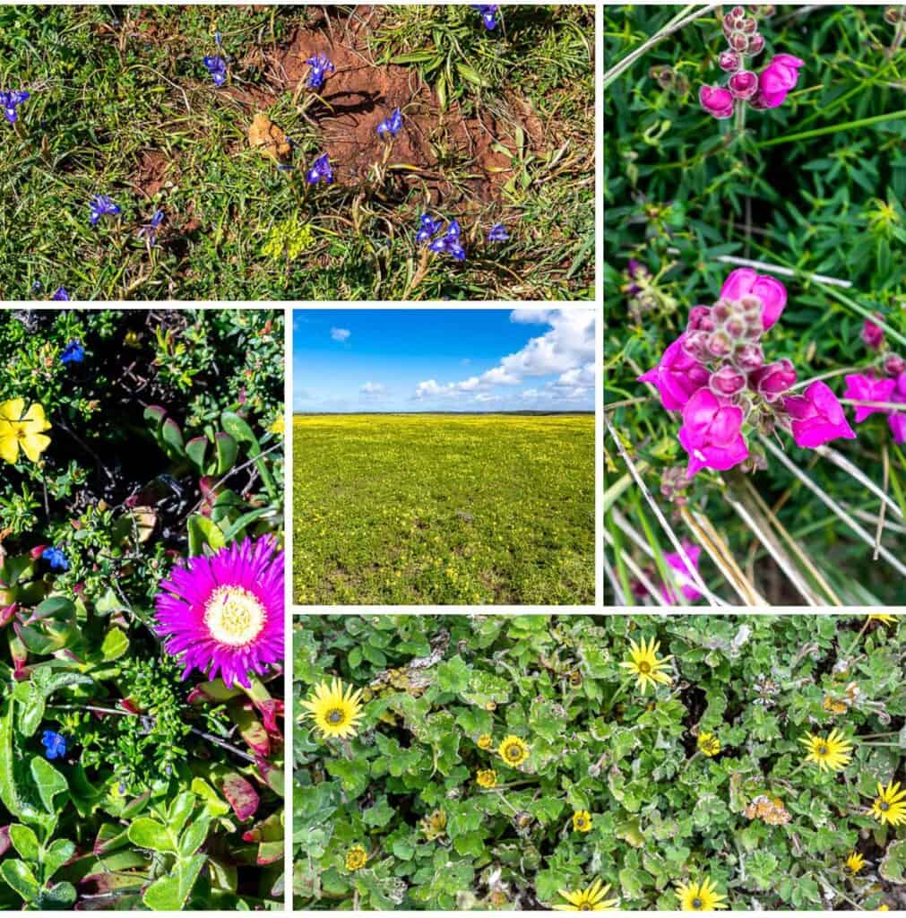
In March the wildflowers are out and there is also lots of bird life about. On a bluebird day, you might be mistaken you were in the middle of a Canadian summer.
How hard is to follow the Fisherman’s Trail in Portugal
The Rota Vicentina is marked with teal and green blazes. Signage is generally excellent. Look for the markings on rocks, signposts, fenceposts, gates, basically anything that is permanent and solid.
Getting to and from the start and end of the Fisherman’s Trail in Portugal
I used Busbud to book our bus tickets as the bus company didn’t make it easy directly through their website. We were able to show the QR code from the email to get on the bus.
To Porto Covo
Try and choose the 2-hour run versus the 3-hour option when you’re traveling from Lisbon to Porto Covo. The buses aren’t very comfortable, so the less time on them the better.
We bought last minute tickets for about $Cdn23 each.
It was about a 10-minute walk to the Mute Hostel from the bus stop. Pass some good restaurants and traditional blue and white Alentejo houses on the walk there.
Return from Lagos
There were lots of buses back to Lisbon from Lagos. We booked about three days ahead of time on a direct bus for 6.85 Euros. It took about 3.5 hours and was on time. They may not be the most comfortable (no washrooms onboard either) but they sure are inexpensive.
Need an English speaking driver?
For another convenient and flexible alternative, especially if you’re carrying hiking gear or traveling in a group, you can book a private transfer with a local, English-speaking driver with Daytrip. These door-to-door rides are pre-booked, reliable, and allow you to travel on your own schedule. You can also request stops at scenic viewpoints or small towns along the way to make the most of your journey.
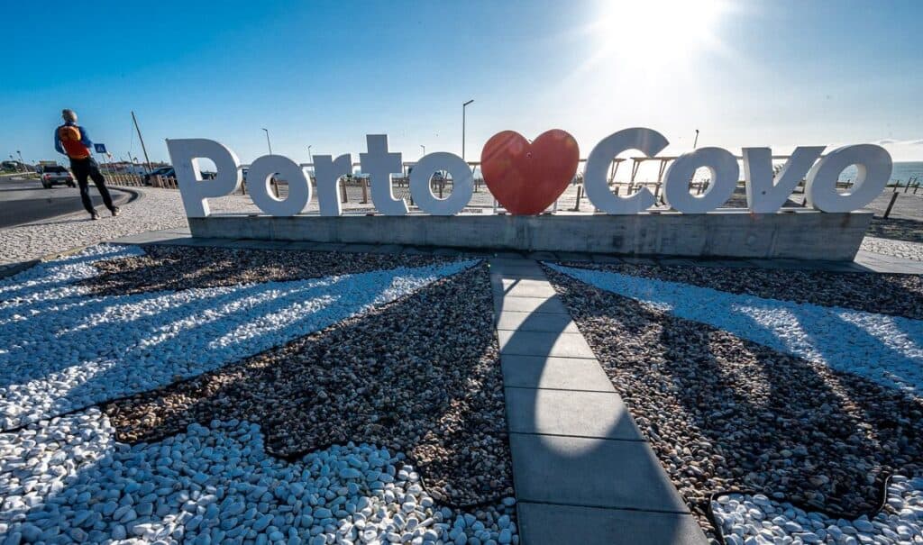
Where does the Fisherman’s Trail officially start and end?
It officially starts at São Torpes Beach in Sines in the Alentejo region and finishes in Lagos in the Algarve region. Most people start at Porto Covo. We hiked from Porto Covo towards Sines for almost 4 km to get a sense of the trail. That is well worth doing.
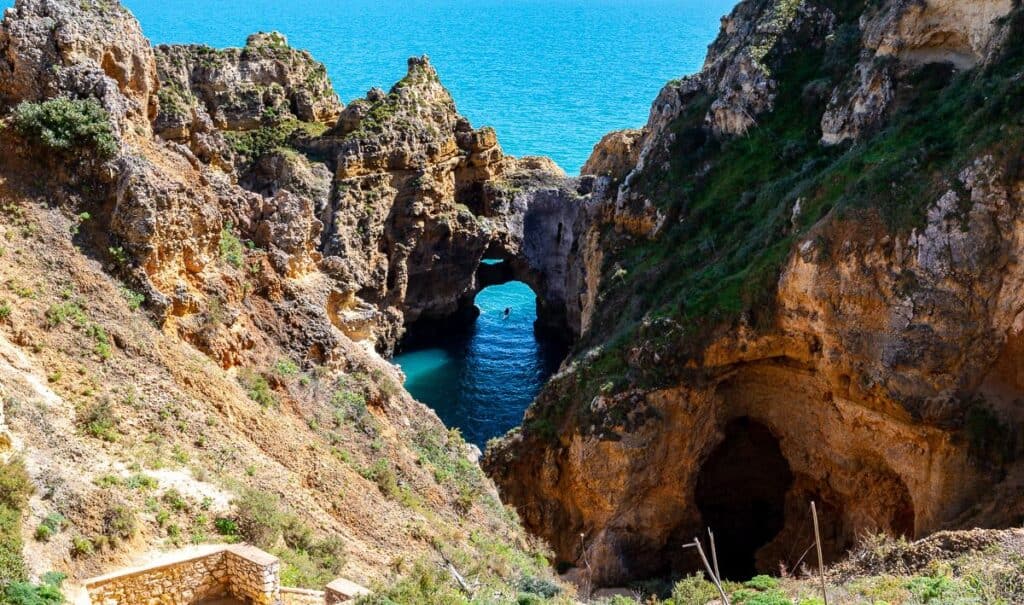
Day 1 on the Rota Vicentina Fisherman’s Trail in Portugal: Porto Covo part way to São Torpes Beach and back
Distance: About 10 km one way
Time needed: About 3 hours
Elevation gain: Mostly flat.
Experience: A great warm up for the rest of the Fisherman’s Trail hike in Portugal.
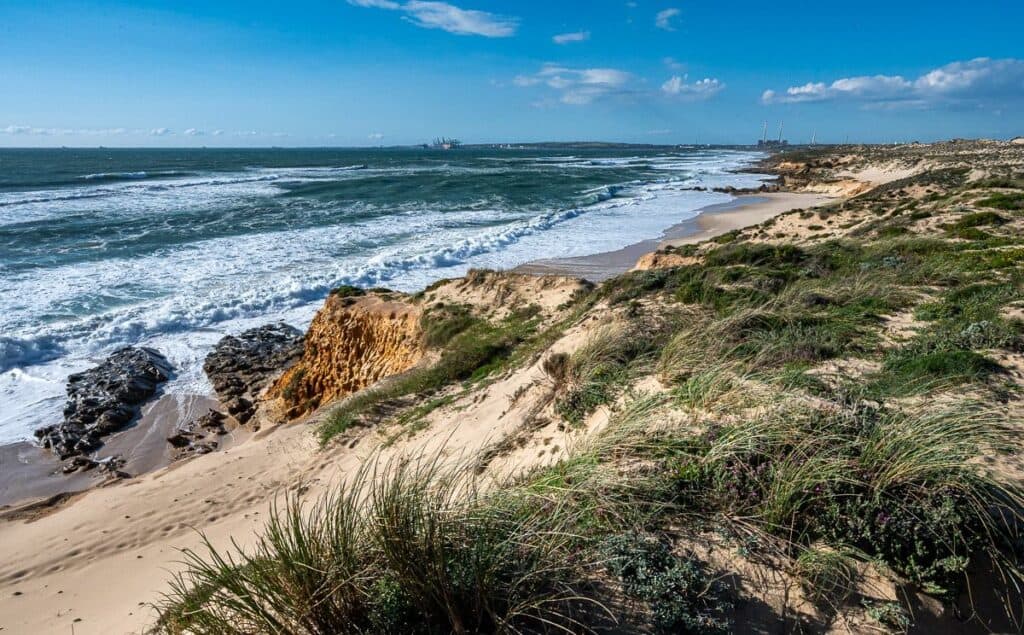
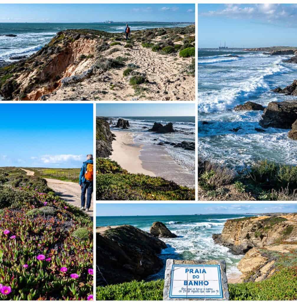
- From Porto Covo we hiked north about 3.5 km to get a taste of the Fisherman’s Trail. The only downside to this section was the industrial landscape off in the distance.
- Largely a sandy trail with beach access via ladders. Some dune walking. Overall, a pretty section.
- Look for warning signs related to wind, waves and falls off cliffs.
- Lots of ice plants and colourful wildflowers.
- Gets very industrial about 75 minutes north of Porto Covo and not a section you’ll want to linger on.
Where to stay in Porto Covo
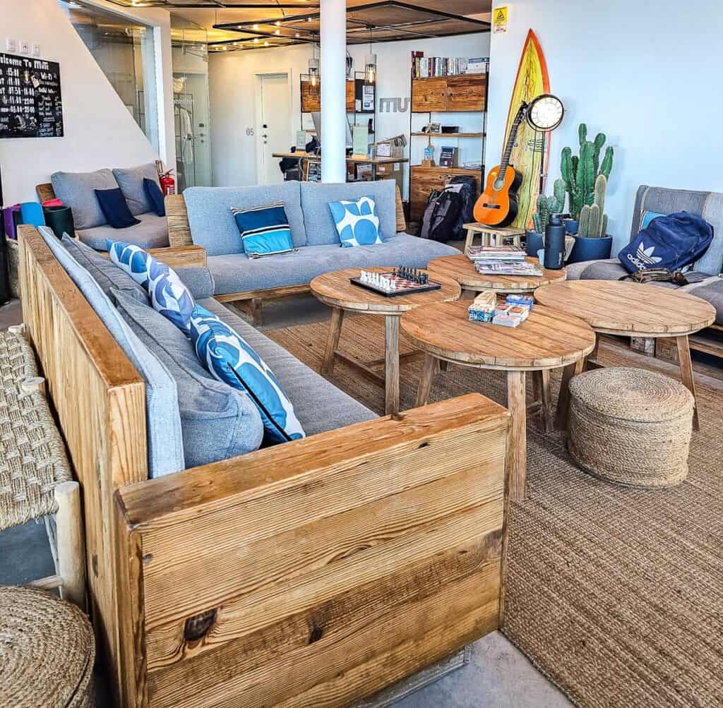
Mute Hostel – A choice of dorm and private rooms with a great location and pool. Breakfast included and food available for lunch and dinner. They also rent surfboards.
Porto Covo Praia Hotel & Spa Enjoy quick access to the beach and a year-round swimming pool. Many of the rooms have sea views. There is also an onsite restaurant.
Calmaria Guesthouse – Comfortable accommodation in recently renovated rooms, 500 m from the beach.
Ahoy Porto Covo Hostel (budget option) – Choose from dorm rooms and double rooms just 100 m from the beach.
Day 2: Porto Covo to Vila Nova de Milfontes on the Fisherman’s Trail in Portugal
Distance: 20 km
Time needed: About 6 hours
Elevation gain: About 200 m
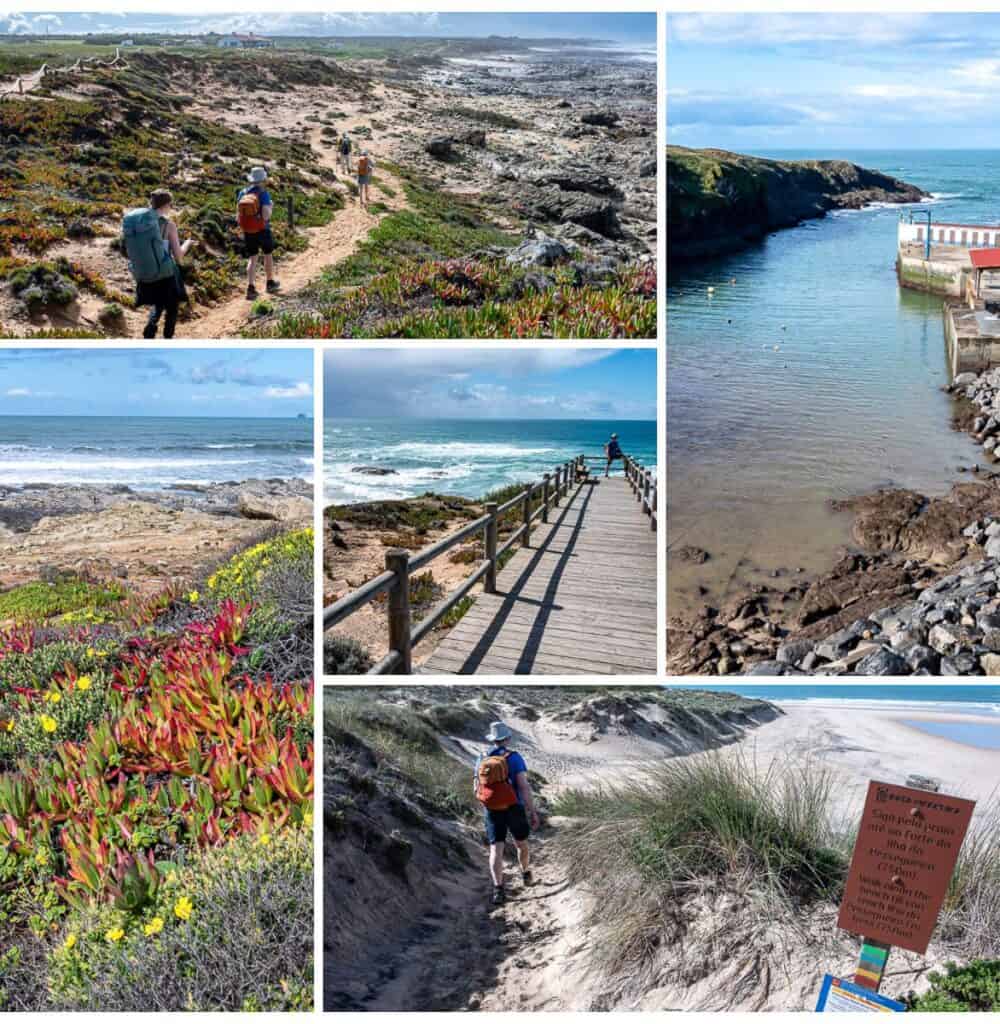
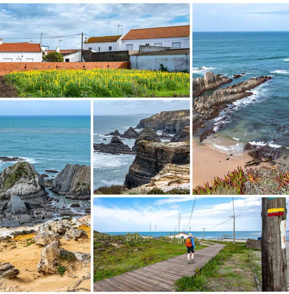
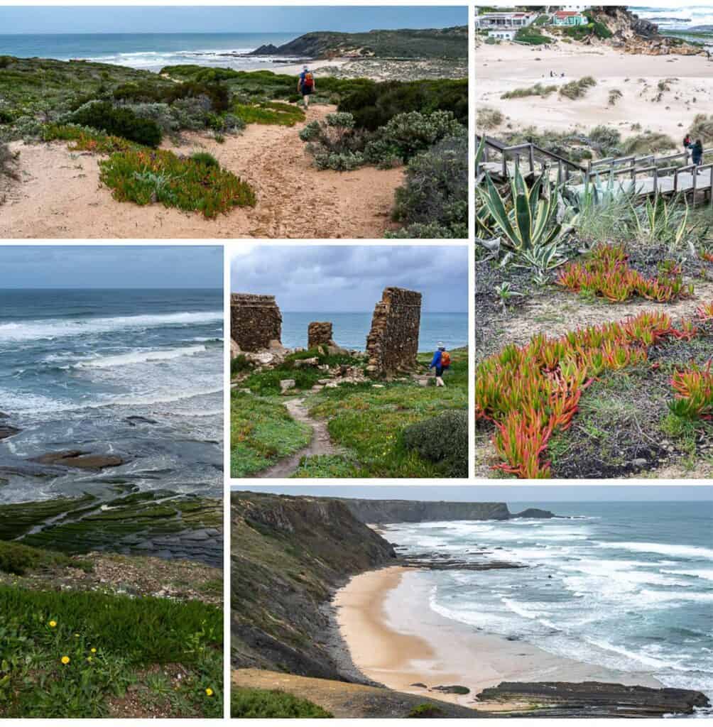
Experience: Today was a glorious day of oceanside hiking from the start and up to the final 2 km into Vila Nova de Milfontes.
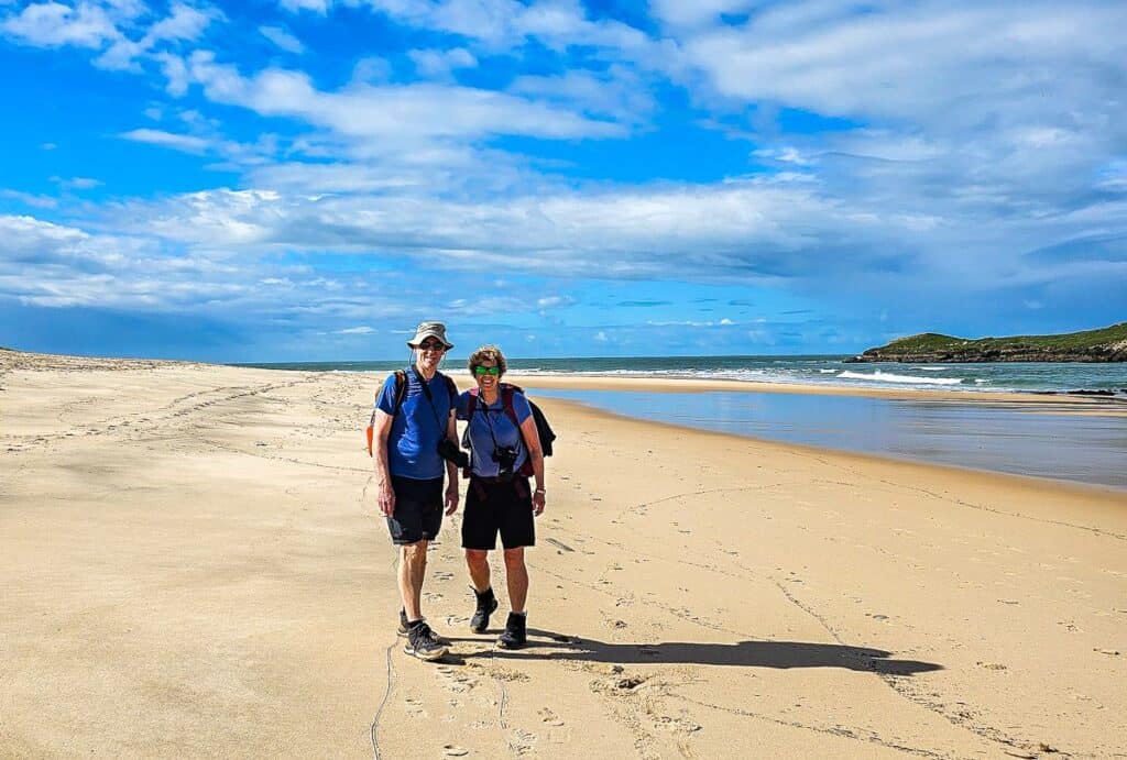
- Most of the walking is on sand – deep sand, hard sand, beach walking, and a mix of sand and rocks on the headlands.
- Spectacular coastal views all day. There is lots of airy cliff-top walking that some might not enjoy.
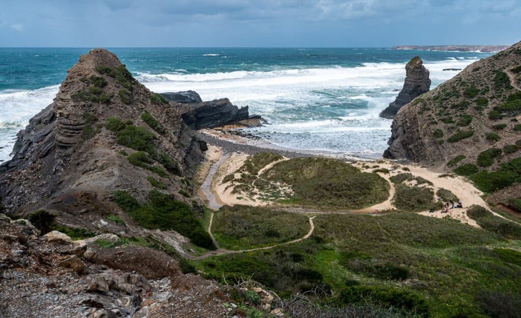
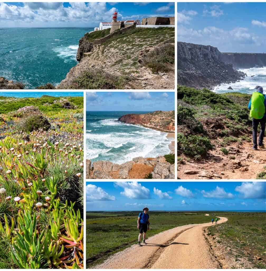
- About three hours into the hike you get into the best scenery of the day, and it lasts for a good two hours. Think grand repeating views, booming waves hitting cliffs and caves, and clean empty white sand beaches.
- Fun to see the fisherman, who the trail is named for – perched on cliffs fishing for I’m not sure what.
- Loads of wildflowers in bloom. Plenty of gulls and small birds too.
- No services, save for one restaurant called Restaurante A Ilha we passed as we came off a long beach, about two hours into the walk. There is also a restaurant just as you hit the road after coming off the trail on the way into Vila Nova de Milfontes.
Where to stay in Vila Nova de Milfontes
Charm-In Center – Nice rooms, good-sized bathroom but no breakfast. Walking distance to grocery stores, a bakery and restaurants.
Day 3: Vila Nova de Milfontes to Almograve
Distance: 15 km
Time needed: 4 hours with a short lunch stop.
Elevation gain: Approximately 250 m
Experience:
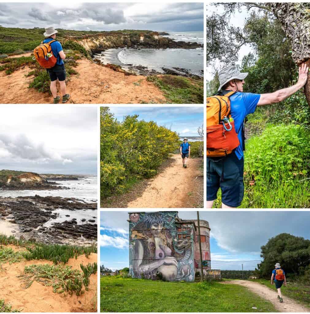
- The day starts with a walk across the bridge over the Mira River. There is an option to take a short ferry ride across, but since we weren’t sure if it was working, we played it safe.
- Very pretty walking through birdsong filled woods on the far side of the Mira River on route to the beach across from Nova de Milfontes.
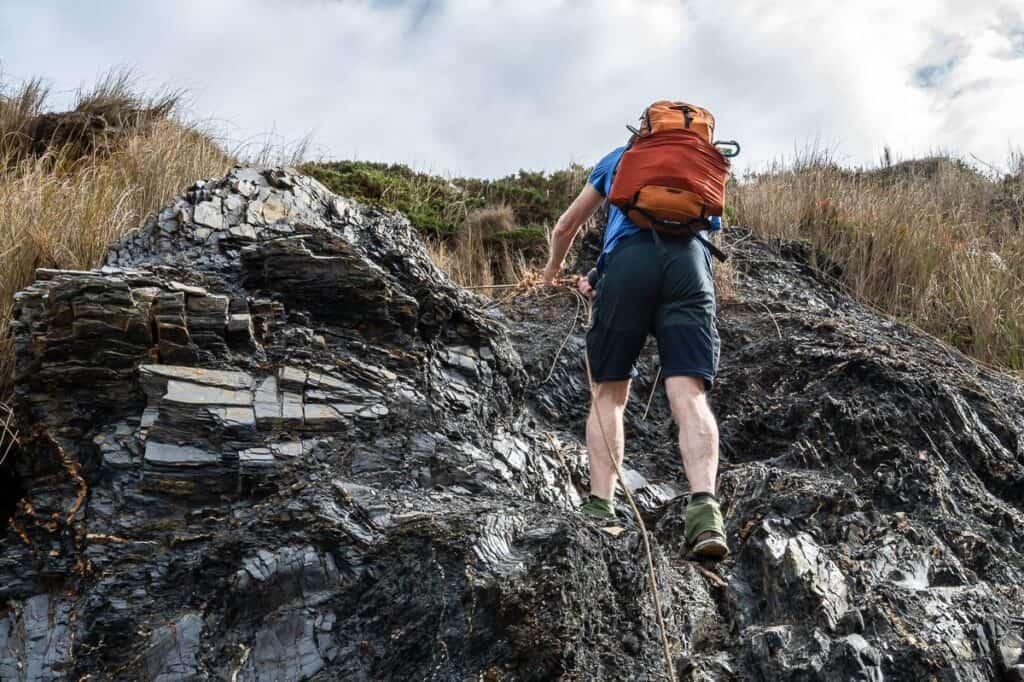
- Enjoyed a long stretch of beach walking until a rising tide forced us up some cliffs with the help of a rope – not as hard as it sounds and it’s on the map.
- Lots of sandy walking along tracks and on top of cliffs.
- One section of dense undergrowth with a narrow trail through it.
- Well marked all day. There was a sign pointing to Almograve which took you inland instead of along the coast. Pay attention at intersections.
- Some light rain at the end of the hike.
Where to stay in Almograve
Casa Azul – a stand-along home just a few blocks from restaurants. Nothing fancy but clean and a few kitchen facilities and a washer. Host was kind enough to leave some goodies for us.
For a hostel – check out HI Almograve – Pousada de Juventude.
Day 4: Almograve to Zambujeira do Mar
Distance: 22 km
Time needed: About 5 hours
Elevation gain: Approximately 296 m
Experience: A wonderful day with loads of coastal views.
- A pleasant walk through Almograve to a quiet dirt road leading to the beach.
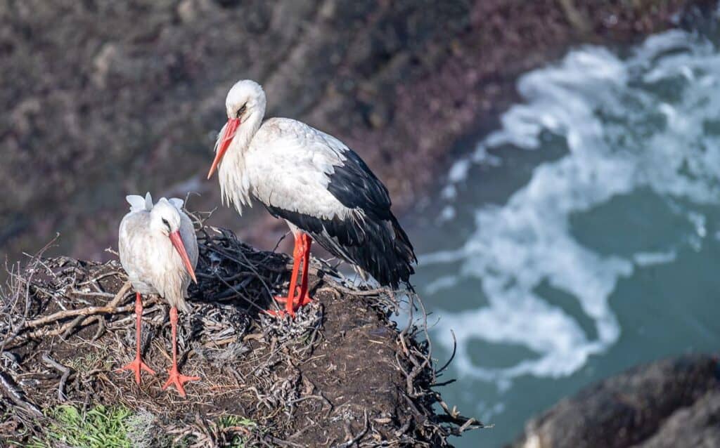
- Beautiful cliff top walking for kilometres with cool rocks folded into amazing shapes and impossibly big stork nests on precarious perches.
- Lots of sand dunes.
- Turn away from the see and enjoy a pleasant walk into the town of Cavaleiro past loads of wildflowers – with the perfectly situated Cafe Adelia Snack Bar located immediately as you reach town. Stop and enjoy lunch outside in the sun.
- Continue on the main road before turning onto dirt roads and heading back towards the sea. Parallel the sea passing a lighthouse; there are numerous viewpoints via boardwalks if you’re interested.
- Stay on a kilometres-long sandy track with potholes filled with water.
- Descend a steep set of stairs to a small fishing area, climb the steep road and take a break at the picnic tables.
- The last 1.5 km are on a gravel path beside a tarmac road. Follow it all the way into Zambujeira do Mar to your accommodation. You did pre-book in high season -right.
Where to stay in Zambujeira do Mar
AZUL – Great place – clean, 5 minutes walk from the trail. Breakfast included.
For a hostel check out Hostel Nature, rated superb. It offers direct beachfront access.
Day 5: Zambujeira do Mar to Odeceixe
Distance: 18 km
Time needed: About 5 hours
Elevation gain: Approximately 413 m
Experience: It’s a great day of hiking on the Fisherman’s Trail in Portugal to Odeceixe.
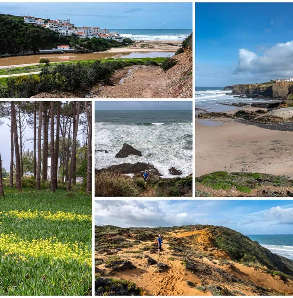
- Leave Zambujeira do Mar by walking through the town square and descending to a beach. Climb up the far side and enjoy some lovely hill and cliff top hiking – with some excellent views back to the town.
- This is a day where you’ll see a lot of storks on the edge of the cliffs along with numerous fishermen.
- Pass a surf school where you can get another coffee fix.
- There is a steep descent followed by another big climb. Then enjoy a long stretch of gorgeous cliff top walking. Most of the morning is like that – up, beautiful walking with great views, down and repeat.
- By the Rio Seixe you turn inland and then descend to a quiet road that takes you all the way into town. Climb up past colourful murals in Odeceixe to reach the town square – where you’ll find bars and cafes.
Where to stay in Odeceixe
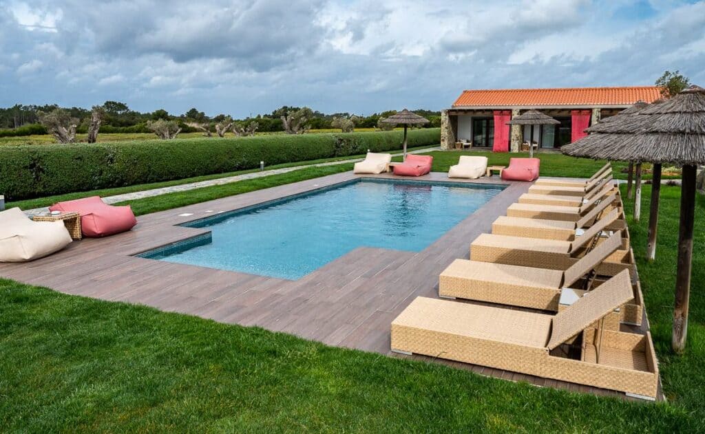
We stayed at Monte do Cardal, about 7 km out of town. It was worth the walk – though you could also take a taxi. It shortened the next day’s hike, and we had a lovely stay. The place las a great pool, a lovely room with some port and two glasses as a welcome, and a superb breakfast. I didn’t want to leave.
In Odeceixe, Casa Morais is given a fabulous rating and it does include breakfast.
AL-Odeceixe rated exceptional has nice looking rooms with city views and it comes with breakfast.
Day 6: Odeceixe to Aljezur
Distance: 23 km
Time needed: 5 – 6 hours
Elevation gain: 287 m
Experience: We had a head start because of where we stayed the night before, so we didn’t enjoy as much coastal walking.
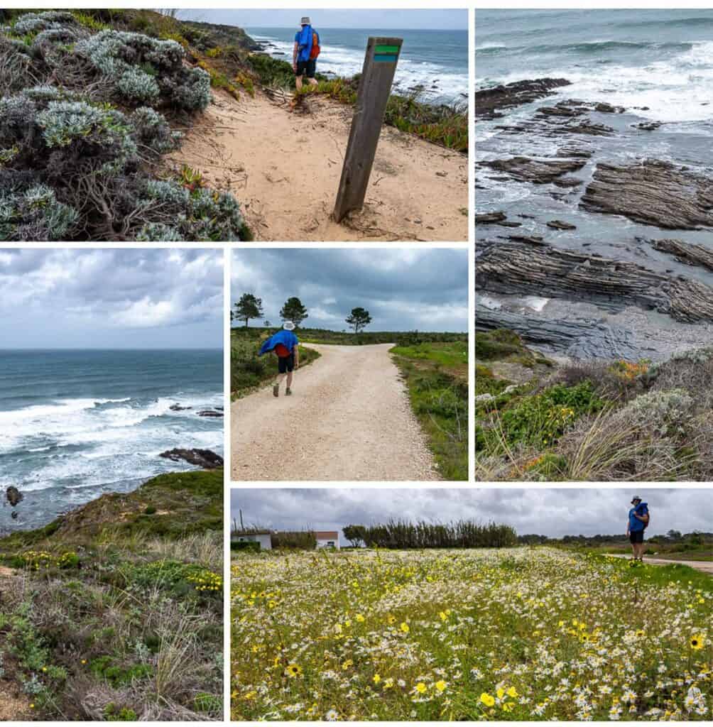
- Today was not as interesting a day because there was less coastal walking for us. The weather wasn’t as cooperative either with big winds and on and off rain showers.
- Follow the river out of Odeceixe heading for the ocean. You’ll pass Praia de Odeceixe – the beach you saw from the other side of the river yesterday.
- If the river is low, you’ll be able to continue walking along the coast for some time. People had to detour because of all the recent rain.
- We stopped for lunch at Pao do Rogil – a bakery with great coffee and pastries in Rogil.
- Then it’s back to the coast for some pretty walking. The trail splits at the top of a headland before a descent to the Aljezur River. We opted to go right and go down to a road by the river. It probably would have been prettier in the woods if we’d followed the signage.
- At the river we followed a quiet road for about 6 km to reach Aljezur. It’s a bigger town so easy to load up on supplies.
Where to stay in and near Aljezur
Hostel Amazigh – great location, close to restaurants with a mix of twin, double and dormitory type rooms.
Vicentina Hotel – where we stayed but we didn’t love it except for its great location across the street from Varzea Horta & Bistrot – the best restaurant in town. The staff at the hotel aren’t very friendly and rooms have no personality but there is a pool if it’s a hot day. It’s popular with the walking crowd as there isn’t much choice in town and it does come with breakfast.
There is one high end hotel on the walk out of Aljezur – Praia Do Canal. If you’re looking for luxury, this is the place, though not sure if they do dinner. You might need to take a taxi back into town.
Day 7: Aljezur to Arrifana
Distance: 17 km
Time needed: About 4 hours.
Elevation gain: Approximately 375 m
Experience: At the end of the day, we had a river detour because of high water – so that added an extra kilometre or two.
- Start with a steep climb out of Aljezur and then some lovely walking through a lush river valley.
- Next up is several kilometres of road walking before you head off on quiet dirt roads to reach the mouth of the Ribeira de Aljezur. Look for stairs down to viewpoints. The best beach is on the other side of the river. A restaurant with a view is well positioned for anyone needing a coffee or a meal. From Aljezur to the restaurant it’s roughly 7.5 km.
- Continue up a road, then down to the small but pretty village of Monte Clerigo overlooking a big beach. There are a few places to grab food before heading up another steep road and onto scenic clifftop trails to reach the Ribat da Arrafina, the remains of a Muslim coastal fortress built around 1130 AD.
- From there head into beautiful pine forests with plenty of wildflowers in the understory. It’s about 3.2 km to reach Arrifana from there.
Where to stay in Arrifana
Arrifana Destination Suites – I booked this place but a wind storm had broken some windows so they put us up in the HI Arrifana Destination Hostel instead with a big private room with large windows, a view, a fridge and a private bathroom. The people running it were amazing. One lady drove us the next morning to The Bakery for great coffee and baked goods.
Day 8: Arrifana to Carrapateira
Distance: 19 km though probably did 23 km because of detours related to swollen rivers.
Time needed: 6 – 6.5 hours
Elevation gain: Approximately 560 metres.
Experience:
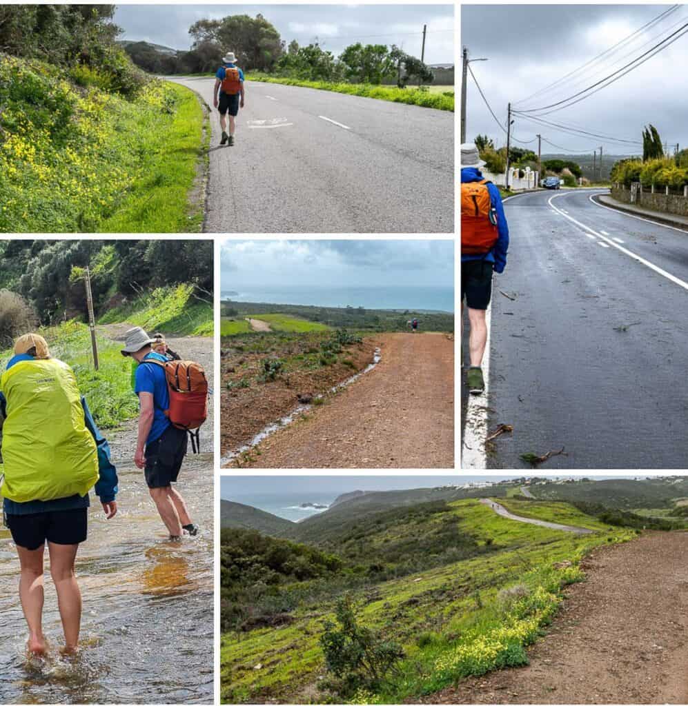
- Head south out of Arrifana following the road to reach a track heading off towards Praia do Canal. Red and white signage is good indicating you’re on the Historical Way.
- Unfortunately for us, the river several kilometres up the track was swollen (chest high for a guy who crossed it), so we backtracked to pick up a good track to Monte Novo. It’s also the track some people use coming from Aljezur. Well before Monte Novo we started seeing Historical Way signs again, so we followed them to reach a river crossing near Foia that looked like it had a bridge.
- The river crossing was a ford as there was no bridge, but it took less than 30 seconds to do it and the water was warm and just above boot height.
- From there we followed highway ER268 for about 3.0 km into Carrapateria – paying close attention to cars and trucks as there is no shoulder. It would have been nice to come in via the beach but this way it was an easy walk to our inn for the night.
Where to stay in Carrapateria
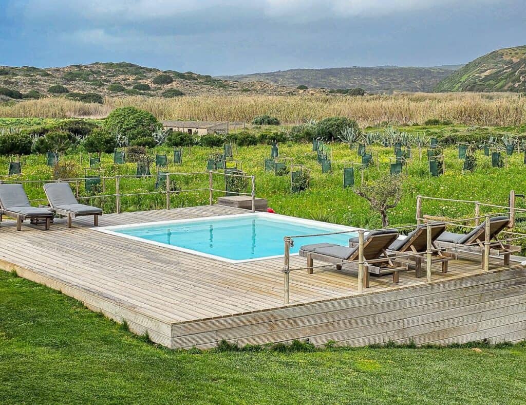
Hortas do Rio – Casa de Campo – A beautiful property with gardens and a small pool. Rooms are nicely appointed with a couple of chairs looking out to the fields. Very quiet. Excellent breakfast and lovely hosts.
If you want a budget option, check out Hostel Do Mar, rated superb. It has a rooftop terrace along with private and shared bathrooms.
Day 9: Carrapateira to Vila do Bispo on the Fisherman’s Trail in Portugal
Distance: 15 – 16 km
Time needed: 4 – 5 hours
Elevation gain: Approximately 300 m
Experience: A wonderful hike starting with a walk out of Carrapateria towards the sea.
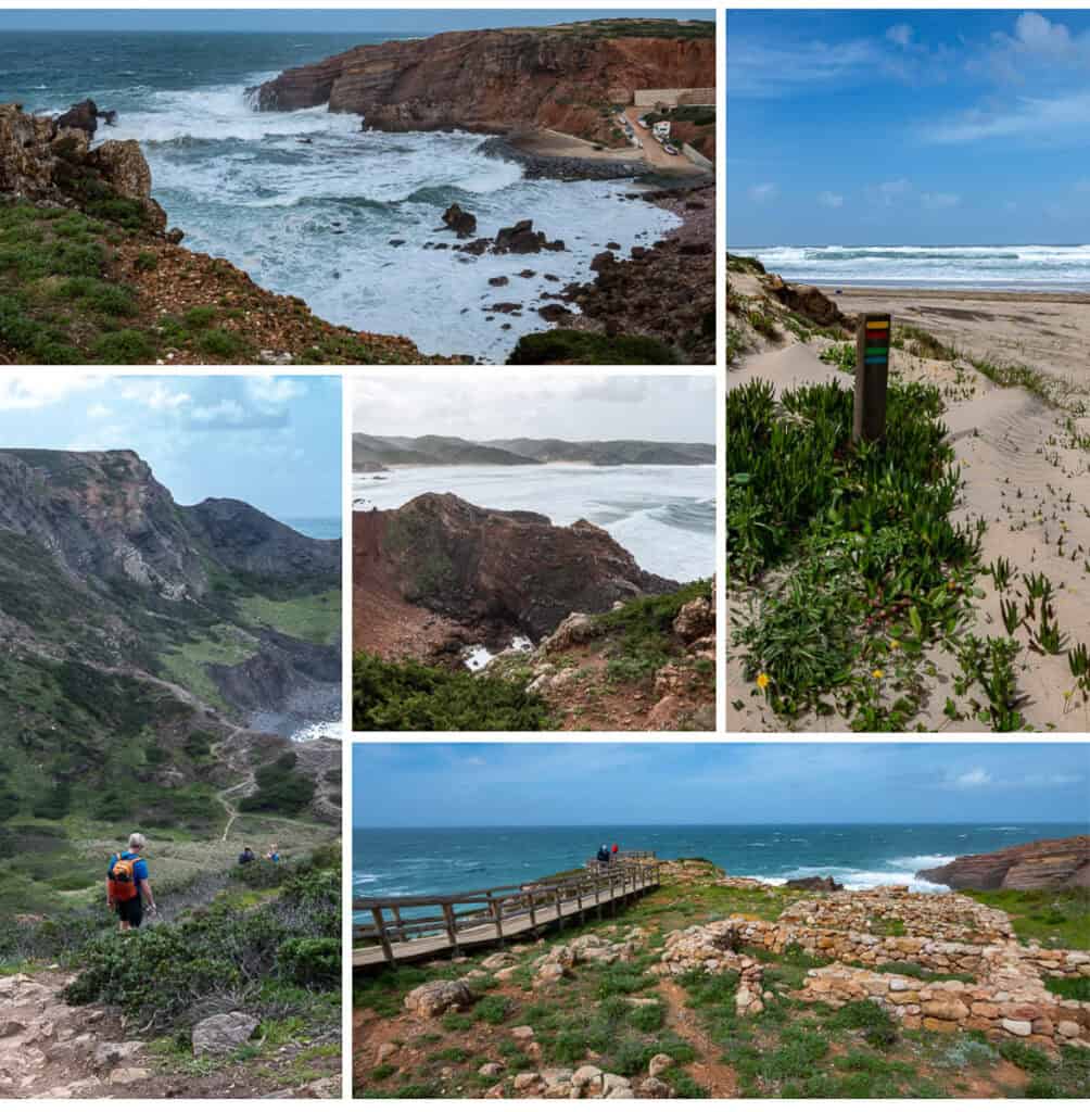
- That was followed by several hours of scenic though very windy walking along the coast with the biggest elevation gains of the entire hike so far. It was great fun to watch the massive waves crashing into offshore rocks.
- Some of the hiking was on narrow trails with drop-offs – though there is the option to do the Historical Way and avoid this. Also, there are some descents on steep scree. This could be a tough day for people that are afraid of heights.
- Once the coastal section is finished the walking remains scenic. Some of it is in pine forests filled with blooming heather if you walk in March, while other parts of the path offer up big valley views along with wind turbines, suggesting that all the wind we had was a common occurrence along here.
- The last 3 – 4 km towards Vila do Bispo can be hiked on the highway – but that isn’t a lot of fun. We went straight when we reached the highway, continuing on a dirt road for just over a kilometre. Then we went left and descended a hill -which had electric wiring on either side of the road. At the bottom there was a large amount of water from recent rains, but we were able to work our way around – and then continued up to the highway. After a few hundred metres move onto quieter roads that take you all the way into Vila do Bispo.
Where to stay in Vila do Bispo
Pure Fonte Velha B&B – great place with large bedrooms including two seats and a coffee table. Another gathering area on the second floor and a large dining area for breakfast.
I highly recommend dinner at Pisco – a mostly vegetarian restaurant that also features exceptional pizzas. Make reservations or order pizza and wine to take out. It was one of the best meals we had on the Fisherman’s Trail in Portugal.
Day 10: Vila do Bispo to Sagres on the Fisherman’s Trail in Portugal
Distance: 20 km
Time needed: Allow 5 hours.
Elevation gain: About 350 m
Experience: Reach the southwest corner of Portugal today.
- Leave Vila do Bispo heading out onto a wide dirt trail through the countryside. You’ll see signage letting you know that it’s 13 km to reach the lighthouse at Cape St. Vincent. – and you’ll be able to see it off the distance. You can also see Sagres early on in the hike.
- When we did the initial section, it was very windy as there isn’t much protection from the Atlantic. When you turn start to head in a more southerly direction, you’ll be close to the coast again, so it gets more interesting. But the easy walking is over until you get to the road to the lighthouse.
- Some sections along the trail are quite pretty with plenty of wildflowers in bloom. There is some up and down, but sections are short. Enjoy plenty of great beach and ocean views and it’s fun to watch the waves break on the cliffs as you get closer to the lighthouse.
- There is about a kilometre of tough walking on a mix of sand and broken limestone. I found it fastest to rock hop, but you must concentrate. End this section on the road to the lighthouse. Cross the street and take the wide trail to the lighthouse. Some of the best views of it are from the rocks on the Sagres side of the ocean.
- Finish the hike to Sagres by walking the trail for 7 km. There are a couple of worthwhile short options to get closer to the water. They are worth doing as they provide some excellent views and the sea around here is a compelling turquoise colour.
If you’re in need of refreshments stop by the large Santo Logo surf shop. They have cold drinks, coffees and lots of baked goods on the final part of the walk in Sagres.
Where to stay in Sagres
We stayed at the Pousada de Sagres, just over half a kilometre from the city centre. It’s a massive place and not very homey but the price was right and the breakfast – which is included was excellent. We walked back into town for an excellent Italian dinner at Arte Bianca – Cucina Italiana.
For a boutique bed and breakfast try Mareta View – just 100 m from the city centre. It comes with breakfast and is rated fabulous.
For those on a budget check out The Lighthouse Hostel – 1.3 km from the centre with an outdoor pool. Choose between dorm rooms, doubles and quadruples.
Day 11: Sagres to Selema
Distance: 20 km
Time needed: 5 – 6 hours and one of the more difficult sections
Elevation gain: About 600 m and a similar amount on the descent
Experience: Lots of up and down today so count on a workout.
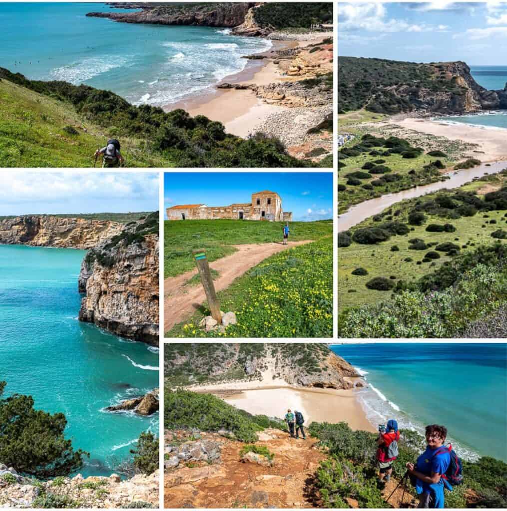
- Leave Sagres heading for the large beach and resort to the south. Enjoy a walk across the beach before climbing the first of many headlands. Follow the trail, enjoying superb coastal views. Then head inland through a sea of flowers past an abandoned building.
- Descend to a small beach – much beloved by the surfer crowd if the number of vans in the parking lot is any indication. Climb up to another headland, taking the time to watch the waves roll into shore. Continue hiking along the headlands, admiring the fantastic turquoise blue waters.
- Enjoy the sight of all the surfers waiting to catch a wave at Praia do Zavial. Descend to the river and then climb steeply towards Ponta de Torre (the remains of Tower Bridge).
- Follow the coast to another steep descent to Praia das Fumas. There is a big beach here with some caves at sea level. From here turn head inland towards Figueira before doing an abrupt 90 degree turn back to towards the coast.
- From the coast until you reach Salema there are numerous ups and downs, largely on steep scree – so watch your footing. Salema is built on a hill overlooking the ocean and our accommodation – Romantik Villa which was lovely, was at the top of one of them – but worth it for the rooms, hospitality, pool and garden.
- For a treat head to Em Lume Brando for dinner. My mushroom lasagna was as beautiful as it was delicious.
Day 12: Salema to Lagos at the end of the Fisherman’s Trail in Portugal
Distance: 22.5 km
Time needed: 4.5 – 5 hours
Elevation gain: About 220 m
Experience: I felt I was walking closer and closer to a busy city and was already missing the peacefulness I felt on the other days on the Fisherman’s Trail in Portugal.
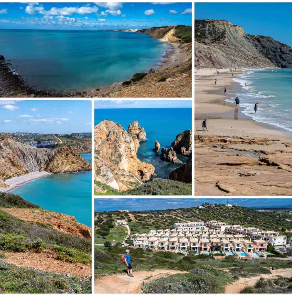
- It was a pretty hike through Salema to get to the waterfront. After a short detour inland, we headed for a trail on top of the cliffs along the coast. The hiking was marvelous and the views of the turquoise water below, stunning.
- Most of today’s hike is along the coast overlooking beaches but the difference today is that there are lots of cafes and restaurants for breaks in Burgau and Luz. I particularly liked Burgau and think many people would enjoy staying here for an extra day.
- From Luz there is a big climb up to the top of the headland you can see off in the distance before you start. It’s a further 11 km from Luz to Lagos, so many hikers that aren’t in a rush spend a night here.
- The last part of the hike takes you tot the popular Ponta de Piedade area accessed via a series of boardwalks. After admiring the stunning scenery – likely surrounded by tourists, walk into Lagos to your accommodation. We never did find a starting sign – but we didn’t look too closely as a cold drink was first and foremost on our mind.
Where to stay in Lagos
Alta Mar Inn rated superb, is a renovated bed and breakfast with a balcony.
For a hostel check out Olive Hostel, in the historical centre of Lagos. There are dorms and double and twin rooms.
More long distance hikes you might enjoy
- Coast to Coast – Canada’s Long Distance Hiking Trails
- The Best Part of Hiking the GR221 in Mallorca
- Hiking on Gran Canaria – A One Week Itinerary
- Hiking La Gomera – A One Week Itinerary
- What’s It’s Like to Hike the Full Tour du Mont Blanc
- Hiking the Stunning Via Alpina in Switzerland
Click on the photo to bookmark to your Pinterest boards.
I’ve followed your adventures for awhile now and we happened to be planning a trip to Portugal and in June. We have time to do at most 3 days of this trail. Which 2-3 successive days would you suggest for someone wanting to get a taste of it?
Hi Anita – I’d start in Porto Covo and go north. That section was a real highlight for me.
We ended up just doing one day—Lagos to Salema. The recommendation for Romantik Villa and Em Lune Brando for dinner was absolutely excellent.