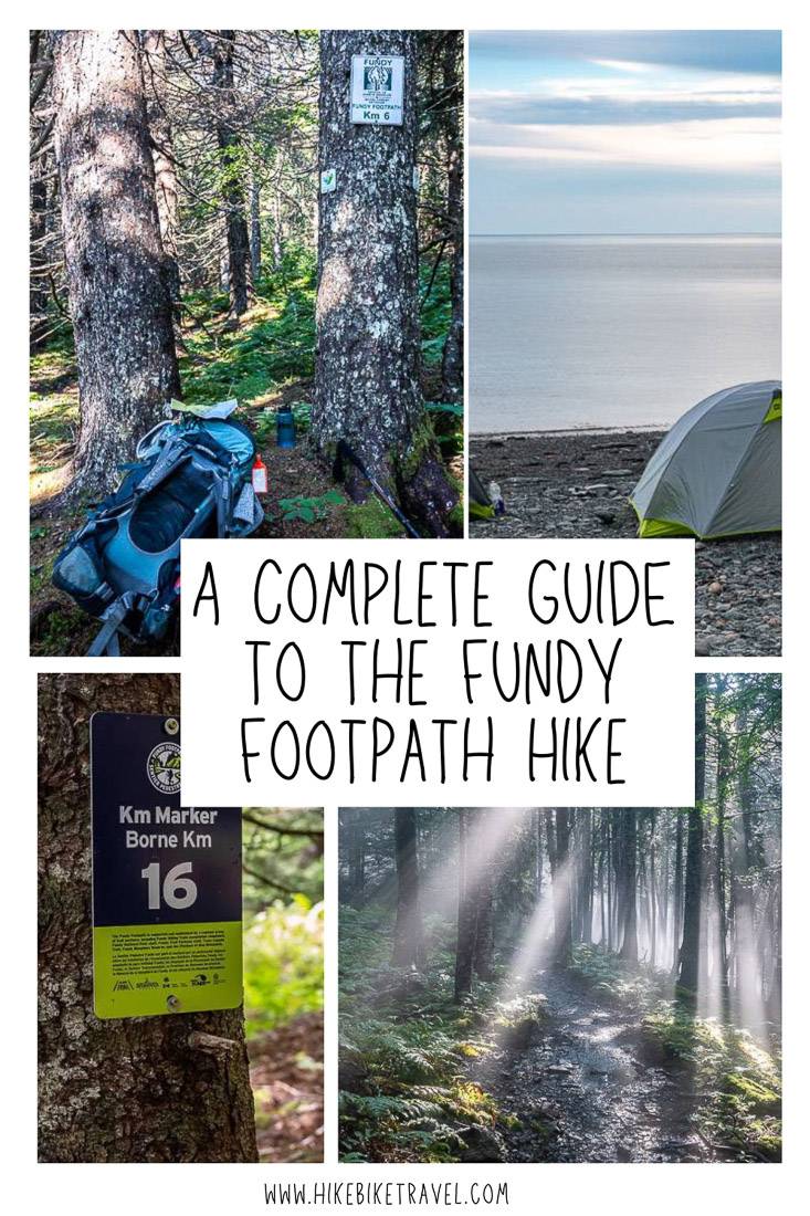
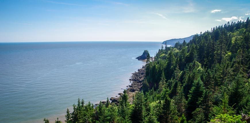
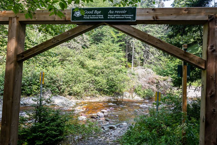
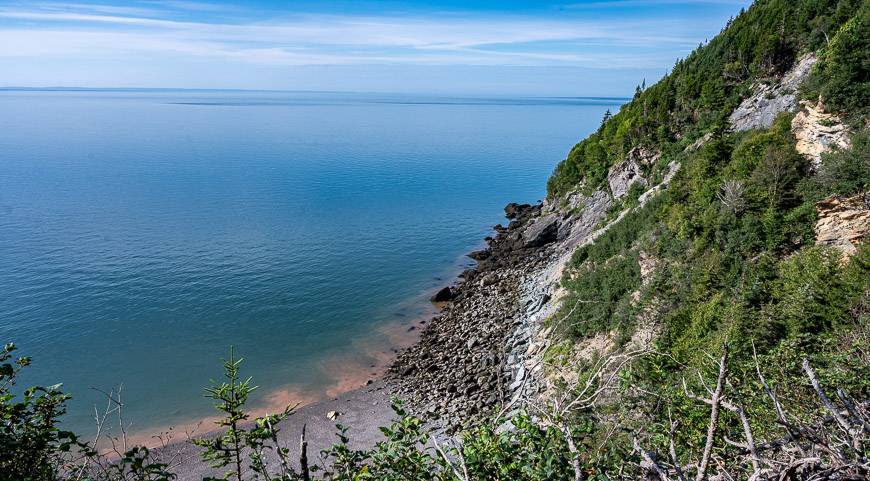
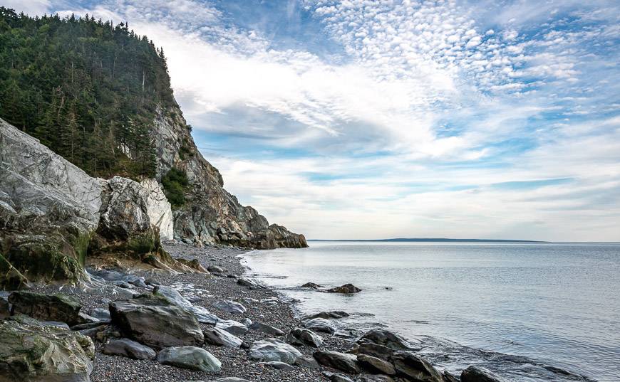
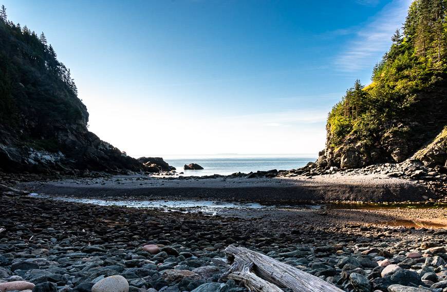
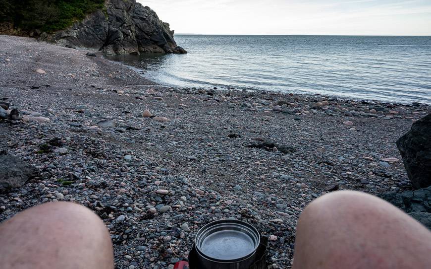
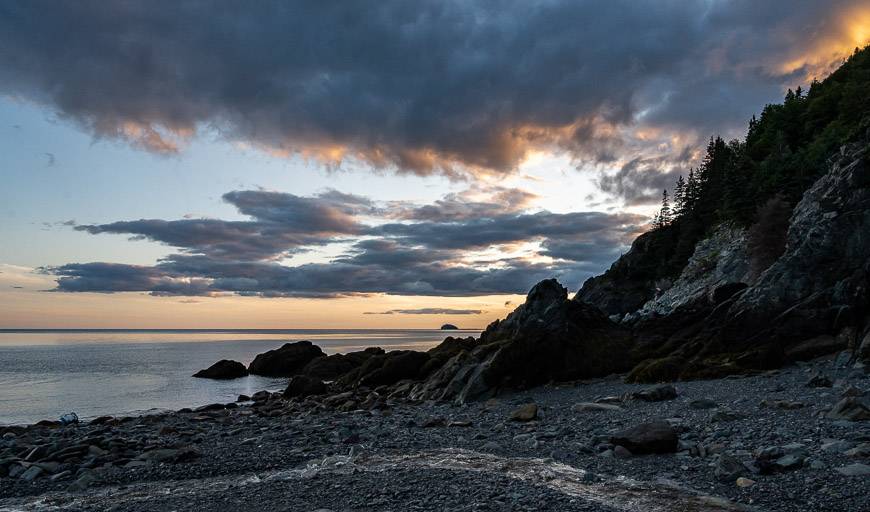
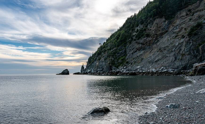
The Fundy Footpath is a rigorous multi-day hike along the Bay of Fundy in New Brunswick. Highlights include pretty, mixed forests, stunning headland views from atop 100-metre sea cliffs and some exceptional beachfront campsites over the 64 kilometres (39.8 miles) you travel from the Fundy National Park Visitor Centre to the Big Salmon River Visitor Centre on the Fundy Trail.
Most people don’t usually hike the full 64 km on the Fundy Footpath, preferring to bite off the distance as a day outing or a one-night overnight.
However, there are many that do what I did, and start in Fundy National Park on the Goose River Trail and hike approximately 54 km (33.6 miles) over four days to end at the suspension bridge over the Big Salmon River.
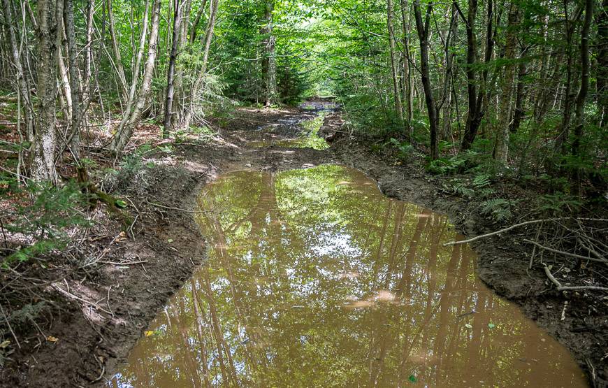
Don’t expect to see many people on this hike. The main reason lies with the difficulty – and the reality that there are long stretches of less than interesting forest to get to the good stuff.
I knew the Fundy Footpath had a reputation for being a tough one, but what really surprised me was just how bloody steep the ups and downs were. One misplaced foot too, and you could take a terrible tumble. You do end up climbing and descending over 1,829 m or 6,000 feet of vertical.
Described in this post is everything you need to know to hike the Fundy Footpath including the location of the best campsites.
This is one trail where you don’t have to book a thing – just show up – unless you need to organize a shuttle.
Fundy Footpath summary
Length: 64 km (39.8 miles) one way
Elevation gain: 1,929 m or 6,000 feet over the length of the Fundy Footpath
Level of difficulty: Hard as a thru-hike; some day hikes would be in the moderate category
Time needed: 4 – 5 days
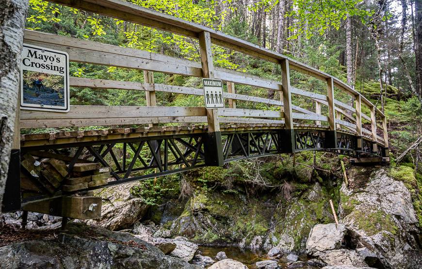
Trailheads: Start or end at the Goose River trailhead in Fundy National Park and start or finish at the Big Salmon River Suspension Bridge.
Don’t forget: Always carry the 10 hiking essentials.
Bears: I took bear spray as a precaution but didn’t so much as see bear scat. At least be bear aware.
Gear: Be sure your hiking boots are well broken in. This is a trail where hiking poles help.
Food: Take an extra day’s supply of food should you get caught in a bad wind or rain storm.
Campsites: A big plus for hiking the Fundy Footpath is that you don’t need to make campsite reservations.
Before you go: Register to hike the Fundy Footpath by emailing info@fundytrailparkway.com or by telephone at: 1-866- 386-3987.
This post includes some affiliate links. If you make a qualifying purchase through one of these links, I will receive a small percentage of the sale at no extra cost to you. Thank you very much for your support.
Starting the Fundy Footpath
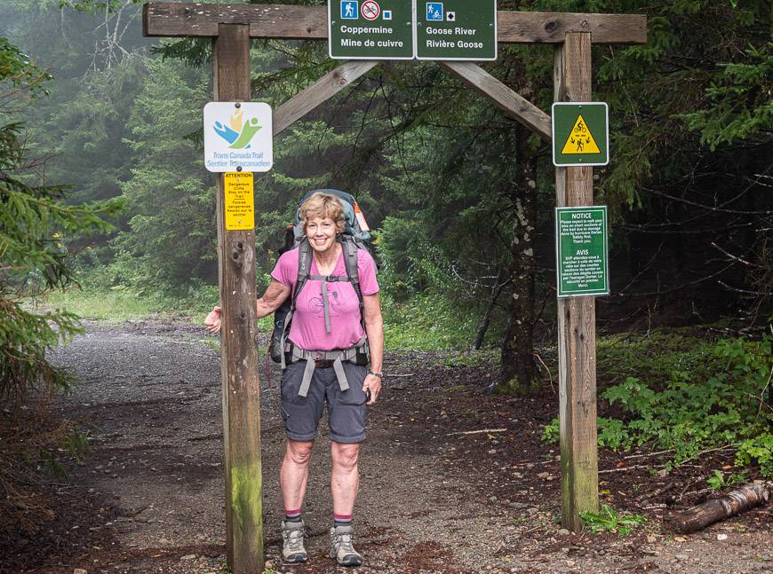
Assuming you want the full multi-day experience, you can start the Fundy Footpath at several locations (links take you to Google maps) – the Big Salmon River Visitor Centre at the western end of the trail near the suspension bridge, the Fundy National Park Visitor Centre near Alma at the eastern end of the trail or at the trailhead for Goose River, located a few minutes’ drive past the covered bridge in the national park.
Described will be the route I took as I hiked it solo from east to west. Although I didn’t start at the Fundy National Park Visitor Centre, I did do the hike to the Squaw’s Cap Look-off in 2013.
In total, there are only 4 of the 64 km I haven’t hiked.
I wouldn’t recommend this hike if you’ve never camped or done a backpacking trip before.
You might get in over your head and swear off backpacking forever. Be sure to leave a copy of your itinerary with a trusted friend or family member.
Interested in a guided Fundy Footpath adventure?
I was fortunate to have someone drop me off and pick me up, so I didn’t need a shuttle.
If it’s a guided hike you’re after, check out the four and five day trips offered by Bay of Fundy Adventures.
A guided hike would be ideal for solo hikers or anyone who hasn’t done a lot of backpacking and worries about navigation. They include a stay at Martin Head – a pretty area that as far as I could see has been taken over by the ATV crowd on the weekend.
If you to go on your own, be aware of tides and plan to be there on a weekday.
Towns near the Fundy Footpath
There are three towns close to the Fundy Trail – Alma, the Village of St. Martins and Sussex. All three towns offer overnight accommodation.
The other option is to stay at Adairs Wilderness Lodge (though in 2023 it seems to be up for sale.)
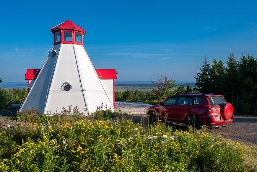
Another option is to stay 30 minutes from Alma at Broadleaf Ranch – a glamping spot with cool accommodation options including a lighthouse, a covered bridge and a chuck wagon. I loved my covered bridge-themed accommodation that included a back deck featuring great views of the Bay of Fundy.
In Alma you might likeAlma Shore Lane Suites & Cottages.
In St. Martins check out theBeach Street Inn.
A good bet in Sussex is theAmsterdam Inn & Suites.
Navigation on the Fundy Footpath
Years ago, I had considered including the Fundy Footpath in my bookDiscover Canada: 100 Inspiring Outdoor Adventures. But I didn’t after speaking with someone from New Brunswick who said the trail was poorly marked.
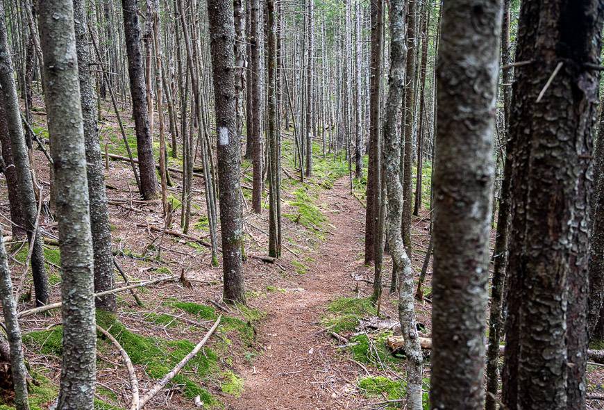
I am happy to report that the trail as of 2021 the Fundy Footpath is exceptionally well-marked. If you can follow a white blaze through the woods, then in theory you almost don’t need a map.
I say almost, as there are a few places where it’s tricky. Those places are primarily around river or stream crossings where a map does make sense of where the trail is headed. In addition, a map, shows the location of campsites which is extremely helpful.
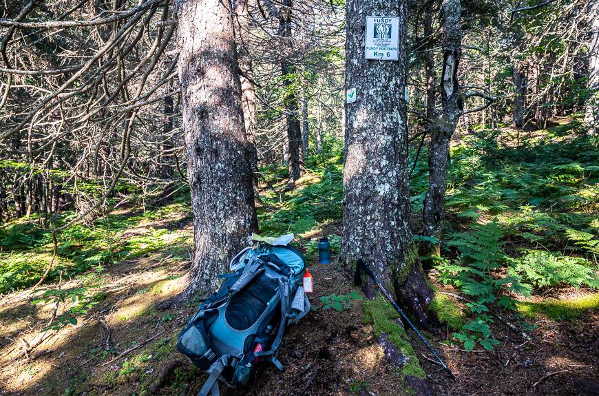
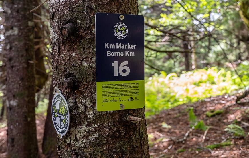
You will find kilometre signs almost every kilometre. There were perhaps three or four kilometres over four days where I didn’t see a sign.
It isn’t until you’re about halfway into the hike, that you run into new kilometre signs. They match up with the map provided in the Fundy Footpath Hiker’s Guide Book so I much preferred them.
Goose River section
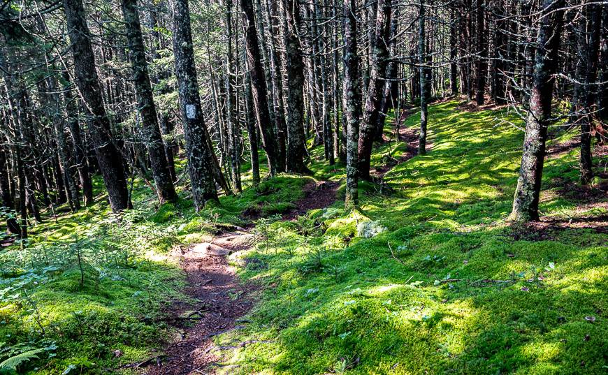
On the section to Goose River via the Goose River Trail in Fundy National Park, the hiking is straight-forward, well-signed and in fantastic condition.
However, you won’t find white blazes in the park. They aren’t used until you’re on the far side of the Goose River on the Fundy Footpath proper and out of the park.
What is somewhat confusing is the fact that the Goose River Trail is part of the Fundy Footpath – though it’s a more recent addition.
Sections of the trail that can be a navigation challenge
My first navigation challenge on the Fundy Footpath was within 5 minutes of crossing Goose River.
I saw the white blazes in the trees and started following them as I started climbing. At this point, I wondered what I’d got myself into as the trail was very steep and not in anywhere near the same shape as what I had enjoyed all morning in Fundy National Park.
After about 10 minutes, while following a trail, I noticed I’d lost the white blazes. Oh, oh I thought. Is this what the rest of the hike is going to be like? Fortunately, it was not.
I made the mistake of following a trail without looking for blazes.
Once you’ve been on the Fundy Footpath for a few hours, you know to expect the blazes at frequent intervals (you should actually be able to see one either behind or in front of you at all times) – and if you lose them, you need to back up to find them again.
That’s exactly what I did. I reversed direction, going downhill – and then I met another hiker (one of the few I saw in four days). He had an old hiking app which showed that the trail that we were on would meet the main trail in short order.
So, I turned around again and followed him for about 10 minutes to reach the main trail and breathed a sign of relief.
There are a few other spots on the Fundy Footpath where I’d recommend paying attention and pulling out the map or your hiking app.
Goose Creek navigation
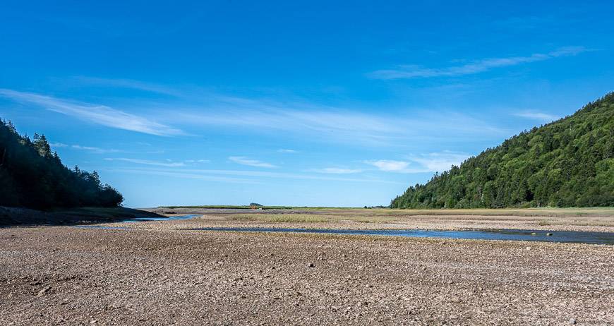
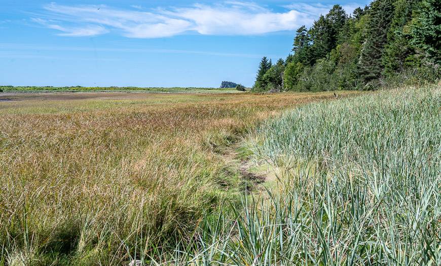
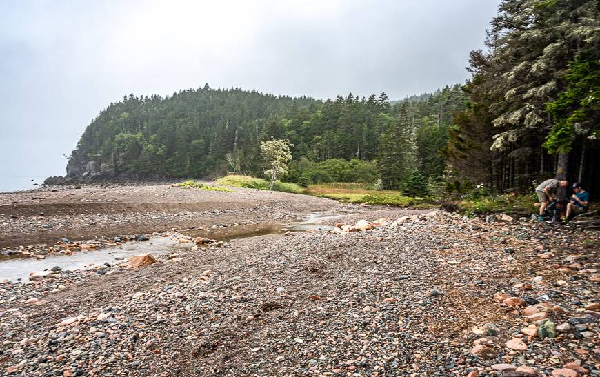
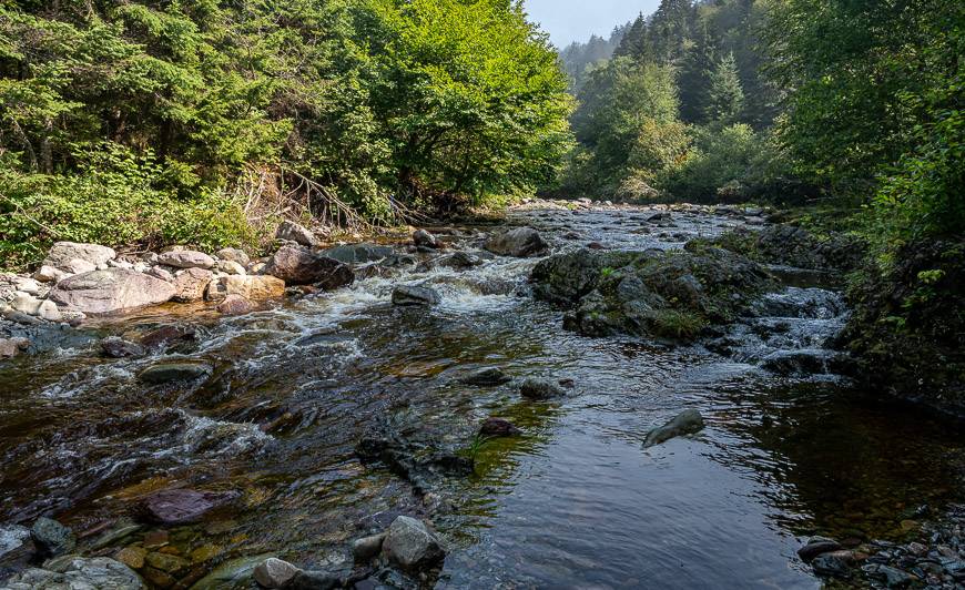
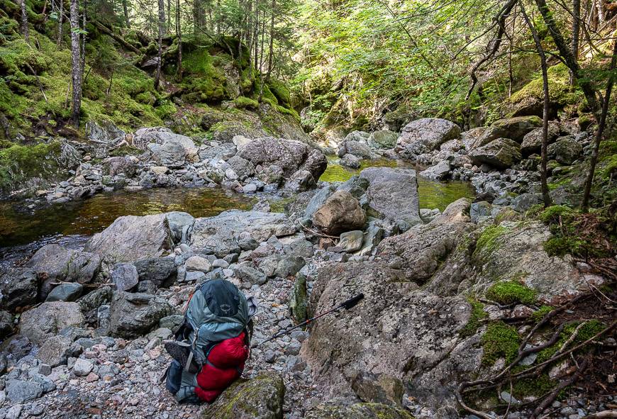
Goose Creek is massive. Once you arrive at the creek, the white blazes disappear until you get to the other side. Don’t forget to time your crossing with the help of tide charts.
I crossed four creeklets in my water shoes to get to an opening in the trees, that could be seen directly across from the trail you arrive on.
Despite signage that suggests the Fundy Footpath takes off into the woods on the far side, don’t do it. Instead follow a trail through the grasses immediately adjacent to the woods to a point where you’re almost at the Bay of Fundy.
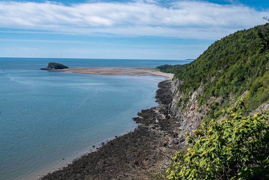
If you look at the photo below, you ultimately end up at the far-right hand corner where the tidal flats meet the woods. You will see signage and there is the option to go to the beach. Some of the walking once you’ve crossed to the other side is wet thanks to ATV usage.
Martin Head area
If you follow the white blazes, you won’t lose the trail in the Martin Head area. However, do expect to cross numerous ATV tracks. If you’re there on a weekend expect lots of noise and music.
If you’re interested in camping in the Martin Head area, you’ll have to pay close attention to the tides and the route you take in on the roads from the Fundy Footpath.
I didn’t bother checking out the area so I can’t comment on how easy or difficult it is to navigate. If it’s a weekend, be aware that you will be camping with lots of partying ATVers.
When you arrive at the Wolf Brook Campground, it seems counterintuitive – at least to me, that you head inland via the brook. If you’re hiking west, turn right at the campground and look up the brook.
You’ll see an open area in the trees a couple of hundred metres away. That’s your destination.
But to get there you must scramble over a slippery outcrop or put your water shoes on and wade. I scrambled – and slid down on my rear to the trail going east.
From then on it was a snap to reach the second tenting location – which I might add is less desirable unless it’s raining. Cross the brook – which can sometimes be deep – and pick up the blazes again.
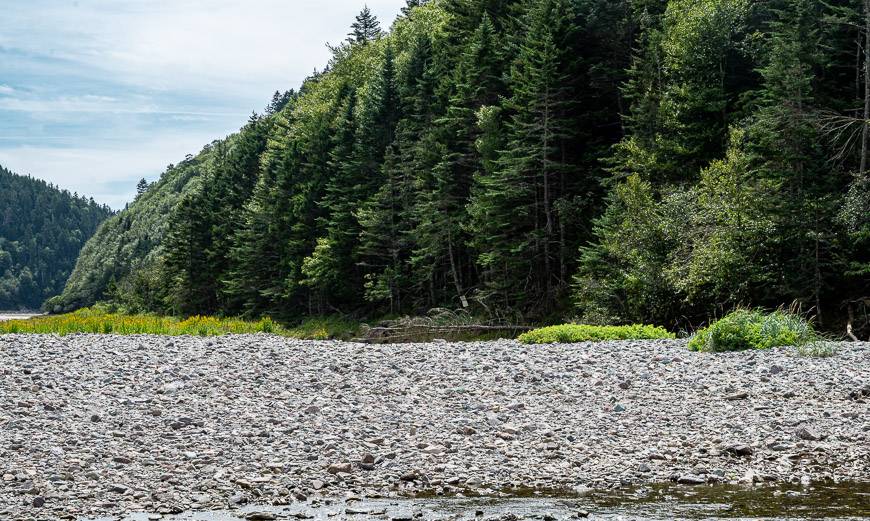
Little Salmon River Navigation
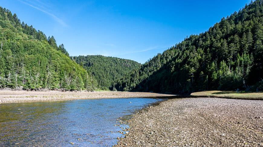
At the Little Salmon River, it’s not immediately obvious where you go but if you look in the first photo you can see a white sign in the trees.
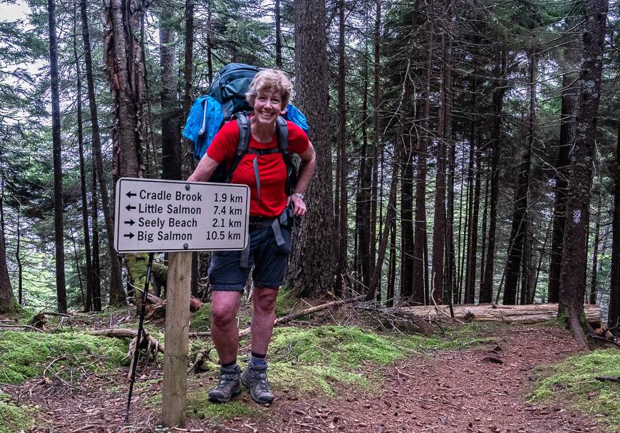
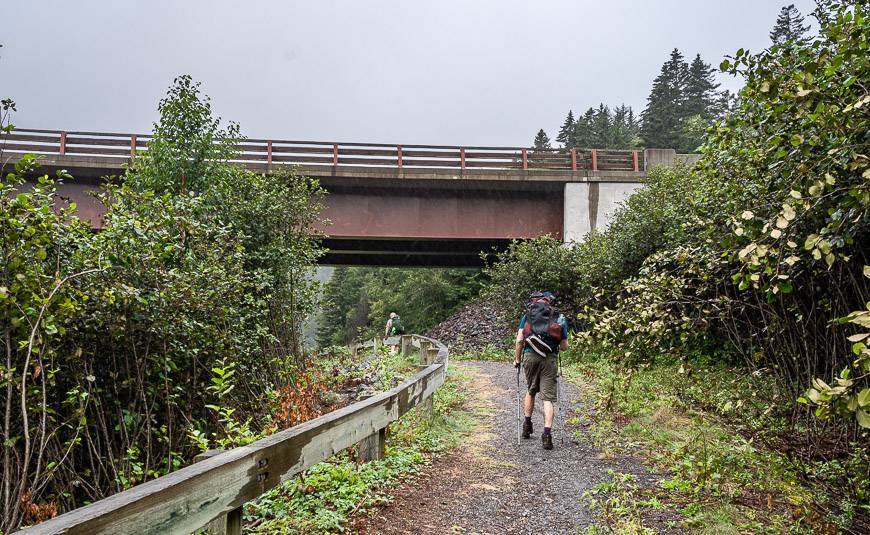
That’s your first marker. Then continue along the grassy shoreline to pick up the trail heading up into the trees. This area is one of the busier ones as there is a parking lot at McCumber Brook Road along the Fundy Trail that provides good access to the footpath.
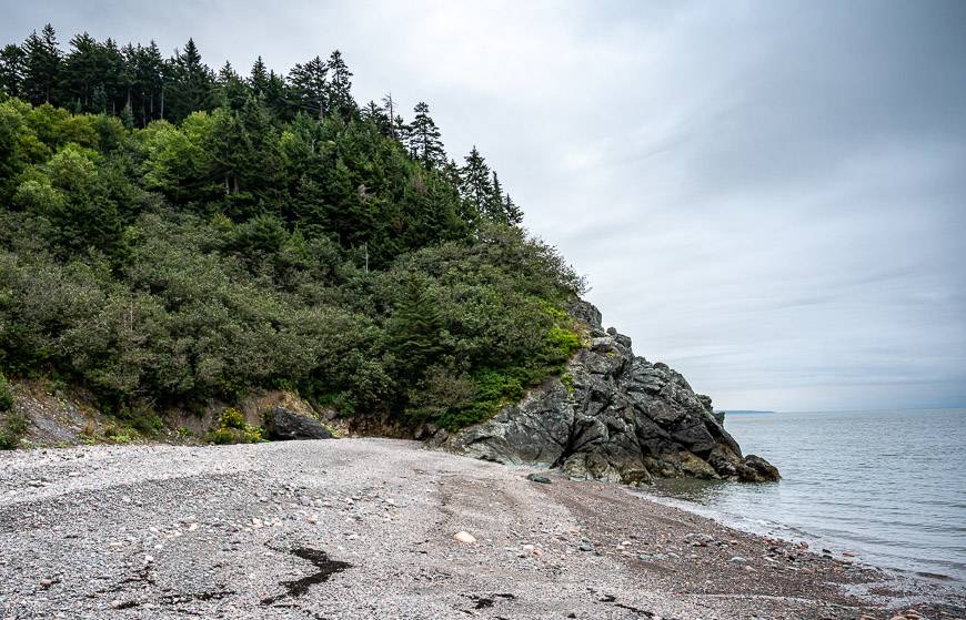
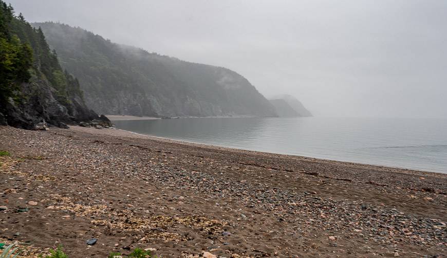
Seely Beach navigation
Seely Beach is one long beach. When you arrive on it heading west, turn right and follow it to reach trees with blazes.
It’s about 5 minutes from the location pictured below. It too is one of the busier spots so there will likely be people around to point you in the right direction.
Here’s what my 4-day solo hiking experience on the Fundy Footpath looked like.
Day one: Goose River Trailhead in Fundy National Park to Rose Brook Campground – Approximately 14 km and 6 hours with breaks
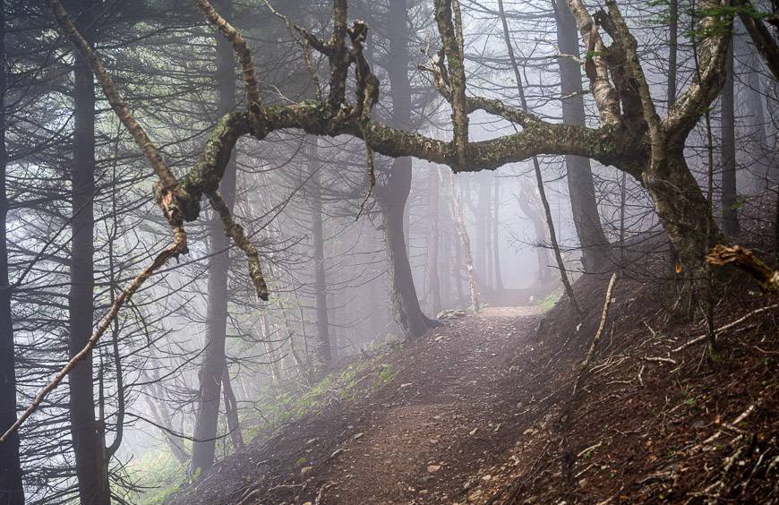
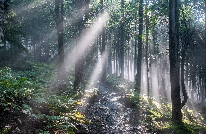
The Goose River section of the Fundy Footpath offers lovely walking, especially in the morning with all the sunbeams. It’s rated as difficult by the national park – perhaps because of its length, but I found the hiking on it to be quick and easy.
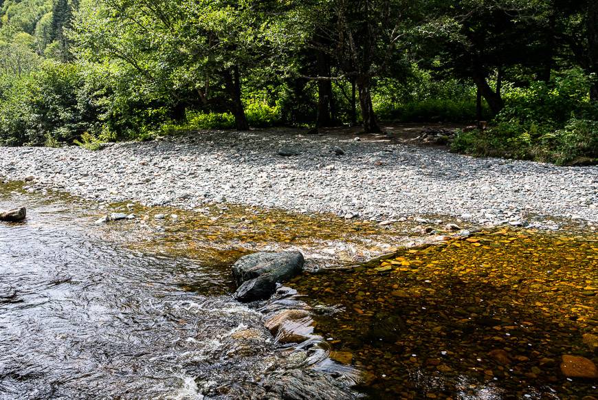
The crossing of Goose River – which is tidal – needs to be taken into consideration. It was a non-event and I was across it in seconds.
From there the trail steepened and the next 2.5 km or so were tough, especially the steep descent to Rose Brook.
I met a couple of fellows at Rose Brook and ended up sharing the next two campsites with them. They were locals doing it to celebrate a 40th birthday but both said, “once was enough.” A big thank you goes out to them for hanging my food with theirs every night.
Day 2: Rose Brook to Telegraph Brook – Approximately 14 km – 6.5 hours with breaks
This was an interesting day of hiking that started off steeply – a running theme every day.
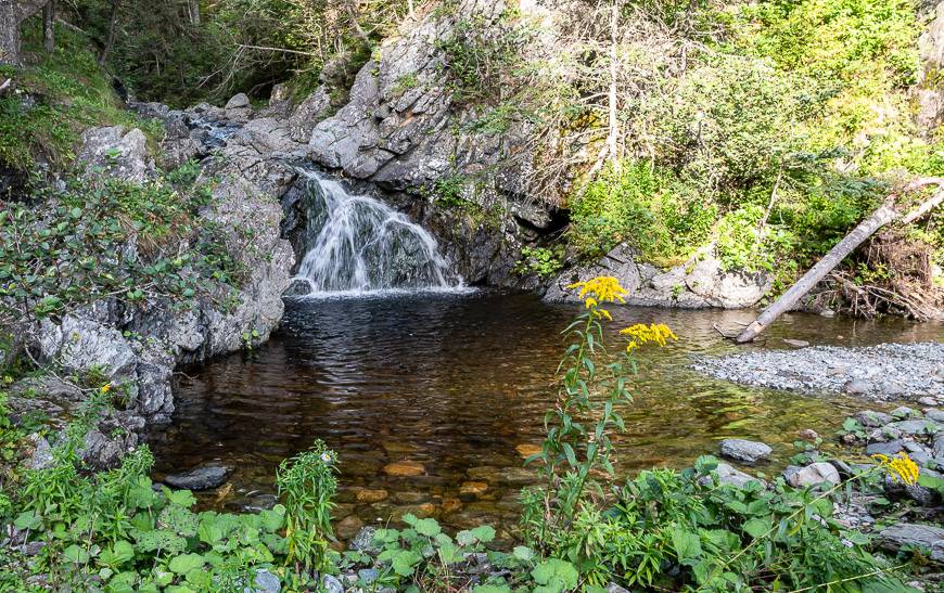
Within a few kilometres you reach the Cougar’s Lair – an area of cliffs and crevasses that can hold ice in the spring for a long time. Brandy Brook makes for a nice lunch stop. It’s got several decent campsites too though it’s more closed-in than I like. From there, you can do an optional hike to Tweedle-Dee Tweedle-Dum Falls, 10 minutes away.
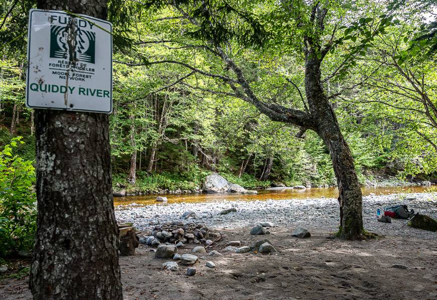
After lunch I enjoyed pretty views of Martin Head as I was often quite close to the cliff edge. (Be careful!!) After getting through the Martin Head area and the maze of ATV trails, it was a pleasure to reach the Quiddy River. Good camping here.
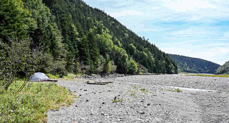
The afternoon offered less interesting hiking through some alders and along old roads. The descent to Telegraph Brook is extremely steep. The rocky beach has room for about 4 tents along with one near the falls but it’s noisy. It was my favourite campsite of all.
Day 3: Telegraph Brook to Cradle Brook campsite- 14 km – approximately 6 hours
This felt like a long hard day to me. Originally, I had planned to go on to Seely Beach but in the end I am so happy I opted to camp at Cradle Brook. It is another wonderful campsite overlooking the Bay of Fundy.
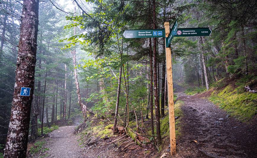
It didn’t take long to get to Wolfe Brook. From there it got interesting.
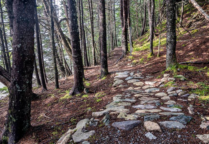
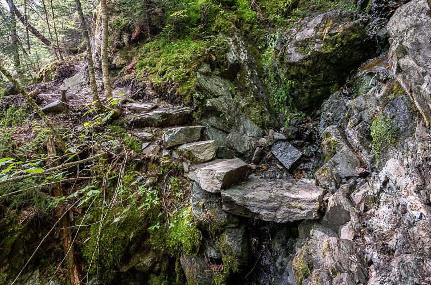
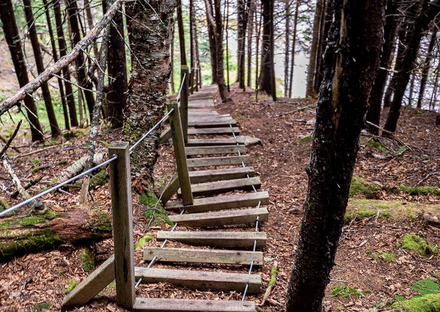
After crossing the brook (which can be a challenge after a big rain) pass by the base of a small waterfall. Then descend to Brothers Brook, cross the bridge and be prepared for some of the roughest hiking on the trail via the giant steps shown below. Contour around Round Hill and then descend steeply to the Little Salmon River.
The trail for the descent is in great shape. After crossing the river, the climb up on the other side was far less onerous than the map suggested.
This is one of the few areas where you run into regular day hikers who are accessing the trail from the Fundy Parkway.
Finish with a steep descent to Cradle Brook!
Day 4: Cradle Brook to the Big Salmon River Visitor Centre – 12 km – approximately 5 hours
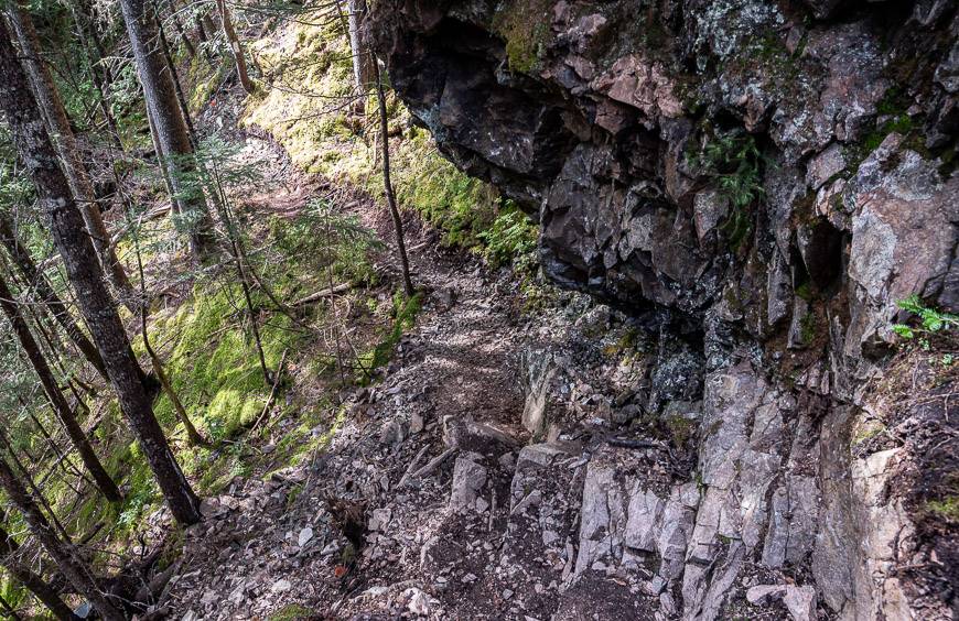
I figured the last day would be a snap. It was not. It started with steep ladders and continued off and on with steep , sometimes poorly maintained ladders until I reached Seely Beach.
I had expected far gentler hiking on this section of the trail. Once at the beach I also figured it would be easy going. Again, it was not.
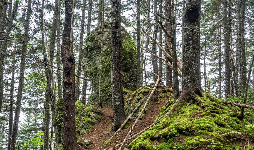
The vertical I climbed on the last day wasn’t as severe as on the other days but there was still plenty of it. And it was wet and muddy – a far cry from the sunshine on the other three days. Just after Seely Beach reach the Dragon’s Tooth – a cool looking mossy-covered balancing rock.
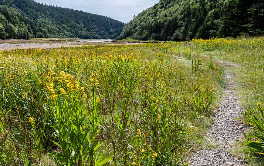
Before you reach Long Beach, you climb through a section of grasses and wildflowers.
Long Beach would normally be a lovely spot to explore – or at least to enjoy a lunch. But by the time I got there I was just ready to wrap up the hike.
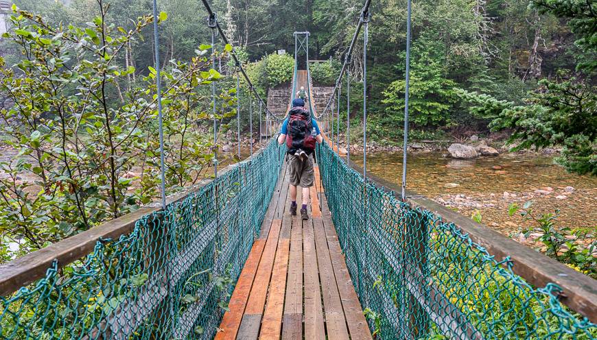
I found the next few kilometres less interesting but that was probably on account of the dreary day. What a treat it was to see the bridge and then walk across the Big Salmon River suspension bridge. I felt I had earned a lobster roll and ice cream cone for finishing!
Best and worst camping spots on the Fundy Footpath
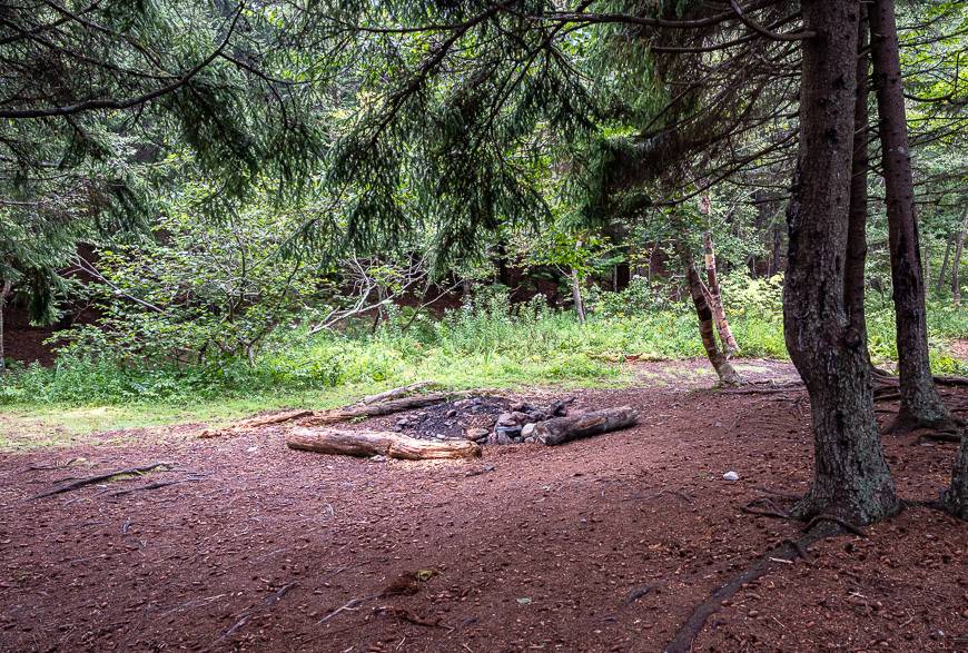
The following are a brief description of the various campsites with my favourites being Rose Brook, Telegraph Brook, and Cradle Brook. I don’t like campsites, like Jim Brook, that are dark and wet or ones that see a lot of people like Seely Beach.
There is a large creek running through the Rose Brook campsite, so the water supply is excellent. The beach camping is lovely and there is room for lots of people.
The next closest campsite is Jim Brook. There is only room for a few tents – and in hindsight I’m so glad I didn’t try and push on to this one.
Goose Creek reportedly has a large campsite with good views. Brandy Brook as mentioned is in a lovely location in the woods so you wouldn’t go wrong with this one – though probably no more than three to four tents could comfortably fit here.
Martin Head would be too busy for my liking though on a quiet day I’m sure there’s some gorgeous camping to be had.
At Telegraph Brook there ended up being four sets of tents set up – and no one was on top of anyone. It has the added benefit of a swimming hole.
Wolf Brook would be fine if you weren’t in the trees. There are lots of campsites.
Brothers Brook is reportedly okay for hammocks but not tents.
Little Salmon River has lots of campsites. It’s pretty though I prefer to be right on the Bay of Fundy.
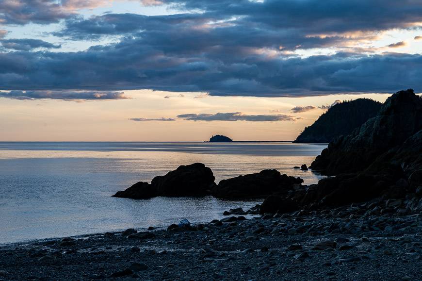
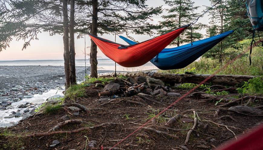
Cradle Brook offers great beach camping.
Seely Beach would be fantastic on a sunny day when you didn’t need shelter, but I found the wooded campsites to be dark and heavily used.


Important things to do before you go
Apart from ensuring your hiking boots are broken in and you’re in the physical shape to do the trail, be sure to pick up a copy of the 2021 edition of the Fundy Footpath Hiker’s Guide Book. It’s small and portable but unfortunately full of errors – both spelling and factual. But if you can overlook that, it’s still useful.
It comes with a tide chart and the map – which also has errors e.g., the location of Rose Brook in kilometres in relation to Goose River and the elevation maps aren’t entirely accurate, especially heading west out of Little Salmon River.
Set your compass declination to 18° west.
Print out a copy of the tide charts – to plan your crossing of Goose River and Goose Creek. You will need to cross within about three hours on either side of low tide.
With a copy of the guidebook, you will get a sense of what’s coming up along the trail. I would pull it out at lunch time to see if there was anything of note ahead.
But for navigation purposes, following the white blazes (they conform to the Appalachian Trail System blazes) and being aware of the navigation challenges noted above is all you really need to do on the trail. Note that a change of direction is marked by double white blazes and side trails by yellow blazes.

What to take on the Fundy Footpath hike
Be sure to takelightweight hiking poles.
Awater filterortreatment systemis a necessity. So is high calorie food – so pack plenty ofenergy bars.
I thought I had read beforehand that there were bear boxes, but I never saw one. So take acarabiner or two-a length of rope, and a waterproof bag to store your food. You’ll have to hang it every night.
I thinka tentis a far preferable choice to a camping hammock for this hike, especially after my experience with the most inconsiderate campers of all time.
Take acamping stove.
Reportedlybug repellentis a necessity but apart from biting flies one night, I didn’t ever see many bugs. That’s the beauty of going in late August.
Good rain gear and arain hatis a important. So is abackpack rain cover. Clothing should be quick dry. Take something warm and windproof for its cool in the mornings by mid-August. I love thePatagonia down sweater.
Take acellphone battery chargerif you want to talk to people every night. All the campsites I stayed at had good cell signals, probably bounced over from Nova Scotia.

A big thank you to all the volunteers that have developed and maintained the Fundy Footpath over the years. I was in awe at what a great job people have done blazing the trail.
Further reading on long distance hikes in Canada
- Coast to Coast – Canada’s Long Distance Hiking Trails
- A 3 day hike on the Cape Chignecto Coastal Trail
- Hiking the Coastal Trail in Pukaskwa National Park
- Backpacking Tips and Tricks
- 10 Beginner Backpacking Trips in the Canadian Rockies
A giant thank you to Tourism New Brunswick for making this trip happen and to Neil Hodge for the pick up and drop off.
Click on the photo to bookmark to your Pinterest boards.