If you live in the Calgary – Banff corridor chances are pretty good that you already know how many fantastic Kananaskis Trail hikes there are. (Kananaskis Trail is also called Highway 40.)
But out of town visitors largely have no idea that the hiking here is on par with much that is available in nearby Banff National Park. Some of the hikes on the Kananaskis Trail don’t see anywhere near the number of people you see in the national park.
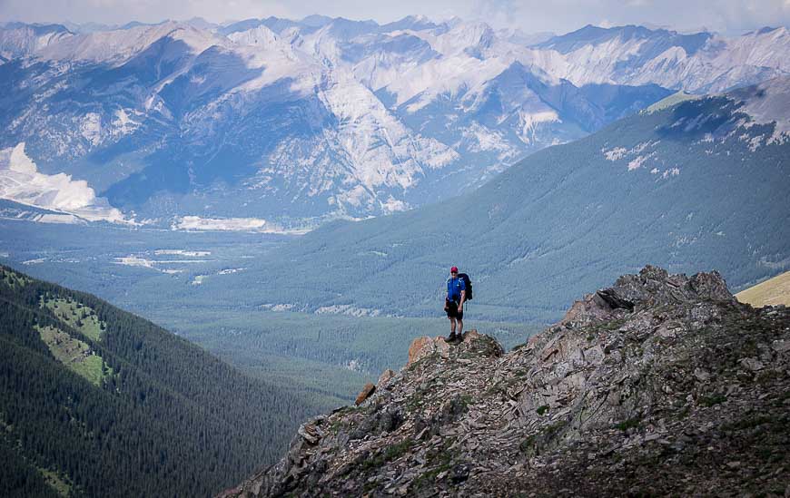
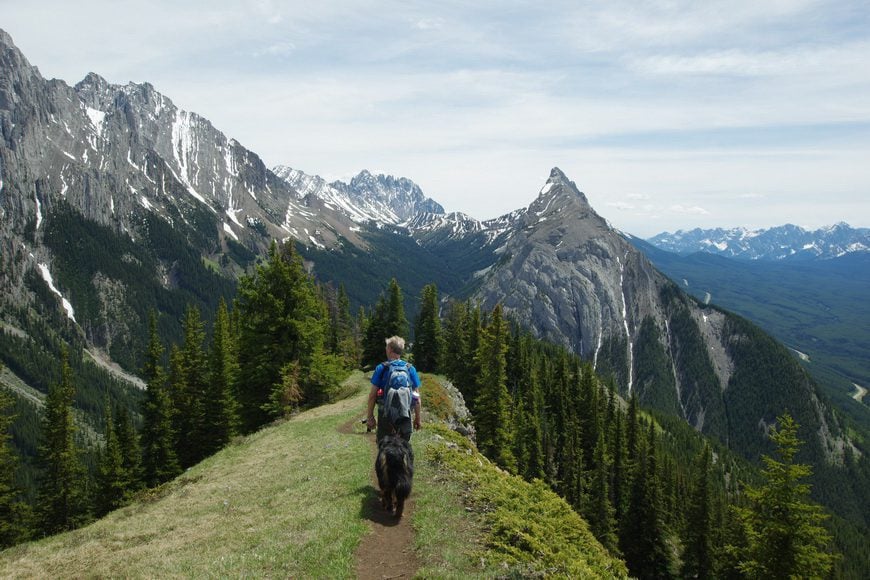
Described are 12 Kananaskis trail hikes with a view I have done over the years. The downside to most – but not all of these hikes – is that they start off steeply. On hikes like Opal Ridge South, Wasootch Ridge and King Creek Ridge, your legs will be screaming at you almost from the get-go.
All of these hikes are worth it for the Rocky Mountain views they deliver in spades.
You might also like: 15 Easy Kananaskis Hikes Everyone Will Love
This post includes some affiliate links. If you make a purchase via one of these links, I will receive a small commission at no extra cost to you. Thank you very much for your support!
Location map of the Kananaskis Trail hikes
Kananaskis Trail hikes summary
Permits: You will need a Kananaskis Conservation Pass to do any of these easy Kananaskis hikes. It’s $90 for a yearly pass, tied to up to two license plates at the same address, or $15 per daily visit.
Trail access: Note that some of these Kananaskis Trail hikes aren’t accessible until June 15th when the road over Highwood Pass opens. Some hikes like Mt Allan are also closed until June 15th to protect the wild animals during their birthing season. And varying snow levels round out the accessibility to some of the other hikes. I’ve had good early season luck hiking Wasootch Ridge (mid-May one year), Opal Ridge South (second week of June) and King Creek Ridge (second week of June).
Don’t forget: No matter what the day’s weather forecast or the difficulty of the hike, take the 10 hiking essentials.
Bears: If you’re in bear country always carry a can of bear spray THAT IS EASILY ACCESSIBLE. I recommend keeping it in a bear spray holster so you don’t accidentally set it off.
Please: Practice Leave No Trace principles. Be sure to let someone know where you’re going and when you’re due back.
Trail conditions: Before you head out on any of these easy Kananaskis hikes, check the trail reports for closures. All it takes is a bear moving into the area, and a trail can be closed for the short term.
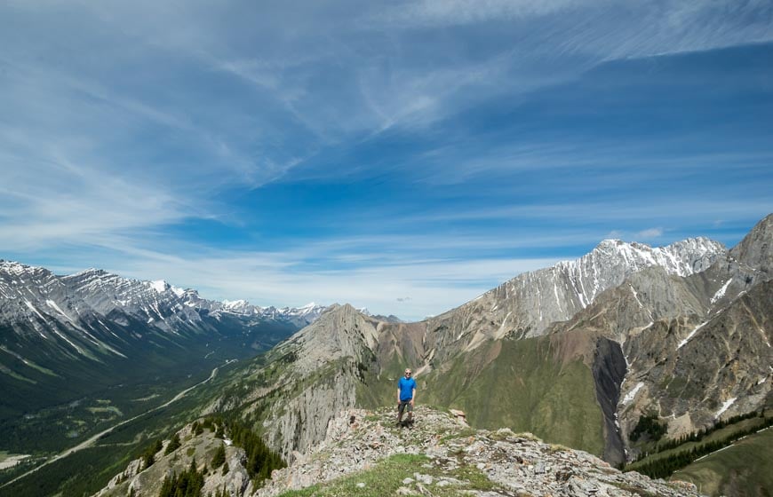
1. Kananaskis Trail hikes: Centennial Ridge – Mt Allan
Distance: 14.6 km as an out and back hike
Time needed: About 7 hours.
Elevation gain: 1,347 m or 4,418 feet
The Centennial Ridge hike is a long one but one of my favourite mountain hikes. We did it as a one way hike with a shuttle and finished after an epic day at Dead Man’s Flats off the Trans-Canada Highway. That trip is described in the link to the blog post below – as are the directions to find the main trail up Centennial Ridge.
The trailhead is located at the Upper Ribbon Creek parking lot accessed off the road to Nakiska Ski Resort. From there it’s a bit tricky finding the right trail as there is a real warren of them – and most of this area is poorly signed. Once you’re on the Centennial Ridge trail and climbing, it’s all pretty straight-forward.
I’d rank this hike as difficult because of its length and vertical gain. It’s approximately a 7.8 km one way hike to the summit of Mount Allan via the Centennial Ridge – and that comes with an elevation gain of 1,356 m (4,448 feet). There is also a tiny bit of down-climbing (after the Mushroom Garden) which may be challenging for some without a spotter.
The highlight of the hike apart from the insane views at the summit, is the Mushroom Garden – an area of conglomerate pinnacles in all manner of shapes and sizes.
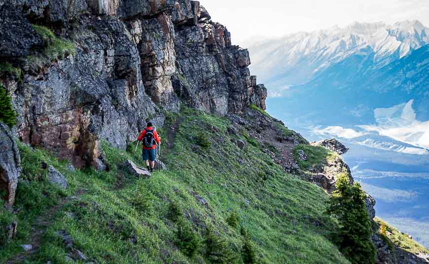
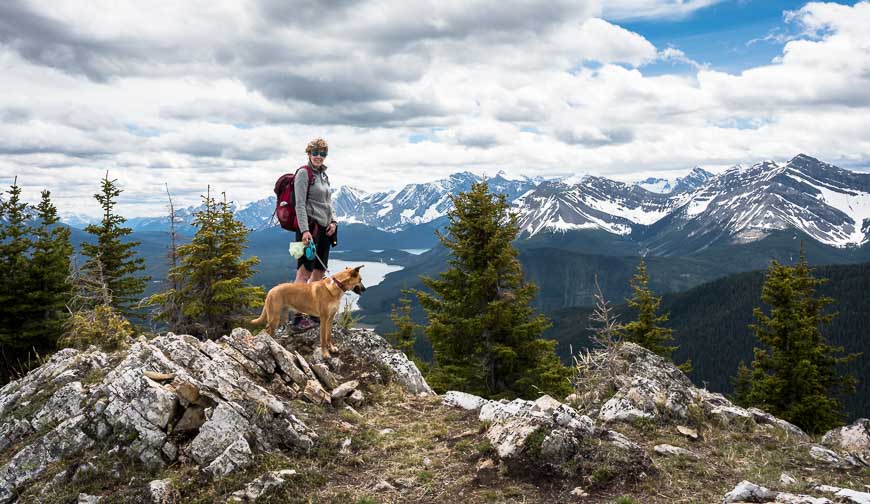
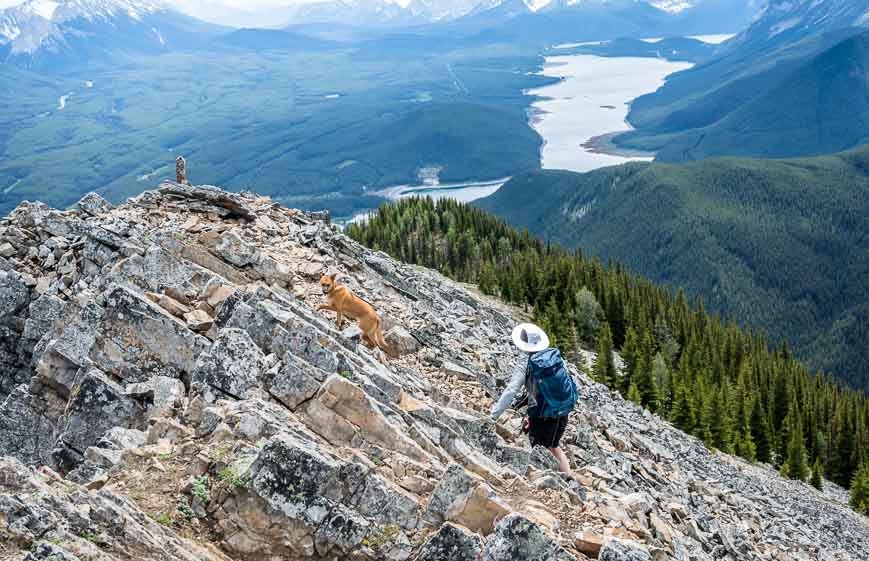
2. Kananaskis Trail hikes: Wasootch Ridge – one of the first to be snow-free
Distance: 11 km (6.8 miles) round-trip to the trail’s end cairn with an option to continue for a1 km but the difficulty increases dramatically.
Time needed: 4- 6 hours for the return hike
Elevation gain: 762 metres or 2,500 feet
The Wasootch Trail hike is typically a great choice for an early season mountain hike as the snow leaves quickly. But that can vary from year to year, so use some common sense.
The trailhead is one of the closest to Calgary. It’s just 17 km off the Trans-Canada Highway at a trailhead that is signed Wasootch Ridge. The actual trail is a little harder to find as there are no markings but read the post below and you’ll see it heads straight up from behind a picnic table.
While it’s a steep hike initially, that also means you get great views in short order. And after the initial steepness the hike is lumpy more than anything else. Most people stop at an obvious turn around point – where the hiking becomes a degree or two more difficult. It’s an obvious spot that’s 5.3 km and 762 m up from the parking lot.
The true summit can be a challenge and most people don’t attempt it. Take note of that fact especially if you’re a tad risk adverse.
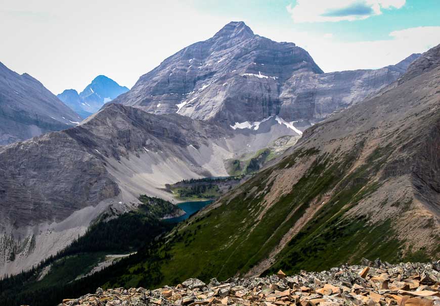
3. Galatea Lakes hike
Distance: 17.8 km return to Upper Galatea Lake but you can knock off 2.6 km if you stop at Lower Galatea Lake.
Time needed: 5.5 – 7.5 hours
Elevation gain: 692 m or 2,270 feet
This is a straightforward, moderate hike that also includes Lillian Lake. Start at the well-signed trailhead approximately 20 km south of Barrier Lake on the west side of the highway. Note that the trail is closed annually from May 1 until the end of June to allow the area to dry.
Hike 5.5 km one way with an elevation gain of 492 m to reach Lillian Lake. You’ll cross numerous bridges as you follow the creek through the trees. The best views of the hike don’t start until you reach Lillian Lake. (Note that there is a backcountry campsite at Lillian Lake.)
From Lillian Lake it’s a further 1.1 km with a 183 m elevation gain to reach the Galatea Lakes. In short order you’re out of the trees and the jaw-dropping views unfold. It’s grand scenery.
There is the option to continue to Guinn Pass from a spur trail off the Galatea Lakes trail.
Read: The Galatea Lakes Hike in Kananaskis, Alberta
4. Kananaskis Trail hikes: Guinn Pass
Distance: 17 km or 10.6 miles return
Time needed: 914 m or 2,999 feet
Elevation gain: 6 – 8.5 hours depending if you add on the hike to the shoulder of Mount Kidd
Guinn Pass is a very worthwhile hike but it’s a level of difficulty harder than the Galatea Lakes hike because of the additional distance and elevation gain.
Follow the trail towards the Galatea Lakes but head off to your right at a signed junction to continue to Guinn Pass. There is the option to continue even higher up the shoulder of Mount Kidd from the pass. From there, the Galatea Lakes look tiny.
It’s 14.4 km as a round-trip hike with an elevation gain of 1055 m. It would make a superb day hike if you were camping at the Lillian Lake Campground.
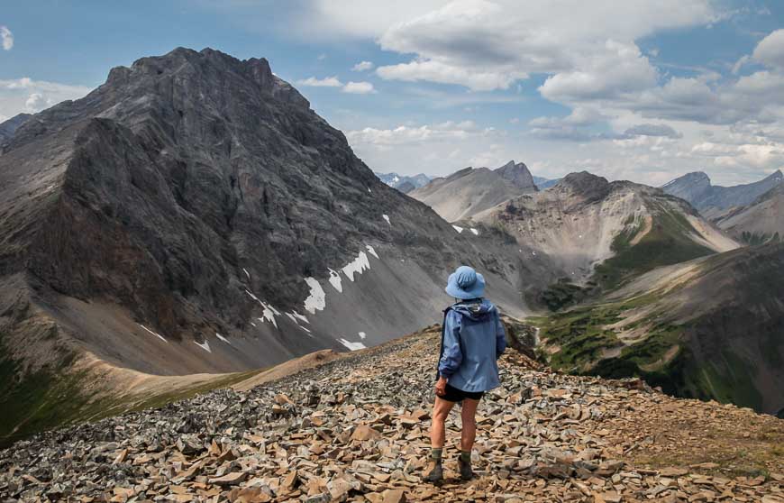
5. Opal Ridge South
Distance: 8 km or 5 miles round trip
Time needed: 5 – 6 hours
Elevation gain: 1,012 m or 3,320 feet
This 8 km round-trip hike to Opal Ridge South is a challenging one as it’s really a bit of a scramble in places. There is a nasty section of scree that will put a lot of people off. And you climb 1,012 m, so over the 5 – 6 hours it takes to do the hike, you get quite a work-out.
The hike starts at the gas station across from the turn-off to Fortress Mountain. While there isn’t any signage, if you follow the route description in the link, you’ll find it to be straightforward.
The rewards after you get through the scree are fantastic. There’s lovely grassy sections, big in your face mountain views and then to finish – a delightful ridge walk.
6. King Creek Ridge – one of the steep and rewarding Kananaskis Trail hikes
Distance: 7.0 km (4.3 miles) round trip
Time needed: 4 – 5 hours
Elevation gain: A relentlessly steep 731 metres or 2,398 feet.
I like to do something outdoors on my birthday and the King Creek Ridge hike was my choice in 2019. By the second week of June it was snow free, save for a few mounds of snow the dog enjoyed rolling in to cool off. The snow free date will vary considerably from year to year.
Park on the east side of Highway 40, roughly 100 m north of the winter gate for Highwood Pass. To find the trailhead walk back out towards Highway 40 and look north. You can’t miss the trail taking off into the grass from the road.
This is not one of the family-friendly or novice Kananaskis Trail hikes. It gains 731 m and most of that is on the steep 2 km trail up to the ridge. When you finally reach the ridge turn left and follow it for 1.5 km. The ridge top hiking is sublime and the views outstanding. I felt like I’d been transported to Switzerland.
Don’t forget the hiking poles on this outing.
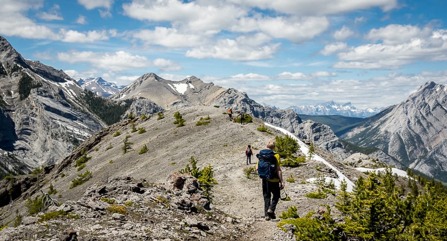
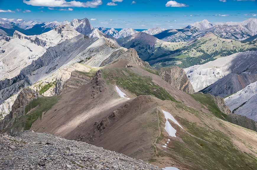
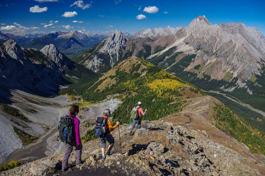
7. Kananaskis Trail hikes: Pocaterra Ridge hike – best in larch season
Distance: 9.3 km or 5.8 miles one way with a car shuttle
Time needed: 5 – 7 hours as a one way hike
Elevation gain: 550 m or 1,804 feet from Highwood Pass and an elevation loss of 875 m or 2,871 feet
Book off a day between the second and third week of September so you can hike Pocaterra Ridge and enjoy the larch display. It’s one of the best I’ve experienced in Alberta.
Gather a few friends together – who own cars – as the 9.3 km Pocaterra Ridge hike is best done with a car shuttle. Leave one car at the Little Highwood Pass parking lot and the other at your start point on Highwood Pass. If you do it as a one way hike it’s moderate but difficult as an out and back hike. In total there is a 550 m elevation gain and a 875 m elevation loss.
The initial trail is a tad difficult to follow (check out the link below) but once you see the ridge the rest of the hike is entirely obvious.
There is one major ascent and then four minor ones along the ridge. The final descent is steep at times and the trail is definitely on the sketchy side. Fortunately a few of our group had done the hike before and led the way. In the ideal world you should finish directly across from the Little Highwood Pass parking lot.
This is one of the Kananaskis Trail hikes where it pays to take your time and revel in the views.
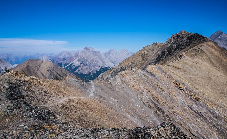
8. Grizzly Ridge – one of the off the beaten path Kananaskis Trail hikes
Distance: 9.6 km or 6.0 miles
Time needed: 4.5 – 6 hours
Elevation gain: 683 m or 2,240 feet
Start the hike to Grizzly Col and Grizzly Ridge at Highwood Pass – the same trailhead used for Ptarmigan Cirque and Pocaterra Ridge.
It’s 4 km one way to Grizzly Col from Highwood Pass. Add another 0.8 km to Grizzly Ridge. The elevation gain is 518 m to reach the col and another 165 m to reach the summit of Grizzly Ridge.
This hike is one for serious hikers as there are scree slopes on the way up to the col and an airy but totally doable final climb to the top of Grizzly Ridge. I think it’s a magnificent hike – and it doesn’t get crowded.
Allow five to six hours for the return trip so you can hang around the col and/or the summit and take in the views. Read the post to get detailed instructions on finding the trail from the Pocaterra Ridge hike.
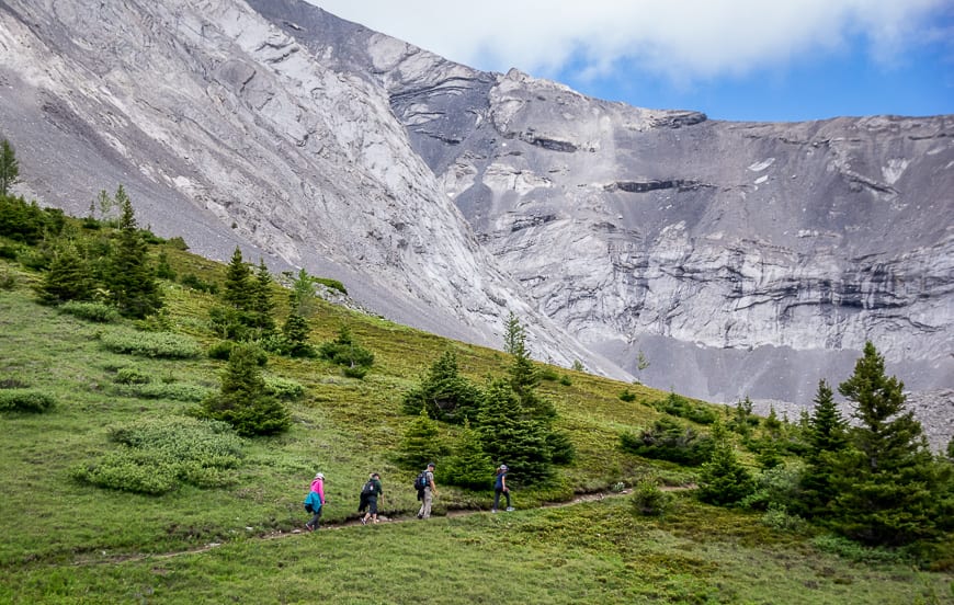
9. Kananaskis Trail hikes: Ptarmigan Cirque
Distance: 4.5 km or 2.8 miles return.
Time needed: 1.5 – 2.5 hours
Elevation gain: 214 m or 702 feet
The Ptarmigan Cirque hike is another hike that is accessed from the Highwood Pass parking lot, which opens on June 15th every year. Unlike the other two hikes, this one is family-friendly and perfect for taking out of town guests who want a taste of the high alpine, without having to work too hard to get it.
The hike is a family-friendly 3.6 km loop, including the interpretive trail, with just 210 m of elevation gain. Enjoy waterfalls, a desolate looking cirque and plentiful wildflowers if you hike it in the summer.
10. Kananaskis Trail hikes: Arethusa Cirque hike – great in larch season
Distance: 4.6 km return
Time needed: 2.5 – 3 hours so you can poke around
Elevation gain: 330 m or 1,083 feet
The Arethusa Cirque hike is one of the less-traveled Kananaskis Trail hikes. It’s easy and family-friendly but the hike is not on a maintained trail. It’s a fantastic one in late September.
The trailhead can be found approximately 1.25 km south of Highwood Pass on the east side of the highway. There is an unmarked but large parking lot and a trail sign (the only one) at the north end of the parking lot.
This hike is approximately 4.5 km round-trip with 330 m of elevation gain. It’s a hike that delivers views the minute you reach the first tarn. Continue on, climbing a short scree slope to enjoy superlative views in all directions.
The area around Arethusa Cirque is a well-known spot for fossil hunting which makes it an appealing outing for kids.
11. Pickle Jar Lakes hike
Distance: 9 km or 5.6 miles return
Time needed: 3 – 5 hours depending on how much time you hang out by the lakes.
Elevation gain: 474 metres or 1,555 feet
To do the Pickle Jar Lakes you can drive over Highwood Pass or access the trail via Highway 40 out of Longview. From Highwood Pass drive 20.6 km south on Highway 40 to get to the Lantern Creek parking lot.
The hike to the Pickle Jar Lakes is approximately 9.0 km round-trip – but that’s if you visit all four of the Pickle Jar Lakes. The elevation gain is a very doable 450 m. Not all lakes are pretty. I think the third one is the best of the lot but if you’ve gone that far, you might as well knock off the fourth one.
Some sections of the hike are on scree (not for long fortunately) and hard packed dirt where it’s hard to gain any purchase. I’d recommend poles again on this hike – and a fishing rod (and license) as the lakes are stocked.
12. Kananaskis Trail hikes: Elbow Lake – Rae Glacier hike
Distance: 8.1 km or 5.0 miles
Time needed: 3 hours
Elevation gain: 366 m or 1,200 feet
You can knock off the return hike to Elbow Lake in under an hour. It’s only 1.3 km one way from the well-signed trailhead (62 km south of the Trans-Canada Highway) with 137 m of elevation gain. There’s great backcountry camping by the lake that is ideal for young families.
The hike to Rae Glacier takes off from the trail about halfway around Elbow Lake as you hike it counterclockwise. The trail to the glacier is marked with a piece of flagging tape. The Rae Glacier hike is not a difficult one as it only gains a further 229 m over a distance of 2.2 km.
There isn’t a lot left of the Rae Glacier but you can get to the point where you’re standing on blocks of ice. Turn around when it feels prudent to do so. Along the trail enjoy a smattering of wildflowers and a pretty waterfall.
I’d encourage you to hike all the way around Elbow Lake before returning to the trailhead as the views are quite lovely.
13. South End of Lawson hike
Distance: 8.4 km or 5.2 miles round trip
Time needed: 4 – 5 hours
Elevation gain: 762 m or 2,500 feet
In mid-June 2020 I did the South End of Lawson hike, just 4.5 km off the Kananaskis Trail. While it’s a steep one, the views are superlative in very short order. Near the end of the hike there is a fun bit of scrambling.
Allow 4 hours to do the 8.4 km round-trip hike with 690 m of elevation gain.
A few things to take on the Kananaskis trail hikes
It’s always a good idea to carry a paper map (GPS batteries can die) so I’d highly recommend picking up a copy of the Gem Trek – Kananaskis Lakes map. It makes the trip planning that much easier.
Before you head out on any of these Kananaskis Trail hikes read Tips for Staying Safe in Bear Country. Be sure to carry a can of bear spray that’s easy to access.
Always take the 10 hiking essentials.
A few other things I like to take on every hike include lightweight hiking poles, a buff, an inflatable seat cushion for a more comfortable lunch and short gaiters in the summer to keep the small stones out.
Accommodation options near the Kananaskis Trail hikes
If you want to stay in Kananaskis Country you have three good choices – Mt Engadine Lodge – a personal favourite, Kananaskis Mountain Lodge (then you’re a hop, skip and a jump from the Kananaskis Nordic Spa, and the Kananaskis Wilderness Hostel for a lower budget option.
For campers – check out A Complete Guide to Camping in Kananaskis.
Click on the photo to bookmark to your Pinterest boards.
