21 Backpacking Trips in BC That Will Blow You Away
If you’re a keen backpacker, chances are you’re always looking for a new trail to hike. Everyone knows about the classic BC backpacking trips: the West Coast, Berg Lake and Mount Assiniboine area trails, but if you’re looking for some fresh ideas, sometimes in out-of-the way places, I’ve got some ideas for you.
Many of the backpacking trips in BC I’ve described are easy one-night affairs, but there are plenty of difficult multi-day trips to work up to. There’s a good mix of easy, moderate and expert trips – all personally tested over the years.
In the description you’ll also find the number of days you need, the distance, the total elevation gain if I can find it, reservation links, fees to expect, whether you can take your dog, and links to posts for more detailed information.
This post includes some affiliate links. If you make a qualifying purchase through one of these links, I will receive a small percentage of the sale at no extra cost to you. Thank you very much for your support.
Would you like to save this?
Being prepared is key for any one of the BC backpacking trips
Don’t forget: Pack the hiking essentials and be sure to carry easy to access bear spray, perhaps in a bear spray holster so you don’t set it off accidentally. Many hikes travel through black bear and grizzly bear country.
When you can’t book a campsite: Sign up with Schnerp and they will let you know when the one you want becomes available so you can jump on it. British Columbia-based Campnab has a similar product.
Maps: Paper maps still have a role, but I’d still recommend that you carry one for any of the BC backpacking trips you do. I also like Organic Maps as an offline hiking app.
Leave NO Trace: There are still a lot of people out there who think it’s a great idea to leave their toilet paper in the bushes and garbage in bear boxes. Please don’t be that person and pack out whatever you pack in. Please practice the seven Leave No Trace principles.
Useful info: Visit Destination BC’s Know Before You Go page. When conditions change rapidly related to wildfires or severe weather, it pays to check out Drive BC, BC Wildfire Service, and Emergency Info BC. It would be a good idea to download and allow notifications from Alertable, an app which delivers geographically relevant updates.
New to camping: You might find Camping for Beginners useful along with 7 Backpacking Tips and Trips.
Books: This blog is an incomplete list of the backpacking trips in BC that are out there. If you need even more ideas pick one of Taryn Eyton’s books – Backpacking in Southwestern British Columbia and Backpacking on Vancouver Island: The Essential Guide to the Best Multi-Day Trips and Day Hikes.
Another book that isn’t about backpacking per se,. but could still be interesting especially as part of your drive to a trailhead is 125 Nature Hot Spots in British Columbia.
Useful information before you book one of these fabulous BC backpacking trips
Day passes versus backcountry camping reservations: Some parks like Garibaldi Provincial Park require a BC Parks day pass BUT if you have a backcountry reservation, you won’t need the day pass.
Visit Destination BC’s Know Before You Go page. When conditions change rapidly related to wildfires or severe weather, it pays to check out Drive BC, BC Wildfire Service, and Emergency Info BC. It would be a good idea to download and allow notifications from Alertable, an app which delivers geographically relevant updates.
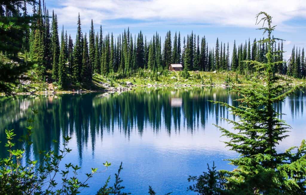
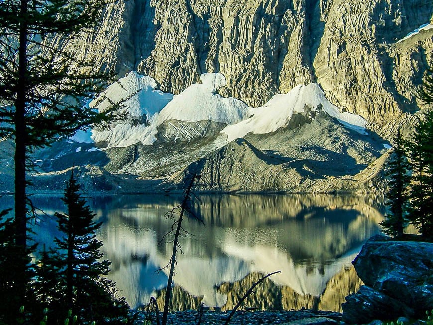
Berg Lake – one of the classic backpacking trips in BC
Time needed: 2 to 4 days
Distance: 42 km round trip (+ more km to Robson Pass Campground and Snowbird Pass)
Elevation Gain: 800 m or 2,625 feet
Best Months: July to early September
Difficulty: Moderate
Fees and Reservations: Camping reservations opened on April 2, 2025 at 7 AM PT for arrivals starting on June 25, 2025. Reservations are required and cost $6/night/tent pad. Camping fees are $10/person/night
There’s a reason the Berg Lake Trail is one of the most iconic backpacking routes in British Columbia. It delivers jaw-dropping scenery and a fabulous alpine adventure. Picture yourself hiking alongside the Robson River, passing thundering waterfalls, and gazing up at Mount Robson, the tallest peak in the Canadian Rockies at 3,954 metres. Set up camp near glaciers, wander through meadows bursting with wildflowers, and wake up to views that feel like a dream.
This multi-day hike near Valemount, BC is worth every step. Berg Lake is the trail’s crown jewel – but leave time for the equally interesting day hikes that take off from the main route. With good weather, this trail is pure backcountry bliss.
For more information read my Berg Lake hiking guide.

Elfin Lakes, Garibaldi Provincial Park
Time needed: 2 – 4 days (and 5.5 – 7 hours as a day trip)
Distance: 22 km return or 13.6 miles
Elevation gain: 600 m or 1,968 feet
Best time to hike: July – October
Dogs: Not allowed
Day-use pass: You ‘ll need a free day-use pass to access Elfin Lakes via the Diamond Head trailhead from June 13, 2025 – October 13, 2025. Reserve a day-use pass from BC Parks as there is no available first come, first served parking during the time period. If you a valid camping reservation, you do not need a day use pass. Fifty-five vehicles can be accommodated at the Diamond Head trailhead.
Fees: A non-refundable reservation fee of $6 (plus tax) will be charged per tent pad, per night to a maximum of $18 (plus tax) per tent pad. The backcountry camping fee is $10 per night.
More details: Read The Elfin Lakes Hike in Garibaldi Provincial Park
Follow an old road until you reach the Red Heather Hut day-use shelter. It gets more interesting after this as you head through a sub-alpine landscape dotted with wildflowers in summer. The hike culminates at two tiny lakes – one you can swim in and the other reserved for drinking water.
You have the option of camping or booking a night at the Elfin Lakes Shelter.

Elk Lakes – Petain Basin – one of the less well-known backpacking trips in BC
Time needed: 2 -3 days
Distance: 2.4 km return to the Lower Elk Lake Campground but a further 10.8 km return to visit Petain Falls, and another 4.6 km return to get to Petain Basin where you can also camp.
Elevation Gain: Minimal to the campground, +95 m to Petain Falls, +547m to Petain Basin from the campground
Best Months: July to mid-September
Difficulty: Easy to the campground, challenging to Petain Basin
Dogs allowed: Yes, on a leash.
Fees and Reservations: Reservations aren’t required. Pre-pay $5 pp online or bring $5 in cash and register at the campsite. Camping is free in the Petain Creek Valley and Petain Basin.
Starting point: Logging roads in from Sparwood. My blog Elk Lakes – Petain Falls Hike – has all the details.
It’s an easy hike from the parking lot to the Lower Elk Lake campground with carts provided. It would be easy to park yourself here for a day or two to simply enjoy the scenery around Lower and Upper Elk Lakes. But it’s well worth your while doing a day hike to Petain Falls. The hardy among you who like to explore off the beaten path will love the wild world of glaciers and the possibility of summiting Mount Foch for the premier view of Petain Basin.


Eva Lake, Mount Revelstoke National Park
Time needed: 2 days as an overnight backpacking trip
Distance: 14.2 km or 8.8 miles return
Elevation gain: 465 m or 1,526 feet.
Time needed: Allow 5 – 7 hours to do Eva Lake as a day hike. Not a great choice for young families but those with active kids 10 – 12 years of age or older, should be able to handle both the hike and backpacking trip.
Best time to backpack: Mid-July through till October. If you go too early in the season, you risk running into a lot of snow.
Dogs: No longer allowed though they were when I did the hike to Eva Lake.
Fees and reservations: To access the Eva Lake trail hike you will need to purchase a pass for Mount Revelstoke National Park. Daily admission is $11 per person. Visit the Parks Canada website to make backcountry reservations. Camping fees are $13.50 pp per night plus a reservation fee.
Options: The Jade Lake backcountry campsite is a quieter alternative.
From the 26-km long Meadows in the Sky Parkway, it’s a straightforward hike to Eva Lake. If you time your overnight for late July or August when wildflowers are at their peak, then the meadows you pass through will blow you away. Check out the views of the Columbia River – thousands of feet below. After hiking through a world of rocks and boulders – broken by the piercing cry of marmots – arrive at stunning Eva Lake. You’ll find the backcountry campground on the far side of the lake.
Frosty Mountain, Manning Provincial Park
Time needed: 2 days
Distance: 22 km round trip
Elevation Gain: 1,220 m or 4,003 feet
Best Months: July to early October
Difficulty: Difficult.
Dogs: Permitted on a leash.
Fees and Reservations: Make campsite reservations. There is a nonrefundable reservation fee of $6 + tax per tent pad plus the campsite fee of $5/person/night.
Starting from the Lightning Lakes parking lot, the Frosty Mountain Trail is a must-do in September when the golden larches put on a stunning show. I first hiked the trail in summer 2004—before I knew what larches were. Now I’d make a point of only going in September – though it can get crazy busy.
The out-and-back route is more straightforward and less punishing than the full loop hike, taking you through forest to the Frosty Creek campsite at the 7 km mark. The real reward lies beyond, where the trail climbs through the larches and into alpine terrain after 10 km, offering great views and stands of larch trees. It’s one of the best and busiest fall hikes in the park for backpackers or strong day hikers.
Garibaldi Lake, Garibaldi Provincial Park – one of the most popular backpacking trips in BC
Time needed: 2 – 3 days
Distance: 18 km (11.2 miles) round trip
Elevation Gain: 810 m or 2,687 feet
Best Months: July to early October Difficulty: Moderate.
Dogs: Not permitted
Fees and Reservations: Make campsite reservations. There is a nonrefundable reservation fee of $6 + tax per tent pad plus the campsite fee of $10/person/night and $5/child/night.
Garibaldi Lake is one of the iconic backpacking trips in BC, featuring a stunning turquoise lake, glaciers, and wildflowers like columbines in summer. The hike in is a bit of a grind with over 6 km of steady switchbacks through second-growth forest.
Fortunately, once you reach the junction, where you stay right to reach Garibaldi Lake (left leads to Taylor Meadows with campsites and the Black Tusk), the views finally open. It can be busy on weekends, but the lake is a real beauty and the quieter trails beyond – Panorama Ridge or the Black Tusk make it a top-tier backpacking destination.

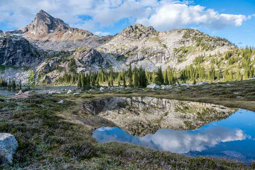
Gwillim Lakes in Valhalla Provincial Park
Time needed: 5 – 6 hours as a day trip and two days for a backpacking trip.
Distance: 11.6 km or 7.2 miles round trip
Elevation gain: Approximately 894 m
Best time to do the backpacking trip: Mid-July to late September
Degree of difficulty: Difficult – one of the hardest backpacking trips in BC.
Dogs allowed: No.
Fees and reservations: Campsites are free – and first come, first served.
Additional hiking: There is the option to scramble to Lucifer Pass. Strong hikers can get to the pass and back to the trailhead in about 10 hours. But if you overnight, it would make a great addition from the campground.
A 4WD vehicle is the best way to access the trailhead though we did it in a Subaru and elected to walk up the rockiest part of the road. Reach Drinnon Lake after 2 km of sometimes steep hiking. There are backcountry campsites around this lake as well. Continue to Drinnon Pass and then a final 2.5 km hike to the Gwillim Lakes. I loved all the tarn and wildflowers in the area. Campers will love the well-spaced wooden tent pads and the kitchen set-up.
Howe Sound Crest Trail near Vancouver
Duration: 2-4 days
Distance: 29 km (18 miles) one way Elevation Gain: Approximately 1830 m or 6,003 feet
Best months to hike: Mid-July to September
Difficulty: Very Challenging
Fees and Reservations: None.
The Howe Sound Crest Trail, just a 25-minute drive from downtown Vancouver, was the first backpacking trip I ever did in BC (hence the lack of any photos). It’s a very rugged but rewarding weekend adventure with some great views along the way. Most people start at the Cypress Provincial Park trailhead and hike to Porteau Cove to reduce the elevation gain. The trail takes you over three mountain peaks and passes close by ten others.
The hike climbs over St. Marks Mountain, Mt. Unnecessary, both the West and East Lions, Thomas Peak, James Peak, Mt. Harvey, Brunswick Mountain, Hat Mountain, Brunswick Lake and Deeks Lake. There is a lot of up and down and many steep scrambles. In places the trail is very rough and isolated. (Pack a Garmin InReach Mini.) But the Howe Sound views, and sense of accomplishment are the reward,
Read Outdoor Vancouver’s Howe Sound Crest Trail Hiking Guide for all the details.
Hermit Trail, Glacier National Park
Time needed: Two days or 3-4 hours to do it as a day hike.
Distance: 3.2 km one way
Elevation gain: 819 metres or 2,687 feet.
Level of difficulty: Hard because of how steep it is.
Best months to hike: July – September
Permit: You need a Parks Canada pass to access the trail. It can be purchased online or at the nearby Rogers Pass Discovery Centre.
Fees: The backcountry fee is $13.50 per person per night in 2025. You can camp at Hermit Meadows from July 1st until October 1st, 2025, though it’s snow dependent. Make reservations for campsites between July 14 – September 21, 2025. You can reserve online or by calling 1-877-737-3783.
Options from the Hermit Meadows campground: There are several peaks you can explore from the meadows including Mount Tupper, Hermit Mountain, Mount Rogers, and Swiss Peak.
From the Trans-Canada Trail hike up the Hermit Trail – the steepest one in Glacier National Park. The first part of the hike takes you past massive trees, but in just 45 minutes great views of glaciers and mountains appear. As you climb into the high alpine on perfectly laid slabs of rock, the environment gets more and more austere. End at Hermit Meadows where the ear-piercing whistle of marmots will make you jump.

Iceline Trail – Yoho Valley Loop Backpack
Time needed: Two days Distance: 20.9 km (13 miles) loop
Elevation gain: Approximately 650 m or 2,133 feet.
Level of difficulty: Moderate
Best months to hike: July till late-September
Dogs: Yes, on a leash.
Permit: You’ll need a Parks Canada Pass and a backcountry camping permit. Reserve online. You have a choice of camping at Laughing Falls or Little Yoho Campground. Little Yoho is the better choice for faster access to the Iceline Trail. The Stanley Mitchell Hut is another option.
Fees: There is a backcountry reservation fee of $11.50 plus $13.50 pp fee for the campsite per night.
Most people do the Iceline Trail as an out and back hike. But you can make it into a backpacking trip, with a night at either Laughing Falls or Little Yoho near the Stanley Mitchell Hut. That way you’ll be forced to hike the length of the Iceline Trail – hardly a hardship. The hike delivers high impact scenery including glaciers and alpine lakes – and you’ll see the full height of Takakkaw Falls. The hike up Yoho Valley isn’t as interesting, but it’s not difficult.
Option: From the Little Yoho Campground spend a day exploring the President Range Trails. Or combine this backpacking trip with the one that includes the Whaleback and Waterfall Valley.

Juan de Fuca Trail – one of the BC backpacking trips similar to the West Coast Trail
Note that the Juan de Fuca Trail is closed for summer 2025 because of winter storm damage. Some day hikes are possible but backpacking the trail is not.
Time needed: 3 – 5 days
Distance: 47 km (29 miles) one way
Level of difficulty: Moderate
Best months: Mid-June -early October
Dogs: Allowed on leash.
Permits and fees: No reservations needed but you need a camping permit. Cost is $10pp per night with kids 5-15 $5pp per night.
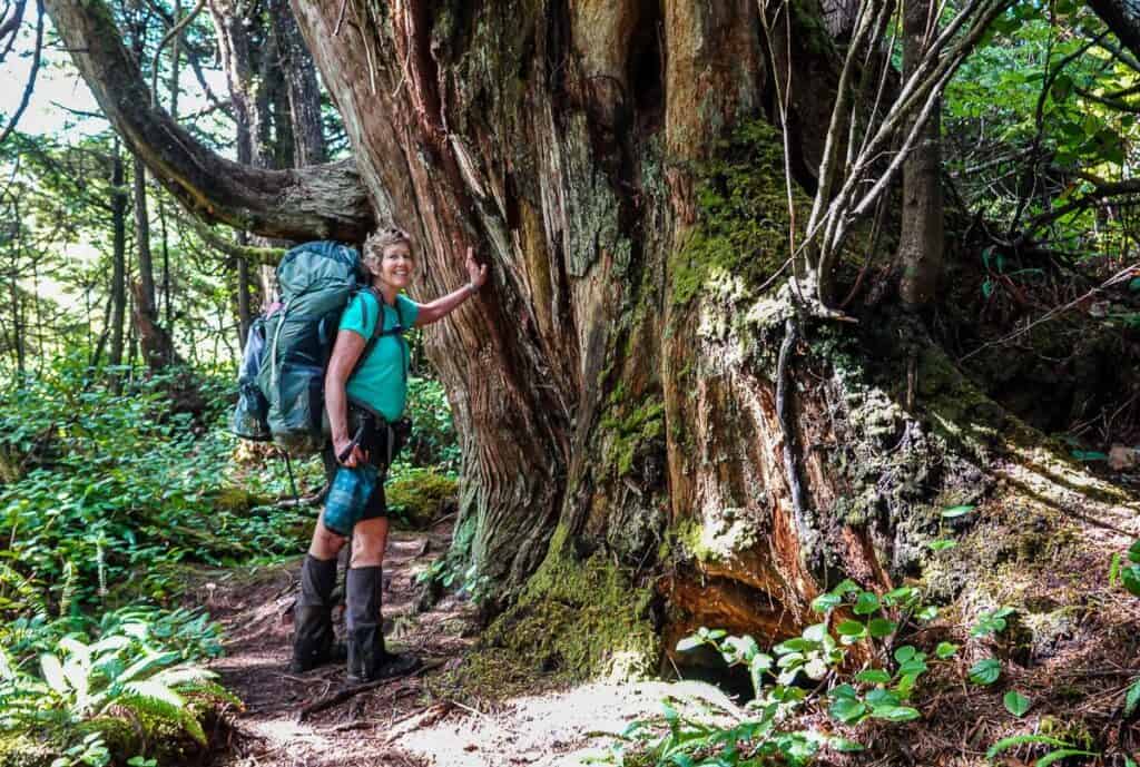
The Juan de Fuca Trail is a cousin to the better-known West Coast Trail. It runs parallel to the west coast of Vancouver Island dodging and weaving through temperate rainforest and along rocky beaches. It travels from China Beach to Botanical Beach just outside of Port Renfrew. It’s rarely flat and often muddy. The rewards include magical sections of forest with massive trees hundreds of years old and some truly gorgeous beach walking and campsites. Be warned – it’s a busy trail in summer.

Kaslo Lake or Kokanee Glacier Cabin in Kokanee Glacier Park
Time needed: 2 to 3 days
Distance: 18 km round trip
Elevation gain: 580 m
Best Months: Mid-July to late September
Difficulty: Moderate
Dogs: Not permitted in Kokanee Glacier Provincial Park.
Fees and Reservations: Camping fees are $10/person/night. All campsites are first-come, first-served. You can also book a night at the lovely Kokanee Glacier Cabin run through the Alpine Club of Canada.
The hike to Kokanee Glacier Cabin in the Selkirk Mountains is a beauty, offering nonstop views for much of its 8.5-kilometre length. Most of the 400 metres of elevation gain happens in the first half, with Kokanee Lake—an unreal mix of deep blue and emerald-green – marking a scenic midpoint. From there, the trail eases into sub-alpine meadows with clear streams and noisy marmots, making the final stretch to the either the campground or cabin a mellow way to end the hike.


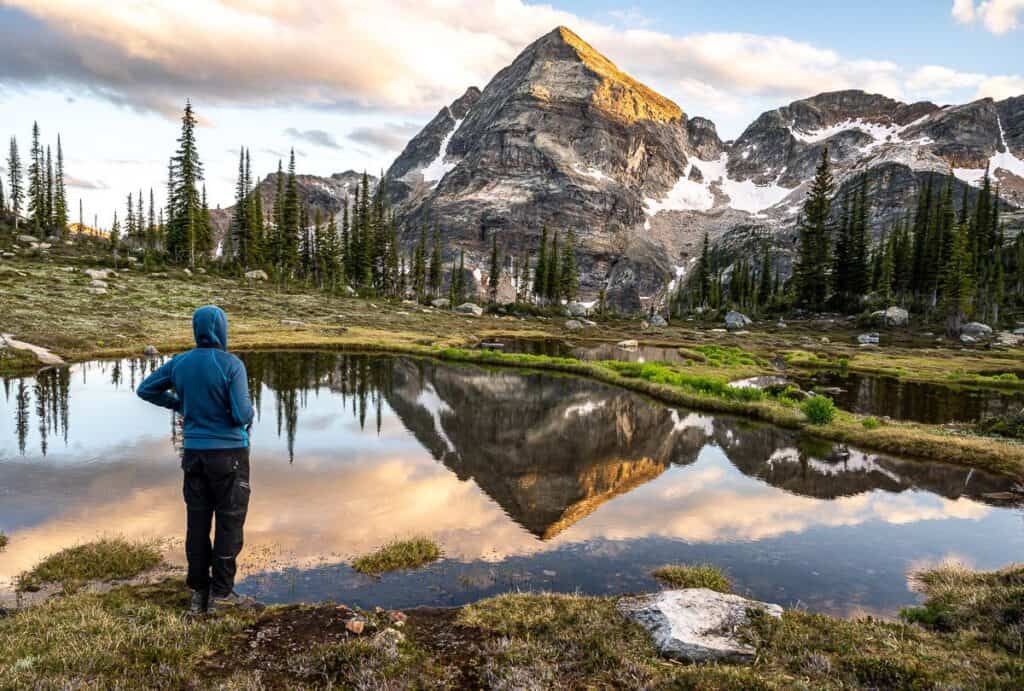
Mount Assiniboine
Duration: 4 to 5 days
Distance: Highly variable but count on 50 – 55 km
Best Months: Mid-July to mid-September
Difficulty: Moderate
Fees and Reservations: You’ll need to book campsites four months in advance in Mount Assiniboine Provincial Park through camping.bcparks.ca. A non-refundable reservation fee of $6 (plus tax) will be charged per tent pad. The camping cost per night is $10 pp.
In Banff National Park, make online reservations for backcountry campsites if you’re planning to camp at Wonder Lake or Howard Douglas Lake. Reservation fees are $11.50, and campsite fees are $13.50 pp per night.
Called the Matterhorn of the Canadian Rockies, Mount Assiniboine is one of the first-class backpacking trips in BC, though the logistics of getting up here can be time consuming. The hike up to the Magog Lake campground in Mount Assiniboine Provincial Park can be done as a loop or out and back hike, or via helicopter if you have the funds.
You will be rewarded with wildflower-filled meadows, incredible lakes, jagged mountain peaks, and a fine sense of accomplishment. There are numerous day hikes to do in the Mount Assiniboine area including Wonder Pass, the Nublet and Sunburst Peak.
Check out Taryn Eaton’s full Mount Assiniboine hiking guide for literally all the details to organize this trip. It’s made more difficult as you must start in either Banff National Park or Peter Lougheed Provincial Park in Alberta, but you end up in Mount Assiniboine Provincial Park in British Columbia.

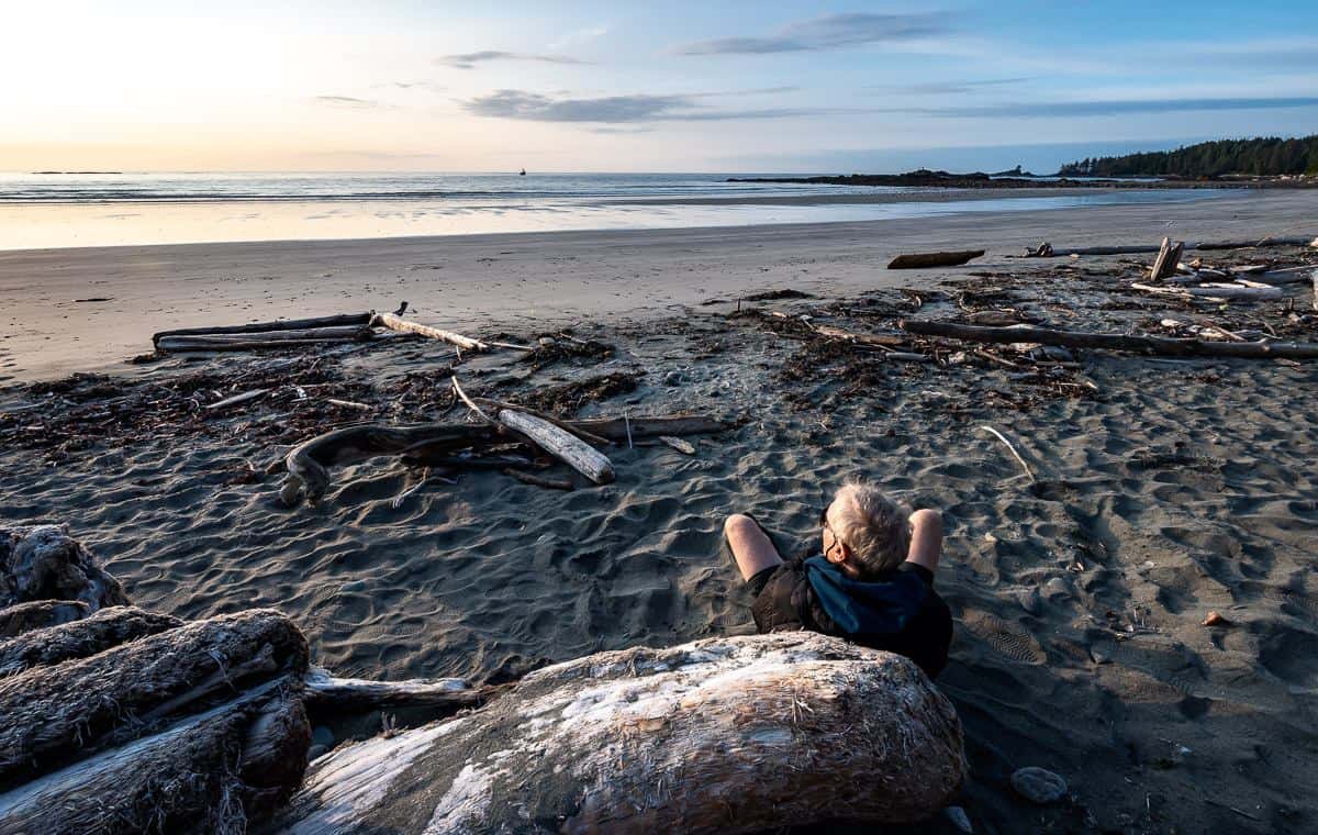
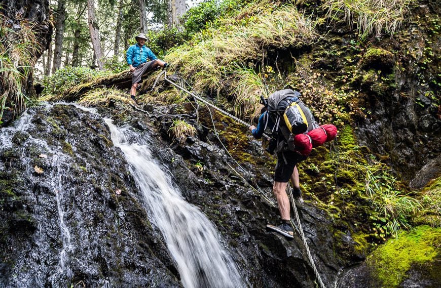
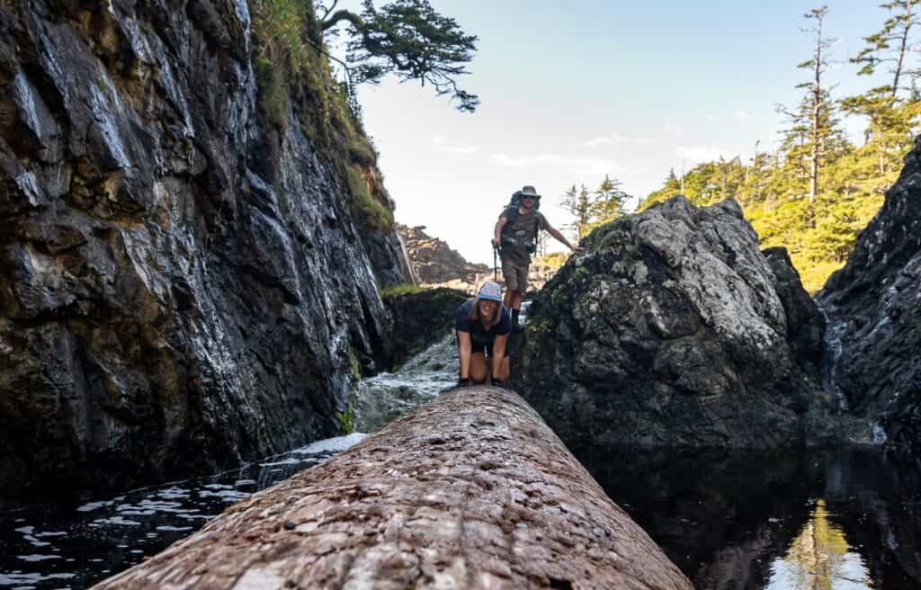
Nootka Island Trail – one of my favourite backpacking trips in BC
Time needed: 4 – 8 days. We did it comfortably in 5 days.
Distance: 37 km one way
Elevation gain: Not a lot but I don’t know the number.
Best Months: June to mid-September; July and August are the most popular times.
Difficulty: Hard and technically difficult in places.
Dogs allowed: Not recommended because of all the wildlife.
Fees and Reservations: There are no reservation or campsite costs associated with hiking the Nootka trail. But there is a weekly hiking pass that costs $50 per adult ($25 per senior and $25 for youth 6-17) that includes one night at Yuquot Campground.
If you’re looking for a remote coastal backpacking trip in British Columbia, the Nootka Trail delivers a true wilderness experience with stunning West Coast scenery. Most of the hike follows the shoreline, offering a mix of hardpacked sand, rocky shelves, and slippery boulders, with sections of forest trail that range from breathtaking old-growth trees to challenging, muddy stretches.
Unlike the busier West Coast Trail, this route sees far fewer hikers – and you might even have it all to yourself like we did. It’s common to spot wildlife like black bears, whales, seals, and wolves along the way. With beautiful beachfront campsites that don’t require reservations, near continuous ocean views, and a culturally rich finish in Yuquot, the traditional territory of the Mowachaht Muchalaht First Nations, this is one of the best off-the-beaten-path backpacking adventures in BC.
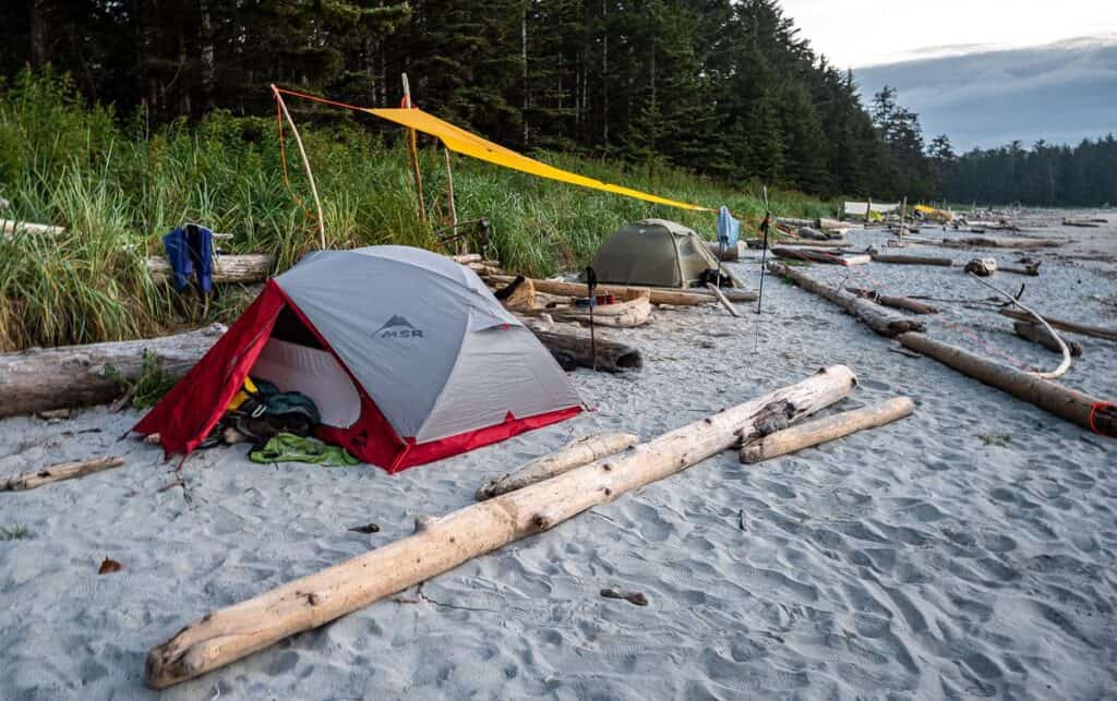
North Coast Trail – one of the hardest backpacking trips in BC
Duration: 5 – 8 days. We did it comfortably in five days and added time to visit the Cape Scott Lighthouse and spend a night at San Josef Bay.
Distance: 43 km one way but most people hike 58 km and combine the North Coast Trail with the Cape Scott Trail to end at the San Josef trailhead.
Best Months: June to September
Difficulty: Challenging – the hardest of the coastal backpacking trips in BC on Vancouver Island.
Elevation Gain: 160 m the first day (starting at Shushartie Bay) and then a maximum of approximately 100 m every other day.
Dogs allowed: Not permitted because of the number of wolves around.
Fees and Reservations: You will need a backcountry camping permit from BC Parks. You can register and pay online before you show up in Port Hardy. Be sure to carry printed copies in case your phone doesn’t work. The cost is $10 per person per night. At the trailhead you can also purchase permits – with cash only.
Most people start at Shushartie Bay and for that you need a boat shuttle with the Cape Scott Water Taxi. There is a minimum of four hikers to run the shuttle. Prices are $150 +GST per person plus tax for the boat shuttle in 2025 to Shushartie Bay. Also organize a van pickup in the Cape Scott parking lot. It leaves daily and should be booked at the same time you book the water taxi. The cost in 2025 is $125 +GST per person.
The North Coast Trail is tougher than the West Coast Trail, but it’s far less crowded—and the only reservation you’ll need is for the boat shuttle and van pickup. If you’re looking to save money, you can skip the shuttle and do an out-and-back hike, a “North Coast Trail taster” by hiking from the parking lot to the Irony Creek campsite and back.
On the North Coast Trail, you’ll enjoy some of the best campsites on Vancouver Island like Irony Creek on Shuttleworth Bight and Nissen Bight plus pristine white beaches, incredible sunsets, abundant wildlife including sea otters, whales, black bears, possibly wolves, and seabirds. Expect mud, roots, ropes, rain, and rugged beach walking too—but if you’re lucky with mostly dry conditions, like we were, it’s a fantastic adventure.
Rainbow Range Trail, Tweedsmuir Provincial Park
Distance: 16 km return (10 miles) though once you’re in the vicinity of the Rainbow Range you could hike for days.
Elevation gain: 300 m or 964 feet – quite civilized to get a hike of this quality. The elevation gain is greater if you continue past the last of the cairns.
Time needed: Two days. Level of difficulty: Easy.
Best months: July to September
Be safe: This is truly an off the beaten path hike. You may not see another soul so be prepared to be self-sufficient in an emergency. Consider taking a Garmin InReach Mini.
Backcountry camping: There are obvious campsites situated by a small lake on the trail with a bear proof box provided for your food. You might also consider taking a bear cannister to give you more flexibility in where you want to camp.
The Rainbow Range hike is about as close to hiking nirvana as you’re going to get. It offers amazing wildflowers, beautiful tarns, rainbow-coloured mountains, silence – and a sense that you have this part of the world to yourself. But don’t forget the bear spray.

Rockwall Trail – one of the hardest to book backpacking trips in BC
Duration: 4 to 5 days
Distance: 55 km (34.2 miles) as a one-way traverse
Elevation Gain: 2260 m (7,416 feet)
Best Months: Mid-July to late-September
Difficulty: Challenging.
Dogs: Permitted on a leash.
Fees and Reservations: Backcountry campsite reservations are required (and are difficult to get) and cost $11.50/per reservation. Camping fees are $13.50/person/night. You will also need to buy a National Park pass.
The Rockwall Trail is one of the outstanding backpacking trips in BC. It’s a challenge with so much daily elevation gain and loss – but the rewards are many. The Rockwall itself is an amazing sight as are the numerous pretty meadows bursting with wildflowers, along with lakes and numerous waterfalls. Another bonus is that much of the Rockwall Trail is above treeline.
Sunshine Coast Trail: Sarah Point to Powell River
Time needed: 4 days
Distance: 49.7 km or 30.8 miles
Level of difficulty: Moderate
Best months: Late May – early October
Dogs: Permitted on leash but not in huts.
Permit and fees: None required
This pretty section of the Sunshine Coast Trail from Sarah Point to Rieveley Pond Hut is packed with forest beauty, ocean views, and memorable campsites. It begins with a boat drop-off and coastal vistas before winding through mossy woods, past quiet lakes, and open bluffs with panoramic lookouts. While Manzanita Hut is a popular goal, bringing a tent gives you the flexibility to adjust plans and enjoy shorter, more relaxed days. With waterfalls, centuries-old trees, and beautiful forest walking, this stretch delivers a rewarding BC backpacking experience.

Sunshine Coast Trail: Mount Troubridge to Saltery Bay
Time needed: 3 days
Distance: 26.5 km with lots of elevation change including a 1,300 m descent from Mt. Troubridge to Fairview Hut
Level of difficulty: Moderate
Best months: Late May – early October
Dogs: Permitted on leash but not in huts.
Permit and fees: None required
We started the three-day hut to hut section of the Sunshine Coast Trail at Branch 41 Road near Elephant Lake and finished at Saltery Bay, thereby avoiding a strenuous climb to Mount Troubridge. Despite a drizzly start, the hike to the Mount Troubridge Hut was beautiful, especially through old-growth forest, and the hut itself was cozy. The next leg to Fairview Hut featured a scenic descent through diverse ecological zones.
And the final stretch to Saltery Bay rewarded with coastal views, arbutus trees, and benches to take in the scenery before finishing near the ferry terminal. If you can get a shuttle to Branch 41 – you’ll find this to be a fantastic section to hike.

Takkakaw Falls – Laughing Falls – Twin Falls – Whaleback Ridge Loop backpacking trip in BC
Time needed: Two days.
Distance: 21.8 km as a loop hike
Level of difficulty: Moderate.
Best months: July – September
Dogs: Yes on a leash.
Permit: You’ll need a Parks Canada Pass and a backcountry camping permit. Reserve online. You have a choice of camping at Takakkaw Falls walk-in campground, Laughing Falls or Twin Falls Campground.
Fees: There is a backcountry reservation fee of $11.50 plus $13.50 pp fee for the campsite.
This 21.8 km loop hike in Yoho National Park starts at Takkakaw Falls and takes you past Point Lace Falls and Laughing Falls to reach the stunning Twin Falls and Twin Falls Tea House National Historic Site. From there it climbs to the top of Whaleback Ridge. This is a great place to stop for a break with all the scenic views around.
Follow the Whaleback Ridge for 3.9 km enjoying views of up more than ten mountain peaks and even a part of the Iceline Trail before descending steeply back to the Yoho Valley.
Optional add on: Extend the loop into remote Waterfall Valley, adding 90 minutes to two hours to the loop hike.

West Coast Trail – one of the most famous backpacking trips in BC
Time needed: 6 – 8 days
Distance: 75 km or 46.6 miles
Elevation gain: Approximately 1,222 m
Level of difficulty: Hard
Best months: Peak season is June 15 – September 15 but open May 1- September 30th.
Dogs: None allowed.
Permit: Book campsites online. You will need to know which entry point you want – Pachena Bay near Bamfield, Balaats’adt (Nitinaht Village) or Gordon River by Port Renfrew.
Fees: $248.50 and that includes a reservation fee- $25.75, backcountry use permit – $160 per person, and the Gordon Bay and Nitinat River ferries – $28 per person per ferry. There is also a National Park entry fee ($11 pp/day) and a campsite fee. You can also buy a National Park Discovery Pass – which can be more cost effective if you visit additional parks.
The West Coast Trail (WCT) is a legendary backpacking trip along Vancouver Island’s rugged west coast, running between Port Renfrew and Bamfield. Open seasonally from May 1 to September 30, it attracts over 7,500 hikers annually and is known worldwide for its breathtaking beauty and demanding terrain. Even though it’s only 75 km long, it typically takes six to eight days to complete, and many hikers consider it a rite of passage.
When the weather cooperates, every campsite offers a stunning backdrop, and the trail camaraderie is second to none. Highlights include abundant wildlife, interesting geological features, First Nations and European history, and a fine sense of accomplishment.

More backpacking trips in Canada you’ll probably love
- The Top Backpacking Trips in the Canadian Rockies
- 10 Wildly Scenic Backpacking Trips in Canada
- 10 Beginner Backpacking Trips in the Canadian Rockies
- 10+ Must Do Backpacking Trips in Kananaskis Country
- 10 + Best Backpacking Trips in Banff National Park
Click on the photo to bookmark to your Pinterest boards.


