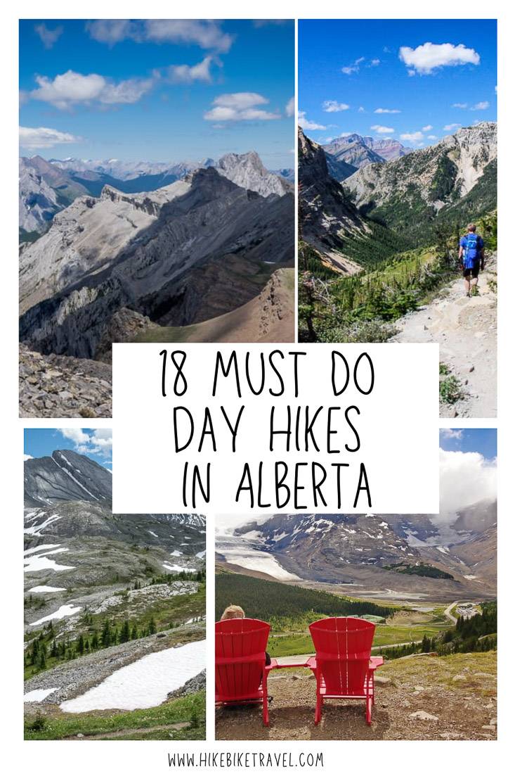
Hiking in Alberta: 18 Best Day Hikes
Hiking in Alberta is incredible. We’re spoiled here with an abundance of outstanding day hikes to choose from. These 16 hikes described below give you but a taste of what is out there. With three national parks, numerous provincial parks, and the Rocky Mountains you can expect plenty of world-class mountain views, gorgeous high alpine lakes and with a little luck some wildlife sightings.
If you haven’t done a lot of hiking in bear country read my tips here before heading out and always take the 10 essentials for hiking.
Should you be in the planning stages of a trip to Alberta read Best Things to do in Canada for Outdoor Lovers. This post covers more than just hiking. You’ll find info on how to get to Alberta, how to get around and some of the sights to see that don’t involve a hike.
If it’s backpacking you love check out these 10 plus overnight trips in Kananaskis Country for beginners, families, and expert hikers alike.
This post includes some affiliate links. If you make a purchase via one of these links, I ‘ll receive a small commission at no extra cost to you. Thank you very much for your support.
Hiking in Alberta – location map of the must do day hikes
- Click on the three dots in the top right hand corner to email a copy of the map.
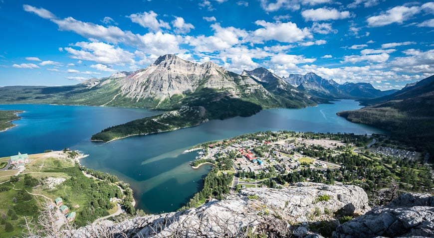
Hiking in Alberta in Waterton Lakes National Park
Waterton Lakes National Park is just three hours south of Calgary, so I’m always amazed when I meet locals that have never visited. There are so many fun things to do in Waterton, especially in summer that I would encourage you to visit for a minimum of three nights. You’ll find lots of hotels and plenty of camping at the Waterton townsite.
Hikers will love this park. There are loads of easy, family-friendly hikes, the famous Crypt Lake trail described below and loads of hikes in the moderate range. Check out 10+ Fabulous Hikes in Waterton Lakes National Park.
Would you like to save this?
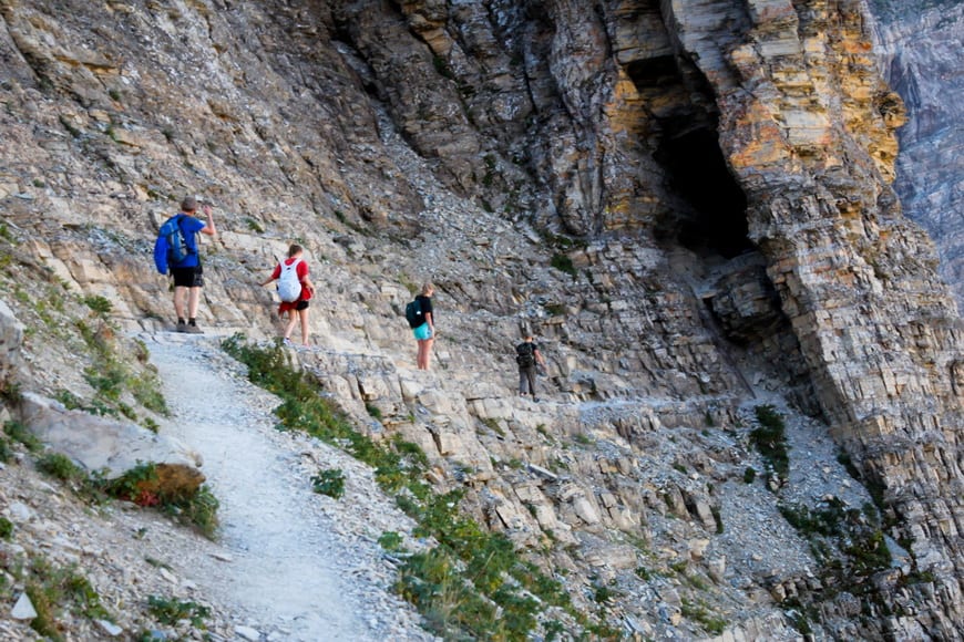
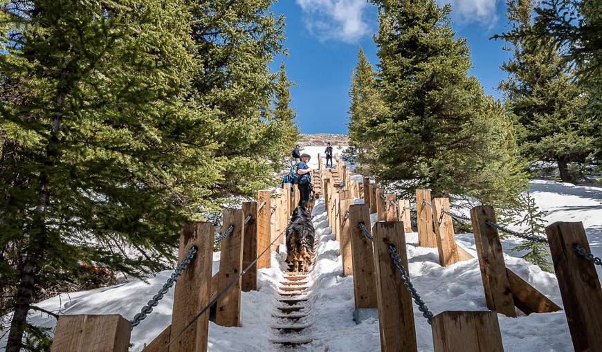
1. Crypt Lake Trail, Waterton Lakes National Park
Unless you hit a weekday in the shoulder season, expect company on the Crypt Lake trail. The boat runs until Thanksgiving weekend in October.
Distance: 17.4 km round-trip.
Elevation gain: 690 m or 2,264 feet.
Difficultly: Moderate
Time needed: 5 – 7 hours
Highlights: A boat ride to the trailhead, waterfalls, a gnarly section that includes a ladder, tunnel and chains, beautiful alpine lake with a beach at the end of the hike.
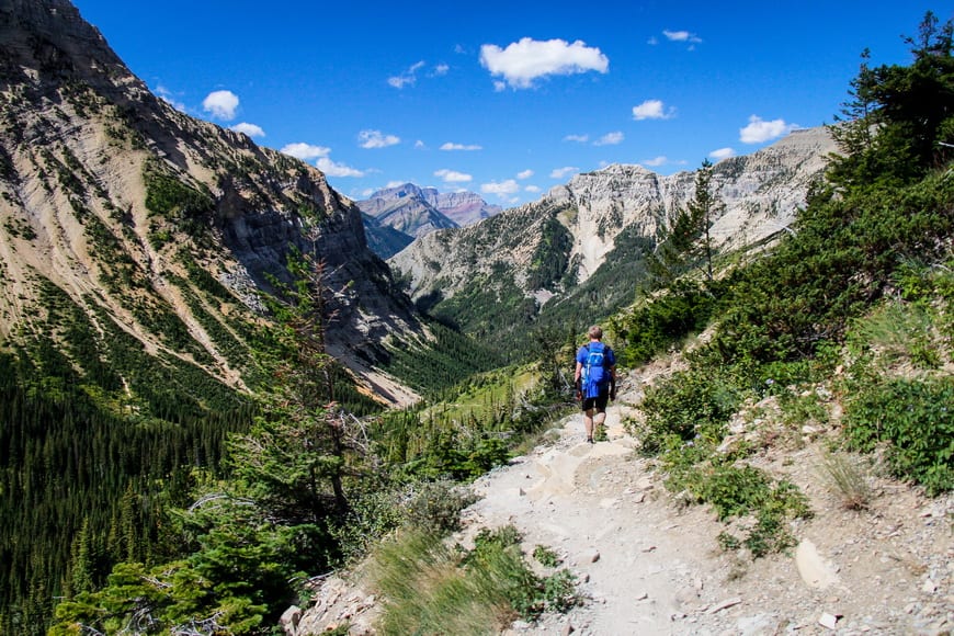
Hiking in Alberta – Crowsnest Pass area in the south
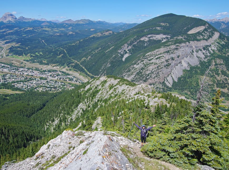
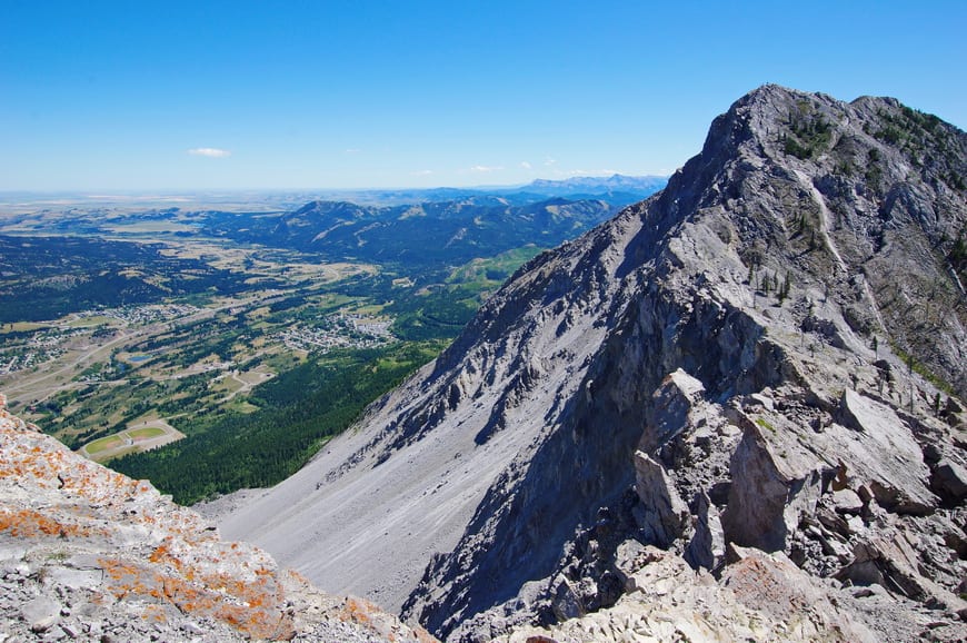
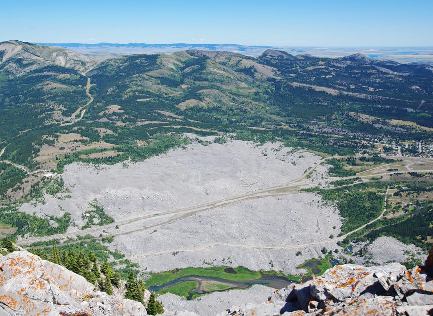
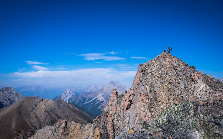
2. Turtle Mountain, Crowsnest Pass Area
If you want to go hiking in Alberta and feel a wee bit of tension at the summit, put the Turtle Mountain hike on your list. It’s predicted that there will be another rock slide at some point.
Distance: 6.2 km round-trip
Elevation gain: 780 m or 2,559 feet
Difficulty: Challenging
Time needed: 3 – 6 hours
Highlights: At the top you can see where Turtle Mountain broke off to cause the Frank Slide in 1903. Enjoy superb views of the Frank Slide itself. Great view of the town of Blairmore and up and down the Crowsnest Valley. There is the option to scramble to the South Peak (where monitoring equipment is in place to detect movement) but it’s about an hour each way even though the distance isn’t great.
Read: 5 of the Best Hikes in the Crowsnest Pass Area
Hiking in Alberta in Kananaskis Country
Kananaskis Country is a fantastic playground for those of us lucky to live close by. The area covers numerous provincial parks under one banner – so it’s large and home to some of the most amazing backpacking and hiking in Alberta.
If you want more ideas on where to go hiking in Kananaskis check out Easy Kananaskis Hikes Everyone Will Love, 12 Kananaskis Trail Hikes With a View and Best Kananaskis Hikes for Mountain Lovers.
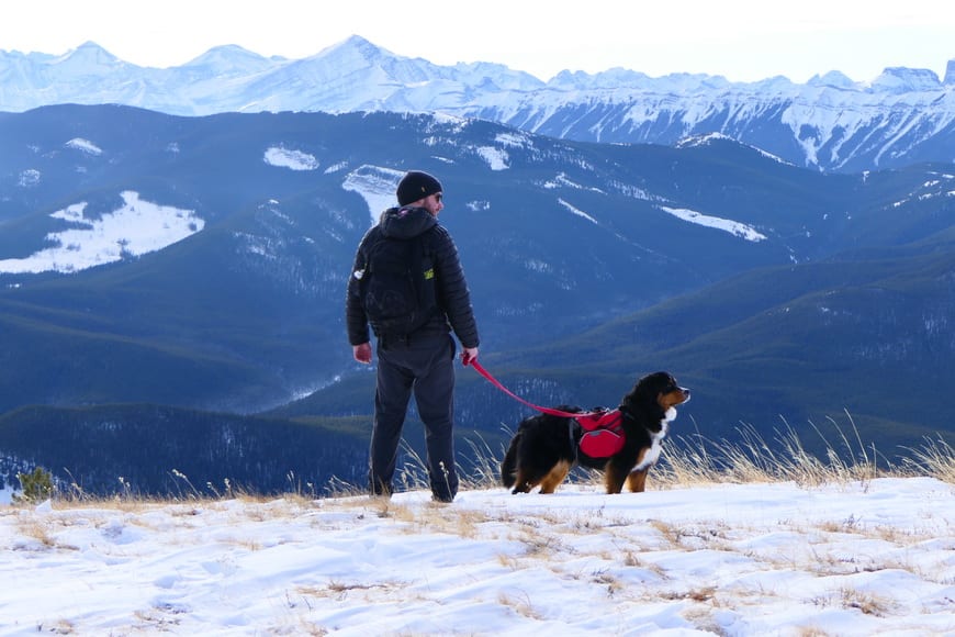
3. Prairie Mountain, Kananaskis Country (Bragg Creek area)
I only do the Prairie Mountain hike in the winter or the shoulder season as there are definitely prettier hikes out there to do in spring and summer. But you can’t beat it for a work-out or to get your mountain fix as the trailhead is just 45 minutes from Calgary.
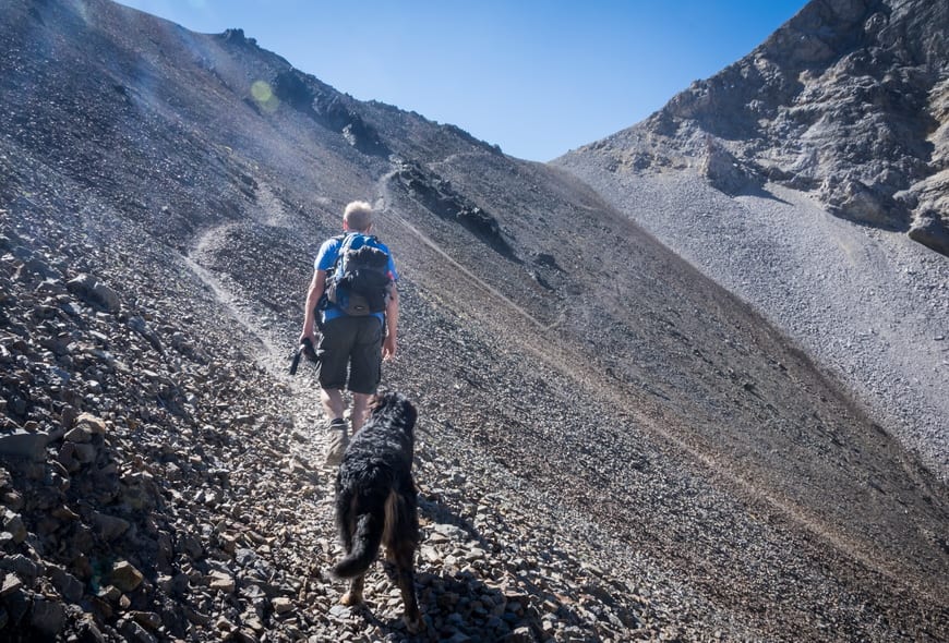
It can be bloody cold and windy on top and ice-cleats are recommended in winter. It’s dog friendly but they are supposed to be on a leash.
Distance: 7.6 km return
Elevation gain: 726 m 0r 2,382 feet
Difficulty: Moderate to difficult because of the steepness
Time needed: 2.5 – 4.5 hours unless you’re superhuman
Highlights: Prairie and mountain views. A great year round workout. You can see downtown Calgary on a clear day.
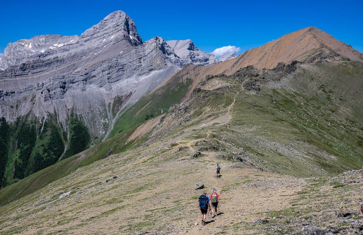
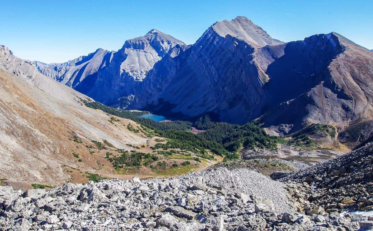
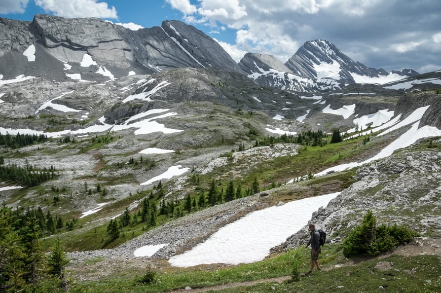
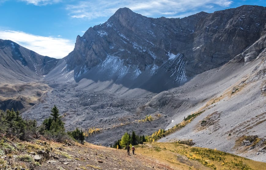
4. Buller Pass
Buller Pass is one of the great hikes off the Smith Dorrien Road in Kananaskis Country. In fall, larches provide a blast of colour. From Buller Pass you can see Guinn Pass and Ribbon Lake.
Distance: 13 km round-trip
Elevation gain: 671 m or 2,201 feet
Difficulty: Moderate to hard
Time needed: 5 – 6 hours round trip
Highlights: Waterfalls, great views from Buller Pass, option to continue to Ribbon Lake where there’s a campsite but would be a long day hike
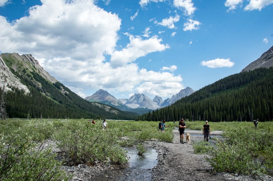
7. Burstall Pass
Bring a pair of water shoes if you’re not good at jumping streams as there’s a long wet area you have to get through to get to the good stuff on the Burstall Pass hike. Also a great trail to do in the fall with some larches.
Distance: 16.4 km round-trip
Elevation gain: 667 m or 2,188 feet
Difficulty: Moderate
Time needed: 5 – 6 hours
Highlights: Stunning valley, beautiful meadows and terrific views up high. Options to continue from the pass or bag a peak. Great for a family hike too. This is hiking in Alberta at its best.
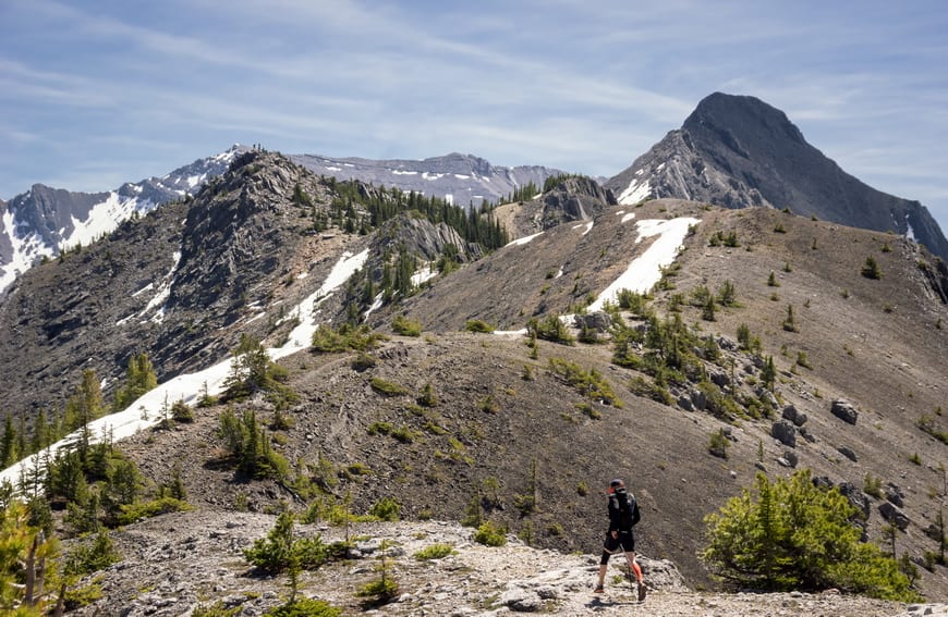
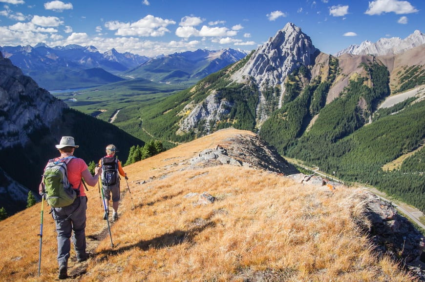
8. Wasootch Ridge off of Highway 40
A steep hike gets you onto undulating Wasootch Ridge with expansive views. If you want to go hiking in Alberta early in the season, this hike is for you.
Distance: 11.7 km round-trip approximately
Elevation gain: 750 m or 2,461 feet
Difficulty: Moderate
Time needed: 5 – 6 hours
Highlights: A well-defined trail along the ridge line offers views of Wasootch Creek and the Nakiska Ski Hill. It becomes a scramble near the end and most people turn around when the going gets tough. I hear it’s a good one to snowshoe or hike in the winter if you’ve got ice cleats and go prepared.
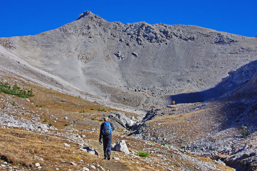
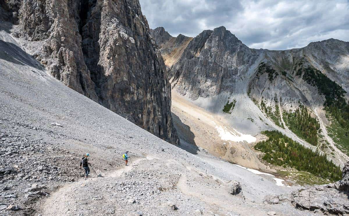
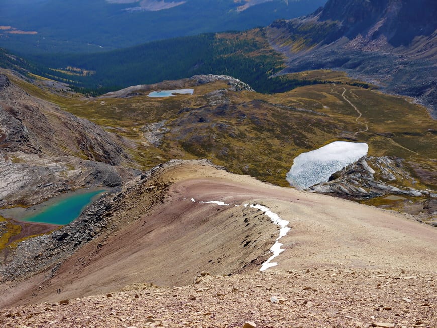
9. Opal Ridge South
More of a scramble at times than a hike so you’re less likely to see people on this one. Lots of variety and a high possibility of wildlife.
Distance: 6.3 km round-trip
Elevation gain: 900 m or 2,953 feet
Difficulty: Hard
Time needed: 5 – 6 hours
Highlights: If you like surprises when you’re hiking in Alberta then Opal Ridge South is ideal. The rock pillars near the ridge line are completely unexpected and the views into a valley most people never see are sublime as are views across to Fortress Mountain.
This hike is not for beginners. You should be comfortable hiking on scree. If you want to be challenged while hiking in Alberta, Opal Ridge South is a great choice.
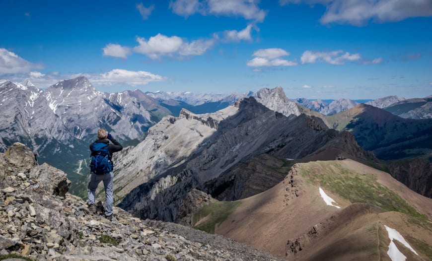
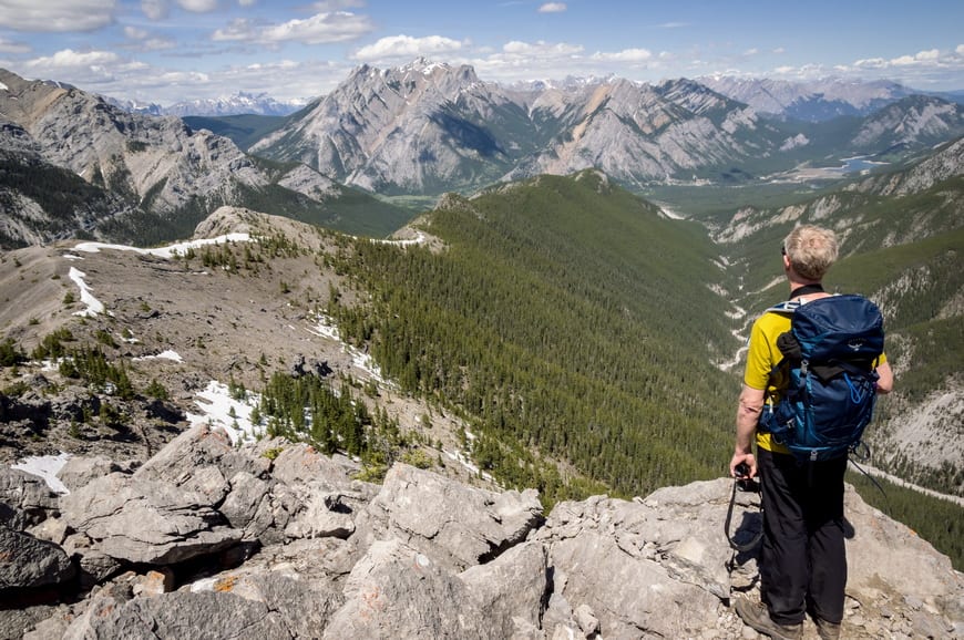
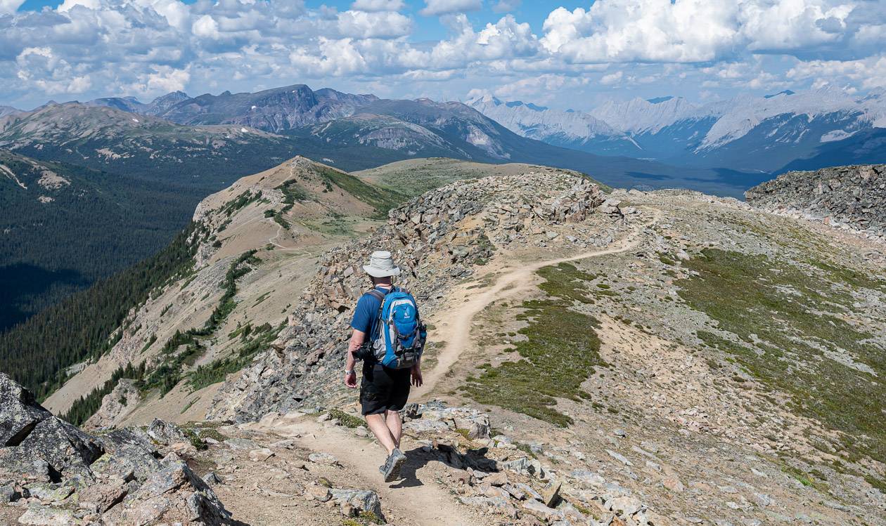
10. Grizzly Ridge from Highwood Pass
The Grizzly Ridge hike shares a trailhead at the Highwood Pass parking area with the Pocaterra Ridge hike but the hiking experience is completely different. This one rewards with a tiny summit via a short ridge and a bit of easy scrambling. It’s one of the best hikes in Kananaskis Country – and yet you probably won’t see many people.
Distance: 9.6 km round-trip
Elevation gain: 518 m (1,699 feet) to the col plus an additional 165 m (541 feet) to the summit
Difficulty: Moderate to difficult (only at the very end)
Time needed: 4 – 6 hours to the summit
Highlights: Larches in the fall; stunning views in the Highwood Pass area. It’s also fun watching people scramble on Mt. Tyrwhitt.
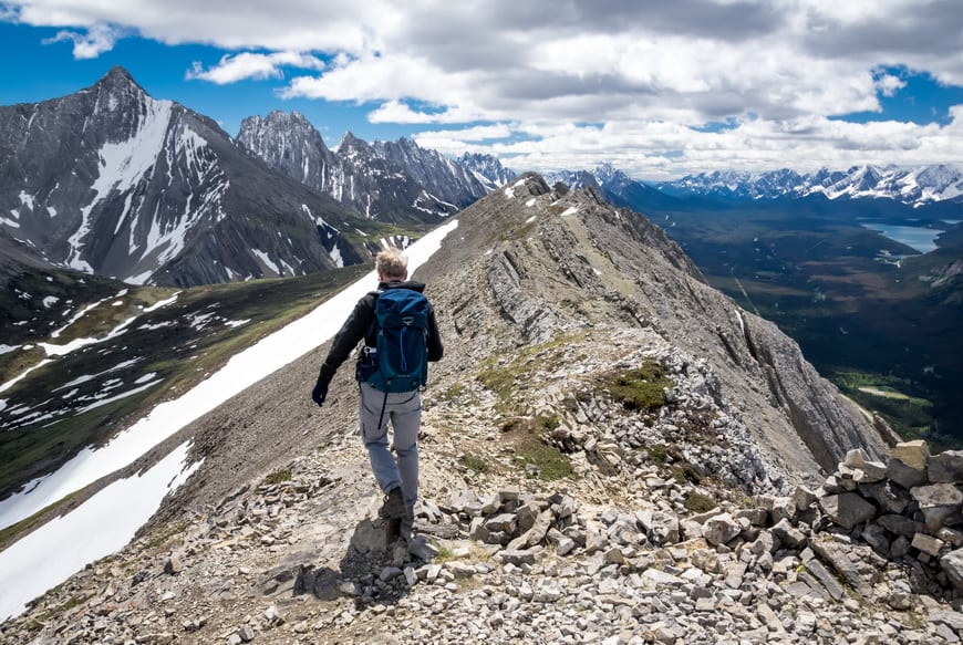
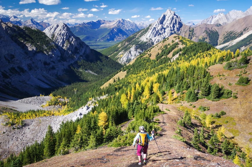
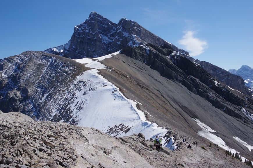
11. Pocaterra Ridge – one of the best fall hikes in Alberta
Plan a car shuttle – parking one car at Little Highwood Pass and the other at Highwood Pass. The Pocaterra Ridge hike is best done as a one way affair starting at Highwood Pass. If you love hiking in Alberta in the fall this is the hike for you. Look for intense blasts of yellow larches in pockets along the length of the trail.
Distance: 8.9 km one way and would suggest that you only do it as a one-way hike.
Elevation gain: 950 m (3,117 feet) gain and a 640 m (2,100 feet) loss
Difficulty: Moderate
Time needed: 6 hours
Highlights: Phenomenal hike in larch season. Once you gain Pocaterra Ridge, the views are some of the best in the Rockies.
12. Ha Ling Peak near Canmore
Ha Ling Peak is one of the early season hikes that will get you into shape for summer hiking but it’s heavily trafficked. Reopened in winter 2023 with improvements to the trail after the Goat Creek parking lot got a facelift.
Distance: 5.6 km round-trip
Elevation gain: 762 m or 2,500 feet
Difficulty: Moderate
Time needed: 4 – 5 hours
Highlights: Steep trail delivers you to the edge of the mountain overlooking the city of Canmore. Great views also of the east end of Mt Rundle hike (EEOR).
Hiking in Alberta in Banff National Park
I love hiking in Banff National Park as the variety of hikes is fantastic. You should know that private cars can no longer drive to Moraine Lake and the area around Lake Louise can be a zoo in the summer. Plan to take public transit from Banff via Roam Transit or book a Parks Canada shuttle. If you manage to score a parking spot at Lake Louise you will have to pay. Gone are the days of free summer parking.
I’ve done a lot more hiking in Banff since I first penned this post. Check out 18 day hikes in Banff for more ideas and 10 Breathtaking Lake Louise Hikes.
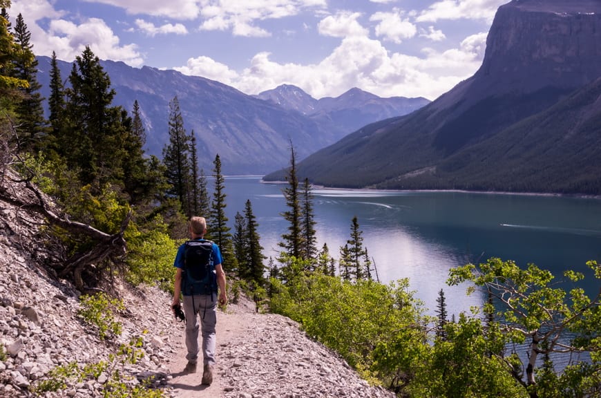
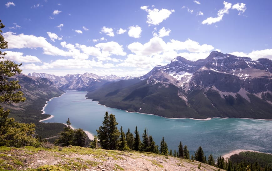
13. Aylmer Lookout
Count on a long day when you hike to Aylmer Lookout, though fortunately most of it is pretty with great views of Lake Minnewanka. From Aylmer Lookout it feels like you can see forever. This is prime grizzly country (we saw mama bear and her three cubs) so go prepared.
Distance: 23.4 km return to the lookout plus 3.6 km round-trip to Aylmer Pass.
Elevation gain: 570 m (1,870 feet) plus 230 m (755 feet) for Aylmer Pass.
Difficulty: Moderate because of the length.
Time needed: 7 -8 hours
Highlights: Superb views up and down the entire length of Lake Minnewanka.
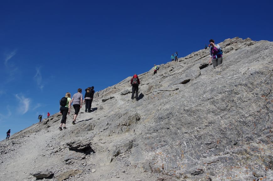
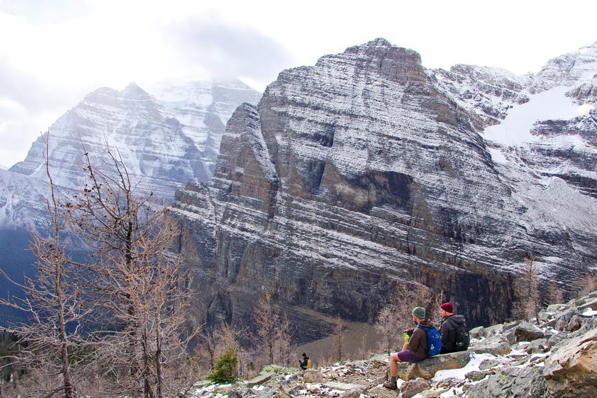
14. Fairview Mountain near Lake Louise
It’s a steep climb to the top of Fairview Mountain but the view is worth the effort. Lake Louise looks puny 1,000 metres below. The early part of the Fairview Mountain hike is superlative during larch season.
Distance: 10.6 km round-trip.
Elevation gain: 1,014 m 0r 3,327 feet.
Difficulty: Moderate
Time needed: 4- 6 hours
Highlights: The highest trail in the Rockies; interesting and unusual perspective of Lake Louise and in-your-face mountain views of Mt. Temple.
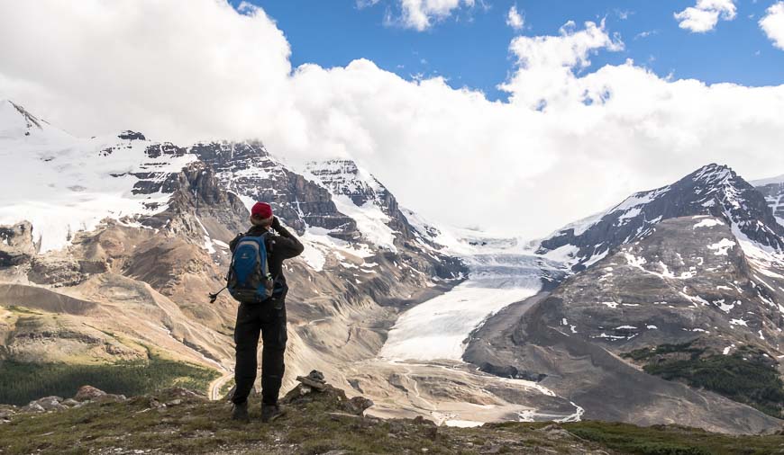
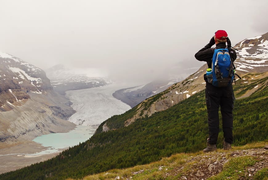
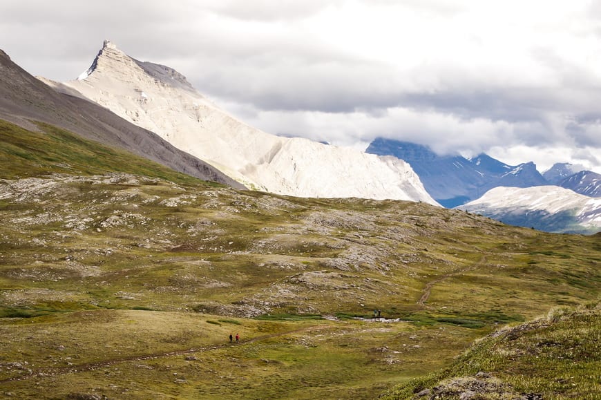
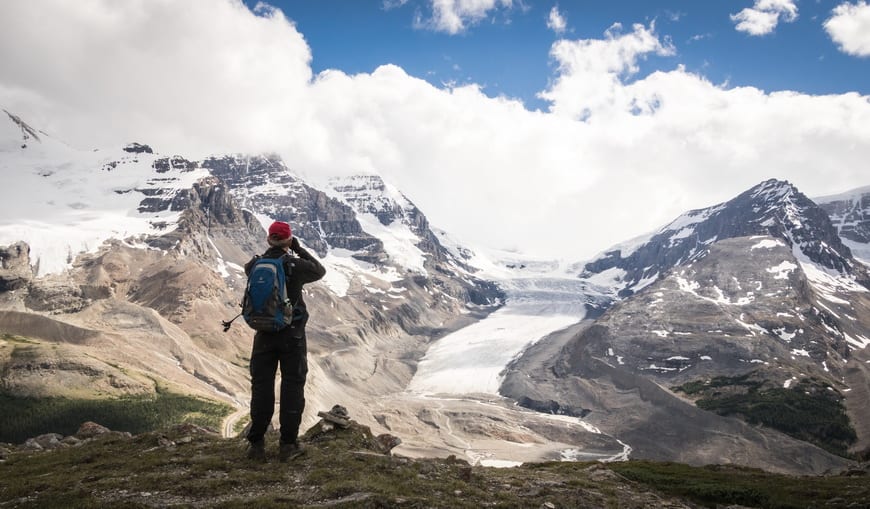
15. Parker Ridge
Parker Ridge is a popular family-friendly hike with zero route-finding issues. Quick access to the high alpine along with superb views. If you’re heading for the Columbia Icefields a great hike to stretch your legs.
Distance: 4 km round-trip to the saddle with 272 m of elevation gain, 11 km round-trip to the ridgecrest and 593 m of elevation gain
Difficulty: Easy
Elevation gain: 272 m (892 feet) to the saddle plus 593 m (1,946 feet) to the ridgecrest
Time needed: 1 – 2 hours for the saddle; 4 – 5 hours for the ridgecrest
Highlights: Views start within 15 minutes of hiking; great views of the Saskatchewan Glacier; option to hike to the ridgecrest – which few people do.
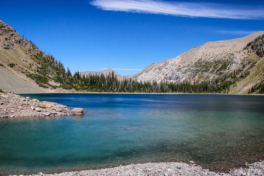
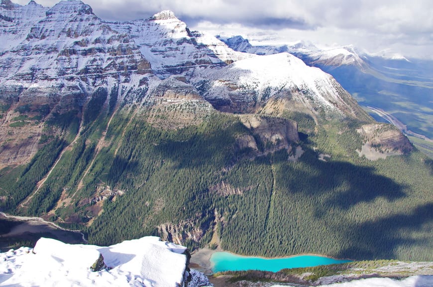
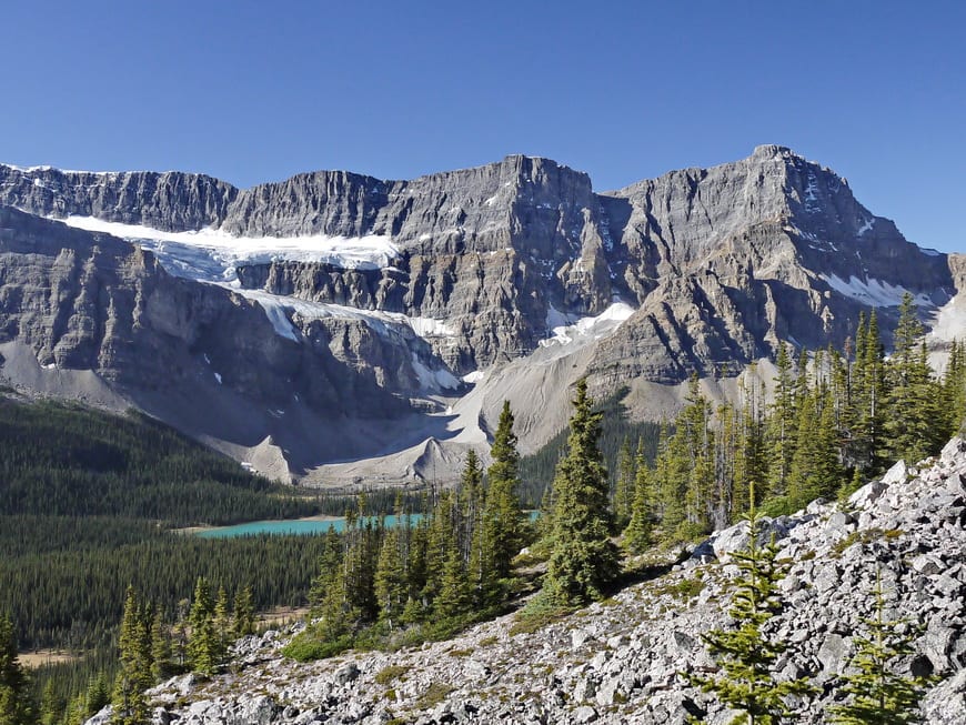
16. Helen Lake and Cirque Peak
It’s not a lot of work to hike to Helen Lake but count on a full day’s hike if you go all the way to Cirque Peak. Expect amazing glacier views within a short time of starting the trail! This is of the best wildflower hikes in the Rockies if your timing is good.
Distance: 14 km return for the ridge above Helen Lake.
Elevation gain: 550 m (1,804 feet) to ridge above the lake plus 493 m (1,617 feet) to the summit of Cirque Peak.
Difficulty: Easy to the ridge but moderate for the peak
Time needed: 4 hours for the ridge, 6 – 7 hours for the peak
Highlights: Gorgeous summer wildflowers, mostly above tree line; fabulous mountain and glacier views.
Hiking in Alberta in Jasper National Park
Jasper National Park has lots to offer the day hiker, especially in the Maligne Lake area. Over the years hiking in Alberta I have explored a lot more of the park so in addition to the hikes described below, I’d encourage you to read the Best Hikes in Jasper for ideas across all levels of hiking difficulty.
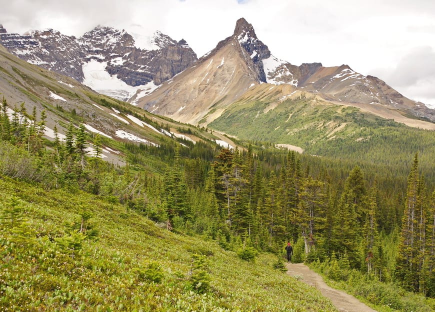
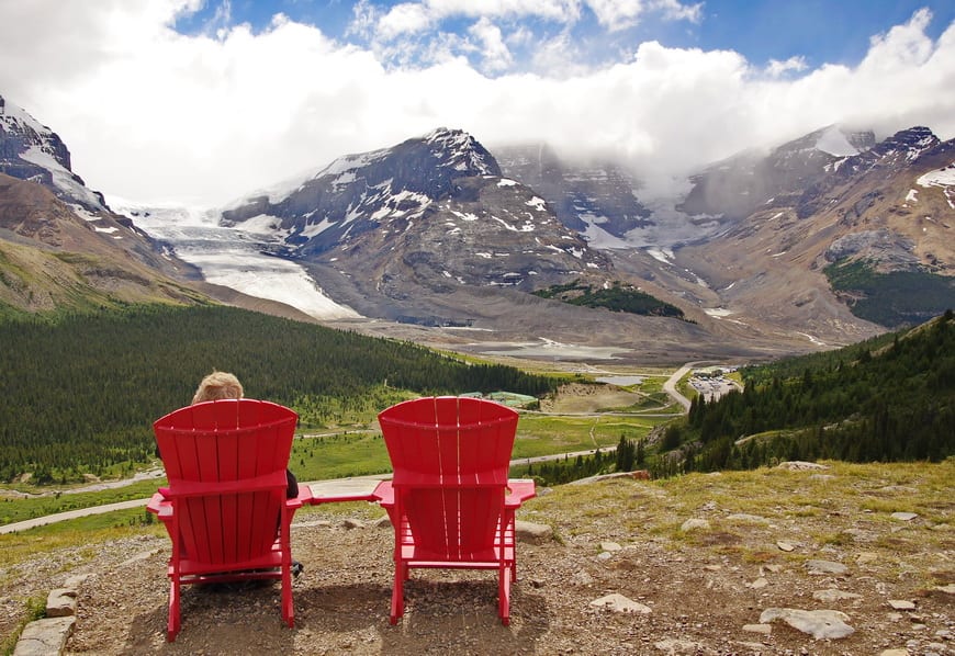
17. Wilcox Pass, Jasper National Park
Once you clear the trees after a steep start you’re rewarded with some of the finest scenery in the Rockies. Look for bighorn sheep.
Distance: 9.8 km round-trip
Elevation gain: 409 m or 1,342 feet.
Difficulty: Moderate to the meadow, then easy to the pass.
Time needed: 3 – 4 hours.
Highlights: Bighorn sheep sightings are almost guaranteed; meadows are gorgeous; scenic red chair views over to the Columbia Icefields; side trails offer even better Icefields views; option to scramble up Mt. Wilcox.
Read: 5 Stunning Hikes to do Along the Icefields Parkway
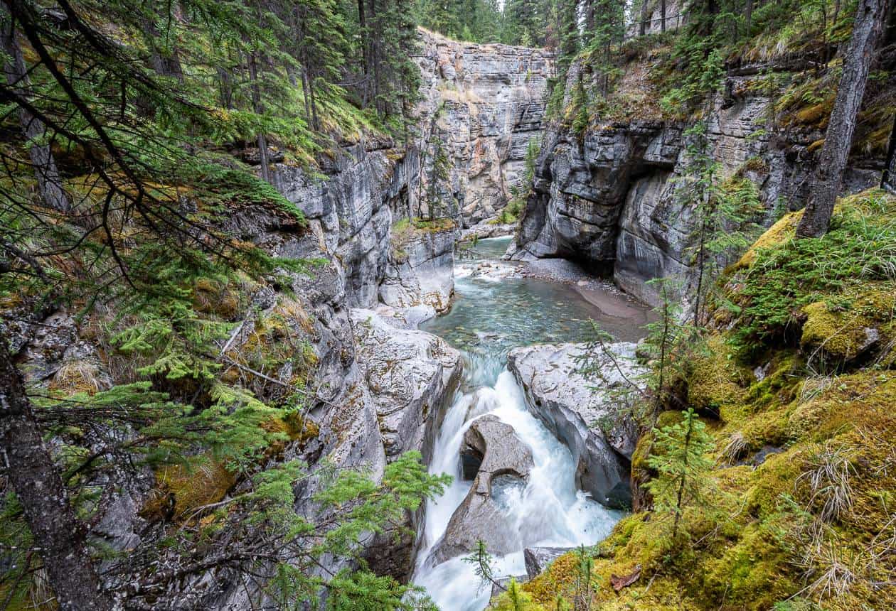
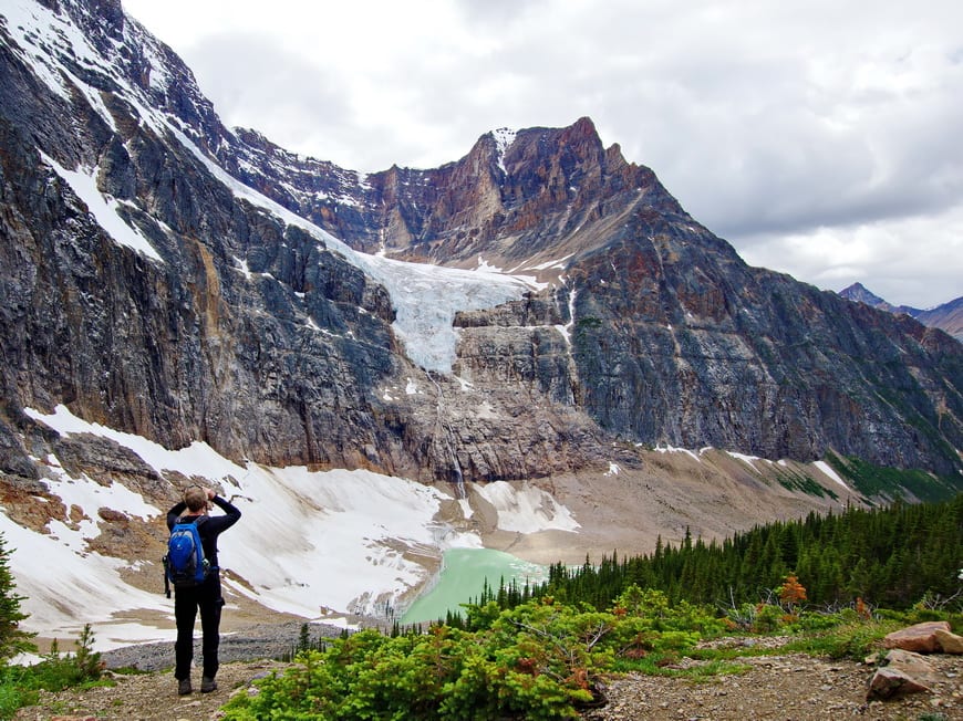
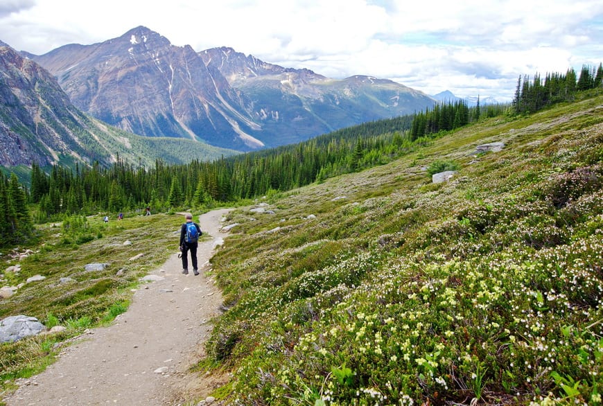
18. Path of the Glacier Trail
After a winding drive up a mountain road you land in a world of glaciers, mountains, and wildflowers. Follow the paved path to Cavell Pond and the loop that includes Cavell Meadows is a recommended add on.
Note: The access road remains closed in 2025 after the 2024 Jasper fire.
Distance: 1.6 km return BUT there is an option to do a longer loop that includes Cavell Meadows.
Elevation gain: 70 m or 230 feet
Difficulty: Easy
Time needed: 1 hour, but more if you want to do longer loops.
Highlights: Wildflower filled meadows if you go beyond Cavell Pond, glaciers, mini icebergs and towering cliffs.
What to take hiking in Alberta
Carry a Garmin InReach Mini 2 in case of emergency.
I like something soft to sit on at lunch time. I swear by my inflatable seat cushion. It helps keep my butt warm, dry and comfortable.
I like using hiking poles to save my knees – and I rely on them when a stream crossing is involved. Invest in a good pair that are collapsible so you can take them traveling too.
I find a brim hat with a chin strap invaluable in the rain or on a hot, sunny day while hiking in Alberta.
I always pack a buff as it’s inexpensive and multi-purpose. It can keep your hair in place on a windy day or warm your neck and head on a cold one.
Another nice addition for those of you who love wildflowers is a simple guide like this one – Alberta Trees and Wildflowers: A Folding Pocket Guide to Familiar Plants.
Useful maps for hiking in Alberta
The other thing I’d recommend taking when you’re hiking in Alberta are some of the Gem Trek maps. I know a lot of people are happy having maps on their phones but I personally love a paper map – preferably waterproof.
For a hiking app you can use offline I like Organic Maps.
For Canmore and the Kananaskis area use Gem Trek Canmore & Kananaskis Village. The Kananaskis Lakes map is also very useful.
For the Wilcox Pass and Parker Ridge hikes there is a Columbia Icefield map.
In Waterton, the parks people can give you a map or you could buy the Gem Trek Waterton Lakes National Park map.
Further ideas for Alberta hikes
- Blackshale Suspension Bridge Hike, Kananaskis
- Bald Hills Trail Hike, Jasper National Park
- The Headwall Lakes Hike in Kananaskis Country
- 9 Canmore Hikes that Offer Great Views
- 8 Bragg Creek Hikes Along Highway 66 in Alberta
Click on the photo to bookmark to your Pinterest boards.


Thank you for your info about adventure outdoor hiking. Love reading your post. I will be following your story and thank you.
Thank you Leigh for your info about hiking. Love reading it. I will be starting to hike and reading your blog make me more inspired to hike. I will be following your story and thank you.
Emy
@Emy Thanks for making my day. So many more to do on my part that it will take me many summers to get them all checked off.